Directions to PAPAS MANOLO (San Pedro Cholula) with public transportation
The following transit lines have routes that pass near PAPAS MANOLO
 Bus: RUTA 38A, RUTA 46, RUTA FLECHA VERDE, RUTA UTP, A35.
How to get to PAPAS MANOLO by bus?
Click on the bus route to see step by step directions with maps, line arrival times and updated time schedules.
From Avenida San Claudio, Puebla
51 minFrom CME UNIVERSIDAD Centro Mexicano de Especialidades, San Andrés Cholula
39 minFrom Residencial Campestre Haras del Bosque, Puebla
81 minFrom Ciudad Universitaria, Puebla
57 minFrom Dirección General De Centros De Reinsersión Social Dell Estado De Puebla, San Andrés Cholula
39 minFrom Mercado La Piedad, San Andrés Cholula
42 minFrom Fraccionamiento Camino Real, Puebla
54 minFrom ISSSTEP Hospital de Especialidades, San Andrés Cholula
44 minFrom Bosque Eterno, Puebla
75 minFrom Ciudad Universitaria, Puebla
55 min
Bus stops near PAPAS MANOLO in San Pedro Cholula
- A San Pablo Del Monte O Calzada Del Conde, 15a, 4 min walk,VIEW
- A San Pablo Del Monte O Calzada Del Conde, 10, 4 min walk,VIEW
- A San Pablo Del Monte 24, 5 min walk,VIEW
- A San Pablo Del Monte O Calzada Del Conde, 21b, 5 min walk,VIEW
- Circuito Interior Oriente, 42, 5 min walk,VIEW
- 104 Poniente-Interior Oriente, 5 min walk,VIEW
Bus lines to PAPAS MANOLO in San Pedro Cholula
- A35, Central De Abastos - Diagonal Ote. Pte,VIEW
- RUTA 46, Ramal 2, San Baltazar Campeche - Solidaridad Nacional (Ida),VIEW
- RUTA FLECHA VERDE, Ramal 1, Lim. Est. Pue - Tlax - Del Refugio,VIEW
- TRANSPORTE NOCTURNO, Paseo Bravo - Central De Abasto,VIEW
- RUTA UTP, Ramal 2 Lim. Est. Pue - Tlax - La Candelaria,VIEW
- RUTA 38, Ramal 1 San José Los Cerritos - Santa Bárbara (Regreso),VIEW
- A34, Central De Abastos (11 Norte) - Diagonal Ote. Pte.,VIEW
- RUTA 38A, Ramal 1 San Sebastián Aparicio - Centro (Ida),VIEW
What are the closest stations to PAPAS MANOLO?
The closest stations to PAPAS MANOLO are:
- A San Pablo Del Monte O Calzada Del Conde, 15a is 260 meters away, 4 min walk.
- A San Pablo Del Monte O Calzada Del Conde, 10 is 297 meters away, 4 min walk.
- A San Pablo Del Monte 24 is 315 meters away, 5 min walk.
- A San Pablo Del Monte O Calzada Del Conde, 21b is 323 meters away, 5 min walk.
- Circuito Interior Oriente, 42 is 373 meters away, 5 min walk.
- 104 Poniente-Interior Oriente is 382 meters away, 5 min walk.
Which bus lines stop near PAPAS MANOLO?
These bus lines stop near PAPAS MANOLO: RUTA 38A, RUTA 46, RUTA FLECHA VERDE, RUTA UTP.
What’s the nearest bus station to PAPAS MANOLO in San Pedro Cholula?
The nearest bus stations to PAPAS MANOLO in San Pedro Cholula are A San Pablo Del Monte O Calzada Del Conde, 15a and A San Pablo Del Monte O Calzada Del Conde, 10. The closest one is a 4 min walk away.
What time is the first bus to PAPAS MANOLO in San Pedro Cholula?
The TRANSPORTE NOCTURNO is the first bus that goes to PAPAS MANOLO in San Pedro Cholula. It stops nearby at 3:18 AM.
What time is the last bus to PAPAS MANOLO in San Pedro Cholula?
The TRANSPORTE NOCTURNO is the last bus that goes to PAPAS MANOLO in San Pedro Cholula. It stops nearby at 2:18 AM.
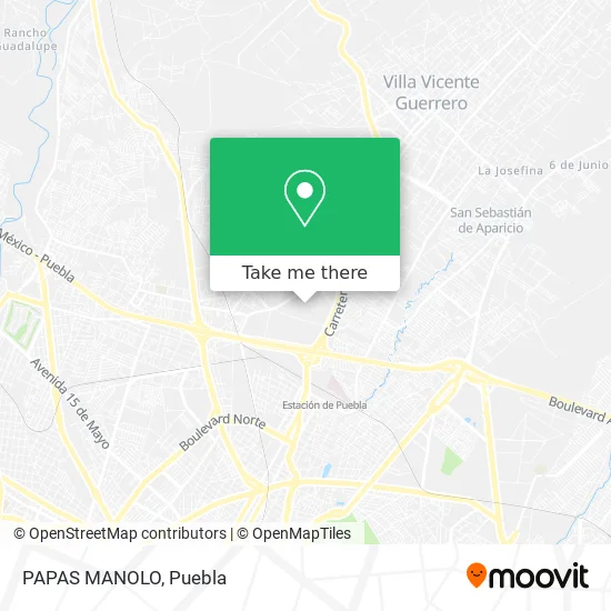
See PAPAS MANOLO, San Pedro Cholula, on the map
Public Transit to PAPAS MANOLO in San Pedro Cholula
Wondering how to get to PAPAS MANOLO in San Pedro Cholula? Moovit helps you find the best way to get to PAPAS MANOLO with step-by-step directions from the nearest public transit station.
Moovit provides free maps and live directions to help you navigate through your city. View schedules, routes, timetables, and find out how long does it take to get to PAPAS MANOLO in real time.
Looking for the nearest stop or station to PAPAS MANOLO? Check out this list of stops closest to your destination: A San Pablo Del Monte O Calzada Del Conde; A San Pablo Del Monte O Calzada Del Conde; A San Pablo Del Monte 24; A San Pablo Del Monte O Calzada Del Conde; Circuito Interior Oriente; 104 Poniente-Interior Oriente.
Bus: RUTA 38A, RUTA 46, RUTA FLECHA VERDE, RUTA UTP, A35, TRANSPORTE NOCTURNO, RUTA 38, A34.
Want to see if there’s another route that gets you there at an earlier time? Moovit helps you find alternative routes or times. Get directions from and directions to PAPAS MANOLO easily from the Moovit App or Website.
We make riding to PAPAS MANOLO easy, which is why over 1.5 million users, including users in San Pedro Cholula, trust Moovit as the best app for public transit. You don’t need to download an individual bus app or train app, Moovit is your all-in-one transit app that helps you find the best bus time or train time available.
For information on prices of bus, costs and ride fares to PAPAS MANOLO, please check the Moovit app.
Use the app to navigate to popular places including to the airport, hospital, stadium, grocery store, mall, coffee shop, school, college, and university.
PAPAS MANOLO Address: PAPAS MANOLO, Calle Interior C, Central de Abastos, 72019 Puebla, Puebla street in San Pedro Cholula
- Cocina Económica Chely,
- Distribuidora de Pollo Morales,
- Cedis Puebla,
- Comercializadora de Frutas y Verduras Campo Verde,
- Pescadería La Langosta Dorada,
- Marisquería La Portuguesa,
- Productos Mexicanos Jace,
- Sukarne Puebla 2,
- Barradas Equipos Comerciales,
- Cemitas Cemiplus,
- Operadora Avicola San Miguel Bodega 13,
- Corporativo La Gran Bodega,
- La Gran Bodega,
- Parque Industrial 5 de mayo,
- Abastecedora San Jose,
- Jarcieria Zutam,
- Calle 104 Poniente 1720,
- TORRE FUERTE,
- Central de Abastos Puebla,
- Central de Abastos
Places Near PAPAS MANOLO (San Pedro Cholula)
- Hospital Imss La Margarita, Puebla,
- Zona de los Fuertes, Puebla,
- Complejo Cultural Universitario, Ocoyucan,
- Parque Puebla, Puebla,
- Galerías Serdán, San Pedro Cholula,
- Parque Ecologico, Pue., San Andrés Cholula,
- Tres Cruces, Puebla,
- Plaza Las Animas, Puebla,
- Hospital General Regional 36 IMSS San Alejandro, San Andrés Cholula,
- Centro Integral de Servicios CIS, San Andrés Cholula,
- 25 Zona Militar, Puebla,
- Plaza Dorada Centro Comercial, Puebla,
- Centro Comercial Angelópolis, San Andrés Cholula,
- Hospital Traumatología y Ortopedia de Puebla, San Pedro Cholula,
- Ciudad Universitaria, Puebla,
- SAT, San Andrés Cholula,
- Centro de Desarrollo Comunitario Tres Cruces, Puebla,
- Secretaria de Finanzas, Puebla,
- Estadio Cuauhtémoc, Puebla,
- Ciudad Judicial del Estado de Puebla, San Andrés Cholula
How to get to popular places in Puebla with public transit
Get around San Pedro Cholula by public transit!
Traveling around San Pedro Cholula has never been so easy. See step by step directions as you travel to any attraction, street or major public transit station. View bus and train schedules, arrival times, service alerts and detailed routes on a map, so you know exactly how to get to anywhere in San Pedro Cholula.
When traveling to any destination around San Pedro Cholula use Moovit's Live Directions with Get Off Notifications to know exactly where and how far to walk, how long to wait for your line, and how many stops are left. Moovit will alert you when it's time to get off — no need to constantly re-check whether yours is the next stop.
Wondering how to use public transit in San Pedro Cholula or how to pay for public transit in San Pedro Cholula? Moovit public transit app can help you navigate your way with public transit easily, and at minimum cost. It includes public transit fees, ticket prices, and costs. Looking for a map of San Pedro Cholula public transit lines? Moovit public transit app shows all public transit maps in San Pedro Cholula with all bus routes and stops on an interactive map.
Puebla has 1 transit type(s), including: bus, operated by several transit agencies, including RUTA, RUTA Alimentadoras, Rutas Convencionales and Líneas temporales