How to get to PCC by bus?
Click on the bus route to see step by step directions with maps, line arrival times and updated time schedules.
From Haulover Nude Beach, Miami Beach
51 minFrom Florida International University-Biscayne Bay, Miami
70 minFrom Miami Shores, Miami
70 minFrom Opa-Locka, FL, Miami
100 minFrom The Casino at Dania Beach (Dania Jai-alai), Hollywood
84 minFrom Seminole Hard Rock Hotel & Casino, Hollywood
63 minFrom Dania Pointe, Hollywood
100 minFrom Dania Beach, Hollywood
77 minFrom Sawgrass Mills Mall, Miami
65 minFrom 16900 NW 12th Ave, Miami Gardens
79 min
How to get to PCC by train?
Click on the train route to see step by step directions with maps, line arrival times and updated time schedules.
Bus stops near PCC in Miami
Train station near PCC in Miami
- Aventura, 41 min walk,VIEW
Bus lines to PCC in Miami
What are the closest stations to PCC?
The closest stations to PCC are:
- Ne 205 Te & Ne 15 Av is 698 yards away, 9 min walk.
- Ne 20 Av & Ne 202 St is 1514 yards away, 18 min walk.
- Aventura is 3521 yards away, 41 min walk.
Which bus line stops near PCC?
199 (199 - Red Rd Transit Hub)
Which train line stops near PCC?
BLFM (Mco)
What’s the nearest bus station to PCC in Miami?
The nearest bus station to PCC in Miami is Ne 205 Te & Ne 15 Av. It’s a 9 min walk away.
What time is the first train to PCC in Miami?
The BLFM is the first train that goes to PCC in Miami. It stops nearby at 6:09 AM.
What time is the last train to PCC in Miami?
The BLFM is the last train that goes to PCC in Miami. It stops nearby at 12:07 AM.
What time is the first bus to PCC in Miami?
The 199 is the first bus that goes to PCC in Miami. It stops nearby at 5:06 AM.
What time is the last bus to PCC in Miami?
The 199 is the last bus that goes to PCC in Miami. It stops nearby at 11:03 PM.
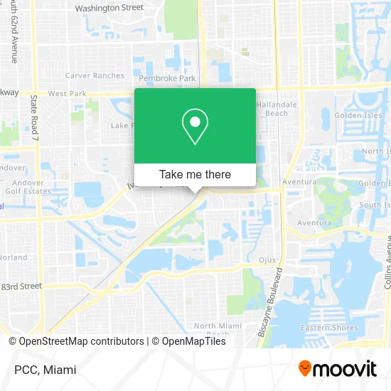
See PCC, Miami, on the map
Public Transit to PCC in Miami
Wondering how to get to PCC in Miami? Moovit helps you find the best way to get to PCC with step-by-step directions from the nearest public transit station.
Moovit provides free maps and live directions to help you navigate through your city. View schedules, routes, timetables, and find out how long does it take to get to PCC in real time.
Looking for the nearest stop or station to PCC? Check out this list of stops closest to your destination: Ne 205 Te & Ne 15 Av; Ne 20 Av & Ne 202 St; Aventura.
Bus: 199, 95.Train: BLFM.
Want to see if there’s another route that gets you there at an earlier time? Moovit helps you find alternative routes or times. Get directions from and directions to PCC easily from the Moovit App or Website.
We make riding to PCC easy, which is why over 1.5 million users, including users in Miami, trust Moovit as the best app for public transit. You don’t need to download an individual bus app or train app, Moovit is your all-in-one transit app that helps you find the best bus time or train time available.
For information on prices of bus and train, costs and ride fares to PCC, please check the Moovit app.
Use the app to navigate to popular places including to the airport, hospital, stadium, grocery store, mall, coffee shop, school, college, and university.
PCC Address: 20195 NE 16th Pl Miami, FL 33179 street in Miami
- SRM Mechanical Design,
- Mulco Watches,
- Pinnacle Genetics Labs,
- Same Day Stitch,
- Lavior,
- AAA American Airlines Arena,
- Hurricane Home Improvement,
- Eco Air Conditioning,
- Galilee Lighting,
- Happea's,
- Miami Artificial Turf and Landscaping,
- Gopuff,
- No-H2O Miami Beach,
- Sportline USA,
- Mibh Construction,
- Taurus Telecommunications,
- Alltrust Movers,
- Summit Junk,
- Church Sinners Welcome,
- Larry Dudkiewicz: Allstate Insurance
Places Near PCC (Miami)
- Keiser University Flagship Campus, West Palm Beach,
- Sawgrass mall ( FL ), Miami Beach,
- Dolphin Mall Bus, Miami,
- Sawgrass Mall, Miami,
- Aventura Mall, Miami Beach,
- Little Havana, Miami,
- Marlins Park, Miami,
- Aventura Mall, Miami,
- Port of Miami Cruise Terminal, Miami,
- Hard Rock Stadium, Miami Gardens,
- Wynwood, Miami,
- Zoo Miami, Miami,
- Miami VA Hospital, Miami,
- Bayside Marketplace, Miami,
- Dolphin Mall, Miami,
- Miami Freedom Park, Miami,
- Miami-Dade County Courthouse, Miami,
- Brickell City Centre, Miami,
- Miami Design District, Miami,
- Richard E. Gerstein Justice Building, Miami
How to get to popular places in Miami with public transit
Get around Miami by public transit!
Traveling around Miami has never been so easy. See step by step directions as you travel to any attraction, street or major public transit station. View bus and train schedules, arrival times, service alerts and detailed routes on a map, so you know exactly how to get to anywhere in Miami.
When traveling to any destination around Miami use Moovit's Live Directions with Get Off Notifications to know exactly where and how far to walk, how long to wait for your line, and how many stops are left. Moovit will alert you when it's time to get off — no need to constantly re-check whether yours is the next stop.
Wondering how to use public transit in Miami or how to pay for public transit in Miami? Moovit public transit app can help you navigate your way with public transit easily, and at minimum cost. It includes public transit fees, ticket prices, and costs. Looking for a map of Miami public transit lines? Moovit public transit app shows all public transit maps in Miami with all Bus, Train, Light Rail and Ferry routes and stops on an interactive map.
Miami has 4 transit type(s), including: Bus, Train, Light Rail and Ferry, operated by several transit agencies, including Broward County Transit, Miami-Dade Transit, Metrorail, Palm Tran, Tri-Rail, Brightline, MARTY, City of Homestead Trolley, Key West Transit, Treasure Coast Connector, GoLine IRT, Amtrak, Greyhound-us, FlixBus-us and Aventura Express Shuttle Bus