Directions to PLM (Banyuasin) with public transportation
The following transit lines have routes that pass near PLM
 Bus: KM 5 - TALANG BETUTU.
- Train: LRT, LRT PALEMBANG.
How to get to PLM by bus?
Click on the bus route to see step by step directions with maps, line arrival times and updated time schedules.
How to get to PLM by train?
Click on the train route to see step by step directions with maps, line arrival times and updated time schedules.
Train station near PLM in Banyuasin
- Stasiun Bandara, 1 min walk,
What are the closest stations to PLM?
The closest stations to PLM are:
- Stasiun Bandara is 71 meters away, 1 min walk.
Which bus line stops near PLM?
KM 5 - TALANG BETUTU
Which train line stops near PLM?
LRT
What’s the nearest train station to PLM in Banyuasin?
The nearest train station to PLM in Banyuasin is Stasiun Bandara. It’s a 1 min walk away.
What time is the first train to PLM in Banyuasin?
The LRT PALEMBANG is the first train that goes to PLM in Banyuasin. It stops nearby at 6:00 AM.
What time is the last train to PLM in Banyuasin?
The LRT PALEMBANG is the last train that goes to PLM in Banyuasin. It stops nearby at 7:21 PM.
See PLM, Banyuasin, on the map
Public Transit to PLM in Banyuasin
Wondering how to get to PLM in Banyuasin? Moovit helps you find the best way to get to PLM with step-by-step directions from the nearest public transit station.
Moovit provides free maps and live directions to help you navigate through your city. View schedules, routes, timetables, and find out how long does it take to get to PLM in real time.
Looking for the nearest stop or station to PLM? Check out this list of stops closest to your destination: Stasiun Bandara.
Bus: KM 5 - TALANG BETUTU.Train: LRT, LRT PALEMBANG.
Want to see if there’s another route that gets you there at an earlier time? Moovit helps you find alternative routes or times. Get directions from and directions to PLM easily from the Moovit App or Website.
We make riding to PLM easy, which is why over 1.5 million users, including users in Banyuasin, trust Moovit as the best app for public transit. You don’t need to download an individual bus app or train app, Moovit is your all-in-one transit app that helps you find the best bus time or train time available.
For information on prices of bus and train, costs and ride fares to PLM, please check the Moovit app.
Use the app to navigate to popular places including to the airport, hospital, stadium, grocery store, mall, coffee shop, school, college, and university.
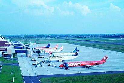
Location: Banyuasin, Palembang
- Sop Buah Rara,
- Bengkel Afifa Motor,
- Cemilanku,
- Jalan Kol. Sai Husin,
- Briefing Office Smb II,
- Bakso Malang Bandara lama,
- Bakso Arema,
- Taman Alat Meteorologi,
- Starbucks,
- Stasiun Meteorologi Sultan Mahmud Badaruddin II,
- Ground Support Equipment Gse PT Gapura Angkasa Branch Palembang,
- Kantor PT.Angkasa Pura II (Persero) Palembang,
- Klinik Kesehatan PT Angkasa Pura II,
- Gedung VIP Bandara SMB II Palembang,
- Almi Caterindo. PT,
- pesawat,
- Pangkalan TNI Angkatan Udara Palembang,
- Playground Kids Bandara Smb II Palembang,
- Syailendra Lounge, Bandara SM Badaruddin II,
- Starbuck Airport Palembang @dediyaki_zawa
Places Near PLM (Banyuasin)
- Palembang Square Mall, Palembang,
- Pagaralam, Palembang,
- Dr. Jan Hadi, ST, Palembang,
- Palembang Indah Mall (Pim), Palembang,
- PT. OKI Pulp & Paper Mills, Palembang,
- Jl. Perintis Kemerdekaan Lrg. Produksim, Palembang,
- Praktek dr. Monica Amalia Susanti, S.pOG, Palembang,
- Terminal KM 12 - Alang alang lebar, Banyuasin,
- Danau Ranau OKU Selatan, Palembang,
- PTC Mall, Palembang,
- Cv Fajar Indah (expedisi fajar indah express), Palembang,
- Halte bus unsri indralaya, Palembang,
- Pelabuhan Tanjung Api -Api, Palembang,
- loket sinar dempo, Palembang,
- Rumah Sakit Muhammad Husein, Palembang,
- Unsri Indralaya, Palembang,
- Panti Pijat Plus Plus, Palembang,
- Jl. Basuki Rahmat No. 1, Simpang Polda, Palembang,
- Jalan Raya Lintas Timur Palembang-Jambi, Banyuasin,
- Indralaya, Palembang
How to get to popular places in Palembang with public transit
Get around Banyuasin by public transit!
Traveling around Banyuasin has never been so easy. See step by step directions as you travel to any attraction, street or major public transit station. View bus and train schedules, arrival times, service alerts and detailed routes on a map, so you know exactly how to get to anywhere in Banyuasin.
When traveling to any destination around Banyuasin use Moovit's Live Directions with Get Off Notifications to know exactly where and how far to walk, how long to wait for your line, and how many stops are left. Moovit will alert you when it's time to get off — no need to constantly re-check whether yours is the next stop.
Wondering how to use public transit in Banyuasin or how to pay for public transit in Banyuasin? Moovit public transit app can help you navigate your way with public transit easily, and at minimum cost. It includes public transit fees, ticket prices, and costs. Looking for a map of Banyuasin public transit lines? Moovit public transit app shows all public transit maps in Banyuasin with all Bus and Train routes and stops on an interactive map.
Palembang has 2 transit type(s), including: Bus and Train, operated by several transit agencies, including LRT, Trans Musi and Angkutan Palembang