How to get to PLS Check Cashing Store by bus?
Click on the bus route to see step by step directions with maps, line arrival times and updated time schedules.
From 3,Stone St Stone St, Manhattan
50 minFrom 100 Church Street, Manhattan
45 minFrom Broadway and 168th St, Manhattan
68 minFrom One World Trade Center, Manhattan
47 minFrom 168 St, Manhattan
69 minFrom Washington Heights, Manhattan
68 minFrom 22 Cortlandt St, Manhattan
45 minFrom Costco, Queens
39 minFrom Aaaaa Aaaa, Bronx
99 minFrom Walmart, Secaucus
47 min
How to get to PLS Check Cashing Store by train?
Click on the train route to see step by step directions with maps, line arrival times and updated time schedules.
How to get to PLS Check Cashing Store by subway?
Click on the subway route to see step by step directions with maps, line arrival times and updated time schedules.
From 3,Stone St Stone St, Manhattan
28 minFrom 100 Church Street, Manhattan
21 minFrom Broadway and 168th St, Manhattan
28 minFrom One World Trade Center, Manhattan
24 minFrom 168 St, Manhattan
28 minFrom Washington Heights, Manhattan
28 minFrom 22 Cortlandt St, Manhattan
24 minFrom Costco, Queens
39 minFrom Aaaaa Aaaa, Bronx
42 min
Subway stations near PLS Check Cashing Store in Manhattan
Bus stops near PLS Check Cashing Store in Manhattan
Train station near PLS Check Cashing Store in Manhattan
- Grand Central, 7 min walk,VIEW
Bus lines to PLS Check Cashing Store in Manhattan
- SIM23, Annadale Via Arden Av,VIEW
- SIM24, Princes Bay Via Huguenot Av,VIEW
- QM10, Lefrak City - Midtown Express,VIEW
- QM12, Forest Hills - Midtown Express,VIEW
- QM24, Glendale - Midtown Express,VIEW
- QM15, Arverne Beach 54 St Via Woodhaven Bl Via Cross Bay Bl,VIEW
- QM16, Neponsit Riis Park Via Cross Bay Bl Via Rock Bch Bl,VIEW
- QM17, Midtown 57 St Via 6 Av,VIEW
- QM18, S. Ozone Pk 130 St Via Lefferts Bl,VIEW
- BXM6, Parkchester - Midtown,VIEW
- BXM7, Co-Op City - Midtown,VIEW
- BXM8, Pelham Bay/City Island - Midtown,VIEW
- BXM9, Throgs Neck - Midtown Express,VIEW
- BXM10, Williamsbridge/Morris Park - Midtown,VIEW
- BXM11, Wakefield - Midtown,VIEW
- BXM18, Riverdale - Downtown,VIEW
- 28, - Bxm4c,VIEW
- QM1, Fresh Meadows - Midtown Express,VIEW
- M5, George Washington Bridge - 31 St & 6 Av,VIEW
- QM5, Glen Oaks - Midtown Express,VIEW
What are the closest stations to PLS Check Cashing Store?
The closest stations to PLS Check Cashing Store are:
- 49 St is 126 yards away, 2 min walk.
- 5 Av/W 43 St is 156 yards away, 2 min walk.
- 6 Av/W 43 St is 159 yards away, 2 min walk.
- 6 Av/W 44 St is 191 yards away, 3 min walk.
- 42 St-Bryant Pk is 196 yards away, 3 min walk.
- 6 Av/W 42 St is 201 yards away, 3 min walk.
- W 42nd St & 5th Ave is 211 yards away, 3 min walk.
- 6 Avenue & West 44 Street is 238 yards away, 3 min walk.
- W 42 St/6 Av is 284 yards away, 4 min walk.
- W 42nd St & 5th Ave (Westbound) is 328 yards away, 4 min walk.
- Times Sq-42 St is 516 yards away, 7 min walk.
- Grand Central is 529 yards away, 7 min walk.
Which bus lines stop near PLS Check Cashing Store?
These bus lines stop near PLS Check Cashing Store: M1, M42, M5, M55, QM12.
Which train line stops near PLS Check Cashing Store?
YEL (Journal Square - 33rd Street)
Which subway lines stop near PLS Check Cashing Store?
These subway lines stop near PLS Check Cashing Store: 1, 2, 6, D, M.
What’s the nearest subway station to PLS Check Cashing Store in Manhattan?
The nearest subway station to PLS Check Cashing Store in Manhattan is 49 St. It’s a 2 min walk away.
What’s the nearest train station to PLS Check Cashing Store in Manhattan?
The nearest train station to PLS Check Cashing Store in Manhattan is Grand Central. It’s a 7 min walk away.
What’s the nearest bus station to PLS Check Cashing Store in Manhattan?
The nearest bus stations to PLS Check Cashing Store in Manhattan are 5 Av/W 43 St and 6 Av/W 43 St. The closest one is a 2 min walk away.
What time is the first subway to PLS Check Cashing Store in Manhattan?
The 2 is the first subway that goes to PLS Check Cashing Store in Manhattan. It stops nearby at 3:00 AM.
What time is the last subway to PLS Check Cashing Store in Manhattan?
The N is the last subway that goes to PLS Check Cashing Store in Manhattan. It stops nearby at 4:01 AM.
What time is the first train to PLS Check Cashing Store in Manhattan?
The 3 is the first train that goes to PLS Check Cashing Store in Manhattan. It stops nearby at 5:28 AM.
What time is the last train to PLS Check Cashing Store in Manhattan?
The 1 is the last train that goes to PLS Check Cashing Store in Manhattan. It stops nearby at 2:12 AM.
What time is the first bus to PLS Check Cashing Store in Manhattan?
The M42 is the first bus that goes to PLS Check Cashing Store in Manhattan. It stops nearby at 3:26 AM.
What time is the last bus to PLS Check Cashing Store in Manhattan?
The M7 is the last bus that goes to PLS Check Cashing Store in Manhattan. It stops nearby at 2:46 AM.
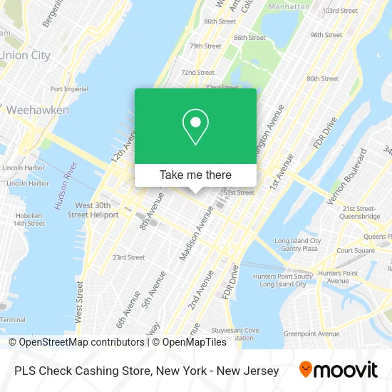
See PLS Check Cashing Store, Manhattan, on the map
Public Transit to PLS Check Cashing Store in Manhattan
Wondering how to get to PLS Check Cashing Store in Manhattan? Moovit helps you find the best way to get to PLS Check Cashing Store with step-by-step directions from the nearest public transit station.
Moovit provides free maps and live directions to help you navigate through your city. View schedules, routes, timetables, and find out how long does it take to get to PLS Check Cashing Store in real time.
Looking for the nearest stop or station to PLS Check Cashing Store? Check out this list of stops closest to your destination: 49 St; 5 Av/W 43 St; 6 Av/W 43 St; 6 Av/W 44 St; 42 St-Bryant Pk; 6 Av/W 42 St; W 42nd St & 5th Ave; 6 Avenue & West 44 Street; W 42 St/6 Av; W 42nd St & 5th Ave (Westbound); Times Sq-42 St; Grand Central.
Bus: M1, M42, M5, M55, QM12, QM10, QM24, SIM23, SIM24.Train: YEL, 1, 2, 3, 4, 5.Subway: 1, 2, 6, D, M, N, Q, R, W, B, F, FX, S, 3.
Want to see if there’s another route that gets you there at an earlier time? Moovit helps you find alternative routes or times. Get directions from and directions to PLS Check Cashing Store easily from the Moovit App or Website.
We make riding to PLS Check Cashing Store easy, which is why over 1.5 million users, including users in Manhattan, trust Moovit as the best app for public transit. You don’t need to download an individual bus app or train app, Moovit is your all-in-one transit app that helps you find the best bus time or train time available.
For information on prices of subway, bus and train, costs and ride fares to PLS Check Cashing Store, please check the Moovit app.
Use the app to navigate to popular places including to the airport, hospital, stadium, grocery store, mall, coffee shop, school, college, and university.
PLS Check Cashing Store Address: 37 W 43rd St street in Manhattan
- Restaurant,
- Tanagro Jewelry Corporation,
- Ultra Health and Wellness,
- Performance Footcare,
- Kiss Kiss Pop,
- Zirconia Crowns Nyc,
- Law Office Of Tara Gray,
- Lobrutto Law,
- She Winks Lash Studio,
- Abbott Law Pllc,
- KS Law Firm Pllc,
- Geoffrey G. Gussis, Esq.,
- Diligent Key & Deadbolt Service - Locksmiths,
- Law Office Of Thomas J. Kniffen,
- Amineddoleh and Associates,
- Legalcleanup.Com by Vonnie C. Dones Iii, Esq.,
- Dr. Nima Dayani,
- Colormasters Gem,
- Committee Of 100,
- Asian American / Asian Research Institute
Places Near PLS Check Cashing Store (Manhattan)
- 3 Stone St, Manhattan,
- San Gennaro Feast, Manhattan,
- 376 Hudson Street, Manhattan,
- Chinatown, Manhattan,
- 911 Memorial, Manhattan,
- Pier 83, Manhattan,
- Rockefeller Center, Manhattan,
- Queens Center Mall, Queens,
- 111 Centre New York City Supreme Court, Manhattan,
- Wall Street, Manhattan,
- SoHo, Manhattan,
- Mountainside Hospital, Glen Ridge,
- Times Square, Manhattan,
- qqqq, Manhattan,
- Hudson Yards, Manhattan,
- Katz's Deli, Manhattan,
- 1 Police Plaza, Manhattan,
- 66 John Street, Manhattan,
- Bellevue Hospital, Manhattan,
- 26 Federal Plaza, Manhattan
How to get to popular places in New York - New Jersey with public transit
Get around Manhattan by public transit!
Traveling around Manhattan has never been so easy. See step by step directions as you travel to any attraction, street or major public transit station. View bus and train schedules, arrival times, service alerts and detailed routes on a map, so you know exactly how to get to anywhere in Manhattan.
When traveling to any destination around Manhattan use Moovit's Live Directions with Get Off Notifications to know exactly where and how far to walk, how long to wait for your line, and how many stops are left. Moovit will alert you when it's time to get off — no need to constantly re-check whether yours is the next stop.
Wondering how to use public transit in Manhattan or how to pay for public transit in Manhattan? Moovit public transit app can help you navigate your way with public transit easily, and at minimum cost. It includes public transit fees, ticket prices, and costs. Looking for a map of Manhattan public transit lines? Moovit public transit app shows all public transit maps in Manhattan with all Bus, Train, Subway, Light Rail, Ferry and Cable Car routes and stops on an interactive map.
New York - New Jersey has 6 transit type(s), including: Bus, Train, Subway, Light Rail, Ferry and Cable Car, operated by several transit agencies, including MTA Subway, Metro-North Railroad, LIRR, PATH, MTA New York City Transit - Express routes, MTA Bus, NJ Transit, NYC Ferry, NICE bus, Bee-Line Bus, NJ Transit Rail, Norwalk Transit District, Hartford Line, River Valley Transit and HART