How to get to PSC Paint by bus?
Click on the bus route to see step by step directions with maps, line arrival times and updated time schedules.
Bus stops near PSC Paint in Norfolk
Light Rail stations near PSC Paint in Norfolk
- Monticello, 27 min walk,VIEW
What are the closest stations to PSC Paint?
The closest stations to PSC Paint are:
- Hampton & Woodrow is 224 yards away, 3 min walk.
- 38th & Hampton is 2030 yards away, 25 min walk.
- Monticello is 2196 yards away, 27 min walk.
Which bus lines stop near PSC Paint?
These bus lines stop near PSC Paint: 023, 961.
Which light rail line stops near PSC Paint?
800 (Evmc Fort Norfolk Station)
What’s the nearest light rail station to PSC Paint in Norfolk?
The nearest light rail station to PSC Paint in Norfolk is Monticello. It’s a 27 min walk away.
What’s the nearest bus station to PSC Paint in Norfolk?
The nearest bus station to PSC Paint in Norfolk is Hampton & Woodrow. It’s a 3 min walk away.
What time is the first light rail to PSC Paint in Norfolk?
The 800 is the first light rail that goes to PSC Paint in Norfolk. It stops nearby at 5:27 AM.
What time is the last light rail to PSC Paint in Norfolk?
The 800 is the last light rail that goes to PSC Paint in Norfolk. It stops nearby at 11:40 PM.
What time is the first bus to PSC Paint in Norfolk?
The 002 is the first bus that goes to PSC Paint in Norfolk. It stops nearby at 5:32 AM.
What time is the last bus to PSC Paint in Norfolk?
The 002 is the last bus that goes to PSC Paint in Norfolk. It stops nearby at 12:35 AM.
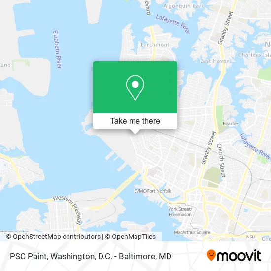
See PSC Paint, Norfolk, on the map
Public Transit to PSC Paint in Norfolk
Wondering how to get to PSC Paint in Norfolk? Moovit helps you find the best way to get to PSC Paint with step-by-step directions from the nearest public transit station.
Moovit provides free maps and live directions to help you navigate through your city. View schedules, routes, timetables, and find out how long does it take to get to PSC Paint in real time.
Looking for the nearest stop or station to PSC Paint? Check out this list of stops closest to your destination: Hampton & Woodrow; 38th & Hampton; Monticello.
Bus: 023, 961, 002, 004.Light Rail: 800.
Want to see if there’s another route that gets you there at an earlier time? Moovit helps you find alternative routes or times. Get directions from and directions to PSC Paint easily from the Moovit App or Website.
We make riding to PSC Paint easy, which is why over 1.5 million users, including users in Norfolk, trust Moovit as the best app for public transit. You don’t need to download an individual bus app or train app, Moovit is your all-in-one transit app that helps you find the best bus time or train time available.
For information on prices of bus, train and light rail, costs and ride fares to PSC Paint, please check the Moovit app.
Use the app to navigate to popular places including to the airport, hospital, stadium, grocery store, mall, coffee shop, school, college, and university.
PSC Paint Address: 921 Weyanoke St Norfolk, VA 23507 street in Norfolk
- Mallory Country Club,
- Kimberly McNeil,
- Westover Memorial Park,
- 1421 Graydon Pl Norfolk VA,
- Smartmouth Brewing,
- USPS Collection Box - Blue Box,
- Graydon Park,
- Hampton Roads Chamber Players,
- Weyanoke Bird and Wildflower Sanctuary,
- Weyanoke Wildlife Sanctuary,
- Norfolk Southern Lamberts Point West End Tower,
- Norfolk Professionals Chiropractor,
- Jeff Robertson Park,
- Blue Bird Park,
- Grimes Gardening and Gutting,
- Star Wars Day Light Saber Battle,
- Norfolk Southern,
- West Ghent,
- Scanelli John A Attorney Ofc,
- Ghent Plumbing
Places Near PSC Paint (Norfolk)
- The Anthem, Washington,
- PG Mall, Prince George's County,
- National Mall, Washington,
- National Museum of African American History and Culture, Washington,
- Warner Theatre, Washington,
- Basilica of the National Shrine, Washington,
- National Zoo, Washington,
- Museum Of The Bible, Washington,
- Sibley Memorial Hospital, Washington,
- Capital One Arena, Washington,
- Washington National Cathedral, Washington,
- Marriott Marquis Washington, DC, Washington,
- Pennsylvania Ave NW (3rd st and pennsylvania), Washington,
- Westfield Montgomery Mall, Montgomery County,
- Rock Creek Tennis Center, Washington,
- M&T Bank Stadium, Baltimore,
- Camden Yards, Baltimore,
- Georgetown, Washington,
- Amazon Hq2, Arlington County,
- Washington DC VA Medical Center, Washington
How to get to popular places in Washington, D.C. - Baltimore, MD with public transit
Get around Norfolk by public transit!
Traveling around Norfolk has never been so easy. See step by step directions as you travel to any attraction, street or major public transit station. View bus and train schedules, arrival times, service alerts and detailed routes on a map, so you know exactly how to get to anywhere in Norfolk.
When traveling to any destination around Norfolk use Moovit's Live Directions with Get Off Notifications to know exactly where and how far to walk, how long to wait for your line, and how many stops are left. Moovit will alert you when it's time to get off — no need to constantly re-check whether yours is the next stop.
Wondering how to use public transit in Norfolk or how to pay for public transit in Norfolk? Moovit public transit app can help you navigate your way with public transit easily, and at minimum cost. It includes public transit fees, ticket prices, and costs. Looking for a map of Norfolk public transit lines? Moovit public transit app shows all public transit maps in Norfolk with all Bus, Train, Metro, Light Rail and Ferry routes and stops on an interactive map.
Washington, D.C. - Baltimore, MD has 5 transit type(s), including: Bus, Train, Metro, Light Rail and Ferry, operated by several transit agencies, including WMATA, Montgomery County Ride On, Fairfax Connector, TheBus, PRTC, DASH - Alexandria, Arlington Transit (ART), RTA of Central Maryland, MDOT MTA, MDOT MTA Light RailLink, MDOT MTA Commuter Bus, MDOT MTA Local Bus, FXBGO!, Virginia Railway Express (VRE) and MARC