St. Pancras Square stop - Thursday schedule
| Line | Direction | Time |
|---|---|---|
| 870 | Paola | 5:13 AM |
| 870 | Paola | 5:32 AM |
| 870 | Paola | 5:49 AM |
| 982 | Quattro Venti Station | 6:07 AM |
| 870 | Paola | 6:09 AM |
| 870 | Paola | 6:29 AM |
| 982 | Quattro Venti Station | 6:47 AM |
| 870 | Paola | 6:48 AM |
| 870 | Paola | 7:11 AM |
| 982 | Quattro Venti Station | 7:19 AM |
| 870 | Paola | 7:32 AM |
| 870 | Paola | 7:43 AM |
| 870 | Paola | 7:53 AM |
| 982 | Quattro Venti Station | 7:56 AM |
| 870 | Paola | 8:18 AM |
| 982 | Quattro Venti Station | 8:19 AM |
| 870 | Paola | 8:42 AM |
| 982 | Quattro Venti Station | 8:43 AM |
| 870 | Paola | 9:04 AM |
| 982 | Quattro Venti Station | 9:08 AM |
| 870 | Paola | 9:19 AM |
| 870 | Paola | 9:30 AM |
| 982 | Quattro Venti Station | 9:33 AM |
| 982 | Quattro Venti Station | 9:56 AM |
| 870 | Paola | 9:56 AM |
Directions to St. Pancras Square stop (Roma) with public transit
The following transit lines have routes that pass near St. Pancras Square
 Bus: 44, 75, 870, 982, 871.
- Train: FL3, R, R, R, RV.
- Metro: A, B.
How to get to St. Pancras Square stop by bus?
Click on the bus route to see step by step directions with maps, line arrival times and updated time schedules.
How to get to St. Pancras Square stop by train?
Click on the train route to see step by step directions with maps, line arrival times and updated time schedules.
How to get to St. Pancras Square stop by metro?
Click on the metro route to see step by step directions with maps, line arrival times and updated time schedules.
Bus stops near St. Pancras Square stop in Roma
- Fonteiana/Ottavilla, 1 min walk,
- Vitellia/St. Pancras, 3 min walk,
- Villa Pamphili/Santa Sofia, 4 min walk,
- Carini/Bonnet, 6 min walk,
Light Rail stations near St. Pancras Square station in Roma
- Trastevere/Bernard. Da Feltre, 12 min walk,
Train stations near St. Pancras Square station in Roma
- Roma San Pietro, 19 min walk,
Bus lines to St. Pancras Square stop in Roma
- 44, Montalcini,
- 871, Trastevere Station,
- 870, Paola,
- 982, Seventeenth Olympics,
- 710, Lenin,
- 75, Poerio/Marino,
What are the closest stations to St. Pancras Square?
The closest stations to St. Pancras Square are:
- Fonteiana/Ottavilla stop is 4 meters away, 1 min walk.
- Vitellia/St. Pancras stop is 223 meters away, 3 min walk.
- Villa Pamphili/Santa Sofia stop is 246 meters away, 4 min walk.
- Carini/Bonnet stop is 431 meters away, 6 min walk.
- Trastevere/Bernard. Da Feltre station is 936 meters away, 12 min walk.
- Roma San Pietro station is 1497 meters away, 19 min walk.
Which bus lines stop near St. Pancras Square?
These bus lines stop near St. Pancras Square: 44, 75, 870, 982.
Which train line stops near St. Pancras Square?
FL3 (Viterbo)
Which metro lines stop near St. Pancras Square?
These metro lines stop near St. Pancras Square: A, B.
What’s the nearest light rail station to St. Pancras Square in Roma?
The nearest light rail station to St. Pancras Square in Roma is Trastevere/Bernard. Da Feltre. It’s a 12 min walk away.
What’s the nearest train station to St. Pancras Square in Roma?
The nearest train station to St. Pancras Square in Roma is Roma San Pietro. It’s a 19 min walk away.
What’s the nearest bus station to St. Pancras Square in Roma?
The nearest bus station to St. Pancras Square in Roma is Fonteiana/Ottavilla. It’s a 1 min walk away.
What time is the first light rail to St. Pancras Square in Roma?
The 3 is the first light rail that goes to St. Pancras Square in Roma. It stops nearby at 5:35 AM.
What time is the last light rail to St. Pancras Square in Roma?
The 3 is the last light rail that goes to St. Pancras Square in Roma. It stops nearby at 1:33 AM.
What time is the first train to St. Pancras Square in Roma?
The FL3 is the first train that goes to St. Pancras Square in Roma. It stops nearby at 5:37 AM.
What time is the last train to St. Pancras Square in Roma?
The FL5 is the last train that goes to St. Pancras Square in Roma. It stops nearby at 11:47 PM.
What time is the first bus to St. Pancras Square in Roma?
The 75 is the first bus that goes to St. Pancras Square in Roma. It stops nearby at 5:27 AM.
What time is the last bus to St. Pancras Square in Roma?
The 44 is the last bus that goes to St. Pancras Square in Roma. It stops nearby at 2:16 AM.
St. Pancras Square station
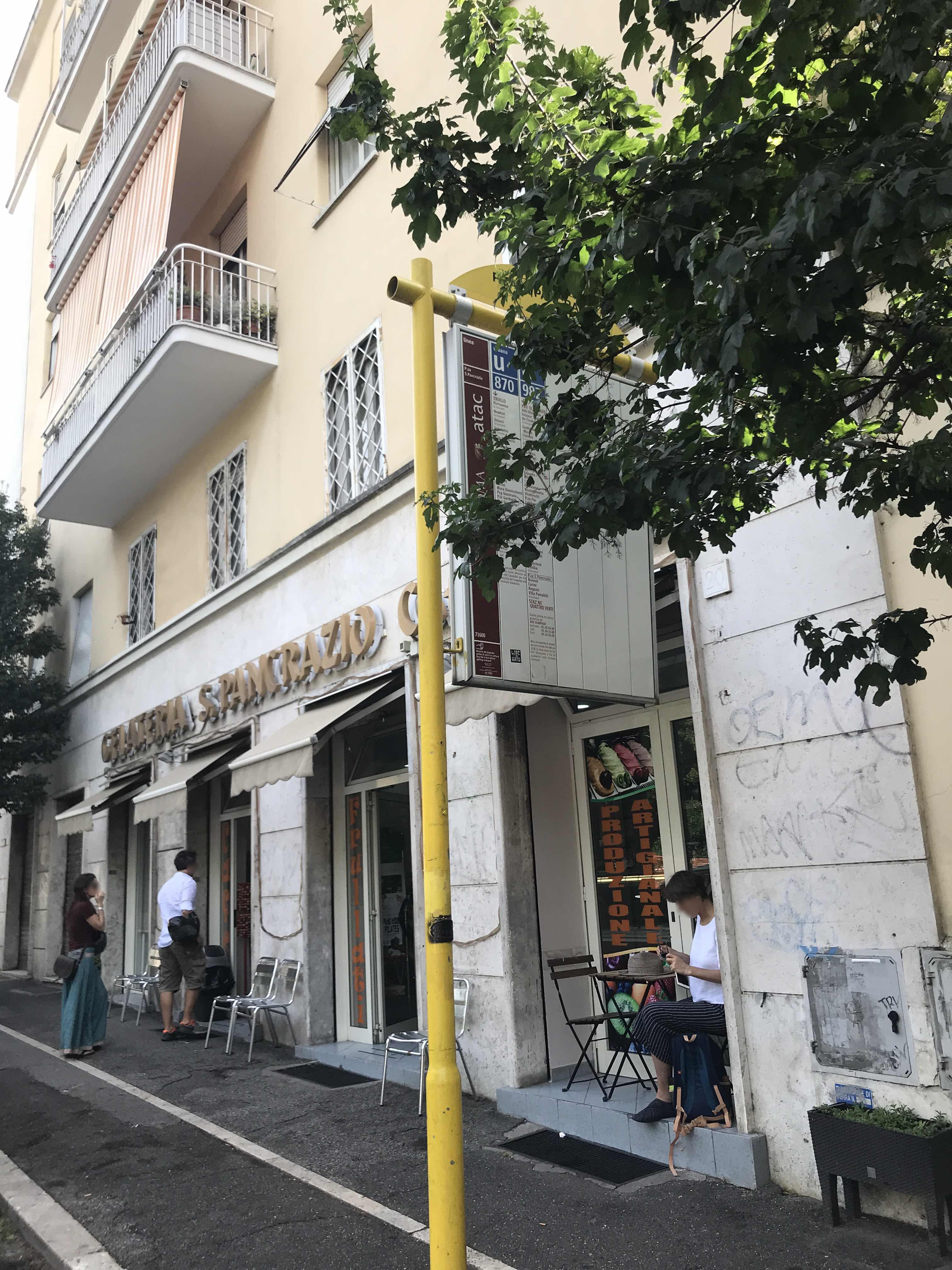 Taken by Julia J.
See St. Pancras Square stop, Roma, on the map
Public transit to St. Pancras Square stop (ID: 71600) in Roma
Looking for directions to St. Pancras Square in Roma, Italy?
Download the Moovit App to find the current schedule and step-by-step directions for Bus, Metro or Train routes that pass through St. Pancras Square.
Looking for the nearest stops closest to St. Pancras Square ? Check out this list of closest stops to your destination: Fonteiana/Ottavilla; Vitellia/St. Pancras; Villa Pamphili/Santa Sofia; Carini/Bonnet; Trastevere/Bernard. Da Feltre; Roma San Pietro.
Bus: 44, 75, 870, 982, 871, 710.Train: FL3, R, R, R, RV.Metro: A, B.
We make riding on public transit to St. Pancras Square easy, which is why over 1.7 billion users, including users in Roma trust Moovit as the best app for public transit.
Use the app to navigate to popular places including to the airport, hospital, stadium, grocery store, mall, coffee shop, school, college, and university.
St. Pancras Square stop’s code is 71600
The first line to this stop is 870, at 5:13 AM, and the last line is 982 at 12:38 AM.
5 Piazza di San Pancrazio, Roma, Italy
This stop serves ATAC and BIS’s lines
- Fonteiana/Ottavilla,
- Vitellia/St. Pancras,
- Villa Pamphili/Santa Sofia,
- Carini/Bonnet
Bus stops near St. Pancras Square stop
- Trastevere/Bernard. Da Feltre
Light Rail station near St. Pancras Square station
- Roma San Pietro
Train station near St. Pancras Square station
- Volturno/Cernaia,
- Fiumicino City,
- Nuovo Salario,
- Tuscolana/Amelia,
- Cola Di Rienzo/Regolo,
- Grotta Perfetta/Bargellini,
- Termini (Giolitti Street, 48),
- Rinascimento,
- Pavese/Atlantic Ocean,
- Boncompagni/Abruzzi,
- Nettuno,
- Cipro/Bragadin,
- Tor Di Quinto/Lupi,
- Casilina/Gallarate,
- Bufalotta/Settebagni,
- Great Wall/Decima,
- Lungotevere De' Cenci/Arenula,
- Poggio Moiano via Mirtense (Osteria Nuova),
- Arenula/Ministry of Justice,
- Pomezia | Pontina Street (Italchimici)
Popular public transit stations in Roma
Get around Roma by public transit!
Traveling around Roma has never been so easy. See step by step directions as you travel to any attraction, street or major public transit station. View bus and train schedules, arrival times, service alerts and detailed routes on a map, so you know exactly how to get to anywhere in Roma.
When traveling to any destination around Roma use Moovit's Live Directions with Get Off Notifications to know exactly where and how far to walk, how long to wait for your line, and how many stops are left. Moovit will alert you when it's time to get off — no need to constantly re-check whether yours is the next stop.
Wondering how to use public transit in Roma or how to pay for public transit in Roma? Moovit public transit app can help you navigate your way with public transit easily, and at minimum cost. It includes public transit fees, ticket prices, and costs. Looking for a map of Roma public transit lines? Moovit public transit app shows all public transit maps in Roma with all Bus, Train, Metro, Light Rail, Ferry, Funicular and Gondola routes and stops on an interactive map.
Rome and Lazio has 7 transit type(s), including: Bus, Train, Metro, Light Rail, Ferry, Funicular and Gondola, operated by several transit agencies, including ATAC, Cotral, Trenitalia, Troiani Transportation Services, BIS, ATR Mobility, Tuscia, Shuttle, Seatour, Troiani Bus Lines, CSC Mobility, Terravision, ATRAL, Tambus and Sitbus