How to get to Pacan by bus?
Click on the bus route to see step by step directions with maps, line arrival times and updated time schedules.
From Ojos De Garza, Telde
59 minFrom Teatro Auditorio Agüimes, Ag�Imes
39 minFrom Aeropuerto de Canarias, Las Palmas De Gran Canaria
44 minFrom Playa De Tufia, Telde
74 minFrom El Goro, Telde
55 minFrom Centro Ecológico Cultural Los Olivos, Telde
86 minFrom Poligono Industrial El Goro, Telde
57 minFrom las Majoreras -Carrizal, Ingenio
37 minFrom El Goro, Telde
55 min
Bus stops near Pacan in Ag�Imes
Bus lines to Pacan in Ag�Imes
- 350, Poligono De Arinaga Fase IV,VIEW
- GL-L350, 350/000 - A - Polígono de Arinaga,VIEW
- 22, Centro De Salud (Arinaga),VIEW
- 23, Centro De Salud (Arinaga),VIEW
- 25, Playa De Arinaga,VIEW
- GL-L22, 81 - B - Agüimes (Por Urb. La Paz),VIEW
- GL-L23, 023/006 - A - Playa de Arinaga (semidirecto),VIEW
- GL-L25, B - Playa de Arinaga,VIEW
What are the closest stations to Pacan?
The closest stations to Pacan are:
- F1 Canal Izquierdo (Bp) is 657 meters away, 9 min walk.
- Montaña San Francisco is 1196 meters away, 16 min walk.
Which bus lines stop near Pacan?
These bus lines stop near Pacan: GL-L22, GL-L25, GL-L31, GL-L36.
What’s the nearest bus station to Pacan in Ag�Imes?
The nearest bus station to Pacan in Ag�Imes is F1 Canal Izquierdo (Bp). It’s a 9 min walk away.
What time is the first bus to Pacan in Ag�Imes?
The GL-L22 is the first bus that goes to Pacan in Ag�Imes. It stops nearby at 6:11 AM.
What time is the last bus to Pacan in Ag�Imes?
The GL-L22 is the last bus that goes to Pacan in Ag�Imes. It stops nearby at 10:41 PM.
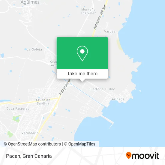
See Pacan, Ag�Imes, on the map
Public Transit to Pacan in Ag�Imes
Wondering how to get to Pacan in Ag�Imes? Moovit helps you find the best way to get to Pacan with step-by-step directions from the nearest public transit station.
Moovit provides free maps and live directions to help you navigate through your city. View schedules, routes, timetables, and find out how long does it take to get to Pacan in real time.
Looking for the nearest stop or station to Pacan? Check out this list of stops closest to your destination: F1 Canal Izquierdo (Bp); Montaña San Francisco.
Bus: GL-L22, GL-L25, GL-L31, GL-L36, 350, GL-L350, 22, 23, 25, GL-L23.
Want to see if there’s another route that gets you there at an earlier time? Moovit helps you find alternative routes or times. Get directions from and directions to Pacan easily from the Moovit App or Website.
We make riding to Pacan easy, which is why over 1.5 million users, including users in Ag�Imes, trust Moovit as the best app for public transit. You don’t need to download an individual bus app or train app, Moovit is your all-in-one transit app that helps you find the best bus time or train time available.
For information on prices of bus, costs and ride fares to Pacan, please check the Moovit app.
Use the app to navigate to popular places including to the airport, hospital, stadium, grocery store, mall, coffee shop, school, college, and university.
Pacan Address: Calle de las Mimosas, 149 35118 Urbanización La Esperanza Agüimes street in Ag�Imes
- Confortauto,
- Francisco Macias e Hijos,
- Productos Navidenos,
- Coima,
- 0246P Aguimes,
- Wurth Canarias,
- Calle las Adelfas 17,
- Taller de Mecánica de General Alesan,
- Canaria de Mármoles y Triturados.,
- Aenaga - Asociación de Empresarios de la Zona Industrial de Arinaga,
- Corman Zona Sur,
- Marcha,
- Northgate Aguimes,
- Motor Telde Arinaga,
- Hotelsa Foodservice Gran Canaria,
- Autodesguace Lito,
- Bambino de Arinaga,
- Polígono Industrial de Arinaga,
- Lopesan Taller,
- Emicela
Places Near Pacan (Ag�Imes)
- Tanatorio De San Miguel, Las Palmas De Gran Canaria,
- Hospital Militar, Las Palmas De Gran Canaria,
- Terminal Naviera Armas, Las Palmas De Gran Canaria,
- La Minilla, Las Palmas De Gran Canaria,
- C.C. Alisios, Las Palmas De Gran Canaria,
- C.C. El Mirador, Las Palmas De Gran Canaria,
- Mogán Mall, Mog�30,
- Estadio de Gran Canaria, Las Palmas De Gran Canaria,
- Centro Comercial Alcampo, Telde,
- Consulta de Traumatología y Cirugía Ortopédica Dr. Juan S Ojeda Castellano, Santa Luc�De Tirajana,
- CC Las Terrazas, Las Palmas De Gran Canaria,
- Alcampo, Telde,
- Cocodrilo Park, Agüimes,
- Ferry Bus Armas, Las Palmas De Gran Canaria,
- Vegueta, Las Palmas De Gran Canaria,
- Centro Comercial Las Terrazas, Telde,
- Hospital Dr. Negrín, Las Palmas De Gran Canaria,
- Centro Comercial Las Arenas, Las Palmas De Gran Canaria,
- Los Alisios, Las Palmas De Gran Canaria,
- IKEA Gran Canaria, Telde
How to get to popular places in Gran Canaria with public transit
Get around Ag�Imes by public transit!
Traveling around Ag�Imes has never been so easy. See step by step directions as you travel to any attraction, street or major public transit station. View bus and train schedules, arrival times, service alerts and detailed routes on a map, so you know exactly how to get to anywhere in Ag�Imes.
When traveling to any destination around Ag�Imes use Moovit's Live Directions with Get Off Notifications to know exactly where and how far to walk, how long to wait for your line, and how many stops are left. Moovit will alert you when it's time to get off — no need to constantly re-check whether yours is the next stop.
Wondering how to use public transit in Ag�Imes or how to pay for public transit in Ag�Imes? Moovit public transit app can help you navigate your way with public transit easily, and at minimum cost. It includes public transit fees, ticket prices, and costs. Looking for a map of Ag�Imes public transit lines? Moovit public transit app shows all public transit maps in Ag�Imes with all bus routes and stops on an interactive map.
Gran Canaria has 1 transit type(s), including: bus, operated by several transit agencies, including GLOBAL (AUTGC), GLOBAL Salcai-Utinsa S.A.L., GUAGUAS (AUTGC), Guaguas Municipales, PARDILLA BUS (AUTGC), TELBUS (AUTGC) and ALSA-GUMIDAFE (AUTGC)