How to get to Pacati Insurance Solutions by bus?
Click on the bus route to see step by step directions with maps, line arrival times and updated time schedules.
From Renwick Gallery, Washington
80 minFrom Pentagon Library and Conference Center, Arlington County
50 minFrom Federal Reserve Board, Washington
83 minFrom US department of state SA 4 E, Washington
84 minFrom US Holocaust Memorial Museum, Washington
98 minFrom Bureau of Engraving and Printing, Washington
97 minFrom Quarterdeck Restaurant, Arlington County
69 minFrom The Royal Sonesta Washington DC Dupont Circle (Sonesta Hotel), Washington
92 minFrom Navy Federal Credit Union, Fairfax County
78 minFrom Royal Sonesta Washington DC, Washington
92 min
How to get to Pacati Insurance Solutions by metro?
Click on the metro route to see step by step directions with maps, line arrival times and updated time schedules.
From Renwick Gallery, Washington
72 minFrom Pentagon Library and Conference Center, Arlington County
81 minFrom Federal Reserve Board, Washington
77 minFrom US department of state SA 4 E, Washington
78 minFrom US Holocaust Memorial Museum, Washington
80 minFrom Bureau of Engraving and Printing, Washington
80 minFrom Quarterdeck Restaurant, Arlington County
77 minFrom The Royal Sonesta Washington DC Dupont Circle (Sonesta Hotel), Washington
83 minFrom Royal Sonesta Washington DC, Washington
83 min
Bus stops near Pacati Insurance Solutions in Fairfax County
Metro station near Pacati Insurance Solutions in Fairfax County
- East Falls Church, 32 min walk,VIEW
Bus lines to Pacati Insurance Solutions in Fairfax County
What are the closest stations to Pacati Insurance Solutions?
The closest stations to Pacati Insurance Solutions are:
- Leesburg Pk+Glenmore Dr is 71 yards away, 2 min walk.
- Glen Carlyn Dr+Leesburg Pk is 384 yards away, 5 min walk.
- East Falls Church is 2735 yards away, 32 min walk.
Which bus lines stop near Pacati Insurance Solutions?
These bus lines stop near Pacati Insurance Solutions: F20, F26.
Which metro lines stop near Pacati Insurance Solutions?
These metro lines stop near Pacati Insurance Solutions: ORANGE, SILVER.
What’s the nearest bus station to Pacati Insurance Solutions in Fairfax County?
The nearest bus station to Pacati Insurance Solutions in Fairfax County is Leesburg Pk+Glenmore Dr. It’s a 2 min walk away.
What time is the first metro to Pacati Insurance Solutions in Fairfax County?
The ORANGE is the first metro that goes to Pacati Insurance Solutions in Fairfax County. It stops nearby at 5:10 AM.
What time is the last metro to Pacati Insurance Solutions in Fairfax County?
The SILVER is the last metro that goes to Pacati Insurance Solutions in Fairfax County. It stops nearby at 12:31 AM.
What time is the first bus to Pacati Insurance Solutions in Fairfax County?
The F20 is the first bus that goes to Pacati Insurance Solutions in Fairfax County. It stops nearby at 4:35 AM.
What time is the last bus to Pacati Insurance Solutions in Fairfax County?
The F20 is the last bus that goes to Pacati Insurance Solutions in Fairfax County. It stops nearby at 2:30 AM.
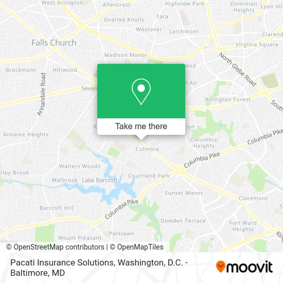
See Pacati Insurance Solutions, Fairfax County, on the map
Public Transit to Pacati Insurance Solutions in Fairfax County
Wondering how to get to Pacati Insurance Solutions in Fairfax County? Moovit helps you find the best way to get to Pacati Insurance Solutions with step-by-step directions from the nearest public transit station.
Moovit provides free maps and live directions to help you navigate through your city. View schedules, routes, timetables, and find out how long does it take to get to Pacati Insurance Solutions in real time.
Looking for the nearest stop or station to Pacati Insurance Solutions? Check out this list of stops closest to your destination: Leesburg Pk+Glenmore Dr; Glen Carlyn Dr+Leesburg Pk; East Falls Church.
Bus: F20, F26, A49, A66.Metro: ORANGE, SILVER.
Want to see if there’s another route that gets you there at an earlier time? Moovit helps you find alternative routes or times. Get directions from and directions to Pacati Insurance Solutions easily from the Moovit App or Website.
We make riding to Pacati Insurance Solutions easy, which is why over 1.5 million users, including users in Fairfax County, trust Moovit as the best app for public transit. You don’t need to download an individual bus app or train app, Moovit is your all-in-one transit app that helps you find the best bus time or train time available.
For information on prices of bus and metro, costs and ride fares to Pacati Insurance Solutions, please check the Moovit app.
Use the app to navigate to popular places including to the airport, hospital, stadium, grocery store, mall, coffee shop, school, college, and university.
Pacati Insurance Solutions Address: 6066 Leesburg Pike Falls Church, VA 22041 street in Fairfax County
- MTM Consulting Group,
- Department for Aging and Rehabilitative Services,
- Oscar A Luna, DDS,
- Veridian-Falls Church,
- Master Calendar,
- 6066 Leesburg Pike,
- Imtiaz Ahmad - Intuit Turbotax Verified Pro,
- JJR & Associates,
- Apartments in Falls Church, VA,
- Walgreens,
- VA Lottery Rite Aid,
- Credit Union 1,
- Chiropractic,
- Culmore, Virginia,
- St. Anthony of Padua Catholic Church, Falls Church, VA,
- Lu'au Gala,
- Culmore Argyle,
- Top Tech Computers,
- C&W Landscaping,
- Munson Hill Towers Apartments
Places Near Pacati Insurance Solutions (Fairfax County)
- Amazon Hq2, Arlington County,
- Georgetown, Washington,
- M&T Bank Stadium, Baltimore,
- Marriott Marquis Washington, DC, Washington,
- Warner Theatre, Washington,
- Westfield Montgomery Mall, Montgomery County,
- Washington DC VA Medical Center, Washington,
- Sibley Memorial Hospital, Washington,
- Pennsylvania Ave NW (3rd st and pennsylvania), Washington,
- The Anthem, Washington,
- Camden Yards, Baltimore,
- Basilica of the National Shrine, Washington,
- National Zoo, Washington,
- National Theatre, Washington,
- Rock Creek Tennis Center, Washington,
- Museum Of The Bible, Washington,
- National Museum of African American History and Culture, Washington,
- Capital One Arena, Washington,
- Washington National Cathedral, Washington,
- PG Mall, Prince George's County
How to get to popular places in Washington, D.C. - Baltimore, MD with public transit
Get around Fairfax County by public transit!
Traveling around Fairfax County has never been so easy. See step by step directions as you travel to any attraction, street or major public transit station. View bus and train schedules, arrival times, service alerts and detailed routes on a map, so you know exactly how to get to anywhere in Fairfax County.
When traveling to any destination around Fairfax County use Moovit's Live Directions with Get Off Notifications to know exactly where and how far to walk, how long to wait for your line, and how many stops are left. Moovit will alert you when it's time to get off — no need to constantly re-check whether yours is the next stop.
Wondering how to use public transit in Fairfax County or how to pay for public transit in Fairfax County? Moovit public transit app can help you navigate your way with public transit easily, and at minimum cost. It includes public transit fees, ticket prices, and costs. Looking for a map of Fairfax County public transit lines? Moovit public transit app shows all public transit maps in Fairfax County with all Bus, Train, Metro, Light Rail and Ferry routes and stops on an interactive map.
Washington, D.C. - Baltimore, MD has 5 transit type(s), including: Bus, Train, Metro, Light Rail and Ferry, operated by several transit agencies, including WMATA, Montgomery County Ride On, Fairfax Connector, TheBus, PRTC, DASH - Alexandria, Arlington Transit (ART), RTA of Central Maryland, MDOT MTA, MDOT MTA Light RailLink, MDOT MTA Commuter Bus, MDOT MTA Local Bus, FXBGO!, Virginia Railway Express (VRE) and MARC