Directions to Pace Company (Richmond) with public transportation
The following transit lines have routes that pass near Pace Company
 Bus: 1B, FLIXBUS N2471, GREYHOUND US0670, 1A, 1C.
- Train: NORTHEAST REGIONAL.
How to get to Pace Company by bus?
Click on the bus route to see step by step directions with maps, line arrival times and updated time schedules.
From Lorton, VA - Amtrak Auto Train Station (LOR), Fairfax County
206 minFrom Rose Gaming Resort, Prince William County
216 minFrom Potomac Mills Mall, Prince William County
191 minFrom Lorton, VA, Fairfax County
200 minFrom UVA Hospital Medical Center, Charlottesville
301 minFrom Woodbridge, VA, Prince William County
135 minFrom Amazon Fulfillment Center-Ric3, Richmond
59 min
How to get to Pace Company by train?
Click on the train route to see step by step directions with maps, line arrival times and updated time schedules.
Bus stops near Pace Company in Richmond
Train station near Pace Company in Richmond
- Pathrichmond Main Street Amtrak Station, 51 min walk,VIEW
Bus lines to Pace Company in Richmond
- 1A, Midlothian/Hull/Transfer Station,VIEW
- 1B, Hull/Warwick Via Southside Plaza,VIEW
- 1C, Elkhart/Hull/Transfer Station,VIEW
- 14, Hermitage/Azalea,VIEW
- BRT, Broad/Main/Rocketts,VIEW
- GREYHOUND US0670, Raleigh Bus Station,VIEW
- GREYHOUND US0700, Charlotte Bus Station,VIEW
- FLIXBUS N2471, Atlanta Bus Station,VIEW
- FLIXBUS N2472, New York City Chinatown (28 Allen St),VIEW
- FLIXBUS 2605, New York Midtown (31st St & 8th Ave),VIEW
- FLIXBUS N2605, Brookline,VIEW
What are the closest stations to Pace Company?
The closest stations to Pace Company are:
- Hull + 3rd is 10 yards away, 1 min walk.
- Main + 17th is 82 yards away, 2 min walk.
- Main Street Station Eastbound Station is 86 yards away, 2 min walk.
- Richmond (Main St Station Plaza) is 518 yards away, 7 min walk.
- Pathrichmond Main Street Amtrak Station is 4380 yards away, 51 min walk.
Which bus lines stop near Pace Company?
These bus lines stop near Pace Company: 1B, FLIXBUS N2471, GREYHOUND US0670.
Which train line stops near Pace Company?
NORTHEAST REGIONAL (Philadelphia)
What’s the nearest bus station to Pace Company in Richmond?
The nearest bus station to Pace Company in Richmond is Hull + 3rd. It’s a 1 min walk away.
What time is the first train to Pace Company in Richmond?
The NORTHEAST REGIONAL is the first train that goes to Pace Company in Richmond. It stops nearby at 5:19 AM.
What time is the last train to Pace Company in Richmond?
The NORTHEAST REGIONAL is the last train that goes to Pace Company in Richmond. It stops nearby at 6:57 PM.
What time is the first bus to Pace Company in Richmond?
The GREYHOUND US0700 is the first bus that goes to Pace Company in Richmond. It stops nearby at 3:20 AM.
What time is the last bus to Pace Company in Richmond?
The GREYHOUND US0670 is the last bus that goes to Pace Company in Richmond. It stops nearby at 2:10 PM.
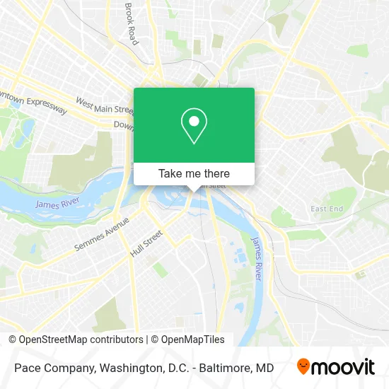
See Pace Company, Richmond, on the map
Public Transit to Pace Company in Richmond
Wondering how to get to Pace Company in Richmond? Moovit helps you find the best way to get to Pace Company with step-by-step directions from the nearest public transit station.
Moovit provides free maps and live directions to help you navigate through your city. View schedules, routes, timetables, and find out how long does it take to get to Pace Company in real time.
Looking for the nearest stop or station to Pace Company? Check out this list of stops closest to your destination: Hull + 3rd; Main + 17th; Main Street Station Eastbound Station; Richmond (Main St Station Plaza); Pathrichmond Main Street Amtrak Station.
Bus: 1B, FLIXBUS N2471, GREYHOUND US0670, 1A, 1C, 14, BRT, GREYHOUND US0700, FLIXBUS N2472, FLIXBUS 2605.Train: NORTHEAST REGIONAL.
Want to see if there’s another route that gets you there at an earlier time? Moovit helps you find alternative routes or times. Get directions from and directions to Pace Company easily from the Moovit App or Website.
We make riding to Pace Company easy, which is why over 1.7 million users, including users in Richmond, trust Moovit as the best app for public transit. You don’t need to download an individual bus app or train app, Moovit is your all-in-one transit app that helps you find the best bus time or train time available.
For information on prices of bus and train, costs and ride fares to Pace Company, please check the Moovit app.
Use the app to navigate to popular places including to the airport, hospital, stadium, grocery store, mall, coffee shop, school, college, and university.
Pace Company Address: 501 S 14th St Ste 219 street in Richmond
- Vcu Mcv M Lot,
- Vcu Mcv R Lot,
- Vauxhall Island,
- Triple Crossing,
- Vistas on the James,
- Vistas on the James Condominium Owners Assoc,
- Floodwall Park,
- 7 Hills Brewing Company,
- Carmax Shockoe,
- Hat Factory,
- Floodwall Parking,
- Carmax,
- The Canal Club,
- South Falls I,
- Southern Railway Taphouse,
- Smbw Architects,
- Hull Street Station,
- Odell Associates Inc,
- Timmons Group,
- Pipeline Overlook
Places Near Pace Company (Richmond)
- Pennsylvania Ave NW (3rd st and pennsylvania), Washington,
- National Museum of African American History and Culture, Washington,
- Marriott Marquis Washington, DC, Washington,
- PG Mall, Prince George's County,
- Westfield Montgomery Mall, Montgomery County,
- Museum Of The Bible, Washington,
- Warner Theatre, Washington,
- Washington DC VA Medical Center, Washington,
- Sibley Memorial Hospital, Washington,
- Georgetown, Washington,
- National Theatre, Washington,
- Washington National Cathedral, Washington,
- Capital One Arena, Washington,
- Camden Yards, Baltimore,
- Rock Creek Tennis Center, Washington,
- National Zoo, Washington,
- M&T Bank Stadium, Baltimore,
- Basilica of the National Shrine, Washington,
- Amazon Hq2, Arlington County,
- The Anthem, Washington
How to get to popular places in Washington, D.C. - Baltimore, MD with public transit
Get around Richmond by public transit!
Traveling around Richmond has never been so easy. See step by step directions as you travel to any attraction, street or major public transit station. View bus and train schedules, arrival times, service alerts and detailed routes on a map, so you know exactly how to get to anywhere in Richmond.
When traveling to any destination around Richmond use Moovit's Live Directions with Get Off Notifications to know exactly where and how far to walk, how long to wait for your line, and how many stops are left. Moovit will alert you when it's time to get off — no need to constantly re-check whether yours is the next stop.
Wondering how to use public transit in Richmond or how to pay for public transit in Richmond? Moovit public transit app can help you navigate your way with public transit easily, and at minimum cost. It includes public transit fees, ticket prices, and costs. Looking for a map of Richmond public transit lines? Moovit public transit app shows all public transit maps in Richmond with all Bus, Train, Metro, Light Rail and Ferry routes and stops on an interactive map.
Washington, D.C. - Baltimore, MD has 5 transit type(s), including: Bus, Train, Metro, Light Rail and Ferry, operated by several transit agencies, including WMATA, Montgomery County Ride On, Fairfax Connector, TheBus, PRTC, DASH - Alexandria, Arlington Transit (ART), RTA of Central Maryland, MDOT MTA, MDOT MTA Light RailLink, MDOT MTA Commuter Bus, MDOT MTA Local Bus, FXBGO!, Virginia Railway Express (VRE) and MARC