How to get to Pace Engineering by bus?
Click on the bus route to see step by step directions with maps, line arrival times and updated time schedules.
From Metterra Hotel on Whyte, Edmonton
52 minFrom Tunis E W Professional, Edmonton
75 minFrom The Derrick Golf & Country Club, Edmonton
73 minFrom YMCA David Thomas King Child Care, Edmonton
29 minFrom Griesbach, Edmonton
42 minFrom Ebus, Edmonton
48 minFrom 에드먼튼 순복음 교회 - Ekfgc, Edmonton
79 minFrom Dollarama, Edmonton
52 minFrom Citadel Theatre, Edmonton
49 minFrom Liberta Coffee Lab, Edmonton
93 min
Bus stops near Pace Engineering in Edmonton
Bus lines to Pace Engineering in Edmonton
What are the closest stations to Pace Engineering?
The closest stations to Pace Engineering are:
- 172 Street & 103 Avenue is 131 meters away, 3 min walk.
- 176 Street & 102 Avenue is 547 meters away, 8 min walk.
- 170 Street & Stony Plain Road is 691 meters away, 10 min walk.
Which bus lines stop near Pace Engineering?
These bus lines stop near Pace Engineering: 054, 921.
What’s the nearest bus station to Pace Engineering in Edmonton?
The nearest bus station to Pace Engineering in Edmonton is 172 Street & 103 Avenue. It’s a 3 min walk away.
What time is the first bus to Pace Engineering in Edmonton?
The 914 is the first bus that goes to Pace Engineering in Edmonton. It stops nearby at 6:35 AM.
What time is the last bus to Pace Engineering in Edmonton?
The 921 is the last bus that goes to Pace Engineering in Edmonton. It stops nearby at 11:18 PM.
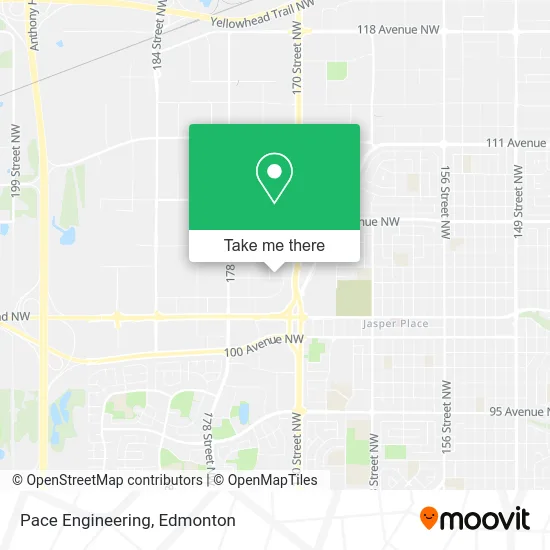
See Pace Engineering, Edmonton, on the map
Public Transit to Pace Engineering in Edmonton
Wondering how to get to Pace Engineering in Edmonton? Moovit helps you find the best way to get to Pace Engineering with step-by-step directions from the nearest public transit station.
Moovit provides free maps and live directions to help you navigate through your city. View schedules, routes, timetables, and find out how long does it take to get to Pace Engineering in real time.
Looking for the nearest stop or station to Pace Engineering? Check out this list of stops closest to your destination: 172 Street & 103 Avenue; 176 Street & 102 Avenue; 170 Street & Stony Plain Road.
Bus: 054, 921, 908, 912, 925, 907, 914.
Want to see if there’s another route that gets you there at an earlier time? Moovit helps you find alternative routes or times. Get directions from and directions to Pace Engineering easily from the Moovit App or Website.
We make riding to Pace Engineering easy, which is why over 1.5 million users, including users in Edmonton, trust Moovit as the best app for public transit. You don’t need to download an individual bus app or train app, Moovit is your all-in-one transit app that helps you find the best bus time or train time available.
For information on prices of bus, costs and ride fares to Pace Engineering, please check the Moovit app.
Use the app to navigate to popular places including to the airport, hospital, stadium, grocery store, mall, coffee shop, school, college, and university.
Pace Engineering Address: 17304 103 Ave NW Edmonton, AB T5S 1N1 street in Edmonton
- Positive Systems Computing,
- Variety Finishing,
- Aspirecare Home Care Services,
- Aces Staffing Solutions,
- Connect Fall Protection,
- Alberta Reproductive Centre,
- Savich Donald M Lawyr,
- Acms Ultrasound,
- Lyman Lawrence R Barristers & Solicitors,
- Wre Amalgamation,
- R P M Planning Associates,
- Coyle & Company Chartered Accountants,
- Robertson Rodney K Professional,
- Soul of Halloween,
- Metis Settlements Land Registry,
- Standard International Underwriters,
- Dieleman Levine Chartered Accountants,
- Primerica Financial Service,
- Rolling Mix Concrete Edmonton Ltd,
- Rockwell Automation Canada Inc
Places Near Pace Engineering (Edmonton)
- Edmonton Valley Zoo, Edmonton,
- Canada Place Service Canada Centre, Edmonton,
- Fort Edmonton Park, Edmonton,
- Alberta Legislature Building, Edmonton,
- Northgate Centre, Edmonton,
- Edmonton Commonwealth Stadium, Edmonton,
- West Edmonton Mall, Edmonton,
- Cross Cancer Institute, Edmonton,
- Edmonton VIA Rail Station, Edmonton,
- Royal Alexandra Hospital, Edmonton,
- Londonderry Mall, Edmonton,
- Whyte Avenue, Edmonton,
- Kaye Edmonton Clinic, Edmonton,
- Rogers Place, Edmonton,
- Borden Park, Edmonton,
- MacEwan University, Edmonton,
- University of Alberta, Edmonton,
- Kingsway Mall, Edmonton,
- Edmonton EXPO Centre, Edmonton,
- Grey Nuns Community Hospital, Edmonton
How to get to popular places in Edmonton with public transit
Get around Edmonton by public transit!
Traveling around Edmonton has never been so easy. See step by step directions as you travel to any attraction, street or major public transit station. View bus and train schedules, arrival times, service alerts and detailed routes on a map, so you know exactly how to get to anywhere in Edmonton.
When traveling to any destination around Edmonton use Moovit's Live Directions with Get Off Notifications to know exactly where and how far to walk, how long to wait for your line, and how many stops are left. Moovit will alert you when it's time to get off — no need to constantly re-check whether yours is the next stop.
Wondering how to use public transit in Edmonton or how to pay for public transit in Edmonton? Moovit public transit app can help you navigate your way with public transit easily, and at minimum cost. It includes public transit fees, ticket prices, and costs. Looking for a map of Edmonton public transit lines? Moovit public transit app shows all public transit maps in Edmonton with all Bus and Light Rail routes and stops on an interactive map.
Edmonton has 2 transit type(s), including: Bus and Light Rail, operated by several transit agencies, including ETS LRT, ETS, Strathcona County Transit, St. Albert Transit, Spruce Grove Transit, Fort Saskatchewan Transit, Beaumont Transit and Leduc Transit