Directions to Pagode Lanches (Campo Magro) with public transportation
The following transit lines have routes that pass near Pagode Lanches
How to get to Pagode Lanches by bus?
Click on the bus route to see step by step directions with maps, line arrival times and updated time schedules.
From São Braz, São Braz
60 minFrom Orleans, Orleans
70 minFrom Avenida Vereador Toaldo Túlio 2500, São Braz
55 minFrom Campo Largo, Campo
106 minFrom Campo Largo, Campo
106 minFrom Hospital do Rocio, Campo
115 minFrom Rua Brasilio Cuman, São Braz
83 minFrom Ligeirinho Curitiba - Campo Largo, Campo
110 minFrom Hospital do Rocio, Campo
93 minFrom Terminal Campo Largo, Campo
99 min
Bus stops near Pagode Lanches in Campo Magro
Bus lines to Pagode Lanches in Campo Magro
- P11 CAMPO MAGRO, Campo Magro → Terminal Santa Felicidade,VIEW
- P69 MAD. CAMPO MAGRO / CURITIBA, Curitiba (Fernando Moreira) → Campo Magro,VIEW
- P31 BATEIAS / CAMPO MAGRO, Campo Magro (Prefeitura) → Bateias,VIEW
- P12 CAMPO MAGRO (SÃO BENEDITO), Terminal Santa Felicidade → Prefeitura de Campo Magro,VIEW
- P32 TERRA BOA / CAMPO MAGRO, Terra Boa → Campo Magro (Prefeitura),VIEW
What are the closest stations to Pagode Lanches?
The closest stations to Pagode Lanches are:
- R. Portela, 18 is 162 meters away, 3 min walk.
- Rod. PR-090, 21177 is 808 meters away, 11 min walk.
- Rod. PR-090, 20767 (Prefeitura de Campo Magro sentido Curitiba) is 1217 meters away, 16 min walk.
Which bus lines stop near Pagode Lanches?
These bus lines stop near Pagode Lanches: P11 CAMPO MAGRO, P31 BATEIAS / CAMPO MAGRO.
What’s the nearest bus station to Pagode Lanches in Campo Magro?
The nearest bus station to Pagode Lanches in Campo Magro is R. Portela, 18. It’s a 3 min walk away.
What time is the first bus to Pagode Lanches in Campo Magro?
The P11 CAMPO MAGRO is the first bus that goes to Pagode Lanches in Campo Magro. It stops nearby at 4:36 AM.
What time is the last bus to Pagode Lanches in Campo Magro?
The P69 MAD. CAMPO MAGRO / CURITIBA is the last bus that goes to Pagode Lanches in Campo Magro. It stops nearby at 2:30 AM.
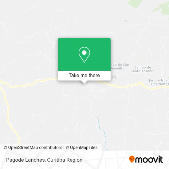
See Pagode Lanches, Campo Magro, on the map
Public Transit to Pagode Lanches in Campo Magro
Wondering how to get to Pagode Lanches in Campo Magro? Moovit helps you find the best way to get to Pagode Lanches with step-by-step directions from the nearest public transit station.
Moovit provides free maps and live directions to help you navigate through your city. View schedules, routes, timetables, and find out how long does it take to get to Pagode Lanches in real time.
Looking for the nearest stop or station to Pagode Lanches? Check out this list of stops closest to your destination: R. Portela; Rod. PR-090; Rod. PR-090.
Bus: P11 CAMPO MAGRO, P31 BATEIAS / CAMPO MAGRO, P69 MAD. CAMPO MAGRO / CURITIBA, P12 CAMPO MAGRO (SÃO BENEDITO), P32 TERRA BOA / CAMPO MAGRO.
Want to see if there’s another route that gets you there at an earlier time? Moovit helps you find alternative routes or times. Get directions from and directions to Pagode Lanches easily from the Moovit App or Website.
We make riding to Pagode Lanches easy, which is why over 1.5 million users, including users in Campo Magro, trust Moovit as the best app for public transit. You don’t need to download an individual bus app or train app, Moovit is your all-in-one transit app that helps you find the best bus time or train time available.
For information on prices of bus, costs and ride fares to Pagode Lanches, please check the Moovit app.
Use the app to navigate to popular places including to the airport, hospital, stadium, grocery store, mall, coffee shop, school, college, and university.
Pagode Lanches Address: Rua José Marques, Campo Magro Campo Magro-PR 83535-000 street in Campo Magro
- Indignação,
- Hortifruti e Varejo Costa,
- Oliveira,
- Pizzaria Katungue,
- Lagoa Bebidas,
- Lagoa de Pedra,
- Ldf Alimentos,
- Estrada do Cerne,
- Loja Casa das Meias,
- Igreja Batista Independente Betel,
- Hw Products,
- Banco do Brasil,
- Estância Aquática e Pesque Pague do Rei,
- Pesque Pague do Rei,
- Frigorifico Bela Vista Basso,
- Rua Pedro Kudlawiec,
- Karícia Motel,
- Recanto das Hortencias,
- Bar do Paulo,
- Prime Pó Pintura Eletrostática
Places Near Pagode Lanches (Campo Magro)
- Parque Barigui, Mercês,
- Hhhhh, Fazendinha,
- Park Shopping Barigüi, Mossunguê,
- Hospital do Rocio, Campo,
- Campo Largo, Campo,
- Hospital Nossa Senhora Das Graças, Mercês,
- Rua General Mário Tourinho, Campina Do Siqueira,
- Jockey Plaza Shopping Center, Tarumã,
- Shopping Palladium, Portão,
- Hospital Universitário Evangélico de Curitiba, Bigorrilho,
- Jardim Botânico de Curitiba PR, Centro,
- Arena Da Baixada - Curitiba,
- Rua Martim Afonso 558, Mercês,
- Shopping Estação, Rebouças,
- Hospital de Clínicas (HC - UFPR), Centro,
- Hospital Madalena Sofia, Bairro Alto,
- Hospital Da Cruz Vermelha, Batel,
- Hospital Erasto Gaertner, Jardim Das Américas,
- Pontifícia Universidade Católica do Paraná (PUCPR), Prado Velho,
- Hospital Angelina Caron, Campina Grande Do Sul
How to get to popular places in Curitiba Region with public transit
Get around Campo Magro by public transit!
Traveling around Campo Magro has never been so easy. See step by step directions as you travel to any attraction, street or major public transit station. View bus and train schedules, arrival times, service alerts and detailed routes on a map, so you know exactly how to get to anywhere in Campo Magro.
When traveling to any destination around Campo Magro use Moovit's Live Directions with Get Off Notifications to know exactly where and how far to walk, how long to wait for your line, and how many stops are left. Moovit will alert you when it's time to get off — no need to constantly re-check whether yours is the next stop.
Wondering how to use public transit in Campo Magro or how to pay for public transit in Campo Magro? Moovit public transit app can help you navigate your way with public transit easily, and at minimum cost. It includes public transit fees, ticket prices, and costs. Looking for a map of Campo Magro public transit lines? Moovit public transit app shows all public transit maps in Campo Magro with all Bus and Cable Car routes and stops on an interactive map.
Curitiba Region has 2 transit type(s), including: Bus and Cable Car, operated by several transit agencies, including Sistema Integrado de Mobilidade (URBS), Sistema Integrado de Mobilidade (AMEP), URBS (Cartões bancários e Dinheiro), URBS (Cartões bancários / Cartão URBS), AMEP (Cartões bancários / Cartão MetroCard), AMEP (Cartões bancários / Cartão MetroCard / Dinheiro), Viação Colombo (Dinheiro), TRIAR (Cartão TRIAR / Dinheiro), Empresa Curitiba Cerro Azul (Dinheiro), Expresso Nossa Senhora da Penha (Dinheiro), Empresa Campo Alto Tijucas (Dinheiro), Auto Viação São José (Cartão VEM / Dinheiro), BRT S/A (Cartão VEM / Dinheiro), TransPiedade (Cartão Cidadão / Dinheiro) and Oceânica Sul (Cartão Transporte / Dinheiro)