How to get to Palm Springs Learning Academy by bus?
Click on the bus route to see step by step directions with maps, line arrival times and updated time schedules.
From Hialeah Hospital Emergency Room, Hialeah
63 minFrom Florida, Miami
69 minFrom BrandsMart USA, Miami
67 minFrom Even Hotel Miami - Airport, An Ihg Hotel, Miami
63 minFrom METRORail-Miami International Airport, Miami
71 minFrom Hyatt Place Miami Airport-East, Miami
71 minFrom Holiday Inn Express Hotel & Suites-Miami Airport East, Miami
68 minFrom Neighbor Transport Services, Miami
91 minFrom MIA Mover, Miami
72 minFrom Flixbus Miami International Airport, Miami
71 min
Bus stops near Palm Springs Learning Academy in Hialeah
Train station near Palm Springs Learning Academy in Hialeah
- Okeechobee, 8 min walk,VIEW
Bus lines to Palm Springs Learning Academy in Hialeah
What are the closest stations to Palm Springs Learning Academy?
The closest stations to Palm Springs Learning Academy are:
- W 12 Av & W 58 St is 87 yards away, 2 min walk.
- W 16 Av & W 60 St is 107 yards away, 2 min walk.
- Okeechobee is 606 yards away, 8 min walk.
Which bus line stops near Palm Springs Learning Academy?
183 (183 - Aventura Mall Terminal)
What’s the nearest train station to Palm Springs Learning Academy in Hialeah?
The nearest train station to Palm Springs Learning Academy in Hialeah is Okeechobee. It’s a 8 min walk away.
What’s the nearest bus station to Palm Springs Learning Academy in Hialeah?
The nearest bus stations to Palm Springs Learning Academy in Hialeah are W 12 Av & W 58 St and W 16 Av & W 60 St. The closest one is a 2 min walk away.
What time is the first train to Palm Springs Learning Academy in Hialeah?
The GREEN is the first train that goes to Palm Springs Learning Academy in Hialeah. It stops nearby at 5:03 AM.
What time is the last train to Palm Springs Learning Academy in Hialeah?
The GREEN is the last train that goes to Palm Springs Learning Academy in Hialeah. It stops nearby at 12:56 AM.
What time is the first bus to Palm Springs Learning Academy in Hialeah?
The 183 is the first bus that goes to Palm Springs Learning Academy in Hialeah. It stops nearby at 4:41 AM.
What time is the last bus to Palm Springs Learning Academy in Hialeah?
The 183 is the last bus that goes to Palm Springs Learning Academy in Hialeah. It stops nearby at 12:12 AM.
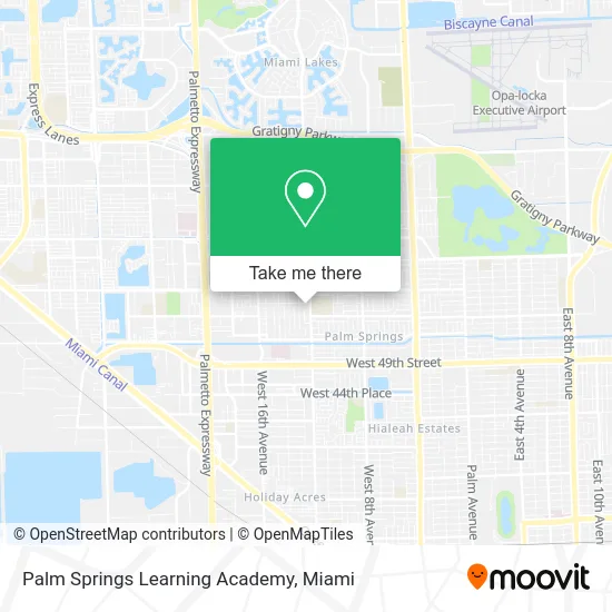
See Palm Springs Learning Academy, Hialeah, on the map
Public Transit to Palm Springs Learning Academy in Hialeah
Wondering how to get to Palm Springs Learning Academy in Hialeah? Moovit helps you find the best way to get to Palm Springs Learning Academy with step-by-step directions from the nearest public transit station.
Moovit provides free maps and live directions to help you navigate through your city. View schedules, routes, timetables, and find out how long does it take to get to Palm Springs Learning Academy in real time.
Looking for the nearest stop or station to Palm Springs Learning Academy? Check out this list of stops closest to your destination: W 12 Av & W 58 St; W 16 Av & W 60 St; Okeechobee.
Bus: 183, 54, HIAFLA.Train: GREEN.
Want to see if there’s another route that gets you there at an earlier time? Moovit helps you find alternative routes or times. Get directions from and directions to Palm Springs Learning Academy easily from the Moovit App or Website.
We make riding to Palm Springs Learning Academy easy, which is why over 1.5 million users, including users in Hialeah, trust Moovit as the best app for public transit. You don’t need to download an individual bus app or train app, Moovit is your all-in-one transit app that helps you find the best bus time or train time available.
For information on prices of bus and train, costs and ride fares to Palm Springs Learning Academy, please check the Moovit app.
Use the app to navigate to popular places including to the airport, hospital, stadium, grocery store, mall, coffee shop, school, college, and university.
Palm Springs Learning Academy Address: 5700 W 12th Ave Hialeah, FL 33012 street in Hialeah
- Kingdom Hall of Jehovah's Witnesses,
- Avalo, Elisa C,
- Ymc Accountax,
- Palm Springs Middle School,
- El Bim Bom Restaurant,
- Exxodo Restaurant,
- Florida Groceries,
- Tres Monitos,
- M & M Emergency Locks Services,
- Stellar Moments Event & Prty Planning,
- Mr Clean and Glow Mobi,
- All Pumping,
- Miami Dade Paramount Locksmith LP,
- Jeniffer's Coin Laundry,
- Caricias Adult Daycare and Social Center,
- Spot Dye Carpet Cleaning,
- Sotelo'Sloundrymat,
- 61 Properties Court,
- Eduardo's Barberia Y Peluqueria,
- El Mundo De Las Telas
Places Near Palm Springs Learning Academy (Hialeah)
- Aventura Mall, Miami Beach,
- Dolphin Mall Bus, Miami,
- Aventura Mall, Miami,
- Port of Miami Cruise Terminal, Miami,
- Miami-Dade County Courthouse, Miami,
- Bayside Marketplace, Miami,
- Little Havana, Miami,
- Miami Freedom Park, Miami,
- Wynwood, Miami,
- Sawgrass Mall, Miami,
- Zoo Miami, Miami,
- Sawgrass mall ( FL ), Miami Beach,
- 1351 NW 12th St, Miami,
- Dolphin Mall, Miami,
- Marlins Park, Miami,
- Hard Rock Stadium, Miami Gardens,
- Richard E. Gerstein Justice Building, Miami,
- Miami Design District, Miami,
- Keiser University Flagship Campus, West Palm Beach,
- Brickell City Centre, Miami
How to get to popular places in Miami with public transit
Get around Hialeah by public transit!
Traveling around Hialeah has never been so easy. See step by step directions as you travel to any attraction, street or major public transit station. View bus and train schedules, arrival times, service alerts and detailed routes on a map, so you know exactly how to get to anywhere in Hialeah.
When traveling to any destination around Hialeah use Moovit's Live Directions with Get Off Notifications to know exactly where and how far to walk, how long to wait for your line, and how many stops are left. Moovit will alert you when it's time to get off — no need to constantly re-check whether yours is the next stop.
Wondering how to use public transit in Hialeah or how to pay for public transit in Hialeah? Moovit public transit app can help you navigate your way with public transit easily, and at minimum cost. It includes public transit fees, ticket prices, and costs. Looking for a map of Hialeah public transit lines? Moovit public transit app shows all public transit maps in Hialeah with all Bus, Train, Light Rail and Ferry routes and stops on an interactive map.
Miami has 4 transit type(s), including: Bus, Train, Light Rail and Ferry, operated by several transit agencies, including Broward County Transit, Miami-Dade Transit, Metrorail, Palm Tran, Tri-Rail, Brightline, MARTY, City of Homestead Trolley, Key West Transit, Treasure Coast Connector, GoLine IRT, Amtrak, Greyhound-us, FlixBus-us and Aventura Express Shuttle Bus