How to get to Pamce by bus?
Click on the bus route to see step by step directions with maps, line arrival times and updated time schedules.
From viñedos casa leal, Aguascalientes
49 minFrom Universidad Tecnologica De Aguascalientes, Aguascalientes
54 minFrom Red Gasolin, Aguascalientes
34 minFrom WESTERN UNION, Aguascalientes
51 minFrom Jardín Rincón Regio, Aguascalientes
49 minFrom Caffenio Aguascalientes, Aguascalientes
53 minFrom WESTERN UNION, Aguascalientes
33 minFrom Universidad Tecnológica De Aguascalientes, Aguascalientes
54 minFrom Miravalle, Aguascalientes
60 minFrom Secundaria Tecnica, 10, Aguascalientes
55 min
Bus stops near Pamce in Aguascalientes
- Avenida Gabriela Mistral, 109, 2 min walk,VIEW
- Obrero Mundial, 409a, 3 min walk,VIEW
- Aparatos Ejercicio (No Oficial), 5 min walk,VIEW
- Prepa Benito Juárez, 6 min walk,VIEW
- Frente A Velódromo, 6 min walk,VIEW
- Aguascalientes - San Francisco De Los Romo, 117, 7 min walk,VIEW
- Domo De Bicicletas, 9 min walk,VIEW
Bus lines to Pamce in Aguascalientes
What are the closest stations to Pamce?
The closest stations to Pamce are:
- Avenida Gabriela Mistral, 109 is 118 meters away, 2 min walk.
- Obrero Mundial, 409a is 224 meters away, 3 min walk.
- Aparatos Ejercicio (No Oficial) is 374 meters away, 5 min walk.
- Prepa Benito Juárez is 396 meters away, 6 min walk.
- Frente A Velódromo is 431 meters away, 6 min walk.
- Aguascalientes - San Francisco De Los Romo, 117 is 485 meters away, 7 min walk.
- Domo De Bicicletas is 641 meters away, 9 min walk.
Which bus lines stop near Pamce?
These bus lines stop near Pamce: RUTA 09, RUTA 35, RUTA 37.
What’s the nearest bus station to Pamce in Aguascalientes?
The nearest bus station to Pamce in Aguascalientes is Avenida Gabriela Mistral, 109. It’s a 2 min walk away.
What time is the first bus to Pamce in Aguascalientes?
The RUTA 20S is the first bus that goes to Pamce in Aguascalientes. It stops nearby at 5:44 AM.
What time is the last bus to Pamce in Aguascalientes?
The RUTA 43 is the last bus that goes to Pamce in Aguascalientes. It stops nearby at 10:27 PM.
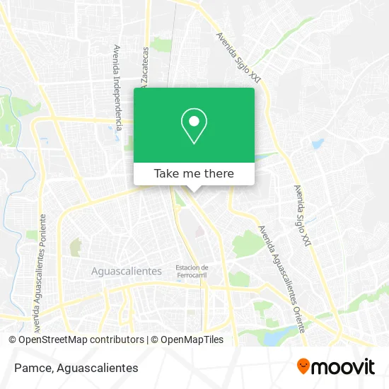
See Pamce, Aguascalientes, on the map
Public Transit to Pamce in Aguascalientes
Wondering how to get to Pamce in Aguascalientes? Moovit helps you find the best way to get to Pamce with step-by-step directions from the nearest public transit station.
Moovit provides free maps and live directions to help you navigate through your city. View schedules, routes, timetables, and find out how long does it take to get to Pamce in real time.
Looking for the nearest stop or station to Pamce? Check out this list of stops closest to your destination: Avenida Gabriela Mistral; Obrero Mundial; Aparatos Ejercicio (No Oficial); Prepa Benito Juárez; Frente A Velódromo; Aguascalientes - San Francisco De Los Romo; Domo De Bicicletas.
Bus: RUTA 09, RUTA 35, RUTA 37, RUTA 16, RUTA 08, RUTA 20N, RUTA 20S, RUTA 43.
Want to see if there’s another route that gets you there at an earlier time? Moovit helps you find alternative routes or times. Get directions from and directions to Pamce easily from the Moovit App or Website.
We make riding to Pamce easy, which is why over 1.5 million users, including users in Aguascalientes, trust Moovit as the best app for public transit. You don’t need to download an individual bus app or train app, Moovit is your all-in-one transit app that helps you find the best bus time or train time available.
For information on prices of bus, costs and ride fares to Pamce, please check the Moovit app.
Use the app to navigate to popular places including to the airport, hospital, stadium, grocery store, mall, coffee shop, school, college, and university.
Pamce Address: Pamce, Calle Gregorio Martínez Soto 116, Fraccionamiento La Estrella, 20150 Aguascalientes, Aguasca street in Aguascalientes
- Club de Nutrición Herbalife,
- Frutería La Catrina,
- Vulcanizadora Valdez,
- Venta de Dulces,
- Avenida Gabriela Mistral,
- Ferretería y Tlapaleria Medina,
- Porto Duga,
- Venta de Bazar,
- Maderas Lore,
- Cosméticos Distribuciones Kava,
- Abarrotes Cuquis,
- Don Genaro,
- Eléctrico Mecanico,
- Menudos Toña,
- Veterinaria Odi,
- Concepción Maldonado,
- Tianguis De La Estrella,
- Abarrotes La Circunvalación,
- Deposito La Red,
- Herrajes Ferretería
Places Near Pamce (Aguascalientes)
- Aeropuerto de Aguascalientes S.A. de C.V., Aguascalientes,
- Universidad Autónoma de Aguascalientes, Aguascalientes,
- Central De Autobuses, Aguascalientes,
- Imss Clinica 1, Aguascalientes,
- Ciudad industrial, Aguascalientes,
- ESPACIOS, Aguascalientes,
- clinica 3 uaa, Aguascalientes,
- Nuevo Hospital Hidalgo, Aguascalientes,
- Centro, Aguascalientes,
- Villas de Nuestra Señora de la Asunción, Aguascalientes,
- Hospital Imss No. 3, Aguascalientes,
- Blvd. Luis Donaldo Colosio, Aguascalientes,
- Parque Las Tres Centurias, Aguascalientes,
- Villasuncion, Aguascalientes,
- Jesús María, Aguascalientes,
- Agropecuario, Aguascalientes,
- Isla San Marcos, Aguascalientes,
- La Isla San Marcos, Aguascalientes,
- Centro Comercial Altaria, Aguascalientes,
- Terminal De Combis, Aguascalientes
How to get to popular places in Aguascalientes with public transit
Get around Aguascalientes by public transit!
Traveling around Aguascalientes has never been so easy. See step by step directions as you travel to any attraction, street or major public transit station. View bus and train schedules, arrival times, service alerts and detailed routes on a map, so you know exactly how to get to anywhere in Aguascalientes.
When traveling to any destination around Aguascalientes use Moovit's Live Directions with Get Off Notifications to know exactly where and how far to walk, how long to wait for your line, and how many stops are left. Moovit will alert you when it's time to get off — no need to constantly re-check whether yours is the next stop.
Wondering how to use public transit in Aguascalientes or how to pay for public transit in Aguascalientes? Moovit public transit app can help you navigate your way with public transit easily, and at minimum cost. It includes public transit fees, ticket prices, and costs. Looking for a map of Aguascalientes public transit lines? Moovit public transit app shows all public transit maps in Aguascalientes with all bus routes and stops on an interactive map.
Aguascalientes has 1 transit type(s), including: bus, operated by several transit agencies, including Coordinación General de Movilidad