Directions to Pan Neto (Olinda) with public transportation
The following transit lines have routes that pass near Pan Neto
How to get to Pan Neto by bus?
Click on the bus route to see step by step directions with maps, line arrival times and updated time schedules.
From Clube Português Do Recife, Graças
32 minFrom Centro de Convenções de Pernambuco, Olinda
35 minFrom Praça Miguel De Cervantes, Ilha Do Leite
37 minFrom Clínica Nossa Senhora do Carmo, Madalena
48 minFrom Rua Dezenove de Novembro 48, Madalena
48 minFrom Ilha do Leite, Ilha Do Leite
37 minFrom IMIP, Coelhos
46 minFrom Avenida Manoel Borba, Boa Vista
41 minFrom Graças, Graças
42 min
Bus stops near Pan Neto in Olinda
Bus lines to Pan Neto in Olinda
- 1986 TI PE-15 / TI RIO DOCE, TI PE-15 / TI Rio Doce,VIEW
- 882 TI XAMBÁ / RIO DOCE (CARLOS DE LIMA CAVALCANTI), Via Jardim Fragoso / Funeso,VIEW
- 1971 AMPARO, Amparo,VIEW
- 1975 AMPARO (BACURAU), Amparo (Bacurau),VIEW
- 1062 TI ABREU E LIMA (PCR) (PARADOR) - BRT, TI Abreu e Lima (PCR) (Parador),VIEW
- 1076 TI PELÓPIDAS (PCR) (PARADOR) - BRT, TI Pelópidas (PCR) (Parador),VIEW
- 1100 TI PE-15 (PCR) (PARADOR) - BRT, TI PE-15 (PCR) (Parador),VIEW
- 1909 TI PELÓPIDAS / TI JOANA BEZERRA, Ti Pelópidas / Ti Joana Bezerra,VIEW
- 1913 TI PE-15 / TI JOANA BEZERRA, Via Aacd,VIEW
- 1921 TI PE-15 / OURO PRETO, Ti PE-15 / Ouro Preto,VIEW
- 1923 CIDADE TABAJARA / TI PE-15, Via Chã De Mangabeira,VIEW
- 1940 TI PE-15 (CIRCULAR), Ti Pe-15 (Circular),VIEW
- 1946 TI IGARASSU (BR-101), Ti Igarassu (BR-101) ,VIEW
- 1966 TI RIO DOCE/TI PE-15 (FRAGOSO), Ti Rio Doce/Ti Pe-15 (Fragoso),VIEW
- 1967 TI IGARASSU (SÍTIO HISTÓRICO) - BRT, Via Sítio Histórico - Inicio na Praça De Cruz De Rebouças,VIEW
- 1977 TI PELÓPIDAS (CONDE DA BOA VISTA), Ti Pelópidas (Conde Da Boa Vista),VIEW
- 883 TI XAMBÁ / TI PE-15, Ti Xambá / Ti Pe-15,VIEW
- 893 TI PE-15 / ALTO DA CONQUISTA, Ti Pe-15 / Alto da Conquista ,VIEW
- 914 TI PE-15 / TI AFOGADOS, TI PE-15 / TI Afogados,VIEW
- 050, Pe-15/ Boa Viagem,VIEW
What are the closest stations to Pan Neto?
The closest stations to Pan Neto are:
- Rua José Alexandre De Carvalho, 231 | Mercadinho Gouveia is 14 meters away, 1 min walk.
- Av. João De Melo Morais, 99 is 26 meters away, 1 min walk.
- Ti Pe-15 | Sentido Subúrbio is 429 meters away, 6 min walk.
- Ti Pe-15 | Sentido Centro is 436 meters away, 6 min walk.
- Área Externa T.I Pe-015 - Sentido Subúrbio is 451 meters away, 6 min walk.
Which bus lines stop near Pan Neto?
These bus lines stop near Pan Neto: 050, 1977 TI PELÓPIDAS (CONDE DA BOA VISTA), 1986 TI PE-15 / TI RIO DOCE, 914 TI PE-15 / TI AFOGADOS.
What’s the nearest bus station to Pan Neto in Olinda?
The nearest bus stations to Pan Neto in Olinda are Rua José Alexandre De Carvalho, 231 | Mercadinho Gouveia and Av. João De Melo Morais, 99. The closest one is a 1 min walk away.
What time is the first bus to Pan Neto in Olinda?
The 1963 TI PE-15 / TI IGARASSU (SÍTIO HISTÓRICO) is the first bus that goes to Pan Neto in Olinda. It stops nearby at 3:00 AM.
What time is the last bus to Pan Neto in Olinda?
The 1956 IGARASSU (BACURAU) is the last bus that goes to Pan Neto in Olinda. It stops nearby at 4:03 AM.
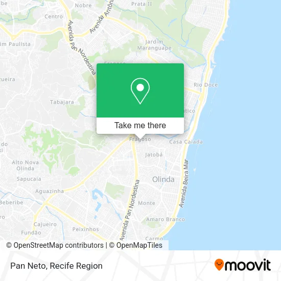
See Pan Neto, Olinda, on the map
Public Transit to Pan Neto in Olinda
Wondering how to get to Pan Neto in Olinda? Moovit helps you find the best way to get to Pan Neto with step-by-step directions from the nearest public transit station.
Moovit provides free maps and live directions to help you navigate through your city. View schedules, routes, timetables, and find out how long does it take to get to Pan Neto in real time.
Looking for the nearest stop or station to Pan Neto? Check out this list of stops closest to your destination: Rua José Alexandre De Carvalho; Av. João De Melo Morais; Ti Pe-15 | Sentido Subúrbio; Ti Pe-15 | Sentido Centro; Área Externa T.I Pe-015 - Sentido Subúrbio.
Bus: 050, 1977 TI PELÓPIDAS (CONDE DA BOA VISTA), 1986 TI PE-15 / TI RIO DOCE, 914 TI PE-15 / TI AFOGADOS, 882 TI XAMBÁ / RIO DOCE (CARLOS DE LIMA CAVALCANTI), 1971 AMPARO, 1975 AMPARO (BACURAU), 1062 TI ABREU E LIMA (PCR) (PARADOR) - BRT, 1076 TI PELÓPIDAS (PCR) (PARADOR) - BRT, 1100 TI PE-15 (PCR) (PARADOR) - BRT, 1909 TI PELÓPIDAS / TI JOANA BEZERRA, 1913 TI PE-15 / TI JOANA BEZERRA, 1933 TI PE-15 / TI ABREU E LIMA, 1963 TI PE-15 / TI IGARASSU (SÍTIO HISTÓRICO), 19001 PONTA DE PEDRAS - RECIFE, 19002 GOIANA - RECIFE, 1907 PAULISTA / RIO DOCE, 1927 OURO PRETO (BACURAU), 1928 MARANGUAPE II (BACURAU).
Want to see if there’s another route that gets you there at an earlier time? Moovit helps you find alternative routes or times. Get directions from and directions to Pan Neto easily from the Moovit App or Website.
We make riding to Pan Neto easy, which is why over 1.5 million users, including users in Olinda, trust Moovit as the best app for public transit. You don’t need to download an individual bus app or train app, Moovit is your all-in-one transit app that helps you find the best bus time or train time available.
For information on prices of bus, costs and ride fares to Pan Neto, please check the Moovit app.
Use the app to navigate to popular places including to the airport, hospital, stadium, grocery store, mall, coffee shop, school, college, and university.
Pan Neto Address: Rua José Alexandre Carvalho, 117B Fragoso Olinda-PE 53250-150 street in Olinda
- Ja Moveis Planejados,
- Rua José Alexandre Carvalho 158,
- Amparo,
- Frescauto Ar Condicionado,
- Ad Madureira Olinda,
- Policlínica Jardim Fragodo,
- Maranata-Supermercado,
- Tomhair,
- Rua Maria Celina Monteiro 140,
- Fragoso,
- Oficina de Ceramica Jacira Lucena,
- Comidas Caseira do Xande e Aline,
- Verdão Nova Era,
- Avenida Coronel João de Melo Morais 122,
- Boladoes do Forró,
- Hotel Castelo Real,
- 1986 T.I. PE-15/ T.I. Rio Doce,
- Magnifique Frios,
- Linha Pe-15 Arthur Lundgren 1,
- Carnes e Bebidas Barato do Dia
Places Near Pan Neto (Olinda)
- SHOPPING GUARARAPES, Jaboatão Dos Guararapes,
- Marco Zero, Bairro Do Recife,
- Hospital Agamenon Magalhães, Tamarineira,
- Shopping Patteo Olinda, Olinda,
- Shopping Recife, Boa Viagem,
- Hospital Universitário Oswaldo Cruz, Santo Amaro,
- Hospital Altino Ventura, Iputinga,
- Centro de Convenções de Pernambuco, Olinda,
- hospital otavio de freitas - UTI, Tejipió,
- tuuuuu, Olinda,
- Hospital Eduardo Campus Da Pessoa Idosa, Areias,
- Arena de Pernambuco, São Lourenço Da Mata,
- Imbiribeira, Imbiribeira,
- llll, Fundão,
- SHOPPING TACARUNA, Santo Amaro,
- Imip (Instituto Materno-Infantil De Pernambuco), Coelhos,
- Hospital Geral De Areias, Areias,
- Parque da Jaqueira, Jaqueira,
- Hospital Maria Lucinda, Parnamirim,
- Shopping RioMar Recife, Pina
How to get to popular places in Recife Region with public transit
Get around Olinda by public transit!
Traveling around Olinda has never been so easy. See step by step directions as you travel to any attraction, street or major public transit station. View bus and train schedules, arrival times, service alerts and detailed routes on a map, so you know exactly how to get to anywhere in Olinda.
When traveling to any destination around Olinda use Moovit's Live Directions with Get Off Notifications to know exactly where and how far to walk, how long to wait for your line, and how many stops are left. Moovit will alert you when it's time to get off — no need to constantly re-check whether yours is the next stop.
Wondering how to use public transit in Olinda or how to pay for public transit in Olinda? Moovit public transit app can help you navigate your way with public transit easily, and at minimum cost. It includes public transit fees, ticket prices, and costs. Looking for a map of Olinda public transit lines? Moovit public transit app shows all public transit maps in Olinda with all Bus, Train and Subway routes and stops on an interactive map.
Recife Region has 3 transit type(s), including: Bus, Train and Subway, operated by several transit agencies, including CBTU (Metrorec), BRT (Via Livre), Grande Recife, BORBOREMA IMPERIAL (TIP), BORBOREMA IMPERIAL (B.V), RODOVIÁRIA POTENGY, EMPRESA METROPOLITANA, CONSÓRCIO RECIFE, SÃO JUDAS TADEU, Expresso 1002, Rodotur Turismo, Complementar Recife, Sistema Municipal - Jaboatão, Sistema Municipal - Cabo and Sistema Municipal - Ipojuca
Public transit lines with stations closest to Pan Neto in Olinda
Bus lines with stations closest to Pan Neto in Olinda
Ti Pe-15 | Sentido Subúrbio
 1062 TI ABREU E LIMA (PCR) (PARADOR) - BRTTI Abreu e Lima (PCR) (Parador)
- 1076 TI PELÓPIDAS (PCR) (PARADOR) - BRTTI Pelópidas (PCR) (Parador)
- 1100 TI PE-15 (PCR) (PARADOR) - BRTTI PE-15 (PCR) (Parador)
- 1909 TI PELÓPIDAS / TI JOANA BEZERRATI Pelópidas / TI Joana Bezerra
- 1913 TI PE-15 / TI JOANA BEZERRATI PE-15 / TI Joana Bezerra