How to get to Panaderia Churin by bus?
Click on the bus route to see step by step directions with maps, line arrival times and updated time schedules.
From Hospital Nacional Hipólito Unanue, El Agustin
49 minFrom Comas, Comas
47 minFrom Jr. Andahuaylas, Lima
32 minFrom Oficinas Air France -KLM, San Isidro
52 minFrom Instituto Nacional De Salud Del Niño, San Borja
55 minFrom Colegio Alfonso Ugarte @ Paseo de la Republica cdra 34, San Isidro
43 minFrom Ate Vitarte, Ate
57 minFrom Mibanco Oficina Principal, Surquillo
56 minFrom Círculo Militar Del Perú, Jesus Mari
38 minFrom Av.Angamos, Surquillo
51 min
Bus stops near Panaderia Churin in Lima
Bus lines to Panaderia Churin in Lima
- 1012, Comas - Magdalena,VIEW
- 1233, Puente Camote (San Martin De Porres),VIEW
- 1244, Las Palmas (Pachacamac) - Pan de Azúcar (San Martín De Porres),VIEW
- 1249, Chuquitanta (San Martín De Porres) - Av. Lima (Villa El Salvador),VIEW
- 1280, Tablada (Villa María Del Triunfo) - Profam (Santa Rosa),VIEW
- 1284, Canta Callao (San Martin De Porres),VIEW
- 1303, Pachacútec (Ventanilla) - Av. México (El Agustino),VIEW
- IO30B, 28 De Julio (Lima) - Pacasmayo (S.M.P.),VIEW
- CR62, Carabayllo - Lima - Carabayllo,VIEW
- 372, Av. Tacna (Lima) - Quilca (San Martín de Porres),VIEW
- 9503, Callao - Lima - Callao,VIEW
- IM47, Km. 22 - Caquetá - Brasil - La Marina - Faucett - Km. 22,VIEW
- CR43, Ventanilla - Carabayllo,VIEW
- 1181, Ensenada (Puente Piedra) - Pumacahua (Chorrillos),VIEW
- 1197, Chuquitanta (San Martin De Porres) - Ovalo Higuereta (Santiago De Surco) - Chuquitanta (San Martin De Porres),VIEW
- 1226, Ceres Medio (Ate) - Av. Perú (San Martin De Porres),VIEW
- CR24, Manylsa,VIEW
- CR25, Pacasmayo (Callao) - Santa Clara (Ate),VIEW
- CR44, Ate - Callao,VIEW
- CR57, Puente Nuevo (El Agustino) - Parque Porcino (Ventanilla),VIEW
What are the closest stations to Panaderia Churin?
The closest stations to Panaderia Churin are:
- Angulo is 470 meters away, 7 min walk.
- Duárez is 501 meters away, 7 min walk.
- Victor Reynel is 561 meters away, 8 min walk.
- Pimentel is 577 meters away, 8 min walk.
- Meiggs is 691 meters away, 10 min walk.
- Monterrey is 1292 meters away, 17 min walk.
Which bus lines stop near Panaderia Churin?
These bus lines stop near Panaderia Churin: 1012, 1244, 1249, 1284, 1303.
What’s the nearest bus station to Panaderia Churin in Lima?
The nearest bus stations to Panaderia Churin in Lima are Angulo and Duárez. The closest one is a 7 min walk away.
What time is the first bus to Panaderia Churin in Lima?
The CR24 is the first bus that goes to Panaderia Churin in Lima. It stops nearby at 4:46 AM.
What time is the last bus to Panaderia Churin in Lima?
The 1280 is the last bus that goes to Panaderia Churin in Lima. It stops nearby at 12:47 AM.
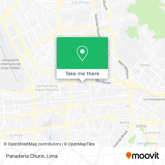
See Panaderia Churin, Lima, on the map
Public Transit to Panaderia Churin in Lima
Wondering how to get to Panaderia Churin in Lima? Moovit helps you find the best way to get to Panaderia Churin with step-by-step directions from the nearest public transit station.
Moovit provides free maps and live directions to help you navigate through your city. View schedules, routes, timetables, and find out how long does it take to get to Panaderia Churin in real time.
Looking for the nearest stop or station to Panaderia Churin? Check out this list of stops closest to your destination: Angulo; Duárez; Victor Reynel; Pimentel; Meiggs; Monterrey.
Bus: 1012, 1244, 1249, 1284, 1303, 1233, 1280, CR62, 372, 9503, IM47, CR43.
Want to see if there’s another route that gets you there at an earlier time? Moovit helps you find alternative routes or times. Get directions from and directions to Panaderia Churin easily from the Moovit App or Website.
We make riding to Panaderia Churin easy, which is why over 1.5 million users, including users in Lima, trust Moovit as the best app for public transit. You don’t need to download an individual bus app or train app, Moovit is your all-in-one transit app that helps you find the best bus time or train time available.
For information on prices of bus, costs and ride fares to Panaderia Churin, please check the Moovit app.
Use the app to navigate to popular places including to the airport, hospital, stadium, grocery store, mall, coffee shop, school, college, and university.
Panaderia Churin Address: Jr. Crespo y Castillo 2201 - Mirones Bajos street in Lima
- D Lady,
- Churin,
- Iglesia Cristiana Evangelica en Hacore,
- Crisol Cajachagua Victor Ubaldo,
- Matusita,
- Institución Educativa 1150 Abraham Zea Carreon,
- Centro Social Y Cultural De Mirones,
- Estimulacion Temprana Creciendo Sjl,
- Vía Expresa - Línea Amarilla,
- Hernandez Cabezudo Marco Antonio,
- Colegio Abraham Zea Carrión,
- Cruz Trujillo Ehblin Magdalena,
- Tintas para Plotter Hp,
- Centro de salud mirones bajo,
- Maminos de Surco,
- La tía veneno,
- Torque Studio,
- Ferretería,
- Institución Educativa Inicial 100 Virgen De La Merced,
- Victor Reynel 187
Places Near Panaderia Churin (Lima)
- Larcomar, Miraflores,
- Paradero Av.Brasil,
- Parque Kennedy, Miraflores,
- Plaza San Miguel, San Miguel,
- Hospital Edgardo Rebagliati Martins, Jesus Mari,
- Av. Abancay, Lima,
- Jockey Plaza, Santiago D,
- av arequipa, Lima,
- Real Plaza Puruchuco, Ate,
- Gamarra,
- Centro Comercial Plaza Norte, Independen,
- Miraflores, Miraflores,
- Mall Del Sur,
- Av. La Marina, San Miguel,
- Circuito Mágico Del Agua, Lima,
- Parque de las Leyendas, San Miguel,
- Av. Salaverry, Jesus Mari,
- Barranco, Barranco,
- Pontificia Universidad Católica del Perú - PUCP, San Miguel,
- Aeropuerto Internacional Jorge Chávez, Ventanilla
How to get to popular places in Lima with public transit
Get around Lima by public transit!
Traveling around Lima has never been so easy. See step by step directions as you travel to any attraction, street or major public transit station. View bus and train schedules, arrival times, service alerts and detailed routes on a map, so you know exactly how to get to anywhere in Lima.
When traveling to any destination around Lima use Moovit's Live Directions with Get Off Notifications to know exactly where and how far to walk, how long to wait for your line, and how many stops are left. Moovit will alert you when it's time to get off — no need to constantly re-check whether yours is the next stop.
Wondering how to use public transit in Lima or how to pay for public transit in Lima? Moovit public transit app can help you navigate your way with public transit easily, and at minimum cost. It includes public transit fees, ticket prices, and costs. Looking for a map of Lima public transit lines? Moovit public transit app shows all public transit maps in Lima with all Bus, Metro and Ferry routes and stops on an interactive map.
Lima has 3 transit type(s), including: Bus, Metro and Ferry, operated by several transit agencies, including Metro de Lima Línea 2 , Metro de Lima, Corredor Rojo, Metropolitano, Metropolitano - Alimentadores, Corredor Morado, Corredor Azul, Rutas Tradicionales, Transportes y Servicios La Esperanza S.A., Las Flores S.A., Virgen de la Asunción S.A., Consorcio HAM, Transportes y Service Canadá S.A., ETUL4SA and ETUCHISA