How to get to Panda Technology Group by bus?
Click on the bus route to see step by step directions with maps, line arrival times and updated time schedules.
From Mamaroneck NY, Mamaroneck
58 minFrom Port Chester, NY, Port Chester
58 minFrom Regeneron Pharmaceuticals Inc, Tarrytown
103 minFrom Cross County Shopping Center, Yonkers
81 minFrom New Rochelle, NY, New Rochelle
61 minFrom Rye Playland, Rye
93 minFrom Ridge Hill Mall, Yonkers
108 minFrom St. John's Riverside Hospital, Yonkers
92 minFrom the bee-line system Bus Stop - Rye Playland (13, 75, 91), Rye
92 minFrom GFFF, Stamford
94 min
How to get to Panda Technology Group by train?
Click on the train route to see step by step directions with maps, line arrival times and updated time schedules.
Train station near Panda Technology Group in Harrison
- White Plains, 49 min walk,VIEW
What are the closest stations to Panda Technology Group?
The closest stations to Panda Technology Group are:
- White Plains is 4132 yards away, 49 min walk.
Which bus lines stop near Panda Technology Group?
These bus lines stop near Panda Technology Group: 13, 21, 5, 62.
Which train line stops near Panda Technology Group?
2 (613#| Southeast)
What time is the first train to Panda Technology Group in Harrison?
The 2 is the first train that goes to Panda Technology Group in Harrison. It stops nearby at 4:44 AM.
What time is the last train to Panda Technology Group in Harrison?
The 2 is the last train that goes to Panda Technology Group in Harrison. It stops nearby at 2:52 AM.
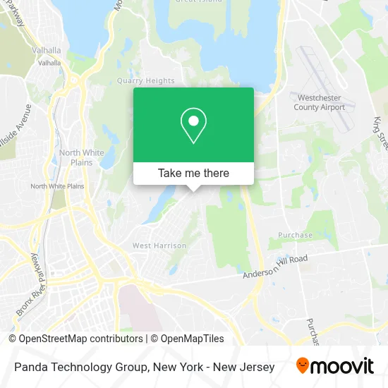
See Panda Technology Group, Harrison, on the map
Public Transit to Panda Technology Group in Harrison
Wondering how to get to Panda Technology Group in Harrison? Moovit helps you find the best way to get to Panda Technology Group with step-by-step directions from the nearest public transit station.
Moovit provides free maps and live directions to help you navigate through your city. View schedules, routes, timetables, and find out how long does it take to get to Panda Technology Group in real time.
Looking for the nearest stop or station to Panda Technology Group? Check out this list of stops closest to your destination: White Plains.
Bus: 13, 21, 5, 62.Train: 2.
Want to see if there’s another route that gets you there at an earlier time? Moovit helps you find alternative routes or times. Get directions from and directions to Panda Technology Group easily from the Moovit App or Website.
We make riding to Panda Technology Group easy, which is why over 1.5 million users, including users in Harrison, trust Moovit as the best app for public transit. You don’t need to download an individual bus app or train app, Moovit is your all-in-one transit app that helps you find the best bus time or train time available.
For information on prices of bus and train, costs and ride fares to Panda Technology Group, please check the Moovit app.
Use the app to navigate to popular places including to the airport, hospital, stadium, grocery store, mall, coffee shop, school, college, and university.
Panda Technology Group Address: 17 Rocky Ridge Rd street in Harrison
- Silver Lake Park,
- Fullerton Beck Llp,
- Omlink: the Studio For Yoga Synthesis,
- Brightview Harrison (Now Open) - Senior Independent Living, Assisted Living, Memory Care,
- Best Roofing Westchester,
- Luna Landscape Corporation,
- Brightview Senior Living,
- The Hardy Garden,
- DN Contracting,
- Westchester Refinishing,
- Sam's Service Exxon,
- Lit Hair Salon,
- Trevi Ristorante,
- Invogue Salon Ltd.,
- Art Nails,
- Meatball Mountain,
- Benjamin Rose Build & Design,
- Benjamin Rose Kitchen & Bath,
- Benjamin Rose Geothermal,
- City Center Dance
Places Near Panda Technology Group (Harrison)
- Katz's Deli, Manhattan,
- Hudson Yards, Manhattan,
- 376 Hudson Street, Manhattan,
- Wall Street, Manhattan,
- SoHo, Manhattan,
- 26 Federal Plaza, Manhattan,
- Bellevue Hospital, Manhattan,
- Rockefeller Center, Manhattan,
- Pier 83, Manhattan,
- 911 Memorial, Manhattan,
- Chinatown, Manhattan,
- Queens Center Mall, Queens,
- 111 Centre New York City Supreme Court, Manhattan,
- Mountainside Hospital, Glen Ridge,
- qqqq, Manhattan,
- 1 Police Plaza, Manhattan,
- 66 John Street, Manhattan,
- Times Square, Manhattan,
- San Gennaro Feast, Manhattan,
- 3 Stone St, Manhattan
How to get to popular places in New York - New Jersey with public transit
Get around Harrison by public transit!
Traveling around Harrison has never been so easy. See step by step directions as you travel to any attraction, street or major public transit station. View bus and train schedules, arrival times, service alerts and detailed routes on a map, so you know exactly how to get to anywhere in Harrison.
When traveling to any destination around Harrison use Moovit's Live Directions with Get Off Notifications to know exactly where and how far to walk, how long to wait for your line, and how many stops are left. Moovit will alert you when it's time to get off — no need to constantly re-check whether yours is the next stop.
Wondering how to use public transit in Harrison or how to pay for public transit in Harrison? Moovit public transit app can help you navigate your way with public transit easily, and at minimum cost. It includes public transit fees, ticket prices, and costs. Looking for a map of Harrison public transit lines? Moovit public transit app shows all public transit maps in Harrison with all Bus, Train, Subway, Light Rail, Ferry and Cable Car routes and stops on an interactive map.
New York - New Jersey has 6 transit type(s), including: Bus, Train, Subway, Light Rail, Ferry and Cable Car, operated by several transit agencies, including MTA Subway, Metro-North Railroad, LIRR, PATH, MTA New York City Transit - Express routes, MTA Bus, NJ Transit, NYC Ferry, NICE bus, Bee-Line Bus, NJ Transit Rail, Norwalk Transit District, Hartford Line, River Valley Transit and HART