Directions to Pandora (Baltimore County) with public transportation
The following transit lines have routes that pass near Pandora
 Bus: CITYLINK RED, TOWSON ORANGE, KENILWORTH AVE/401, 93.
How to get to Pandora by bus?
Click on the bus route to see step by step directions with maps, line arrival times and updated time schedules.
From Hampden, Baltimore
60 minFrom Baltimore City Community College (BCCC) - Liberty Campus, Baltimore
73 minFrom Good Samaritan Hospital, Baltimore
35 minFrom The Maryland Zoo In Baltimore, Baltimore
77 minFrom Mondawmin Mall, Baltimore
71 minFrom Druid Hill Park, Baltimore
77 minFrom Baltimore Polytechnic Institute, Baltimore
47 minFrom Johns Hopkins University, Baltimore
50 minFrom Coppin State University, Baltimore
75 minFrom Harford Road, Baltimore
49 min
Bus stops near Pandora in Baltimore County
Light Rail stations near Pandora in Baltimore County
- Timonium, 41 min walk,VIEW
Bus lines to Pandora in Baltimore County
What are the closest stations to Pandora?
The closest stations to Pandora are:
- Kenilworth Drive at the Shops at Kenilworth Wb 0045 (West) is 253 yards away, 4 min walk.
- #21 Kenilworth at Witherwood Ct. is 295 yards away, 4 min walk.
- York Rd & West Rd Nb is 1063 yards away, 13 min walk.
- Timonium is 3463 yards away, 41 min walk.
Which bus lines stop near Pandora?
These bus lines stop near Pandora: CITYLINK RED, TOWSON ORANGE.
What’s the nearest bus station to Pandora in Baltimore County?
The nearest bus stations to Pandora in Baltimore County are Kenilworth Drive at the Shops at Kenilworth Wb 0045 (West) and #21 Kenilworth at Witherwood Ct.. The closest one is a 4 min walk away.
What time is the first light rail to Pandora in Baltimore County?
The LIGHT RAILLINK is the first light rail that goes to Pandora in Baltimore County. It stops nearby at 4:40 AM.
What time is the last light rail to Pandora in Baltimore County?
The LIGHT RAILLINK is the last light rail that goes to Pandora in Baltimore County. It stops nearby at 1:02 AM.
What time is the first bus to Pandora in Baltimore County?
The 93 is the first bus that goes to Pandora in Baltimore County. It stops nearby at 4:08 AM.
What time is the last bus to Pandora in Baltimore County?
The CITYLINK RED is the last bus that goes to Pandora in Baltimore County. It stops nearby at 2:35 AM.
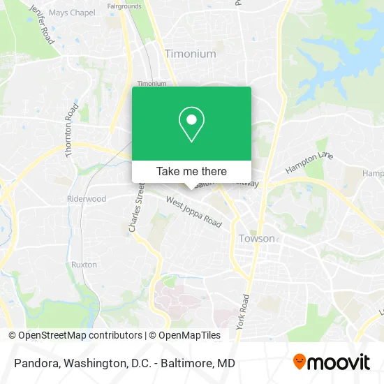
See Pandora, Baltimore County, on the map
Public Transit to Pandora in Baltimore County
Wondering how to get to Pandora in Baltimore County? Moovit helps you find the best way to get to Pandora with step-by-step directions from the nearest public transit station.
Moovit provides free maps and live directions to help you navigate through your city. View schedules, routes, timetables, and find out how long does it take to get to Pandora in real time.
Looking for the nearest stop or station to Pandora? Check out this list of stops closest to your destination: Kenilworth Drive at the Shops at Kenilworth Wb 0045 (West); #21 Kenilworth at Witherwood Ct.; York Rd & West Rd Nb; Timonium.
Bus: CITYLINK RED, TOWSON ORANGE, KENILWORTH AVE/401, 93.
Want to see if there’s another route that gets you there at an earlier time? Moovit helps you find alternative routes or times. Get directions from and directions to Pandora easily from the Moovit App or Website.
We make riding to Pandora easy, which is why over 1.5 million users, including users in Baltimore County, trust Moovit as the best app for public transit. You don’t need to download an individual bus app or train app, Moovit is your all-in-one transit app that helps you find the best bus time or train time available.
For information on prices of bus and light rail, costs and ride fares to Pandora, please check the Moovit app.
Use the app to navigate to popular places including to the airport, hospital, stadium, grocery store, mall, coffee shop, school, college, and university.
Pandora Address: 802 Kenilworth Dr Towson, MD 21204 street in Baltimore County
- Forward Moda,
- Rheb's Candies,
- The Shops at Kenilworth,
- Columbia MD,
- I-695 @ Exit 26 (York Rd / MD 45),
- Carver Center For Arts And Technology,
- Blakehurst Retirement Community,
- Pickersgill Retirement Community,
- Kaiser Permanente Towson Medical Center,
- Baltimore County Department of Corrections- Detention Center,
- Baltimore County Jail,
- Bosley Ave and York Rd,
- Ymca,
- Loyola Blakefield High School,
- Exit 27 Baltimore Beltway Inner Loop,
- The Law Office of David T. Lampton PC,
- Baltimore County Circuit Court,
- ChargePoint,
- Peabody Institute of the Johns Hopkins University,
- Goucher College
Places Near Pandora (Baltimore County)
- Washington DC VA Medical Center, Washington,
- National Zoo, Washington,
- National Museum of African American History and Culture, Washington,
- Camden Yards, Baltimore,
- M&T Bank Stadium, Baltimore,
- Sibley Memorial Hospital, Washington,
- Washington National Cathedral, Washington,
- Amazon Hq2, Arlington County,
- Pennsylvania Ave NW (3rd st and pennsylvania), Washington,
- Museum Of The Bible, Washington,
- Georgetown, Washington,
- The Anthem, Washington,
- Westfield Montgomery Mall, Montgomery County,
- Capital One Arena, Washington,
- PG Mall, Prince George's County,
- Basilica of the National Shrine, Washington,
- National Theatre, Washington,
- Marriott Marquis Washington, DC, Washington,
- Rock Creek Tennis Center, Washington,
- Warner Theatre, Washington
How to get to popular places in Washington, D.C. - Baltimore, MD with public transit
Get around Baltimore County by public transit!
Traveling around Baltimore County has never been so easy. See step by step directions as you travel to any attraction, street or major public transit station. View bus and train schedules, arrival times, service alerts and detailed routes on a map, so you know exactly how to get to anywhere in Baltimore County.
When traveling to any destination around Baltimore County use Moovit's Live Directions with Get Off Notifications to know exactly where and how far to walk, how long to wait for your line, and how many stops are left. Moovit will alert you when it's time to get off — no need to constantly re-check whether yours is the next stop.
Wondering how to use public transit in Baltimore County or how to pay for public transit in Baltimore County? Moovit public transit app can help you navigate your way with public transit easily, and at minimum cost. It includes public transit fees, ticket prices, and costs. Looking for a map of Baltimore County public transit lines? Moovit public transit app shows all public transit maps in Baltimore County with all Bus, Train, Metro, Light Rail and Ferry routes and stops on an interactive map.
Washington, D.C. - Baltimore, MD has 5 transit type(s), including: Bus, Train, Metro, Light Rail and Ferry, operated by several transit agencies, including WMATA, Montgomery County Ride On, Fairfax Connector, TheBus, PRTC, DASH - Alexandria, Arlington Transit (ART), RTA of Central Maryland, MDOT MTA, MDOT MTA Light RailLink, MDOT MTA Commuter Bus, MDOT MTA Local Bus, FXBGO!, Virginia Railway Express (VRE) and MARC