How to get to Panificadora by bus?
Click on the bus route to see step by step directions with maps, line arrival times and updated time schedules.
From Parque Morelos, Aguascalientes
38 minFrom Corral de Barrancos, Aguascalientes
44 minFrom Residencial Punta Del Cielo, Aguascalientes
61 minFrom Fracc. Fuentes del Lago, Aguascalientes
46 minFrom Campos De Futbol Loma Bonita, Aguascalientes
47 minFrom Sabropollo rastro, Aguascalientes
37 minFrom Residencial Villa Sur, Aguascalientes
57 minFrom Aeropuerto de Aguascalientes S.A. de C.V., Aguascalientes
61 minFrom Canchas de futbol Cruz Azul, Aguascalientes
48 minFrom Loreto, Aguascalientes
40 min
Bus stops near Panificadora in Aguascalientes
Bus lines to Panificadora in Aguascalientes
- RUTA 23, Villa Montaña,VIEW
- RUTA 40, Terminal Oriente - Terminal Oriente (N),VIEW
- RUTA 41, Terminal Oriente (Penal),VIEW
- RUTA 41, Terminal Oriente (Alameda),VIEW
- RUTA 48, Centro (Panteón De La Cruz),VIEW
- RUTA 19, Vistas De Oriente,VIEW
- RUTA 24, Vistas De Oriente - Los Negritos,VIEW
- RUTA 35, Uaa,VIEW
- RUTA 25, Las Palmas,VIEW
- RUTA 42, Bellavista,VIEW
- RUTA 45, Valle De Los Cactus - Uaa,VIEW
- RUTA 50, Universidad Tecnológica,VIEW
- RUTA 40, Terminal Oriente - Terminal Oriente (S),VIEW
What are the closest stations to Panificadora?
The closest stations to Panificadora are:
- Avenida Ojocaliente, 117 is 114 meters away, 2 min walk.
- Prolongación Alameda, 360 is 173 meters away, 3 min walk.
- Colegio El Encino is 376 meters away, 5 min walk.
- Avenida Siglo Xxi, 128 is 633 meters away, 9 min walk.
- No Name is 793 meters away, 11 min walk.
Which bus lines stop near Panificadora?
These bus lines stop near Panificadora: RUTA 23, RUTA 25, RUTA 41, RUTA 48, RUTA 50.
What’s the nearest bus station to Panificadora in Aguascalientes?
The nearest bus station to Panificadora in Aguascalientes is Avenida Ojocaliente, 117. It’s a 2 min walk away.
What time is the first bus to Panificadora in Aguascalientes?
The RUTA 41 is the first bus that goes to Panificadora in Aguascalientes. It stops nearby at 5:42 AM.
What time is the last bus to Panificadora in Aguascalientes?
The RUTA 45 is the last bus that goes to Panificadora in Aguascalientes. It stops nearby at 10:31 PM.
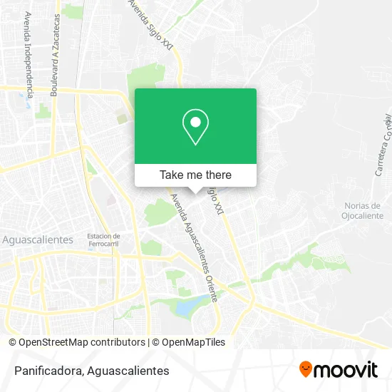
See Panificadora, Aguascalientes, on the map
Public Transit to Panificadora in Aguascalientes
Wondering how to get to Panificadora in Aguascalientes? Moovit helps you find the best way to get to Panificadora with step-by-step directions from the nearest public transit station.
Moovit provides free maps and live directions to help you navigate through your city. View schedules, routes, timetables, and find out how long does it take to get to Panificadora in real time.
Looking for the nearest stop or station to Panificadora? Check out this list of stops closest to your destination: Avenida Ojocaliente; Prolongación Alameda; Colegio El Encino; Avenida Siglo Xxi; No Name.
Bus: RUTA 23, RUTA 25, RUTA 41, RUTA 48, RUTA 50, RUTA 40, RUTA 19, RUTA 24, RUTA 35, RUTA 42, RUTA 45, RUTA 40.
Want to see if there’s another route that gets you there at an earlier time? Moovit helps you find alternative routes or times. Get directions from and directions to Panificadora easily from the Moovit App or Website.
We make riding to Panificadora easy, which is why over 1.5 million users, including users in Aguascalientes, trust Moovit as the best app for public transit. You don’t need to download an individual bus app or train app, Moovit is your all-in-one transit app that helps you find the best bus time or train time available.
For information on prices of bus, costs and ride fares to Panificadora, please check the Moovit app.
Use the app to navigate to popular places including to the airport, hospital, stadium, grocery store, mall, coffee shop, school, college, and university.
Panificadora Address: Avenida Ojocaliente, Unidad Habitacional Fidel Velázquez, 20199 Aguascalientes, Aguascalientes street in Aguascalientes
- Farmacia Saucedo,
- Farmacia Oropeza,
- Refaccionaria Delgado,
- Caeli,
- Dr Javier Oropeza-Médico General,
- Maru Verdulería,
- Club TRES60 Barber Shop,
- Don Pizzeto Pizza,
- Moda Kids,
- Tentaciones,
- Pastelería La Perla,
- tortillería Tláloc,
- Ferretería Tony,
- Fidel Velázquez,
- Copias y Papeleria,
- Fracc. Fidel Velázquez,
- Pc-Line Recarga de Toner y Computo,
- Depósito Lizeth,
- Papeleria El Chavo,
- Tienda de Ropa Saldaña Shop
Places Near Panificadora (Aguascalientes)
- Hospital Imss No. 3, Aguascalientes,
- clinica 3 uaa, Aguascalientes,
- Villas de Nuestra Señora de la Asunción, Aguascalientes,
- Villasuncion, Aguascalientes,
- Universidad Autónoma de Aguascalientes, Aguascalientes,
- Blvd. Luis Donaldo Colosio, Aguascalientes,
- Terminal De Combis, Aguascalientes,
- Aeropuerto de Aguascalientes S.A. de C.V., Aguascalientes,
- Imss Clinica 1, Aguascalientes,
- Isla San Marcos, Aguascalientes,
- Central De Autobuses, Aguascalientes,
- Agropecuario, Aguascalientes,
- Centro Comercial Altaria, Aguascalientes,
- Centro, Aguascalientes,
- Nuevo Hospital Hidalgo, Aguascalientes,
- La Isla San Marcos, Aguascalientes,
- Jesús María, Aguascalientes,
- Ciudad industrial, Aguascalientes,
- Parque Las Tres Centurias, Aguascalientes,
- ESPACIOS, Aguascalientes
How to get to popular places in Aguascalientes with public transit
Get around Aguascalientes by public transit!
Traveling around Aguascalientes has never been so easy. See step by step directions as you travel to any attraction, street or major public transit station. View bus and train schedules, arrival times, service alerts and detailed routes on a map, so you know exactly how to get to anywhere in Aguascalientes.
When traveling to any destination around Aguascalientes use Moovit's Live Directions with Get Off Notifications to know exactly where and how far to walk, how long to wait for your line, and how many stops are left. Moovit will alert you when it's time to get off — no need to constantly re-check whether yours is the next stop.
Wondering how to use public transit in Aguascalientes or how to pay for public transit in Aguascalientes? Moovit public transit app can help you navigate your way with public transit easily, and at minimum cost. It includes public transit fees, ticket prices, and costs. Looking for a map of Aguascalientes public transit lines? Moovit public transit app shows all public transit maps in Aguascalientes with all bus routes and stops on an interactive map.
Aguascalientes has 1 transit type(s), including: bus, operated by several transit agencies, including Coordinación General de Movilidad