How to get to Paolo Chiarugi Bakery by bus?
Click on the bus route to see step by step directions with maps, line arrival times and updated time schedules.
From Tenax (Tenax Club), Florence
60 minFrom Gabriele D'Annunzio Street, Florence
80 minFrom Guarlone Street, Florence
90 minFrom hu Florence Camping in Town, Florence
76 minFrom Gobetti Volta Higher Education Institute, Bagno a Ripoli
88 minFrom Kaikan, Florence
87 minFrom Via Antonio Giacomini, 8, Florence
47 minFrom Giovanni Milton Avenue, Florence
37 minFrom Madonna della Neve Square, Florence
46 minFrom Otel Varietè, Florence
65 min
Bus stops near Paolo Chiarugi Bakery in Scandicci
Light Rail stations near Paolo Chiarugi Bakery in Scandicci
- Aldo Moro, 19 min walk,VIEW
Bus lines to Paolo Chiarugi Bakery in Scandicci
What are the closest stations to Paolo Chiarugi Bakery?
The closest stations to Paolo Chiarugi Bakery are:
- Cioppi is 30 meters away, 1 min walk.
- Roma Cioppi is 42 meters away, 1 min walk.
- Manzoni is 292 meters away, 4 min walk.
- Matteotti Alighieri is 308 meters away, 5 min walk.
- Aleardi Piave is 355 meters away, 5 min walk.
- Aldo Moro is 1396 meters away, 19 min walk.
Which bus lines stop near Paolo Chiarugi Bakery?
These bus lines stop near Paolo Chiarugi Bakery: 26, 27, 6.
Which light rail line stops near Paolo Chiarugi Bakery?
T1 (Villa Costanza)
What’s the nearest light rail station to Paolo Chiarugi Bakery in Scandicci?
The nearest light rail station to Paolo Chiarugi Bakery in Scandicci is Aldo Moro. It’s a 19 min walk away.
What’s the nearest bus station to Paolo Chiarugi Bakery in Scandicci?
The nearest bus stations to Paolo Chiarugi Bakery in Scandicci are Cioppi and Roma Cioppi. The closest one is a 1 min walk away.
What time is the first light rail to Paolo Chiarugi Bakery in Scandicci?
The T2 is the first light rail that goes to Paolo Chiarugi Bakery in Scandicci. It stops nearby at 4:33 AM.
What time is the last light rail to Paolo Chiarugi Bakery in Scandicci?
The T2 is the last light rail that goes to Paolo Chiarugi Bakery in Scandicci. It stops nearby at 1:04 AM.
What time is the first bus to Paolo Chiarugi Bakery in Scandicci?
The 26 is the first bus that goes to Paolo Chiarugi Bakery in Scandicci. It stops nearby at 6:25 AM.
What time is the last bus to Paolo Chiarugi Bakery in Scandicci?
The 27 is the last bus that goes to Paolo Chiarugi Bakery in Scandicci. It stops nearby at 10:29 PM.
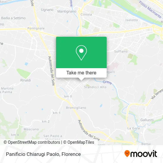
See Paolo Chiarugi Bakery, Scandicci, on the map
Public Transit to Paolo Chiarugi Bakery in Scandicci
Wondering how to get to Paolo Chiarugi Bakery in Scandicci? Moovit helps you find the best way to get to Paolo Chiarugi Bakery with step-by-step directions from the nearest public transit station.
Moovit provides free maps and live directions to help you navigate through your city. View schedules, routes, timetables, and find out how long does it take to get to Paolo Chiarugi Bakery in real time.
Looking for the nearest stop or station to Paolo Chiarugi Bakery? Check out this list of stops closest to your destination: Cioppi; Roma Cioppi; Manzoni; Matteotti Alighieri; Aleardi Piave; Aldo Moro.
Bus: 26, 27, 6, 83, 61, 62, 371 A, 15, 94, 93.Light Rail: T1.
Want to see if there’s another route that gets you there at an earlier time? Moovit helps you find alternative routes or times. Get directions from and directions to Paolo Chiarugi Bakery easily from the Moovit App or Website.
We make riding to Paolo Chiarugi Bakery easy, which is why over 1.5 million users, including users in Scandicci, trust Moovit as the best app for public transit. You don’t need to download an individual bus app or train app, Moovit is your all-in-one transit app that helps you find the best bus time or train time available.
For information on prices of bus, light rail and train, costs and ride fares to Paolo Chiarugi Bakery, please check the Moovit app.
Use the app to navigate to popular places including to the airport, hospital, stadium, grocery store, mall, coffee shop, school, college, and university.
Paolo Chiarugi Bakery Address: Via Roma, 36 50018 Scandicci street in Scandicci
- Chiarugi Bakery Scandicci,
- Giuseppe,
- Hunting and Fishing,
- Ballini Maurizio,
- Sports Armory,
- Hanami Grooming,
- Sotto Sopra Merceria,
- Sotto Sopra SDF - Custom Wool and Cotton Clothing,
- Midori Ink,
- 38/a Roma Street,
- Scandicci Library,
- Stay in Tuscany,
- Camiciottoli Brothers Gastronomy,
- Elda Aesthetics,
- Dolmen Real Estate,
- Pour la Femme,
- Melechì Mauro,
- Antica Marilli Butcher Shop,
- Laura Laundry by Mezzoprete Laura,
- Simone Embroidery by Pulvirenti Simone
Places Near Paolo Chiarugi Bakery (Scandicci)
- I Gigli, Campi Bisenzio,
- Torregalli Hospital Scandicci *, Scandicci,
- Field of Mars, Florence,
- Santa Maria Nuova Hospital, Florence,
- IKEA Florence, Sesto Fiorentino,
- Wanny Palace, Florence,
- Mandela Forum (Nelson Mandela Forum), Florence,
- Santa Maria Novella Station, Florence,
- OOO, Florence,
- Viola Park, Bagno a Ripoli,
- Michelangelo Square, Florence,
- Tobacco Manufacture, Florence,
- Cascine Park, Florence,
- Piero Palagi Hospital Facility-Florence, Florence,
- Campi Bisenzio, Campi Bisenzio,
- Artemio Franchi Municipal Stadium, Florence,
- Asmana, Campi Bisenzio,
- Verdi Theater, Florence,
- Michelangelo Square, Florence,
- Nelson Mandela Forum, Florence
How to get to popular places in Florence with public transit
Get around Scandicci by public transit!
Traveling around Scandicci has never been so easy. See step by step directions as you travel to any attraction, street or major public transit station. View bus and train schedules, arrival times, service alerts and detailed routes on a map, so you know exactly how to get to anywhere in Scandicci.
When traveling to any destination around Scandicci use Moovit's Live Directions with Get Off Notifications to know exactly where and how far to walk, how long to wait for your line, and how many stops are left. Moovit will alert you when it's time to get off — no need to constantly re-check whether yours is the next stop.
Wondering how to use public transit in Scandicci or how to pay for public transit in Scandicci? Moovit public transit app can help you navigate your way with public transit easily, and at minimum cost. It includes public transit fees, ticket prices, and costs. Looking for a map of Scandicci public transit lines? Moovit public transit app shows all public transit maps in Scandicci with all Bus, Train, Light Rail, Ferry and Funicular routes and stops on an interactive map.
Florence has 5 transit type(s), including: Bus, Train, Light Rail, Ferry and Funicular, operated by several transit agencies, including Florence Urban - Tuscan Bus Lines, GEST, Florence and Province - Tuscan Bus Lines, Livorno and Province - Tuscan Bus Lines, Arezzo, Florence and Provinces - Tuscan Bus Lines, Prato and Province - Tuscan Bus Lines, Massa, Carrara and Province - Tuscan Bus Lines, Pisa and Province - Tuscan Bus Lines, Grosseto, Siena and Provinces - Tuscan Bus Lines, Arezzo, Siena and Provinces - Tuscan Bus Lines, Pistoia and Province - Tuscan Bus Lines, Siena and Province - Tuscan Bus Lines, Arezzo and Province - Tuscan Bus Lines, Lucca and Province - Tuscan Bus Lines and Trenitalia