Directions to Panther Trading Co. (Baltimore County) with public transportation
The following transit lines have routes that pass near Panther Trading Co.
 Bus: 29, 32, CITYLINK YELLOW.
- Train: MARC.
How to get to Panther Trading Co. by bus?
Click on the bus route to see step by step directions with maps, line arrival times and updated time schedules.
From I-70 at Security Blvd Baltimore City Lot Park & Ride, Baltimore
70 minFrom Baltimore City Circuit Court, Baltimore
55 minFrom Inner Harbor, Baltimore
51 minFrom Hampden, Baltimore
83 minFrom Baltimore Museum Of Art, Baltimore
74 minFrom Canton, Baltimore
77 minFrom Druid Hill Park, Baltimore
69 minFrom Patterson Park, Baltimore
70 minFrom Patterson Park, Baltimore
71 minFrom I-83 Exit 5 (Maryland Ave/Charles St), Baltimore
71 min
How to get to Panther Trading Co. by train?
Click on the train route to see step by step directions with maps, line arrival times and updated time schedules.
Bus stops near Panther Trading Co. in Baltimore County
Train stations near Panther Trading Co. in Baltimore County
Bus lines to Panther Trading Co. in Baltimore County
What are the closest stations to Panther Trading Co.?
The closest stations to Panther Trading Co. are:
- East Dr & Sulphur Spring Rd FS Nb is 983 yards away, 12 min walk.
- Washington Blvd & Ridge Ave Wb is 2030 yards away, 24 min walk.
- Halethorpe Marc Nb is 3379 yards away, 40 min walk.
- St Denis Marc Sb is 4020 yards away, 47 min walk.
Which bus lines stop near Panther Trading Co.?
These bus lines stop near Panther Trading Co.: 29, 32, CITYLINK YELLOW.
Which train line stops near Panther Trading Co.?
MARC (Outbound - Washington)
What’s the nearest bus station to Panther Trading Co. in Baltimore County?
The nearest bus station to Panther Trading Co. in Baltimore County is East Dr & Sulphur Spring Rd FS Nb. It’s a 12 min walk away.
What time is the first train to Panther Trading Co. in Baltimore County?
The MARC is the first train that goes to Panther Trading Co. in Baltimore County. It stops nearby at 4:46 AM.
What time is the last train to Panther Trading Co. in Baltimore County?
The MARC is the last train that goes to Panther Trading Co. in Baltimore County. It stops nearby at 10:46 PM.
What time is the first bus to Panther Trading Co. in Baltimore County?
The CITYLINK YELLOW is the first bus that goes to Panther Trading Co. in Baltimore County. It stops nearby at 3:28 AM.
What time is the last bus to Panther Trading Co. in Baltimore County?
The CITYLINK YELLOW is the last bus that goes to Panther Trading Co. in Baltimore County. It stops nearby at 2:26 AM.
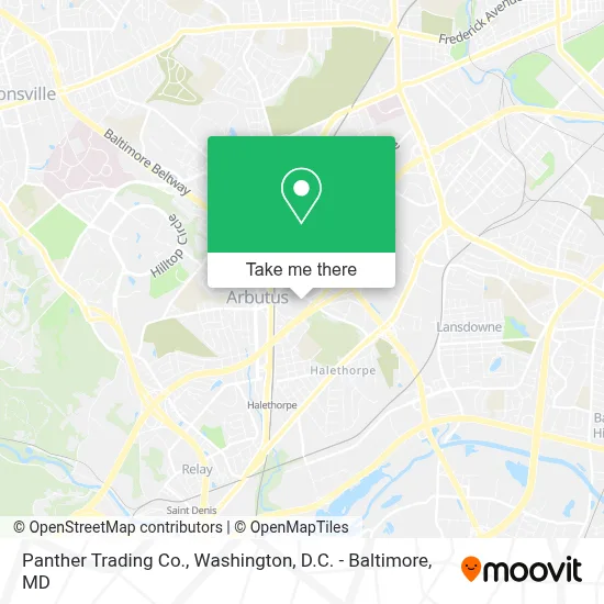
See Panther Trading Co., Baltimore County, on the map
Public Transit to Panther Trading Co. in Baltimore County
Wondering how to get to Panther Trading Co. in Baltimore County? Moovit helps you find the best way to get to Panther Trading Co. with step-by-step directions from the nearest public transit station.
Moovit provides free maps and live directions to help you navigate through your city. View schedules, routes, timetables, and find out how long does it take to get to Panther Trading Co. in real time.
Looking for the nearest stop or station to Panther Trading Co.? Check out this list of stops closest to your destination: East Dr & Sulphur Spring Rd FS Nb; Washington Blvd & Ridge Ave Wb; Halethorpe Marc Nb; St Denis Marc Sb.
Bus: 29, 32, CITYLINK YELLOW.Train: MARC.
Want to see if there’s another route that gets you there at an earlier time? Moovit helps you find alternative routes or times. Get directions from and directions to Panther Trading Co. easily from the Moovit App or Website.
We make riding to Panther Trading Co. easy, which is why over 1.7 million users, including users in Baltimore County, trust Moovit as the best app for public transit. You don’t need to download an individual bus app or train app, Moovit is your all-in-one transit app that helps you find the best bus time or train time available.
For information on prices of bus, train and light rail, costs and ride fares to Panther Trading Co., please check the Moovit app.
Use the app to navigate to popular places including to the airport, hospital, stadium, grocery store, mall, coffee shop, school, college, and university.
Panther Trading Co. Address: 1581 Sulphur Spring Rd Ste 113 street in Baltimore County
- 1st Team Staffing Services,
- Union Station, Washington DC,
- Arbutus, Maryland,
- Brewer Hall - Ascension School,
- Halethorpe, Maryland,
- Halethorpe MARC Station,
- Tim's Motel,
- MD Lot 7-11,
- Commerce Dr (washington blvd and commerce),
- Halethorpe MARC Station Parking Lot,
- Amazon Fulfillment Center-HBA2,
- Gardaworld,
- Southwestern Blvd Baltimore MD,
- Walmart,
- Walmart Supercenter,
- Kaiser Permanente South Baltimore County Medical Center,
- Coin Cloud DCM,
- Setting the Scene Event Planning & Decor,
- Furnival,
- Benson Ave and Joh Ave
Places Near Panther Trading Co. (Baltimore County)
- Georgetown, Washington,
- Museum Of The Bible, Washington,
- Rock Creek Tennis Center, Washington,
- Capital One Arena, Washington,
- Pennsylvania Ave NW (3rd st and pennsylvania), Washington,
- M&T Bank Stadium, Baltimore,
- PG Mall, Prince George's County,
- Sibley Memorial Hospital, Washington,
- Washington DC VA Medical Center, Washington,
- Washington National Cathedral, Washington,
- National Theatre, Washington,
- Camden Yards, Baltimore,
- National Zoo, Washington,
- Warner Theatre, Washington,
- Amazon Hq2, Arlington County,
- Westfield Montgomery Mall, Montgomery County,
- Basilica of the National Shrine, Washington,
- The Anthem, Washington,
- National Museum of African American History and Culture, Washington,
- Marriott Marquis Washington, DC, Washington
How to get to popular places in Washington, D.C. - Baltimore, MD with public transit
Get around Baltimore County by public transit!
Traveling around Baltimore County has never been so easy. See step by step directions as you travel to any attraction, street or major public transit station. View bus and train schedules, arrival times, service alerts and detailed routes on a map, so you know exactly how to get to anywhere in Baltimore County.
When traveling to any destination around Baltimore County use Moovit's Live Directions with Get Off Notifications to know exactly where and how far to walk, how long to wait for your line, and how many stops are left. Moovit will alert you when it's time to get off — no need to constantly re-check whether yours is the next stop.
Wondering how to use public transit in Baltimore County or how to pay for public transit in Baltimore County? Moovit public transit app can help you navigate your way with public transit easily, and at minimum cost. It includes public transit fees, ticket prices, and costs. Looking for a map of Baltimore County public transit lines? Moovit public transit app shows all public transit maps in Baltimore County with all Bus, Train, Metro, Light Rail and Ferry routes and stops on an interactive map.
Washington, D.C. - Baltimore, MD has 5 transit type(s), including: Bus, Train, Metro, Light Rail and Ferry, operated by several transit agencies, including WMATA, Montgomery County Ride On, Fairfax Connector, TheBus, PRTC, DASH - Alexandria, Arlington Transit (ART), RTA of Central Maryland, MDOT MTA, MDOT MTA Light RailLink, MDOT MTA Commuter Bus, MDOT MTA Local Bus, FXBGO!, Virginia Railway Express (VRE) and MARC