Directions to Paper Mill Road Iron Bridge (Baltimore County) with public transportation
The following transit lines have routes that pass near Paper Mill Road Iron Bridge
 Bus: 93.
- Light Rail: LIGHT RAILLINK.
How to get to Paper Mill Road Iron Bridge by bus?
Click on the bus route to see step by step directions with maps, line arrival times and updated time schedules.
From Light Rail-Timonium Fairgrounds, Baltimore County
76 minFrom Towson, MD, Baltimore County
90 minFrom I-695 @ Exit 26 (York Rd/MD 45), Baltimore County
90 minFrom I-695 @ Exit 27 (Dulaney Valley Road/MD 146), Baltimore County
101 minFrom I-695 Exit 29 (Loch Raven Blvd (MD 542)/Cromwell Bridge Rd), Baltimore County
126 minFrom I-83 Exit 16 (Timonium Road), Baltimore County
85 minFrom Good Samaritan Hospital, Baltimore
118 minFrom Towson Town Center, Baltimore County
93 min
Light Rail stations near Paper Mill Road Iron Bridge in Baltimore County
- Warren Road, 45 min walk,VIEW
What are the closest stations to Paper Mill Road Iron Bridge?
The closest stations to Paper Mill Road Iron Bridge are:
- Warren Road is 3820 yards away, 45 min walk.
Which bus line stops near Paper Mill Road Iron Bridge?
93 (Hunt Valley)
Which light rail line stops near Paper Mill Road Iron Bridge?
LIGHT RAILLINK (Northbound)
What time is the first light rail to Paper Mill Road Iron Bridge in Baltimore County?
The LIGHT RAILLINK is the first light rail that goes to Paper Mill Road Iron Bridge in Baltimore County. It stops nearby at 4:34 AM.
What time is the last light rail to Paper Mill Road Iron Bridge in Baltimore County?
The LIGHT RAILLINK is the last light rail that goes to Paper Mill Road Iron Bridge in Baltimore County. It stops nearby at 12:54 AM.
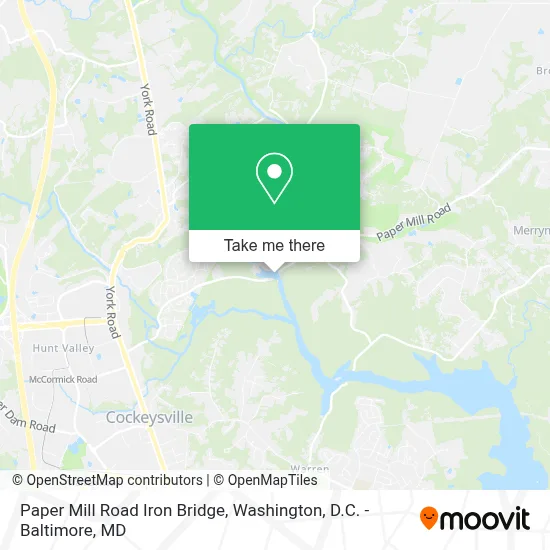
See Paper Mill Road Iron Bridge, Baltimore County, on the map
Public Transit to Paper Mill Road Iron Bridge in Baltimore County
Wondering how to get to Paper Mill Road Iron Bridge in Baltimore County? Moovit helps you find the best way to get to Paper Mill Road Iron Bridge with step-by-step directions from the nearest public transit station.
Moovit provides free maps and live directions to help you navigate through your city. View schedules, routes, timetables, and find out how long does it take to get to Paper Mill Road Iron Bridge in real time.
Looking for the nearest stop or station to Paper Mill Road Iron Bridge? Check out this list of stops closest to your destination: Warren Road.
Bus: 93.Light Rail: LIGHT RAILLINK.
Want to see if there’s another route that gets you there at an earlier time? Moovit helps you find alternative routes or times. Get directions from and directions to Paper Mill Road Iron Bridge easily from the Moovit App or Website.
We make riding to Paper Mill Road Iron Bridge easy, which is why over 1.7 million users, including users in Baltimore County, trust Moovit as the best app for public transit. You don’t need to download an individual bus app or train app, Moovit is your all-in-one transit app that helps you find the best bus time or train time available.
For information on prices of bus and light rail, costs and ride fares to Paper Mill Road Iron Bridge, please check the Moovit app.
Use the app to navigate to popular places including to the airport, hospital, stadium, grocery store, mall, coffee shop, school, college, and university.
Paper Mill Road Iron Bridge Address: MD-145 street in Baltimore County
- Torrey C. Brown Rail Trail,
- Hunt Valley Village Bike Rentals And River Tubes,
- Ncr Trail-Ashland Entrance,
- Historic Jessops Church Inc.,
- Gunpowder Falls State Park York Rd- Hereford Area,
- R&B General Services Llc,
- Warren Road Cliffs (Over Loch Raven Reservoir),
- S&I Elite Transportation,
- Tangy-Orangy,
- Dermatology Partners,
- Windmill Chase Apartments,
- Kelly & Associates Insurance Group,
- Kelly Benefits,
- Top Online Shopping 144,
- Claims Management Solutions, Llc,
- Wittenbach,
- Hunt Valley Orthodontics,
- Natural Concerns Inc,
- Hillis-Carnes Engineering Associates, Inc.,
- Embark Education
Places Near Paper Mill Road Iron Bridge (Baltimore County)
- PG Mall, Prince George's County,
- National Museum of African American History and Culture, Washington,
- Marriott Marquis Washington, DC, Washington,
- Warner Theatre, Washington,
- Rock Creek Tennis Center, Washington,
- Basilica of the National Shrine, Washington,
- Westfield Montgomery Mall, Montgomery County,
- Capital One Arena, Washington,
- Washington National Cathedral, Washington,
- The Anthem, Washington,
- Sibley Memorial Hospital, Washington,
- Pennsylvania Ave NW (3rd st and pennsylvania), Washington,
- Amazon Hq2, Arlington County,
- National Zoo, Washington,
- Camden Yards, Baltimore,
- Georgetown, Washington,
- National Theatre, Washington,
- Washington DC VA Medical Center, Washington,
- Museum Of The Bible, Washington,
- M&T Bank Stadium, Baltimore
How to get to popular places in Washington, D.C. - Baltimore, MD with public transit
Get around Baltimore County by public transit!
Traveling around Baltimore County has never been so easy. See step by step directions as you travel to any attraction, street or major public transit station. View bus and train schedules, arrival times, service alerts and detailed routes on a map, so you know exactly how to get to anywhere in Baltimore County.
When traveling to any destination around Baltimore County use Moovit's Live Directions with Get Off Notifications to know exactly where and how far to walk, how long to wait for your line, and how many stops are left. Moovit will alert you when it's time to get off — no need to constantly re-check whether yours is the next stop.
Wondering how to use public transit in Baltimore County or how to pay for public transit in Baltimore County? Moovit public transit app can help you navigate your way with public transit easily, and at minimum cost. It includes public transit fees, ticket prices, and costs. Looking for a map of Baltimore County public transit lines? Moovit public transit app shows all public transit maps in Baltimore County with all Bus, Train, Metro, Light Rail and Ferry routes and stops on an interactive map.
Washington, D.C. - Baltimore, MD has 5 transit type(s), including: Bus, Train, Metro, Light Rail and Ferry, operated by several transit agencies, including WMATA, Montgomery County Ride On, Fairfax Connector, TheBus, PRTC, DASH - Alexandria, Arlington Transit (ART), RTA of Central Maryland, MDOT MTA, MDOT MTA Light RailLink, MDOT MTA Commuter Bus, MDOT MTA Local Bus, FXBGO!, Virginia Railway Express (VRE) and MARC