Papicu station - Wednesday schedule
| Line | Direction | Time |
|---|---|---|
| AEROPORTO | Destino Aeroporto | 5:37 AM |
| AEROPORTO | Destino Expedicionários | 6:00 AM |
| AEROPORTO | Destino Aeroporto | 6:17 AM |
| AEROPORTO | Destino Expedicionários | 6:40 AM |
| AEROPORTO | Destino Aeroporto | 6:57 AM |
| AEROPORTO | Destino Expedicionários | 7:20 AM |
| AEROPORTO | Destino Aeroporto | 7:37 AM |
| AEROPORTO | Destino Expedicionários | 8:00 AM |
| AEROPORTO | Destino Aeroporto | 8:17 AM |
| AEROPORTO | Destino Expedicionários | 8:40 AM |
| AEROPORTO | Destino Aeroporto | 8:57 AM |
| AEROPORTO | Destino Expedicionários | 9:20 AM |
| AEROPORTO | Destino Aeroporto | 9:37 AM |
| AEROPORTO | Destino Expedicionários | 10:00 AM |
| AEROPORTO | Destino Aeroporto | 10:17 AM |
| AEROPORTO | Destino Expedicionários | 10:40 AM |
| AEROPORTO | Destino Aeroporto | 10:57 AM |
| AEROPORTO | Destino Expedicionários | 11:20 AM |
| AEROPORTO | Destino Aeroporto | 11:37 AM |
| AEROPORTO | Destino Expedicionários | 12:00 PM |
| AEROPORTO | Destino Aeroporto | 12:17 PM |
| AEROPORTO | Destino Expedicionários | 12:40 PM |
| AEROPORTO | Destino Aeroporto | 12:57 PM |
| AEROPORTO | Destino Expedicionários | 1:20 PM |
| AEROPORTO | Destino Aeroporto | 1:37 PM |
Directions to Papicu station with public transit
The following transit lines have routes that pass near Papicu
 Bus: 028 ANTÔNIO BEZERRA / BRT / PAPICU, 031 BORGES DE MELO I / PAPICU, 042 ANTÔNIO BEZERRA / FRANCISCO SÁ / PAPICU, 044 PARANGABA / MONTESE / PAPICU, 045 CONJUNTO CEARÁ / MONTESE / PAPICU.
- Light Rail: NORDESTE.
- Ferry: BARCA DO RIO COCÓ.
How to get to Papicu station by bus?
Click on the bus route to see step by step directions with maps, line arrival times and updated time schedules.
Bus stops near Papicu stop
- Avenida Santos Dumont, 5458 - Cocó, 4 min walk,
- Avenida Engenheiro Santana Júnior, 1927 - Cocó, 5 min walk,
- Avenida Engenheiro Santana Júnior, 1915 - Cocó, 5 min walk,
- Rua Bento Albuquerque, 351 - Papicu, 6 min walk,
- Avenida Farias Brito, 179 - Varjota, 6 min walk,
- Avenida Almirante Henrique Sáboia | Parque Shopping - Cocó, 6 min walk,
- Terminal Papicu | Plataforma B, 7 min walk,
- Rua Monsenhor Catão, Sn - Aldeota, 7 min walk,
- Terminal Papicu | Plataforma A, 9 min walk,
- Avenida Santos Dumont | Condomínio Jardim Iracema - Aldeota, 14 min walk,
Ferry stations near Papicu station
- Avenida Sebastião De Abreu | Pier Rio Cocó, 22 min walk,
Light Rail stations near Papicu station
- Mucuripe, 27 min walk,
Bus lines to Papicu station
- 027 SIQUEIRA / AEROPORTO / PAPICU, Siqueira / Aeroporto / Papicu,
- 032 BORGES DE MELO II / PAPICU, Borges de Melo II / Papicu,
- 036 CORUJÃO / CONJUNTO CEARÁ / MONTESE / PAPICU, Corujão / Conjunto Ceará / Montese / Papicu,
- 038 PARANGABA / PAPICU, Parangaba / Papicu,
- 042 ANTÔNIO BEZERRA / FRANCISCO SÁ / PAPICU, Antônio Bezerra / Francisco Sá / Papicu,
- 044 PARANGABA / MONTESE / PAPICU, Parangaba / Montese / Papicu,
- 045 CONJUNTO CEARÁ / MONTESE / PAPICU, Conjunto Ceará / Montese / Papicu,
- 048 CORUJÃO / PARANGABA / PAPICU, Corujão / Parangaba / Papicu,
- 086 BEZERRA DE MENEZES / SANTOS DUMONT, Bezerra de Menezes / Santos Dumont,
- 087 EXPRESSO / SIQUEIRA / PAPICU, Expresso / Siqueira / Papicu,
- 089 EXPRESSO / PARANGABA / PAPICU, Expresso / Parangaba / Papicu,
- 627 LAGOA REDONDA / PAPICU, Lagoa Redonda / Papicu,
- 680 JOSÉ WALTER / CIDADE JARDIM / PAPICU, José Walter / Cidade Jardim / Papicu,
- 713 RIOMAR PAPICU / JOÃO XXIII, RioMar Papicu / João XXIII,
- 810 PRAIA DO FUTURO / PAPICU, Praia do Futuro / Papicu,
- 813 PRAIA DO FUTURO / PAPICU / ED, Praia do Futuro / Papicu / ED,
- 820 CONJUNTO ALVORADA / PAPICU, Conjunto Alvorada / Papicu,
- 823 BOM JARDIM / MONTESE / ALDEOTA / PAPICU, Bom Jardim / Montese / Aldeota / Papicu,
- 860 CLUBE DOS DIÁRIOS / PAPICU, Clube dos Diários / Papicu,
- 901 PAPICU / DOM LUÍS / CENTRO, Papicu / Dom Luís / Centro,
What are the closest stations to Papicu?
The closest stations to Papicu are:
- Avenida Santos Dumont, 5458 - Cocó stop is 267 meters away, 4 min walk.
- Avenida Engenheiro Santana Júnior, 1927 - Cocó stop is 346 meters away, 5 min walk.
- Avenida Engenheiro Santana Júnior, 1915 - Cocó stop is 381 meters away, 5 min walk.
- Rua Bento Albuquerque, 351 - Papicu stop is 411 meters away, 6 min walk.
- Avenida Farias Brito, 179 - Varjota stop is 425 meters away, 6 min walk.
- Avenida Almirante Henrique Sáboia | Parque Shopping - Cocó stop is 441 meters away, 6 min walk.
- Terminal Papicu | Plataforma B is 485 meters away, 7 min walk.
- Rua Monsenhor Catão, Sn - Aldeota stop is 489 meters away, 7 min walk.
- Terminal Papicu | Plataforma A is 637 meters away, 9 min walk.
- Avenida Santos Dumont | Condomínio Jardim Iracema - Aldeota stop is 1039 meters away, 14 min walk.
- Avenida Sebastião De Abreu | Pier Rio Cocó station is 1688 meters away, 22 min walk.
- Mucuripe station is 2128 meters away, 27 min walk.
Which bus lines stop near Papicu?
These bus lines stop near Papicu: 028 ANTÔNIO BEZERRA / BRT / PAPICU, 031 BORGES DE MELO I / PAPICU, 042 ANTÔNIO BEZERRA / FRANCISCO SÁ / PAPICU, 044 PARANGABA / MONTESE / PAPICU, 045 CONJUNTO CEARÁ / MONTESE / PAPICU, 069 LAGOA / VIA EXPRESSA / PAPICU, 680 JOSÉ WALTER / CIDADE JARDIM / PAPICU, 815 MESSEJANA / CONJUNTO TANCREDO NEVES / PAPICU, 820 CONJUNTO ALVORADA / PAPICU.
Which light rail line stops near Papicu?
NORDESTE (Destino Mucuripe)
What’s the nearest light rail station to Papicu?
The nearest light rail station to Papicu is Mucuripe. It’s a 27 min walk away.
What’s the nearest bus station to Papicu?
The nearest bus station to Papicu is Avenida Santos Dumont, 5458 - Cocó. It’s a 4 min walk away.
What’s the nearest ferry station to Papicu?
The nearest ferry station to Papicu is Avenida Sebastião De Abreu | Pier Rio Cocó. It’s a 22 min walk away.
What time is the first light rail to Papicu?
The NORDESTE is the first light rail that goes to Papicu. It stops nearby at 5:33 AM.
What time is the last light rail to Papicu?
The NORDESTE is the last light rail that goes to Papicu. It stops nearby at 11:24 PM.
What time is the first bus to Papicu?
The 055 CORUJÃO / GRANDE CIRCULAR I is the first bus that goes to Papicu. It stops nearby at 3:11 AM.
What time is the last bus to Papicu?
The 076 CONJUNTO CEARÁ / ALDEOTA / PAPICU is the last bus that goes to Papicu. It stops nearby at 2:15 AM.
Papicu station
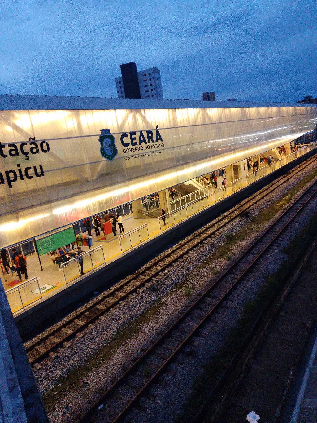 Taken by Elyel S.
See Papicu station on the map
Public transit to Papicu station (ID: PPN)
Looking for directions to Papicu in Papicu, Brazil?
Download the Moovit App to find the current schedule and step-by-step directions for Bus or Light Rail routes that pass through Papicu.
Looking for the nearest stops closest to Papicu ? Check out this list of closest stops to your destination: Avenida Santos Dumont; Avenida Engenheiro Santana Júnior; Avenida Engenheiro Santana Júnior; Rua Bento Albuquerque; Avenida Farias Brito; Avenida Almirante Henrique Sáboia | Parque Shopping - Cocó; Terminal Papicu | Plataforma B; Rua Monsenhor Catão; Terminal Papicu | Plataforma A; Avenida Santos Dumont | Condomínio Jardim Iracema - Aldeota; Avenida Sebastião De Abreu | Pier Rio Cocó; Mucuripe.
Bus: 028 ANTÔNIO BEZERRA / BRT / PAPICU, 031 BORGES DE MELO I / PAPICU, 042 ANTÔNIO BEZERRA / FRANCISCO SÁ / PAPICU, 044 PARANGABA / MONTESE / PAPICU, 045 CONJUNTO CEARÁ / MONTESE / PAPICU, 069 LAGOA / VIA EXPRESSA / PAPICU, 680 JOSÉ WALTER / CIDADE JARDIM / PAPICU, 815 MESSEJANA / CONJUNTO TANCREDO NEVES / PAPICU, 820 CONJUNTO ALVORADA / PAPICU, 027 SIQUEIRA / AEROPORTO / PAPICU, 032 BORGES DE MELO II / PAPICU, 036 CORUJÃO / CONJUNTO CEARÁ / MONTESE / PAPICU, 038 PARANGABA / PAPICU, 004 MESSEJANA / CAMBEBA / PAPICU / TJ, 021 LUCIANO CAVALCANTE / PAPICU, 035 CORUJÃO / PARANJANA II, 041 PARANGABA / OLIVEIRA PAIVA / PAPICU, 034 CORUJÃO / PARANJANA I, 051 GRANDE CIRCULAR I, 055 CORUJÃO / GRANDE CIRCULAR I, 017 INTER SHOPPINGS / SIQUEIRA, 076 CONJUNTO CEARÁ / ALDEOTA / PAPICU.Light Rail: NORDESTE.Ferry: BARCA DO RIO COCÓ.
We make riding on public transit to Papicu easy, which is why over 1.7 billion users, including users in Papicu trust Moovit as the best app for public transit.
Use the app to navigate to popular places including to the airport, hospital, stadium, grocery store, mall, coffee shop, school, college, and university.
The station has the following entrances: Av. Almirante Henrique Sabóia and R. Joaquim Lima
Papicu station’s code is PPN
The first line to this station is AEROPORTO, at 5:37 AM, and the last line is AEROPORTO at 11:20 PM.
1485 Avenida Almirante Henrique Saboia, Fortaleza, Brazil
This station serves METROFOR’s lines
Popular routes from Papicu station
- Avenida Santos Dumont, 5458 - Cocó,
- Avenida Engenheiro Santana Júnior, 1927 - Cocó,
- Avenida Engenheiro Santana Júnior, 1915 - Cocó,
- Rua Bento Albuquerque, 351 - Papicu,
- Avenida Farias Brito, 179 - Varjota,
- Avenida Almirante Henrique Sáboia | Parque Shopping - Cocó,
- Terminal Papicu | Plataforma B,
- Rua Monsenhor Catão, Sn - Aldeota,
- Terminal Papicu | Plataforma A,
- Avenida Santos Dumont | Condomínio Jardim Iracema - Aldeota
Bus stops near Papicu stop
- Avenida Sebastião De Abreu | Pier Rio Cocó
Ferry station near Papicu station
- Mucuripe
Light Rail station near Papicu station
- Rua 35 | Igreja São Francisco De Assis - Jangurussu,
- Avenida José Sabóia, 521-849 - Cais Do Porto,
- Avenida Cruzeiro Do Sul, 192 - Jardim Do Amor,
- Rua Primeiro De Abril, 110 - Boa Vista,
- Avenida Mozart Pinheiro De Lucena, 1684 - Vila Velha,
- Br-020 | Entrada Do Minguaú - Minguaú,
- Rua Bento Albuquerque | Praça Martins Dourado - Cocó,
- Avenida Presidente Castelo Branco | Igreja De Santa Edwirges - Moura Brasil,
- Rua Coronel Matos Dourado | Residencial Matos Dourado - Antônio Bezerra,
- Rua Prisco Bezerra | Shopping Riomar Fortaleza - Papicu,
- Rua Alberto Magno, 300 - Bom Futuro,
- Condomínio Village Água Fria - Edson Queiroz,
- Avenida Maestro Lisboa, 393 - José De Alencar,
- Avenida Doutor Silas Munguba | Praça Da Cruz Grande - Serrinha,
- Rua Chico Lemos, 412 - Cidade Dos Funcionários,
- Rua Guilherme Pessoa, 1361 - Messejana,
- Fazenda Mulata, 1637,
- Avenida Washington Soares | Hospital Distrital Gonzaga Mota - Curió,
- Avenida Francisco Sá | Conjunto Vila Do Mar 3 - Floresta,
- Rua Fausto Aguiar, S/N - Cambeba
Popular public transit stations in Papicu
Get around Papicu by public transit!
Traveling around Papicu has never been so easy. See step by step directions as you travel to any attraction, street or major public transit station. View bus and train schedules, arrival times, service alerts and detailed routes on a map, so you know exactly how to get to anywhere in Papicu.
When traveling to any destination around Papicu use Moovit's Live Directions with Get Off Notifications to know exactly where and how far to walk, how long to wait for your line, and how many stops are left. Moovit will alert you when it's time to get off — no need to constantly re-check whether yours is the next stop.
Wondering how to use public transit in Papicu or how to pay for public transit in Papicu? Moovit public transit app can help you navigate your way with public transit easily, and at minimum cost. It includes public transit fees, ticket prices, and costs. Looking for a map of Papicu public transit lines? Moovit public transit app shows all public transit maps in Papicu with all Bus, Metro, Light Rail and Ferry routes and stops on an interactive map.
Fortaleza Region has 4 transit type(s), including: Bus, Metro, Light Rail and Ferry, operated by several transit agencies, including METROFOR, ETUFOR, Vitória | Metropolitano, Vitória | Passe Livre, Consórcio Metropolitano 2, Via Metro Maracanaú, Viação Penha, Crateús Metropolitano, São Paulo, São Benedito, TRANSPRYME (Alternativo), TRUE, TGA, Via Metro Rodoviário and COOPERTRASGA (Alternativo)