How to get to Papylee by bus?
Click on the bus route to see step by step directions with maps, line arrival times and updated time schedules.
From Buc, Buc
103 minFrom Vélizy 2, Velizy-Villacoublay
62 minFrom Limours, Limours
46 minFrom Technocentre Renault, Guyancourt
87 minFrom Marcoussis, Marcoussis
30 minFrom Clinique De l'Yvette, Longjumeau
84 minFrom Massy-Palaiseau, Massy
38 minFrom Opéra de Massy, Massy
66 minFrom Verrières-le-Buisson, Verrieres-Le-Buisson
63 minFrom Campus Safran University Massy, Massy
59 min
Bus stops near Papylee in Les Ulis
Bus lines to Papylee in Les Ulis
- 5277, Saint-Clair,VIEW
- 4602, Gare De Massy - Palaiseau - Centre Commercial Ulis 2,VIEW
- 4603, Centre Commercial Ulis 2 - Gare D'orsay-Ville,VIEW
- 4604, 8 Mai 1945 - Centre Commercial Ulis 2,VIEW
- 4609, Gare Du Guichet - Campus Hec,VIEW
- 4612, Gare De Courcelle - Lycée De La Vallée - Centre Commercial Ulis 2,VIEW
- 4650, Essouriau - Paul Fort,VIEW
- 4654, Collège De La Guyonnerie - Centre Commercial Ulis 2,VIEW
- 4665, Essouriau - Chêne Rond,VIEW
- 4605, Etang Neuf,VIEW
- 4627, Centre Commercial Ulis 2 - Aubrac,VIEW
- 4621, Centre Commercial Ulis 2,VIEW
- U, Les Vignes,VIEW
What are the closest stations to Papylee?
The closest stations to Papylee are:
- Villeziers la Mare is 364 meters away, 6 min walk.
- Essouriau is 382 meters away, 6 min walk.
- Centre Commercial Ulis 2 - Aubrac is 415 meters away, 6 min walk.
- Centre Commercial Ulis 2 is 632 meters away, 9 min walk.
- Bosquet is 715 meters away, 10 min walk.
Which bus lines stop near Papylee?
These bus lines stop near Papylee: 4602, 4604, 4605, 4609.
What’s the nearest bus station to Papylee in Les Ulis?
The nearest bus stations to Papylee in Les Ulis are Villeziers la Mare, Essouriau and Centre Commercial Ulis 2 - Aubrac. The closest one is a 6 min walk away.
What time is the first bus to Papylee in Les Ulis?
The 4602 is the first bus that goes to Papylee in Les Ulis. It stops nearby at 4:30 AM.
What time is the last bus to Papylee in Les Ulis?
The 4602 is the last bus that goes to Papylee in Les Ulis. It stops nearby at 1:52 AM.
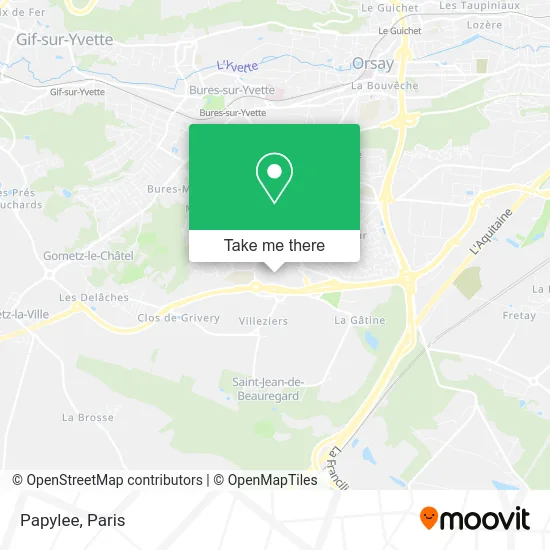
See Papylee, Les Ulis, on the map
Public Transit to Papylee in Les Ulis
Wondering how to get to Papylee in Les Ulis? Moovit helps you find the best way to get to Papylee with step-by-step directions from the nearest public transit station.
Moovit provides free maps and live directions to help you navigate through your city. View schedules, routes, timetables, and find out how long does it take to get to Papylee in real time.
Looking for the nearest stop or station to Papylee? Check out this list of stops closest to your destination: Villeziers la Mare; Essouriau; Centre Commercial Ulis 2 - Aubrac; Centre Commercial Ulis 2; Bosquet.
Bus: 4602, 4604, 4605, 4609, 5277, 4603, 4612, 4627, 4621, U.
Want to see if there’s another route that gets you there at an earlier time? Moovit helps you find alternative routes or times. Get directions from and directions to Papylee easily from the Moovit App or Website.
We make riding to Papylee easy, which is why over 1.5 million users, including users in Les Ulis, trust Moovit as the best app for public transit. You don’t need to download an individual bus app or train app, Moovit is your all-in-one transit app that helps you find the best bus time or train time available.
For information on prices of bus and RER, costs and ride fares to Papylee, please check the Moovit app.
Use the app to navigate to popular places including to the airport, hospital, stadium, grocery store, mall, coffee shop, school, college, and university.
Papylee Address: C Cal les Ulis 91940 Saint-Jean-de-Beauregard street in Les Ulis
- LCL,
- Marionnaud,
- Etam Prêt à Porter,
- Le Jardin de Thierry - Librairie, Presse, Papeterie, Cadeaux - Ccial Ulis 2,
- Association Commerc Cent Comme Ulis 2,
- ULIS 2,
- Carrefour,
- Normal les Ulis, les Ulis 2,
- Riu Aublet et Cie,
- Carrefour,
- Amazon Locker,
- Centre Commercial Les Ulis 2,
- Carrefour Banque,
- Uks,
- Cirque Bouglione,
- Agence Caisse d'Épargne les Ulis 2 les Ulis,
- Picadeli, Bar à Salades,
- C. Cial Les Ulis 2,
- Union Syndicats Centre Commercial Ulis,
- Les Ulis Station
Places Near Papylee (Les Ulis)
- Centre Hospitalier des 15/20, Paris,
- Hôpital Necker, Paris,
- Gare Routière Flixbus, Paris,
- Galeries Lafayette, Paris,
- Hôpital Saint-Joseph, Paris,
- Atelier Des Lumieres, Paris,
- Hôpital de la Pitié-Salpêtrière, Paris,
- Théâtre Mogador, Paris,
- Hôpital Cochin, Paris,
- Créteil Soleil, Creteil,
- 29 Rue Manin, Paris,
- Fondation Louis Vuitton, Paris,
- Hôpital Beaujon, Clichy,
- Hôpital Pitié Salpêtrière, Paris,
- Institut Curie, Paris,
- Marché Saint-Pierre, Paris,
- Hopital Foch, Suresnes,
- Hopital Lariboisière, Paris,
- Hôpital Henri Mondor, Creteil,
- Galeries Lafayette Haussmann, Paris
How to get to popular places in Paris with public transit
Get around Les Ulis by public transit!
Traveling around Les Ulis has never been so easy. See step by step directions as you travel to any attraction, street or major public transit station. View bus and train schedules, arrival times, service alerts and detailed routes on a map, so you know exactly how to get to anywhere in Les Ulis.
When traveling to any destination around Les Ulis use Moovit's Live Directions with Get Off Notifications to know exactly where and how far to walk, how long to wait for your line, and how many stops are left. Moovit will alert you when it's time to get off — no need to constantly re-check whether yours is the next stop.
Wondering how to use public transit in Les Ulis or how to pay for public transit in Les Ulis? Moovit public transit app can help you navigate your way with public transit easily, and at minimum cost. It includes public transit fees, ticket prices, and costs. Looking for a map of Les Ulis public transit lines? Moovit public transit app shows all public transit maps in Les Ulis with all Bus, Train, Metro, Light Rail, RER, Funicular and Gondola routes and stops on an interactive map.
Paris has 7 transit type(s), including: Bus, Train, Metro, Light Rail, RER, Funicular and Gondola, operated by several transit agencies, including RATP, RER, RER Bus de remplacement, Train, Train Bus de remplacement, Tramway Bus de remplacement, TER, ADP, Magical Shuttle, Argenteuil - Boucles de Seine, Autocars Dominique, Bièvre, Brie et 2 Morin, Le Bus - C.C. du Clermontois and Cœur d’Essonne