How to get to Paralect by bus?
Click on the bus route to see step by step directions with maps, line arrival times and updated time schedules.
From N. N. Alexandrov Research and Practical Center of Oncology and Medical Radiology. Department of Anesthesiology and Resuscitation, Barauly
47 minFrom Lobanka Street, Frunzensky District
44 minFrom Nalibotskaya Street 36, Minsk
59 minFrom Military Unit 07147. Central Command Point of Air Force-Air Defense, Minsk
38 minFrom Gashkevich Street 10, Leninsky District
67 minFrom Kizhevatova Stop, Oktyabrsky District
64 minFrom Borovaya, Minsk
42 minFrom Zhdanovichi, Minsk
36 minFrom Polyclinic No. 4, Central District
21 minFrom Dzerzhinsky Avenue 83, Moskovskiy District
52 min
How to get to Paralect by metro?
Click on the metro route to see step by step directions with maps, line arrival times and updated time schedules.
Bus stops near Paralect in Sovetsky District
Trolleybus stations near Paralect in Sovetsky District
Bus lines to Paralect in Sovetsky District
What are the closest stations to Paralect?
The closest stations to Paralect are:
- Riga Supermarket is 91 meters away, 2 min walk.
- Bangalore Square is 206 meters away, 4 min walk.
- Nekrasova is 368 meters away, 6 min walk.
Which bus lines stop near Paralect?
These bus lines stop near Paralect: 133, 24, 46.
Which metro line stops near Paralect?
1 (Uruchye)
Which Trolleybus lines stop near Paralect?
These Trolleybus lines stop near Paralect: 33, 53, 55.
What’s the nearest bus station to Paralect in Sovetsky District?
The nearest bus station to Paralect in Sovetsky District is Riga Supermarket. It’s a 2 min walk away.
What’s the nearest Trolleybus station to Paralect in Sovetsky District?
The nearest Trolleybus station to Paralect in Sovetsky District is Bangalore Square. It’s a 4 min walk away.
What time is the first bus to Paralect in Sovetsky District?
The 136 is the first bus that goes to Paralect in Sovetsky District. It stops nearby at 5:07 AM.
What time is the last bus to Paralect in Sovetsky District?
The 44 is the last bus that goes to Paralect in Sovetsky District. It stops nearby at 1:08 AM.
What time is the first Trolleybus to Paralect in Sovetsky District?
The 33 is the first Trolleybus that goes to Paralect in Sovetsky District. It stops nearby at 5:10 AM.
What time is the last Trolleybus to Paralect in Sovetsky District?
The 33 is the last Trolleybus that goes to Paralect in Sovetsky District. It stops nearby at 1:12 AM.
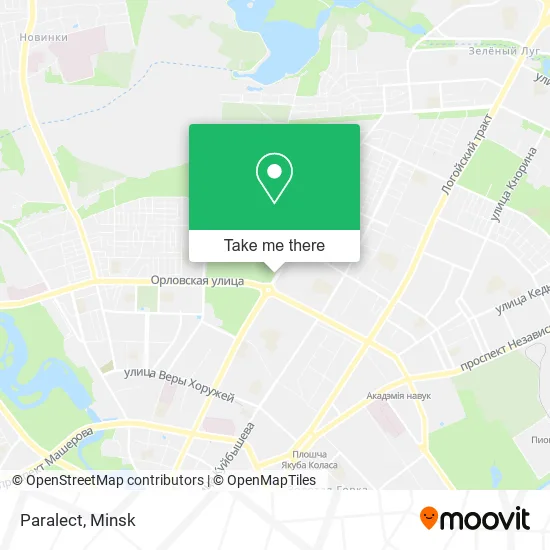
See Paralect, Sovetsky District, on the map
Public Transit to Paralect in Sovetsky District
Wondering how to get to Paralect in Sovetsky District? Moovit helps you find the best way to get to Paralect with step-by-step directions from the nearest public transit station.
Moovit provides free maps and live directions to help you navigate through your city. View schedules, routes, timetables, and find out how long does it take to get to Paralect in real time.
Looking for the nearest stop or station to Paralect? Check out this list of stops closest to your destination: Riga Supermarket; Bangalore Square; Nekrasova.
Bus: 133, 24, 46, 136, 44, 91, 76E.Metro: 1.Trolleybus: 33, 53, 55, 22, 37, 38, 38K, 34, 46, 46П.
Want to see if there’s another route that gets you there at an earlier time? Moovit helps you find alternative routes or times. Get directions from and directions to Paralect easily from the Moovit App or Website.
We make riding to Paralect easy, which is why over 1.5 million users, including users in Sovetsky District, trust Moovit as the best app for public transit. You don’t need to download an individual bus app or train app, Moovit is your all-in-one transit app that helps you find the best bus time or train time available.
For information on prices of bus, Trolleybus and metro, costs and ride fares to Paralect, please check the Moovit app.
Use the app to navigate to popular places including to the airport, hospital, stadium, grocery store, mall, coffee shop, school, college, and university.
Paralect Address: 220000 Минск street in Sovetsky District
- 88 Surganova Street,
- Smolevichi Flats,
- Bogdanovicha, 108,
- 88 Surganova Street,
- Maxim Bogdanovich Street 108,
- At My Bunny,
- Biquants,
- Kate Models,
- Fish&Food,
- Art Fox,
- Salon of Floor Coverings,
- 2 Bobra,
- Rosting,
- Wallpaper Gallery,
- Hästens,
- Nastya's Apartment,
- Polimaster,
- Bangalore Square,
- Striped Camel,
- Kindergarten 230
Places Near Paralect (Sovetsky District)
- Minsk Consultation and Diagnostic Center Semashko Street, 10, Moskovskiy District,
- Republican Scientific and Practical Center 'Mother and Child', Central District,
- Expobel Shopping Mall, Minsk,
- Makaenka Street 17, Pervomaisky District,
- 4th City Clinical Hospital Named After N.E. Savchenko, Moskovskiy District,
- Belexpo Exhibition Complex, Central District,
- Republican Clinical Medical Center, Minsk,
- Expobel, Minsk,
- 10th City Clinical Hospital, Factory District,
- Mersi, Central District,
- N.N. Alexandrov Oncology and Radiology Research Center, Forest,
- 11th City Clinical Hospital, Oktyabrsky District,
- 6th City Clinical Hospital, Partizansky District,
- 24th Special Medical Examination Polyclinic, Pervomaisky District,
- Shopping Center Zamok, Central District,
- Shopping Center «Zhdanovichi», Central District,
- Diamond City, Minsk,
- Military Unit 07147. Central Command Point of Air Force-Air Defense, Minsk,
- Dana Mall, Pervomaisky District,
- Shopping Center Zamok, Central District
How to get to popular places in Minsk with public transit
Get around Sovetsky District by public transit!
Traveling around Sovetsky District has never been so easy. See step by step directions as you travel to any attraction, street or major public transit station. View bus and train schedules, arrival times, service alerts and detailed routes on a map, so you know exactly how to get to anywhere in Sovetsky District.
When traveling to any destination around Sovetsky District use Moovit's Live Directions with Get Off Notifications to know exactly where and how far to walk, how long to wait for your line, and how many stops are left. Moovit will alert you when it's time to get off — no need to constantly re-check whether yours is the next stop.
Wondering how to use public transit in Sovetsky District or how to pay for public transit in Sovetsky District? Moovit public transit app can help you navigate your way with public transit easily, and at minimum cost. It includes public transit fees, ticket prices, and costs. Looking for a map of Sovetsky District public transit lines? Moovit public transit app shows all public transit maps in Sovetsky District with all Bus, Train, Metro, Light Rail and Trolleybus routes and stops on an interactive map.
Minsk has 5 transit type(s), including: Bus, Train, Metro, Light Rail and Trolleybus, operated by several transit agencies, including Capital Transport and Communications and Belarusian Railways
