Directions to Paramount Locksmith (Indianapolis City (Balance)) with public transportation
The following transit lines have routes that pass near Paramount Locksmith
 Bus: 8.
How to get to Paramount Locksmith by bus?
Click on the bus route to see step by step directions with maps, line arrival times and updated time schedules.
From Excel Center, Indianapolis City (Balance)
84 minFrom North Street and New Jersey Street, Indianapolis City (Balance)
42 minFrom Exit 121/Lafayette Rd/N, Indianapolis City (Balance)
86 minFrom Indianapolis Museum of Art, Indianapolis City (Balance)
81 minFrom Ball State University-Downtown, Indianapolis City (Balance)
33 minFrom Pacers Bike Share, Indianapolis City (Balance)
46 minFrom Patrick J McWeeny, Indianapolis City (Balance)
45 minFrom Garfield Regional Park, Indianapolis City (Balance)
62 minFrom Methodist Hospital of Indianapolis, Indianapolis City (Balance)
62 minFrom Expo Design, Indianapolis City (Balance)
35 min
Bus stop near Paramount Locksmith in Indianapolis City (Balance)
- Washington St & Worth Ave, 9 min walk,VIEW
Bus lines to Paramount Locksmith in Indianapolis City (Balance)
- 8, Shortridge Rd,VIEW
What are the closest stations to Paramount Locksmith?
The closest stations to Paramount Locksmith are:
- Washington St & Worth Ave is 670 yards away, 9 min walk.
Which bus line stops near Paramount Locksmith?
8 (Airport)
What’s the nearest bus station to Paramount Locksmith in Indianapolis City (Balance)?
The nearest bus station to Paramount Locksmith in Indianapolis City (Balance) is Washington St & Worth Ave. It’s a 9 min walk away.
What time is the first bus to Paramount Locksmith in Indianapolis City (Balance)?
The 8 is the first bus that goes to Paramount Locksmith in Indianapolis City (Balance). It stops nearby at 5:13 AM.
What time is the last bus to Paramount Locksmith in Indianapolis City (Balance)?
The 8 is the last bus that goes to Paramount Locksmith in Indianapolis City (Balance). It stops nearby at 12:16 AM.
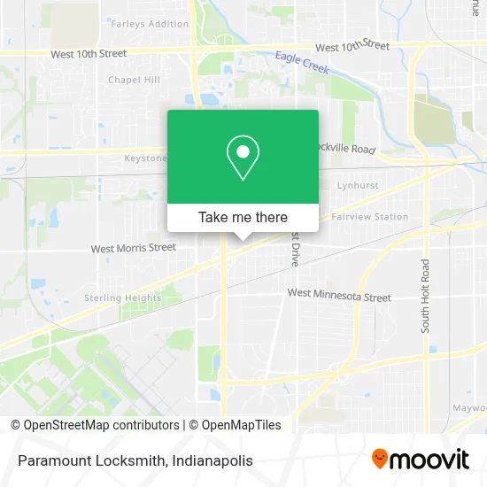
See Paramount Locksmith, Indianapolis City (Balance), on the map
Public Transit to Paramount Locksmith in Indianapolis City (Balance)
Wondering how to get to Paramount Locksmith in Indianapolis City (Balance)? Moovit helps you find the best way to get to Paramount Locksmith with step-by-step directions from the nearest public transit station.
Moovit provides free maps and live directions to help you navigate through your city. View schedules, routes, timetables, and find out how long does it take to get to Paramount Locksmith in real time.
Looking for the nearest stop or station to Paramount Locksmith? Check out this list of stops closest to your destination: Washington St & Worth Ave.
Bus: 8.
Want to see if there’s another route that gets you there at an earlier time? Moovit helps you find alternative routes or times. Get directions from and directions to Paramount Locksmith easily from the Moovit App or Website.
We make riding to Paramount Locksmith easy, which is why over 1.5 million users, including users in Indianapolis City (Balance), trust Moovit as the best app for public transit. You don’t need to download an individual bus app or train app, Moovit is your all-in-one transit app that helps you find the best bus time or train time available.
For information on prices of bus, costs and ride fares to Paramount Locksmith, please check the Moovit app.
Use the app to navigate to popular places including to the airport, hospital, stadium, grocery store, mall, coffee shop, school, college, and university.
Paramount Locksmith Address: 1150 S Mickley Ave Indianapolis, IN 46241 street in Indianapolis City (Balance)
- Plaza Del Sol,
- Autobuses Adame,
- Scientific Concepts,
- Environmental Remediation Service,
- Dollar Tree,
- Taller Mecanico Rudy,
- Orban Auto Repair,
- I 465 @ Washington St,
- Your Beauty Shop,
- D Media,
- Indianapolis Apartment Heating & Cooling Repair,
- Duke Energy Business Services,
- Dogs To Go by Uncle Zo,
- His Grace African Grocery Store,
- Boyer Painting,
- Advantage Funding Services,
- Burnside Express Collision,
- Sanmar Website,
- Ayg Computer Indy (MV Indy Phone Repair GMZ),
- The Caribbean Banquet Hall
Places Near Paramount Locksmith (Indianapolis City (Balance))
- Gainbridge Fieldhouse, Indianapolis City (Balance),
- Indianapolis Motor Speedway, Speedway,
- Cotter's Massage Parlor With Happy Endings, Indianapolis City (Balance),
- Train Ride At Castleton Mall, Indianapolis City (Balance),
- I U Health Methodist Hospital, Indianapolis City (Balance),
- Plainfield, IN, Plainfield,
- Indiana Convention Center, Indianapolis City (Balance),
- Eskenazi Hospital, Indianapolis City (Balance),
- Indiana, Indianapolis City (Balance),
- Indianapolis Airport Zone 2, Indianapolis City (Balance),
- Methodist Hospital of Indianapolis, Indianapolis City (Balance),
- St. Vincent entrance #1, Indianapolis City (Balance),
- 119 W 19th St Parking, Indianapolis City (Balance),
- I-465 / I-65 Interchange, Indianapolis City (Balance),
- Lucas Oil Stadium, Indianapolis City (Balance),
- THE BALT, Indianapolis City (Balance),
- St. Vincent Hospital - Indianapolis, Indianapolis City (Balance),
- Lilly Corporate Center (Eli Lilly & Co), Indianapolis City (Balance),
- Jersey Barn, Indianapolis City (Balance),
- Castleton Square Mall, Indianapolis
How to get to popular places in Indianapolis with public transit
Get around Indianapolis City (Balance) by public transit!
Traveling around Indianapolis City (Balance) has never been so easy. See step by step directions as you travel to any attraction, street or major public transit station. View bus and train schedules, arrival times, service alerts and detailed routes on a map, so you know exactly how to get to anywhere in Indianapolis City (Balance).
When traveling to any destination around Indianapolis City (Balance) use Moovit's Live Directions with Get Off Notifications to know exactly where and how far to walk, how long to wait for your line, and how many stops are left. Moovit will alert you when it's time to get off — no need to constantly re-check whether yours is the next stop.
Wondering how to use public transit in Indianapolis City (Balance) or how to pay for public transit in Indianapolis City (Balance)? Moovit public transit app can help you navigate your way with public transit easily, and at minimum cost. It includes public transit fees, ticket prices, and costs. Looking for a map of Indianapolis City (Balance) public transit lines? Moovit public transit app shows all public transit maps in Indianapolis City (Balance) with all bus routes and stops on an interactive map.
Indianapolis has 1 transit type(s), including: bus, operated by several transit agencies, including IndyGo, FlixBus-us and Greyhound-us