How to get to Sorgane Park by bus?
Click on the bus route to see step by step directions with maps, line arrival times and updated time schedules.
From Tumi House, Sesto Fiorentino
69 minFrom Monterivecchi Social Recreation Center, Florence
80 minFrom Palace of Justice, Florence
54 minFrom Tenax, Florence
63 minFrom Florence Castello, Florence
75 minFrom Falciani-Villa delle Terme Medical Center, Impruneta
77 minFrom Monsignor Oscar Arnulfo Romero Street, Scandicci
84 minFrom Tenax (Tenax Club), Florence
63 minFrom Madonna del Pagano Street, Florence
83 minFrom Tasso Square, Florence
51 min
How to get to Sorgane Park by train?
Click on the train route to see step by step directions with maps, line arrival times and updated time schedules.
Bus stops near Sorgane Park in Florence
Train stations near Sorgane Park in Florence
Bus lines to Sorgane Park in Florence
- 31, Piazzale Montelungo - Grassina,VIEW
- 32, Piazzale Montelungo - Antella,VIEW
- 41, Via Dei Baldovini - Cascine Del Riccio/Via Pietriboni Galluzzo,VIEW
- 60, Piazzale Montelungo - Grassina - Antella,VIEW
- 351 A, Montevarchi-Figline Valdarno-Incisa Valdarno-Florence,VIEW
- 353 A, Reggello-Figline Valdarno-Incisa Valdarno-Florence,VIEW
- 354 A, Figline Valdarno-Lucolena-San Polo-Florence,VIEW
- 365 A, Gaiole-Radda-Greve-Florence,VIEW
- 322 A, Rufina Center,VIEW
- 343 A, Saltino Center,VIEW
- 350 A, Florence Montelungo Hub,VIEW
- 351 A, Figline Valdarno Railway Station,VIEW
- 23, Sorgane,VIEW
- 85, Gobetti Volta Perosi,VIEW
- 85, Impruneta Vittorio Veneto Street,VIEW
- 351 A, Incisa Terminal Barberino,VIEW
- 353 A, Florence Montelungo Hub,VIEW
What are the closest stations to Sorgane Park?
The closest stations to Sorgane Park are:
- Badia A Ripoli is 2 meters away, 1 min walk.
- Via Badia A Ripoli is 136 meters away, 2 min walk.
- Denmark is 151 meters away, 3 min walk.
- Del Pino Cemetery is 573 meters away, 8 min walk.
- Firenze Rovezzano is 1886 meters away, 25 min walk.
- Florence Campo di Marte is 3551 meters away, 46 min walk.
Which bus line stops near Sorgane Park?
23 (Sorgane)
Which train line stops near Sorgane Park?
R (Foligno)
What’s the nearest train station to Sorgane Park in Florence?
The nearest train station to Sorgane Park in Florence is Firenze Rovezzano. It’s a 25 min walk away.
What’s the nearest bus station to Sorgane Park in Florence?
The nearest bus station to Sorgane Park in Florence is Badia A Ripoli. It’s a 1 min walk away.
What time is the first train to Sorgane Park in Florence?
The R is the first train that goes to Sorgane Park in Florence. It stops nearby at 6:06 AM.
What time is the last train to Sorgane Park in Florence?
The R is the last train that goes to Sorgane Park in Florence. It stops nearby at 11:39 PM.
What time is the first bus to Sorgane Park in Florence?
The 23 is the first bus that goes to Sorgane Park in Florence. It stops nearby at 6:04 AM.
What time is the last bus to Sorgane Park in Florence?
The 32 is the last bus that goes to Sorgane Park in Florence. It stops nearby at 1:00 AM.
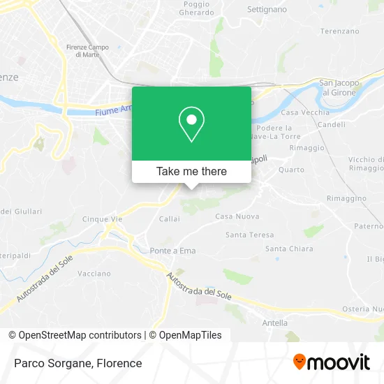
See Sorgane Park, Florence, on the map
Public Transit to Sorgane Park in Florence
Wondering how to get to Sorgane Park in Florence? Moovit helps you find the best way to get to Sorgane Park with step-by-step directions from the nearest public transit station.
Moovit provides free maps and live directions to help you navigate through your city. View schedules, routes, timetables, and find out how long does it take to get to Sorgane Park in real time.
Looking for the nearest stop or station to Sorgane Park? Check out this list of stops closest to your destination: Badia A Ripoli; Via Badia A Ripoli; Denmark; Del Pino Cemetery; Firenze Rovezzano; Florence Campo di Marte.
Bus: 23, 31, 32, 41, 60, 351 A, 322 A, 343 A, 350 A, 351 A, 85, 85, 351 A, 353 A.Train: R.
Want to see if there’s another route that gets you there at an earlier time? Moovit helps you find alternative routes or times. Get directions from and directions to Sorgane Park easily from the Moovit App or Website.
We make riding to Sorgane Park easy, which is why over 1.5 million users, including users in Florence, trust Moovit as the best app for public transit. You don’t need to download an individual bus app or train app, Moovit is your all-in-one transit app that helps you find the best bus time or train time available.
For information on prices of bus and train, costs and ride fares to Sorgane Park, please check the Moovit app.
Use the app to navigate to popular places including to the airport, hospital, stadium, grocery store, mall, coffee shop, school, college, and university.
Sorgane Park Address: Brenta Street street in Florence
- Sorgane Garden,
- Studio the Fourth String,
- Istria Square,
- Sorgane,
- Sorgane Gym,
- Catia Franci Nursery,
- School District No. 14,
- Via Isonzo 26/a,
- Sandro Pertini Guesthouse,
- Athena,
- Tagliamento Street, 18,
- Emilio Visconti Venosta Street,
- Sorgane Coop, Florence,
- Marco Polo Viaduct,
- Sorgane Mosque,
- Livenza Street, 3,
- San Lorenzo 152 Florentine Traditions by Nejam Uddin Sar Ker Md & C.,
- Villa Il Pitto,
- Municipality of Florence - District 3,
- Together Florence Inn
Places Near Sorgane Park (Florence)
- Santa Maria Novella Station, Florence,
- Field of Mars, Florence,
- Michelangelo Square, Florence,
- Verdi Theater, Florence,
- OOO, Florence,
- I Gigli, Campi Bisenzio,
- Campi Bisenzio, Campi Bisenzio,
- Viola Park, Bagno a Ripoli,
- Tobacco Manufacture, Florence,
- Piero Palagi Hospital Facility-Florence, Florence,
- Torregalli Hospital Scandicci *, Scandicci,
- Mandela Forum (Nelson Mandela Forum), Florence,
- IKEA Florence, Sesto Fiorentino,
- Wanny Palace, Florence,
- Artemio Franchi Municipal Stadium, Florence,
- Asmana, Campi Bisenzio,
- Nelson Mandela Forum, Florence,
- Santa Maria Nuova Hospital, Florence,
- Cascine Park, Florence,
- Michelangelo Square, Florence
How to get to popular places in Florence with public transit
Get around Florence by public transit!
Traveling around Florence has never been so easy. See step by step directions as you travel to any attraction, street or major public transit station. View bus and train schedules, arrival times, service alerts and detailed routes on a map, so you know exactly how to get to anywhere in Florence.
When traveling to any destination around Florence use Moovit's Live Directions with Get Off Notifications to know exactly where and how far to walk, how long to wait for your line, and how many stops are left. Moovit will alert you when it's time to get off — no need to constantly re-check whether yours is the next stop.
Wondering how to use public transit in Florence or how to pay for public transit in Florence? Moovit public transit app can help you navigate your way with public transit easily, and at minimum cost. It includes public transit fees, ticket prices, and costs. Looking for a map of Florence public transit lines? Moovit public transit app shows all public transit maps in Florence with all Bus, Train, Light Rail, Ferry and Funicular routes and stops on an interactive map.
Florence has 5 transit type(s), including: Bus, Train, Light Rail, Ferry and Funicular, operated by several transit agencies, including Florence Urban - Tuscan Bus Lines, GEST, Florence and Province - Tuscan Bus Lines, Livorno and Province - Tuscan Bus Lines, Arezzo, Florence and Provinces - Tuscan Bus Lines, Prato and Province - Tuscan Bus Lines, Massa, Carrara and Province - Tuscan Bus Lines, Pisa and Province - Tuscan Bus Lines, Grosseto, Siena and Provinces - Tuscan Bus Lines, Arezzo, Siena and Provinces - Tuscan Bus Lines, Pistoia and Province - Tuscan Bus Lines, Siena and Province - Tuscan Bus Lines, Arezzo and Province - Tuscan Bus Lines, Lucca and Province - Tuscan Bus Lines and Trenitalia