How to get to Parking La Chopera by bus?
Click on the bus route to see step by step directions with maps, line arrival times and updated time schedules.
From Polígono P-29, Collado Villalba
74 minFrom The Style Outlets Las Rozas, Las Rozas De Madrid
79 minFrom Hospital De La Fuenfría., Cuenca Del Guadarrama
125 minFrom Hospital Público de Collado Villalba, Collado Villalba
31 minFrom Heron City Madrid, Área Metropolitana De Madrid Y Corredor Del Henares
78 minFrom Piscinas Naturales Las Berceas, Cercedilla
61 minFrom Tanatorio La Paz, Alcobendas
38 minFrom Las Presillas, Rascafría
261 minFrom Hospital HM Universitario Torrelodones, Torrelodones
67 min
Bus stop near Parking La Chopera in Cuenca Del Guadarrama
- Ctra. M-608 - Peña De Las Gallinas, 6 min walk,VIEW
Bus lines to Parking La Chopera in Cuenca Del Guadarrama
What are the closest stations to Parking La Chopera?
The closest stations to Parking La Chopera are:
- Ctra. M-608 - Peña De Las Gallinas is 378 meters away, 6 min walk.
Which bus lines stop near Parking La Chopera?
These bus lines stop near Parking La Chopera: 720, 724.
What’s the nearest bus station to Parking La Chopera in Cuenca Del Guadarrama?
The nearest bus station to Parking La Chopera in Cuenca Del Guadarrama is Ctra. M-608 - Peña De Las Gallinas. It’s a 6 min walk away.
What time is the first bus to Parking La Chopera in Cuenca Del Guadarrama?
The 720 is the first bus that goes to Parking La Chopera in Cuenca Del Guadarrama. It stops nearby at 5:45 AM.
What time is the last bus to Parking La Chopera in Cuenca Del Guadarrama?
The 720 is the last bus that goes to Parking La Chopera in Cuenca Del Guadarrama. It stops nearby at 12:00 AM.
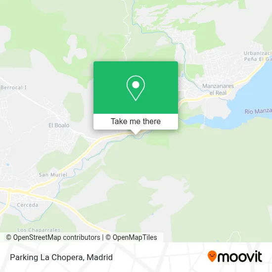
See Parking La Chopera, Cuenca Del Guadarrama, on the map
Public Transit to Parking La Chopera in Cuenca Del Guadarrama
Wondering how to get to Parking La Chopera in Cuenca Del Guadarrama? Moovit helps you find the best way to get to Parking La Chopera with step-by-step directions from the nearest public transit station.
Moovit provides free maps and live directions to help you navigate through your city. View schedules, routes, timetables, and find out how long does it take to get to Parking La Chopera in real time.
Looking for the nearest stop or station to Parking La Chopera? Check out this list of stops closest to your destination: Ctra. M-608 - Peña De Las Gallinas.
Bus: 720, 724.
Want to see if there’s another route that gets you there at an earlier time? Moovit helps you find alternative routes or times. Get directions from and directions to Parking La Chopera easily from the Moovit App or Website.
We make riding to Parking La Chopera easy, which is why over 1.5 million users, including users in Cuenca Del Guadarrama, trust Moovit as the best app for public transit. You don’t need to download an individual bus app or train app, Moovit is your all-in-one transit app that helps you find the best bus time or train time available.
For information on prices of bus, costs and ride fares to Parking La Chopera, please check the Moovit app.
Use the app to navigate to popular places including to the airport, hospital, stadium, grocery store, mall, coffee shop, school, college, and university.
Parking La Chopera Address: Carretera de Cerceda a Manzanares street in Cuenca Del Guadarrama
- Asociación de,
- Antonio Espinosa Cuenca,
- Susana Brabo Narbon,
- Colegio Montesclaros,
- Entorno de Doñana,
- Peña De Las Gallinas,
- Río Samburiel,
- Polideportivo El Boalo,
- el guarro,
- Merendero La Casita,
- Guarderias Ranitas,
- Asociación de,
- C.P. San Sebastian,
- Calle Solana de la Caseta,
- Urbanización San Muriel Bomán,
- Sagar Ice Cream,
- Tartar Inversiones,
- Parque Regional De La Cuenca Alta Del Manzanares,
- P Familiar,
- Urbanización El Rebollar
Places Near Parking La Chopera (Cuenca Del Guadarrama)
- Hospital Universitario La Paz, Madrid,
- Hospital Universitario Ramón y Cajal, Madrid,
- Estadio Wanda Metropolitano, Área Metropolitana De Madrid Y Corredor Del Henares,
- Rastro De Madrid, Área Metropolitana De Madrid Y Corredor Del Henares,
- Estacion de Chamartin, Madrid,
- Hospital Clínico Universitario San Carlos, Madrid,
- Plaza Mayor, Madrid,
- Centro Comercial Oasiz Madrid, Área Metropolitana De Madrid Y Corredor Del Henares,
- Nassica, Área Metropolitana De Madrid Y Corredor Del Henares,
- Wizink Center, Madrid,
- Mendez Alvaro, Madrid,
- Centro Comercial La Gavia, Área Metropolitana De Madrid Y Corredor Del Henares,
- Tres Aguas, Alcorcón,
- Calle de López de Hoyos 169, Madrid,
- Plenilunio, Área Metropolitana De Madrid Y Corredor Del Henares,
- Palacio De Vistalegre, Área Metropolitana De Madrid Y Corredor Del Henares,
- Mercadillo de Majadahonda, Majadahonda,
- Centro Comercial La Vaguada, Área Metropolitana De Madrid Y Corredor Del Henares,
- Centro Comercial Islazul, Área Metropolitana De Madrid Y Corredor Del Henares,
- Sala La Riviera, Madrid
How to get to popular places in Madrid with public transit
Get around Cuenca Del Guadarrama by public transit!
Traveling around Cuenca Del Guadarrama has never been so easy. See step by step directions as you travel to any attraction, street or major public transit station. View bus and train schedules, arrival times, service alerts and detailed routes on a map, so you know exactly how to get to anywhere in Cuenca Del Guadarrama.
When traveling to any destination around Cuenca Del Guadarrama use Moovit's Live Directions with Get Off Notifications to know exactly where and how far to walk, how long to wait for your line, and how many stops are left. Moovit will alert you when it's time to get off — no need to constantly re-check whether yours is the next stop.
Wondering how to use public transit in Cuenca Del Guadarrama or how to pay for public transit in Cuenca Del Guadarrama? Moovit public transit app can help you navigate your way with public transit easily, and at minimum cost. It includes public transit fees, ticket prices, and costs. Looking for a map of Cuenca Del Guadarrama public transit lines? Moovit public transit app shows all public transit maps in Cuenca Del Guadarrama with all Bus, Train, Metro and Light Rail routes and stops on an interactive map.
Madrid has 4 transit type(s), including: Bus, Train, Metro and Light Rail, operated by several transit agencies, including Metro de Madrid, Metro Ligero, Tranvía de Parla, Renfe Cercanías - Servicios de Autobús especiales, Renfe Cercanias, Renfe Cercanías, EMT, Interurbanos, Urbanos de Alcalá de Henares, Urbanos de Alcobendas, Urbanos de Alcorcón, Urbanos de Algete, Urbanos de Aranjuez, Urbanos de Arganda del Rey and Urbanos de Arroyomolinos