How to get to Parque by bus?
Click on the bus route to see step by step directions with maps, line arrival times and updated time schedules.
From Plaza De Las Comendadoras, Área Metropolitana De Madrid Y Corredor Del Henares
48 minFrom Metro Banco de España, Madrid
54 minFrom Madrid Río, Madrid
85 minFrom Teatro Albéniz, Área Metropolitana De Madrid Y Corredor Del Henares
58 minFrom Consulado De Marruecos, Área Metropolitana De Madrid Y Corredor Del Henares
64 minFrom Centro de Especialidades Pontones, Madrid
59 minFrom Calle General Ricardos, Madrid
90 minFrom Museo Arqueológico Nacional, Área Metropolitana De Madrid Y Corredor Del Henares
57 minFrom Universidad Complutense, Madrid
33 minFrom Calle de Claudio Coello, Madrid
61 min
How to get to Parque by train?
Click on the train route to see step by step directions with maps, line arrival times and updated time schedules.
From Plaza De Las Comendadoras, Área Metropolitana De Madrid Y Corredor Del Henares
47 minFrom Metro Banco de España, Madrid
54 minFrom Madrid Río, Madrid
43 minFrom Teatro Albéniz, Área Metropolitana De Madrid Y Corredor Del Henares
54 minFrom Consulado De Marruecos, Área Metropolitana De Madrid Y Corredor Del Henares
67 minFrom Centro de Especialidades Pontones, Madrid
43 minFrom Museo Arqueológico Nacional, Área Metropolitana De Madrid Y Corredor Del Henares
53 minFrom Calle de Claudio Coello, Madrid
60 min
Bus stops near Parque in Pozuelo De Alarcón
Train station near Parque in Pozuelo De Alarcón
- Pozuelo, 7 min walk,VIEW
Light Rail stations near Parque in Pozuelo De Alarcón
- Berna, 14 min walk,VIEW
Bus lines to Parque in Pozuelo De Alarcón
What are the closest stations to Parque?
The closest stations to Parque are:
- Navacerrada - Pico Del Nevero is 162 meters away, 3 min walk.
- Peñalara - Av. Navacerrada is 381 meters away, 6 min walk.
- Lázaro Carreter - Vizcaíno Casas is 484 meters away, 7 min walk.
- Pozuelo is 501 meters away, 7 min walk.
- Leopoldo Calvo Sotelo - Castillo is 620 meters away, 9 min walk.
- Leopoldo Calvo Sotelo - Hnos. Fdez. Carvajal is 643 meters away, 9 min walk.
- María Benítez - Ctra. Benítez is 873 meters away, 12 min walk.
- Berna is 1023 meters away, 14 min walk.
Which bus lines stop near Parque?
These bus lines stop near Parque: 563, 656, 656A.
Which train line stops near Parque?
C10 (Villalba De Guadarrama)
What’s the nearest light rail station to Parque in Pozuelo De Alarcón?
The nearest light rail station to Parque in Pozuelo De Alarcón is Berna. It’s a 14 min walk away.
What’s the nearest train station to Parque in Pozuelo De Alarcón?
The nearest train station to Parque in Pozuelo De Alarcón is Pozuelo. It’s a 7 min walk away.
What’s the nearest bus station to Parque in Pozuelo De Alarcón?
The nearest bus station to Parque in Pozuelo De Alarcón is Navacerrada - Pico Del Nevero. It’s a 3 min walk away.
What time is the first light rail to Parque in Pozuelo De Alarcón?
The ML-2 is the first light rail that goes to Parque in Pozuelo De Alarcón. It stops nearby at 6:04 AM.
What time is the last light rail to Parque in Pozuelo De Alarcón?
The ML-2 is the last light rail that goes to Parque in Pozuelo De Alarcón. It stops nearby at 1:57 AM.
What time is the first train to Parque in Pozuelo De Alarcón?
The C7 is the first train that goes to Parque in Pozuelo De Alarcón. It stops nearby at 6:13 AM.
What time is the last train to Parque in Pozuelo De Alarcón?
The C7 is the last train that goes to Parque in Pozuelo De Alarcón. It stops nearby at 12:06 AM.
What time is the first bus to Parque in Pozuelo De Alarcón?
The N906 is the first bus that goes to Parque in Pozuelo De Alarcón. It stops nearby at 3:11 AM.
What time is the last bus to Parque in Pozuelo De Alarcón?
The N901 is the last bus that goes to Parque in Pozuelo De Alarcón. It stops nearby at 2:30 AM.
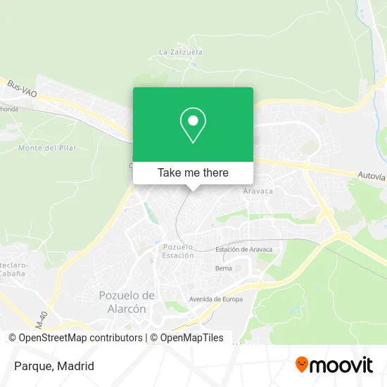
See Parque, Pozuelo De Alarcón, on the map
Public Transit to Parque in Pozuelo De Alarcón
Wondering how to get to Parque in Pozuelo De Alarcón? Moovit helps you find the best way to get to Parque with step-by-step directions from the nearest public transit station.
Moovit provides free maps and live directions to help you navigate through your city. View schedules, routes, timetables, and find out how long does it take to get to Parque in real time.
Looking for the nearest stop or station to Parque? Check out this list of stops closest to your destination: Navacerrada - Pico Del Nevero; Peñalara - Av. Navacerrada; Lázaro Carreter - Vizcaíno Casas; Pozuelo; Leopoldo Calvo Sotelo - Castillo; Leopoldo Calvo Sotelo - Hnos. Fdez. Carvajal; María Benítez - Ctra. Benítez; Berna.
Bus: 563, 656, 656A, 163, 815, N906, N901.Train: C10, C7, REG.
Want to see if there’s another route that gets you there at an earlier time? Moovit helps you find alternative routes or times. Get directions from and directions to Parque easily from the Moovit App or Website.
We make riding to Parque easy, which is why over 1.5 million users, including users in Pozuelo De Alarcón, trust Moovit as the best app for public transit. You don’t need to download an individual bus app or train app, Moovit is your all-in-one transit app that helps you find the best bus time or train time available.
For information on prices of bus, train and metro, costs and ride fares to Parque, please check the Moovit app.
Use the app to navigate to popular places including to the airport, hospital, stadium, grocery store, mall, coffee shop, school, college, and university.
Parque Address: Calle Juan Herreras Sánchez, 1 28224 Pozuelo de Alarcón street in Pozuelo De Alarcón
- Payno Farmacia,
- Altajocris,
- Mappaddan Ka,
- Peluquería Munoz y Ort,
- Calle Fernando Lázaro Carreter,
- Peluqueria Muñoz Ortega,
- Urbanización Las Encinas,
- Kbk Aravaka,
- KBK Aravaka,
- Bm Pozuelo,
- Iberdrola,
- Parque Peñalara,
- Calle Navacerrada,
- Avenida Navacerrada, 4,
- Mercadomper,
- Azedomo,
- Edhinor,
- Asaze Ingenieros,
- Rico Nicolas Veronica,
- Sport Shoes
Places Near Parque (Pozuelo De Alarcón)
- Hospital Universitario La Paz, Madrid,
- Tres Aguas, Alcorcón,
- Hospital Clínico Universitario San Carlos, Madrid,
- Plenilunio, Área Metropolitana De Madrid Y Corredor Del Henares,
- Centro Comercial Islazul, Área Metropolitana De Madrid Y Corredor Del Henares,
- Calle de López de Hoyos 169, Madrid,
- Hospital Universitario Ramón y Cajal, Madrid,
- Wizink Center, Madrid,
- Centro Comercial Oasiz Madrid, Área Metropolitana De Madrid Y Corredor Del Henares,
- Estacion de Chamartin, Madrid,
- Nassica, Área Metropolitana De Madrid Y Corredor Del Henares,
- Sala La Riviera, Madrid,
- Rastro De Madrid, Área Metropolitana De Madrid Y Corredor Del Henares,
- Mercadillo de Majadahonda, Majadahonda,
- Estadio Wanda Metropolitano, Área Metropolitana De Madrid Y Corredor Del Henares,
- Mendez Alvaro, Madrid,
- Palacio De Vistalegre, Área Metropolitana De Madrid Y Corredor Del Henares,
- Plaza Mayor, Madrid,
- Centro Comercial La Gavia, Área Metropolitana De Madrid Y Corredor Del Henares,
- Centro Comercial La Vaguada, Área Metropolitana De Madrid Y Corredor Del Henares
How to get to popular places in Madrid with public transit
Get around Pozuelo De Alarcón by public transit!
Traveling around Pozuelo De Alarcón has never been so easy. See step by step directions as you travel to any attraction, street or major public transit station. View bus and train schedules, arrival times, service alerts and detailed routes on a map, so you know exactly how to get to anywhere in Pozuelo De Alarcón.
When traveling to any destination around Pozuelo De Alarcón use Moovit's Live Directions with Get Off Notifications to know exactly where and how far to walk, how long to wait for your line, and how many stops are left. Moovit will alert you when it's time to get off — no need to constantly re-check whether yours is the next stop.
Wondering how to use public transit in Pozuelo De Alarcón or how to pay for public transit in Pozuelo De Alarcón? Moovit public transit app can help you navigate your way with public transit easily, and at minimum cost. It includes public transit fees, ticket prices, and costs. Looking for a map of Pozuelo De Alarcón public transit lines? Moovit public transit app shows all public transit maps in Pozuelo De Alarcón with all Bus, Train, Metro and Light Rail routes and stops on an interactive map.
Madrid has 4 transit type(s), including: Bus, Train, Metro and Light Rail, operated by several transit agencies, including Metro de Madrid, Metro Ligero, Tranvía de Parla, Renfe Cercanías - Servicios de Autobús especiales, Renfe Cercanias, Renfe Cercanías, EMT, Interurbanos, Urbanos de Alcalá de Henares, Urbanos de Alcobendas, Urbanos de Alcorcón, Urbanos de Algete, Urbanos de Aranjuez, Urbanos de Arganda del Rey and Urbanos de Arroyomolinos