How to get to Parque Adolfo Suarez by bus?
Click on the bus route to see step by step directions with maps, line arrival times and updated time schedules.
From Hospital HM Universitario Torrelodones, Torrelodones
76 minFrom Universidad Alfonso X El Sabio (UAX), Villanueva De La Cañada
121 minFrom Las Rozas Outlet, Las Rozas De Madrid
102 minFrom Hospital Público de Collado Villalba, Collado Villalba
110 minFrom Hospital De La Fuenfría., Cercedilla
141 minFrom Heron City Madrid, Las Rozas De Madrid
97 minFrom The Style Outlets Las Rozas, Las Rozas De Madrid
102 minFrom Universidad Camilo José Cela (UCJC), Villanueva De La Cañada
100 minFrom Villalba (Estación Renfe Villalba), Collado Villalba
68 minFrom Piscinas Naturales Las Berceas, Cercedilla
111 min
How to get to Parque Adolfo Suarez by train?
Click on the train route to see step by step directions with maps, line arrival times and updated time schedules.
Bus stops near Parque Adolfo Suarez in San Lorenzo De El Escorial
Train station near Parque Adolfo Suarez in San Lorenzo De El Escorial
- El Escorial, 26 min walk,VIEW
Bus lines to Parque Adolfo Suarez in San Lorenzo De El Escorial
- 4, Circular San Lorenzo de El Escorial,VIEW
- 1, S. L. de El Escorial - FF.CC. - S. L. de El Escorial,VIEW
- 640, San Lorenzo de El Escorial - Robledo Chavela - Valdemaqueda,VIEW
- 660, San Lorenzo de El Escorial - Guadarrama - Villalba,VIEW
- 661, Madrid (Moncloa) - San Lorenzo de El Escorial (por Galapagar),VIEW
- 664, Madrid (Moncloa) - San Lorenzo de El Escorial (por Guadarrama),VIEW
- 665, San Lorenzo de El Escorial - Peguerinos,VIEW
- 666, San Lorenzo de El Escorial - Zarzalejo - Las Navas del Marqués,VIEW
- 667, Majadahonda (Hospital) - San Lorenzo de El Escorial (por Galapagar),VIEW
- 669, San Lorenzo de El Escorial - Villanueva de la Cañada,VIEW
- 669A, S. L. de El Escorial - Fresnedillas - Navalagamella,VIEW
- N604, Madrid (Moncloa) - El Escorial - San Lorenzo de El Escorial,VIEW
- 2, S. L. Escorial - Hospital - La Pizarra,VIEW
What are the closest stations to Parque Adolfo Suarez?
The closest stations to Parque Adolfo Suarez are:
- Pza. San Antonio Abad - P.º Carlos III is 123 meters away, 2 min walk.
- Est. De Autobuses De S. L. De El Escorial is 640 meters away, 9 min walk.
- Juan De Toledo - Estación De Autobuses is 662 meters away, 9 min walk.
- El Escorial is 2002 meters away, 26 min walk.
Which bus lines stop near Parque Adolfo Suarez?
These bus lines stop near Parque Adolfo Suarez: 1, 661, 664.
Which train line stops near Parque Adolfo Suarez?
C8 (El Escorial)
What’s the nearest train station to Parque Adolfo Suarez in San Lorenzo De El Escorial?
The nearest train station to Parque Adolfo Suarez in San Lorenzo De El Escorial is El Escorial. It’s a 26 min walk away.
What’s the nearest bus station to Parque Adolfo Suarez in San Lorenzo De El Escorial?
The nearest bus station to Parque Adolfo Suarez in San Lorenzo De El Escorial is Pza. San Antonio Abad - P.º Carlos III. It’s a 2 min walk away.
What time is the first train to Parque Adolfo Suarez in San Lorenzo De El Escorial?
The C8 is the first train that goes to Parque Adolfo Suarez in San Lorenzo De El Escorial. It stops nearby at 5:45 AM.
What time is the last train to Parque Adolfo Suarez in San Lorenzo De El Escorial?
The C8 is the last train that goes to Parque Adolfo Suarez in San Lorenzo De El Escorial. It stops nearby at 12:36 AM.
What time is the first bus to Parque Adolfo Suarez in San Lorenzo De El Escorial?
The N604 is the first bus that goes to Parque Adolfo Suarez in San Lorenzo De El Escorial. It stops nearby at 3:09 AM.
What time is the last bus to Parque Adolfo Suarez in San Lorenzo De El Escorial?
The N604 is the last bus that goes to Parque Adolfo Suarez in San Lorenzo De El Escorial. It stops nearby at 3:09 AM.
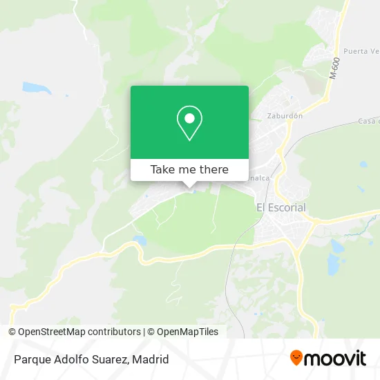
See Parque Adolfo Suarez, San Lorenzo De El Escorial, on the map
Public Transit to Parque Adolfo Suarez in San Lorenzo De El Escorial
Wondering how to get to Parque Adolfo Suarez in San Lorenzo De El Escorial? Moovit helps you find the best way to get to Parque Adolfo Suarez with step-by-step directions from the nearest public transit station.
Moovit provides free maps and live directions to help you navigate through your city. View schedules, routes, timetables, and find out how long does it take to get to Parque Adolfo Suarez in real time.
Looking for the nearest stop or station to Parque Adolfo Suarez? Check out this list of stops closest to your destination: Pza. San Antonio Abad - P.º Carlos III; Est. De Autobuses De S. L. De El Escorial; Juan De Toledo - Estación De Autobuses; El Escorial.
Bus: 1, 661, 664, 4, 640, 660, 2.Train: C8, C8A, C10, MD, REG.
Want to see if there’s another route that gets you there at an earlier time? Moovit helps you find alternative routes or times. Get directions from and directions to Parque Adolfo Suarez easily from the Moovit App or Website.
We make riding to Parque Adolfo Suarez easy, which is why over 1.5 million users, including users in San Lorenzo De El Escorial, trust Moovit as the best app for public transit. You don’t need to download an individual bus app or train app, Moovit is your all-in-one transit app that helps you find the best bus time or train time available.
For information on prices of bus and train, costs and ride fares to Parque Adolfo Suarez, please check the Moovit app.
Use the app to navigate to popular places including to the airport, hospital, stadium, grocery store, mall, coffee shop, school, college, and university.
Parque Adolfo Suarez Address: Parque Adolfo Suarez, Paseo de los Alamillos, 28200 San Lorenzo de El Escorial, Madrid, España street in San Lorenzo De El Escorial
- Parque Adolfo Suárez - Rcu Escorial María Cristina,
- Paseo de los Alamillos 2,
- Asociacion Antiguos Alumnos Real Colegio Universitario Maria Cristina de El Escorial,
- Centro Quiropráctico,
- Nieves Moreno Vela,
- Parque de los Alamillos,
- Cafetería del Real Centro Universitario Escorial-María Cristina,
- Plaza San Antonio de los Alamillos 8,
- Ramos Sanz F. J,
- Aldeasa,
- Colegio de Nuestra Señora del Patrocinio Carmelitas Caridad Prov Madrid,
- Camino Cuesta de los Pastores,
- Hermanas Carmelitas De La Caridad,
- Camerata Lirica,
- Shine & Luxe,
- Pasaje Carlos III,
- Plaza Santa Joaquina Vedruna,
- Robledondo,
- Escurial,
- Real Colegio Alfonso XII
Places Near Parque Adolfo Suarez (San Lorenzo De El Escorial)
- Palacio De Vistalegre, Área Metropolitana De Madrid Y Corredor Del Henares,
- Calle de López de Hoyos 169, Madrid,
- Estadio Wanda Metropolitano, Área Metropolitana De Madrid Y Corredor Del Henares,
- Tres Aguas, Alcorcón,
- Rastro De Madrid, Área Metropolitana De Madrid Y Corredor Del Henares,
- Sala La Riviera, Madrid,
- Centro Comercial Oasiz Madrid, Área Metropolitana De Madrid Y Corredor Del Henares,
- Hospital Clínico Universitario San Carlos, Madrid,
- Hospital Universitario La Paz, Madrid,
- Plenilunio, Área Metropolitana De Madrid Y Corredor Del Henares,
- Mercadillo de Majadahonda, Majadahonda,
- Hospital Universitario Ramón y Cajal, Madrid,
- Centro Comercial La Vaguada, Área Metropolitana De Madrid Y Corredor Del Henares,
- Centro Comercial Islazul, Área Metropolitana De Madrid Y Corredor Del Henares,
- Centro Comercial La Gavia, Área Metropolitana De Madrid Y Corredor Del Henares,
- Plaza Mayor, Madrid,
- Mendez Alvaro, Madrid,
- Nassica, Área Metropolitana De Madrid Y Corredor Del Henares,
- Wizink Center, Madrid,
- Estacion de Chamartin, Madrid
How to get to popular places in Madrid with public transit
Get around San Lorenzo De El Escorial by public transit!
Traveling around San Lorenzo De El Escorial has never been so easy. See step by step directions as you travel to any attraction, street or major public transit station. View bus and train schedules, arrival times, service alerts and detailed routes on a map, so you know exactly how to get to anywhere in San Lorenzo De El Escorial.
When traveling to any destination around San Lorenzo De El Escorial use Moovit's Live Directions with Get Off Notifications to know exactly where and how far to walk, how long to wait for your line, and how many stops are left. Moovit will alert you when it's time to get off — no need to constantly re-check whether yours is the next stop.
Wondering how to use public transit in San Lorenzo De El Escorial or how to pay for public transit in San Lorenzo De El Escorial? Moovit public transit app can help you navigate your way with public transit easily, and at minimum cost. It includes public transit fees, ticket prices, and costs. Looking for a map of San Lorenzo De El Escorial public transit lines? Moovit public transit app shows all public transit maps in San Lorenzo De El Escorial with all Bus, Train, Metro and Light Rail routes and stops on an interactive map.
Madrid has 4 transit type(s), including: Bus, Train, Metro and Light Rail, operated by several transit agencies, including Metro de Madrid, Metro Ligero, Tranvía de Parla, Renfe Cercanías - Servicios de Autobús especiales, Renfe Cercanias, Renfe Cercanías, EMT, Interurbanos, Urbanos de Alcalá de Henares, Urbanos de Alcobendas, Urbanos de Alcorcón, Urbanos de Algete, Urbanos de Aranjuez, Urbanos de Arganda del Rey and Urbanos de Arroyomolinos
Public transit lines with stations closest to Parque Adolfo Suarez in San Lorenzo De El Escorial
Train lines with stations closest to Parque Adolfo Suarez in San Lorenzo De El Escorial
Bus lines with stations closest to Parque Adolfo Suarez in San Lorenzo De El Escorial
Est. De Autobuses De S. L. De El Escorial
 1S. L. de El Escorial - FF.CC. - S. L. de El Escorial
- 640San Lorenzo de El Escorial - Robledo Chavela - Valdemaqueda
- 660San Lorenzo de El Escorial - Guadarrama - Villalba
- 661Madrid (Moncloa) - San Lorenzo de El Escorial (por Galapagar)
- 664Madrid (Moncloa) - San Lorenzo de El Escorial (por Guadarrama)