Directions to Parque Arruda (São Pedro Da Aldeia) with public transportation
The following transit lines have routes that pass near Parque Arruda
How to get to Parque Arruda by bus?
Click on the bus route to see step by step directions with maps, line arrival times and updated time schedules.
From Van Maricá-Niterói, Maricá
237 minFrom Shopping Park Lagos, Cabo Frio
69 minFrom Silva Jardim, Silva Jardim
336 minFrom Monte Alto, Arraial Do Cabo
94 minFrom Van - MaricáxCentral, Maricá
237 minFrom Nova Friburgo, Nova Friburgo
509 minFrom Tanguá, Tanguá
226 minFrom Maricá, Maricá
228 minFrom Unamar, Cabo Frio
91 min
Bus stops near Parque Arruda in São Pedro Da Aldeia
Bus lines to Parque Arruda in São Pedro Da Aldeia
What are the closest stations to Parque Arruda?
The closest stations to Parque Arruda are:
- Estrada Do Arruda, 27 is 116 meters away, 2 min walk.
- Estrada Do Arruda, 24 is 233 meters away, 4 min walk.
Which bus lines stop near Parque Arruda?
These bus lines stop near Parque Arruda: 316 SÃO CRISTÓVÃO / SANTO ANTÔNIO (VIA SÃO JACINTO), 352 SÃO CRISTÓVÃO / SANTO ANTÔNIO (VIA BOTAFOGO), 504.
What’s the nearest bus station to Parque Arruda in São Pedro Da Aldeia?
The nearest bus station to Parque Arruda in São Pedro Da Aldeia is Estrada Do Arruda, 27. It’s a 2 min walk away.
What time is the first bus to Parque Arruda in São Pedro Da Aldeia?
The 504 is the first bus that goes to Parque Arruda in São Pedro Da Aldeia. It stops nearby at 6:21 AM.
What time is the last bus to Parque Arruda in São Pedro Da Aldeia?
The 504 is the last bus that goes to Parque Arruda in São Pedro Da Aldeia. It stops nearby at 11:14 PM.
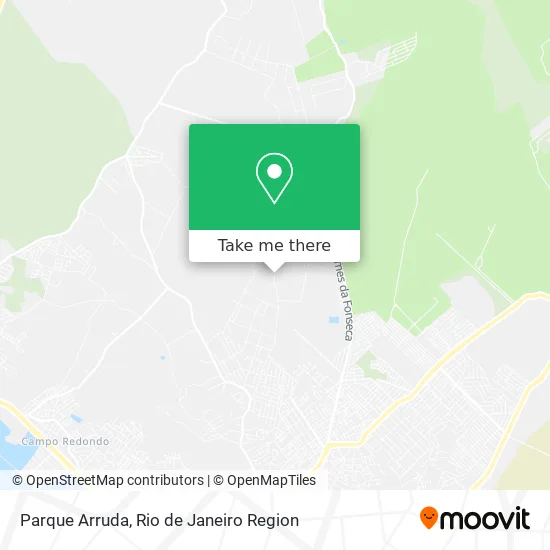
See Parque Arruda, São Pedro Da Aldeia, on the map
Public Transit to Parque Arruda in São Pedro Da Aldeia
Wondering how to get to Parque Arruda in São Pedro Da Aldeia? Moovit helps you find the best way to get to Parque Arruda with step-by-step directions from the nearest public transit station.
Moovit provides free maps and live directions to help you navigate through your city. View schedules, routes, timetables, and find out how long does it take to get to Parque Arruda in real time.
Looking for the nearest stop or station to Parque Arruda? Check out this list of stops closest to your destination: Estrada Do Arruda; Estrada Do Arruda.
Bus: 316 SÃO CRISTÓVÃO / SANTO ANTÔNIO (VIA SÃO JACINTO), 352 SÃO CRISTÓVÃO / SANTO ANTÔNIO (VIA BOTAFOGO), 504, B465 CABO FRIO / ALECRIM.
Want to see if there’s another route that gets you there at an earlier time? Moovit helps you find alternative routes or times. Get directions from and directions to Parque Arruda easily from the Moovit App or Website.
We make riding to Parque Arruda easy, which is why over 1.5 million users, including users in São Pedro Da Aldeia, trust Moovit as the best app for public transit. You don’t need to download an individual bus app or train app, Moovit is your all-in-one transit app that helps you find the best bus time or train time available.
For information on prices of bus, costs and ride fares to Parque Arruda, please check the Moovit app.
Use the app to navigate to popular places including to the airport, hospital, stadium, grocery store, mall, coffee shop, school, college, and university.
Parque Arruda Address: São Pedro da Aldeia-RJ street in São Pedro Da Aldeia
- Parque Arruda,
- Alecrim,
- Rodovia da Integração,
- Rodovia da Integração,
- Pedrinho Pipas,
- Estrada do Alecrim,
- Mercadinho do Luciano,
- Em Vidal de Negreiros,
- Recanto das Orquídeas,
- Rua Manoel C Studart,
- Rua Manoel C Studart / Rua Oito,
- Estrada do Alecrim / Rua Alfazema,
- Estrada do Alecrim, 851,
- Acougue do Macedo,
- Avenida Ézio Cardoso da Fonseca / Travessa Maria Dolores,
- Rua Durval Silva, 564,
- Escola Domingos Savio,
- Asé Parque São Jorge,
- Escola Municipal Professora Patricia Azevedo de Almeida,
- Rua F / Rua Alecrim
Places Near Parque Arruda (São Pedro Da Aldeia)
- Rio De Janeiro,
- Rua Ulysses Guimarães 16, Cidade Nova,
- Avenida Rio Branco, Centro,
- Hospital Pedro Ernesto, Vila Isabel,
- Shopping RioSul, Botafogo,
- Hospital Municipal Ronaldo Gazolla, Acari,
- Avenida Venezuela 134, Saúde,
- Norte Shopping, Cachambi,
- Rua Licínio Cardoso, São Francisco Xavier,
- Shopping Nova América, Del Castilho,
- Hospital Federal Do Andaraí, Andaraí,
- Praia do Arpoador, Ipanema,
- Shopping Rio Sul, Botafogo,
- Niterói, Niterói,
- Rodoviária Novo Rio (Rodoviária do Rio de Janeiro), Santo Cristo,
- Hospital Federal Cardoso Fontes, Jacarepaguá,
- Feira Livre da Gloria, Glória,
- Shopping Downtown, Barra Da Tijuca,
- Feirão De Malhas, Duque De Caxias,
- Museu Do Amanhã, Centro
How to get to popular places in Rio de Janeiro Region with public transit
Get around São Pedro Da Aldeia by public transit!
Traveling around São Pedro Da Aldeia has never been so easy. See step by step directions as you travel to any attraction, street or major public transit station. View bus and train schedules, arrival times, service alerts and detailed routes on a map, so you know exactly how to get to anywhere in São Pedro Da Aldeia.
When traveling to any destination around São Pedro Da Aldeia use Moovit's Live Directions with Get Off Notifications to know exactly where and how far to walk, how long to wait for your line, and how many stops are left. Moovit will alert you when it's time to get off — no need to constantly re-check whether yours is the next stop.
Wondering how to use public transit in São Pedro Da Aldeia or how to pay for public transit in São Pedro Da Aldeia? Moovit public transit app can help you navigate your way with public transit easily, and at minimum cost. It includes public transit fees, ticket prices, and costs. Looking for a map of São Pedro Da Aldeia public transit lines? Moovit public transit app shows all public transit maps in São Pedro Da Aldeia with all Bus, Train, Metro, Light Rail, Ferry, Cable Car, Gondola and Funicular routes and stops on an interactive map.
Rio de Janeiro Region has 8 transit type(s), including: Bus, Train, Metro, Light Rail, Ferry, Cable Car, Gondola and Funicular, operated by several transit agencies, including TrensRJ, Metrô Rio, VLT Carioca, Barcas Rio, BRT MOBI-Rio, Auto Viação Alpha, Auto Viação Tijuca, Gire Transportes, Transurb, Viação Nossa Senhora das Graças, Consórcio INTERSUL, Braso Lisboa (Municipal), Caprichosa Auto Ônibus, Auto Viação Três Amigos and Rodoviária Âncora Matias