How to get to Parque Infantil by bus?
Click on the bus route to see step by step directions with maps, line arrival times and updated time schedules.
From Calle Alcantara, Madrid
69 minFrom Calle Conde Duque 11, Madrid
49 minFrom Calle Guzmán El Bueno, Madrid
41 minFrom Calle López de Hoyos, Madrid
81 minFrom Polígono Industrial De Aguacate, Área Metropolitana De Madrid Y Corredor Del Henares
56 minFrom Luchana - 38, Madrid
58 minFrom Calle Costa Rica, Madrid
77 minFrom Parque de Berlín, Madrid
74 minFrom Calle De La Cruz, Madrid
60 minFrom Ramirez De Prado, Madrid
83 min
How to get to Parque Infantil by train?
Click on the train route to see step by step directions with maps, line arrival times and updated time schedules.
Bus stops near Parque Infantil in Pozuelo De Alarcón
Light Rail stations near Parque Infantil in Pozuelo De Alarcón
- Estación De Aravaca, 16 min walk,VIEW
Train station near Parque Infantil in Pozuelo De Alarcón
- Aravaca, 15 min walk,VIEW
Bus lines to Parque Infantil in Pozuelo De Alarcón
What are the closest stations to Parque Infantil?
The closest stations to Parque Infantil are:
- Av. Comunidad Madrid - Est. Berna is 24 meters away, 1 min walk.
- Av. Comunidad Madrid - Suiza is 58 meters away, 1 min walk.
- Av. Europa - Inglaterra is 499 meters away, 7 min walk.
- Estación De Aravaca is 1098 meters away, 16 min walk.
- Aravaca is 1098 meters away, 15 min walk.
Which bus lines stop near Parque Infantil?
These bus lines stop near Parque Infantil: 657, 658A.
Which train lines stop near Parque Infantil?
These train lines stop near Parque Infantil: C10, C7.
Which light rail line stops near Parque Infantil?
ML-2 (Estación de Aravaca)
What’s the nearest light rail station to Parque Infantil in Pozuelo De Alarcón?
The nearest light rail station to Parque Infantil in Pozuelo De Alarcón is Estación De Aravaca. It’s a 16 min walk away.
What’s the nearest train station to Parque Infantil in Pozuelo De Alarcón?
The nearest train station to Parque Infantil in Pozuelo De Alarcón is Aravaca. It’s a 15 min walk away.
What’s the nearest bus station to Parque Infantil in Pozuelo De Alarcón?
The nearest bus stations to Parque Infantil in Pozuelo De Alarcón are Av. Comunidad Madrid - Est. Berna and Av. Comunidad Madrid - Suiza. The closest one is a 1 min walk away.
What time is the first light rail to Parque Infantil in Pozuelo De Alarcón?
The ML-2 is the first light rail that goes to Parque Infantil in Pozuelo De Alarcón. It stops nearby at 6:04 AM.
What time is the last light rail to Parque Infantil in Pozuelo De Alarcón?
The ML-2 is the last light rail that goes to Parque Infantil in Pozuelo De Alarcón. It stops nearby at 1:57 AM.
What time is the first train to Parque Infantil in Pozuelo De Alarcón?
The C7 is the first train that goes to Parque Infantil in Pozuelo De Alarcón. It stops nearby at 6:13 AM.
What time is the last train to Parque Infantil in Pozuelo De Alarcón?
The C7 is the last train that goes to Parque Infantil in Pozuelo De Alarcón. It stops nearby at 12:06 AM.
What time is the first bus to Parque Infantil in Pozuelo De Alarcón?
The N902 is the first bus that goes to Parque Infantil in Pozuelo De Alarcón. It stops nearby at 3:07 AM.
What time is the last bus to Parque Infantil in Pozuelo De Alarcón?
The N902 is the last bus that goes to Parque Infantil in Pozuelo De Alarcón. It stops nearby at 2:10 AM.
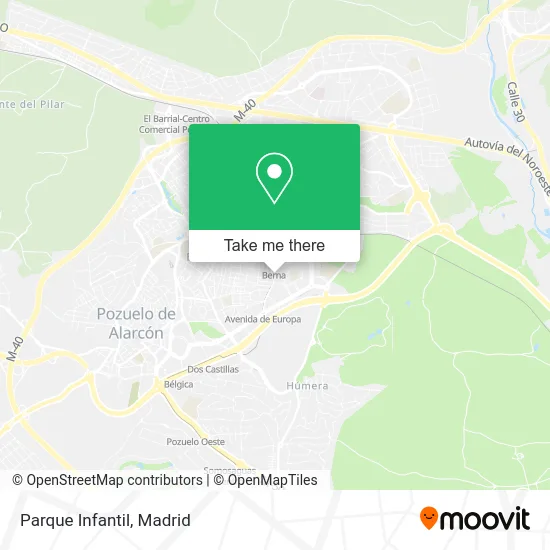
See Parque Infantil, Pozuelo De Alarcón, on the map
Public Transit to Parque Infantil in Pozuelo De Alarcón
Wondering how to get to Parque Infantil in Pozuelo De Alarcón? Moovit helps you find the best way to get to Parque Infantil with step-by-step directions from the nearest public transit station.
Moovit provides free maps and live directions to help you navigate through your city. View schedules, routes, timetables, and find out how long does it take to get to Parque Infantil in real time.
Looking for the nearest stop or station to Parque Infantil? Check out this list of stops closest to your destination: Av. Comunidad Madrid - Est. Berna; Av. Comunidad Madrid - Suiza; Av. Europa - Inglaterra; Estación De Aravaca; Aravaca.
Bus: 657, 658A, 2, N902, 3, 657A.Train: C10, C7, REG.Light Rail: ML-2.
Want to see if there’s another route that gets you there at an earlier time? Moovit helps you find alternative routes or times. Get directions from and directions to Parque Infantil easily from the Moovit App or Website.
We make riding to Parque Infantil easy, which is why over 1.5 million users, including users in Pozuelo De Alarcón, trust Moovit as the best app for public transit. You don’t need to download an individual bus app or train app, Moovit is your all-in-one transit app that helps you find the best bus time or train time available.
For information on prices of bus, metro, train and light rail, costs and ride fares to Parque Infantil, please check the Moovit app.
Use the app to navigate to popular places including to the airport, hospital, stadium, grocery store, mall, coffee shop, school, college, and university.
Parque Infantil Address: Avenida Comunidad de Madrid, 10 28224 Pozuelo de Alarcón street in Pozuelo De Alarcón
- Curves,
- Zurdo Rent,
- Calle Berna 8,
- Visual 3D Publicidad,
- Bevisan Ocio,
- Spherika Perlas y Huevas Naturales de Pescado,
- Farmacia Av. Europa 31,
- SPRINGFIELD,
- Arkraken Arquitectura e Inversiones,
- Calle Venus, 3,
- Asador de Pollos La Granja,
- Mercade Seijas J,
- Núria Martin,
- Nunez Abogados,
- Alberto Marset Gómez,
- Bar Veracruz Pozuelo de Alarcón,
- Grupo Riko's Reproducciones,
- Topografía Dos Mil,
- Metro Berna,
- Fisiodia Clinica de Fisioterapia Pilates e Hipopresivos
Places Near Parque Infantil (Pozuelo De Alarcón)
- Centro Comercial Islazul, Área Metropolitana De Madrid Y Corredor Del Henares,
- Mercadillo de Majadahonda, Majadahonda,
- Hospital Universitario Ramón y Cajal, Madrid,
- Nassica, Área Metropolitana De Madrid Y Corredor Del Henares,
- Calle de López de Hoyos 169, Madrid,
- Mendez Alvaro, Madrid,
- Hospital Universitario La Paz, Madrid,
- Estadio Wanda Metropolitano, Área Metropolitana De Madrid Y Corredor Del Henares,
- Centro Comercial La Vaguada, Área Metropolitana De Madrid Y Corredor Del Henares,
- Hospital Clínico Universitario San Carlos, Madrid,
- Rastro De Madrid, Área Metropolitana De Madrid Y Corredor Del Henares,
- Sala La Riviera, Madrid,
- Palacio De Vistalegre, Área Metropolitana De Madrid Y Corredor Del Henares,
- Centro Comercial La Gavia, Área Metropolitana De Madrid Y Corredor Del Henares,
- Tres Aguas, Alcorcón,
- Centro Comercial Oasiz Madrid, Área Metropolitana De Madrid Y Corredor Del Henares,
- Plaza Mayor, Madrid,
- Plenilunio, Área Metropolitana De Madrid Y Corredor Del Henares,
- Wizink Center, Madrid,
- Estacion de Chamartin, Madrid
How to get to popular places in Madrid with public transit
Get around Pozuelo De Alarcón by public transit!
Traveling around Pozuelo De Alarcón has never been so easy. See step by step directions as you travel to any attraction, street or major public transit station. View bus and train schedules, arrival times, service alerts and detailed routes on a map, so you know exactly how to get to anywhere in Pozuelo De Alarcón.
When traveling to any destination around Pozuelo De Alarcón use Moovit's Live Directions with Get Off Notifications to know exactly where and how far to walk, how long to wait for your line, and how many stops are left. Moovit will alert you when it's time to get off — no need to constantly re-check whether yours is the next stop.
Wondering how to use public transit in Pozuelo De Alarcón or how to pay for public transit in Pozuelo De Alarcón? Moovit public transit app can help you navigate your way with public transit easily, and at minimum cost. It includes public transit fees, ticket prices, and costs. Looking for a map of Pozuelo De Alarcón public transit lines? Moovit public transit app shows all public transit maps in Pozuelo De Alarcón with all Bus, Train, Metro and Light Rail routes and stops on an interactive map.
Madrid has 4 transit type(s), including: Bus, Train, Metro and Light Rail, operated by several transit agencies, including Metro de Madrid, Metro Ligero, Tranvía de Parla, Renfe Cercanías - Servicios de Autobús especiales, Renfe Cercanias, Renfe Cercanías, EMT, Interurbanos, Urbanos de Alcalá de Henares, Urbanos de Alcobendas, Urbanos de Alcorcón, Urbanos de Algete, Urbanos de Aranjuez, Urbanos de Arganda del Rey and Urbanos de Arroyomolinos