How to get to Parque Infantil by bus?
Click on the bus route to see step by step directions with maps, line arrival times and updated time schedules.
From Parque Aquatico Amarante - Aqua Aventura, Amarante
217 minFrom Alijó, Alijó
285 minFrom Parque Aquático de Amarante, Amarante
215 minFrom Zona Industrial de Vila Real, Constantim e Vale de Nogueiras
44 minFrom Aquaplay Complexo Piscinas, Regadas
560 minFrom Estação Ferroviária da Régua, Peso da Régua e Godim
85 minFrom Hospital de Amarante ( Centro Hospitalar Tâmega e Sousa, EPE ), Amarante
90 min
Bus stops near Parque Infantil in Vila Real
Bus lines to Parque Infantil in Vila Real
What are the closest stations to Parque Infantil?
The closest stations to Parque Infantil are:
- Av. Europa is 48 meters away, 2 min walk.
- R. Stº António is 786 meters away, 11 min walk.
Which bus lines stop near Parque Infantil?
These bus lines stop near Parque Infantil: 2, 3, 4, 9404, IR004.
What’s the nearest bus station to Parque Infantil in Vila Real?
The nearest bus station to Parque Infantil in Vila Real is Av. Europa. It’s a 2 min walk away.
What time is the first bus to Parque Infantil in Vila Real?
The 3 is the first bus that goes to Parque Infantil in Vila Real. It stops nearby at 7:31 AM.
What time is the last bus to Parque Infantil in Vila Real?
The N is the last bus that goes to Parque Infantil in Vila Real. It stops nearby at 10:51 PM.
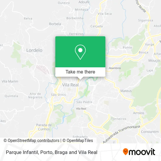
See Parque Infantil, Vila Real, on the map
Public Transit to Parque Infantil in Vila Real
Wondering how to get to Parque Infantil in Vila Real? Moovit helps you find the best way to get to Parque Infantil with step-by-step directions from the nearest public transit station.
Moovit provides free maps and live directions to help you navigate through your city. View schedules, routes, timetables, and find out how long does it take to get to Parque Infantil in real time.
Looking for the nearest stop or station to Parque Infantil? Check out this list of stops closest to your destination: Av. Europa; R. Stº António.
Bus: 2, 3, 4, 9404, IR004, N, 1.
Want to see if there’s another route that gets you there at an earlier time? Moovit helps you find alternative routes or times. Get directions from and directions to Parque Infantil easily from the Moovit App or Website.
We make riding to Parque Infantil easy, which is why over 1.5 million users, including users in Vila Real, trust Moovit as the best app for public transit. You don’t need to download an individual bus app or train app, Moovit is your all-in-one transit app that helps you find the best bus time or train time available.
For information on prices of bus and train, costs and ride fares to Parque Infantil, please check the Moovit app.
Use the app to navigate to popular places including to the airport, hospital, stadium, grocery store, mall, coffee shop, school, college, and university.
Parque Infantil Address: Rua Joaquim Abrantes street in Vila Real
- Sol Dourado - Construções e Urbanizações,
- Ângela Teixeira - Solicitadora,
- Metro Cúbico - Mobiliário,
- Pizzaria Politana,
- João Cruz - Informática, Unipessoal,
- Risotas e Cambalhotas,
- Pizzaria Politana - Prato do Dia,
- Nogueira & Macedo,
- Lusitania Seguros,
- Fábrica de Candeeiros Vale do Sousa,
- Galp P1996 Peso Regu,
- BP Oil,
- Teoria - Produção e Comércio de Vinhos Unipessoal Lda,
- Curva 24,
- Lampião Móveis,
- IMT,
- Shell Portuguesa,
- Aureliano Barrigas,
- Taste and Take Halal Restaurant & Cafe,
- Instituto de Beleza Lea Varandas
Places Near Parque Infantil (Vila Real)
- Valongo, Valongo,
- Hospital de Santo António, Cedofeita, Santo Ildefonso, Sé, Miragaia, São Nicolau e Vitória,
- Avintes, Vila Nova De Gaia,
- Parque Aquatico Amarante - Aqua Aventura, Amarante,
- Leça da Palmeira, Matosinhos e Leça da Palmeira,
- Maia, Maia,
- Hospital Santos Silva, Vila Nova De Gaia,
- Palácio de Cristal, Lordelo do Ouro e Massarelos,
- Rua Calouste Gulbenkian, Lordelo do Ouro e Massarelos,
- Hospital da Prelada, Ramalde,
- VILA do CONDE PORTO FASHION OUTLET, Modivas,
- MAR Shopping, Matosinhos e Leça da Palmeira,
- Zoo Santo Inácio, Vila Nova De Gaia,
- Canidelo, Vila Nova De Gaia,
- Arrábida Shopping, Santa Marinha e São Pedro da Afurada,
- El Corte Inglés de Gaia, Mafamude e Vilar do Paraíso,
- Senhor de Matosinhos, Matosinhos e Leça da Palmeira,
- Exponor, Matosinhos e Leça da Palmeira,
- Espinho, Espinho,
- Acesso ao Shopping Parque Nascente, Campanhã
How to get to popular places in Porto, Braga and Vila Real with public transit
Get around Vila Real by public transit!
Traveling around Vila Real has never been so easy. See step by step directions as you travel to any attraction, street or major public transit station. View bus and train schedules, arrival times, service alerts and detailed routes on a map, so you know exactly how to get to anywhere in Vila Real.
When traveling to any destination around Vila Real use Moovit's Live Directions with Get Off Notifications to know exactly where and how far to walk, how long to wait for your line, and how many stops are left. Moovit will alert you when it's time to get off — no need to constantly re-check whether yours is the next stop.
Wondering how to use public transit in Vila Real or how to pay for public transit in Vila Real? Moovit public transit app can help you navigate your way with public transit easily, and at minimum cost. It includes public transit fees, ticket prices, and costs. Looking for a map of Vila Real public transit lines? Moovit public transit app shows all public transit maps in Vila Real with all Bus, Train, Metro, Ferry, Funicular and Gondola routes and stops on an interactive map.
Porto, Braga and Vila Real has 6 transit type(s), including: Bus, Train, Metro, Ferry, Funicular and Gondola, operated by several transit agencies, including Metro do Porto, Metro do Porto - Metrobus, CP - Comboios de Portugal, STCP, UNIR Mobilidade da Area Metropolitana do Porto, Getbus - Aerobus, Mobiave, Valpibus, TUB - Transportes Urbanos de Braga, TuViana, Guimabus, Ave Mobilidade, Cávado Mobilidade, Transdev and Câmara Municipal de Santo Tirso