How to get to Parque de Manuel de Falla by bus?
Click on the bus route to see step by step directions with maps, line arrival times and updated time schedules.
From Centro Deportivo Militar La Dehesa, Madrid
99 minFrom Centro Comercial Xanadu - Mostoles, Madrid
58 minFrom Hospital De La Zarzuela, Área Metropolitana De Madrid Y Corredor Del Henares
57 minFrom Ciudad de la Imagen, Pozuelo De Alarcón
64 minFrom Paseo de Extremadura, Madrid
53 minFrom Club de Campo Villa de Madrid, Madrid
78 minFrom Parque Deportivo Puerta de Hierro, Madrid
65 minFrom Piscina Puerta de Hierro, Madrid
69 minFrom Universidad Alfonso X El Sabio (UAX), Villanueva De La Cañada
43 minFrom Hipódromo de la Zarzuela, Madrid
76 min
Bus stops near Parque de Manuel de Falla in Majadahonda
- Velázquez - Joaquín Turina, 2 min walk,VIEW
- Manuel De Falla - Ruperto Chapí, 3 min walk,VIEW
- Ruperto Chapí - Joaquín Rodrigo, 5 min walk,VIEW
- Ruperto Chapí - Av. Oliva, 6 min walk,VIEW
- Av. Oliva - Enrique Granados, 6 min walk,VIEW
- Goya - Zuloaga, 7 min walk,VIEW
- Velázquez - C. C. Centro Oeste, 8 min walk,VIEW
Train station near Parque de Manuel de Falla in Majadahonda
- Majadahonda, 31 min walk,VIEW
Bus lines to Parque de Manuel de Falla in Majadahonda
- 567, Av. Villaviciosa - Urb. El Castillo,VIEW
- 626, Acanto - Jacinto,VIEW
- 655, Princesa - Moncloa,VIEW
- 2, Circular (Hospital - Estación FF.CC.),VIEW
- 1, Circular (Hospital - Estación FF.CC.),VIEW
- 667, J. Rodrigo - Hospital Puerta De Hierro,VIEW
- 580, J. Rodrigo - Hospital Puerta De Hierro,VIEW
- 653, Intercambiador De Moncloa (Islas 2 Y 3),VIEW
- 650A, C.º Cerro De Los Gamos - Est. El Barrial,VIEW
- 650B, C.º Cerro De Los Gamos - Est. El Barrial,VIEW
- 654, Princesa - Moncloa,VIEW
- 633, Cañada De Las Merinas - Centro De Salud,VIEW
What are the closest stations to Parque de Manuel de Falla?
The closest stations to Parque de Manuel de Falla are:
- Velázquez - Joaquín Turina is 140 meters away, 2 min walk.
- Manuel De Falla - Ruperto Chapí is 174 meters away, 3 min walk.
- Ruperto Chapí - Joaquín Rodrigo is 354 meters away, 5 min walk.
- Ruperto Chapí - Av. Oliva is 434 meters away, 6 min walk.
- Av. Oliva - Enrique Granados is 441 meters away, 6 min walk.
- Goya - Zuloaga is 541 meters away, 7 min walk.
- Velázquez - C. C. Centro Oeste is 567 meters away, 8 min walk.
- Majadahonda is 2349 meters away, 31 min walk.
Which bus lines stop near Parque de Manuel de Falla?
These bus lines stop near Parque de Manuel de Falla: 567, 626, 650A, 653, 667.
What’s the nearest bus station to Parque de Manuel de Falla in Majadahonda?
The nearest bus station to Parque de Manuel de Falla in Majadahonda is Velázquez - Joaquín Turina. It’s a 2 min walk away.
What time is the first train to Parque de Manuel de Falla in Majadahonda?
The C7 is the first train that goes to Parque de Manuel de Falla in Majadahonda. It stops nearby at 6:24 AM.
What time is the last train to Parque de Manuel de Falla in Majadahonda?
The C7 is the last train that goes to Parque de Manuel de Falla in Majadahonda. It stops nearby at 11:55 PM.
What time is the first bus to Parque de Manuel de Falla in Majadahonda?
The 654 is the first bus that goes to Parque de Manuel de Falla in Majadahonda. It stops nearby at 6:15 AM.
What time is the last bus to Parque de Manuel de Falla in Majadahonda?
The 655 is the last bus that goes to Parque de Manuel de Falla in Majadahonda. It stops nearby at 1:13 AM.
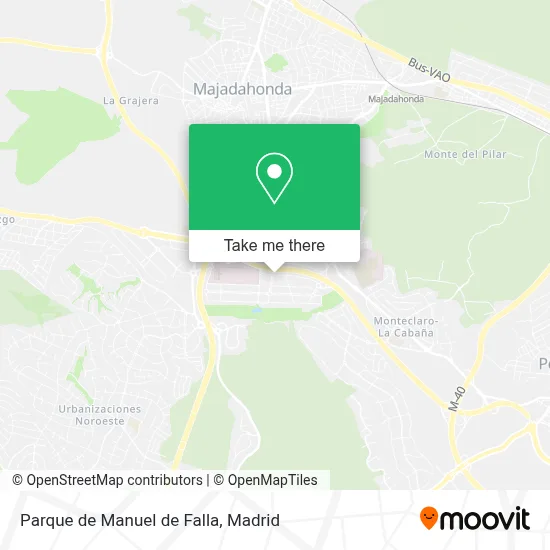
See Parque de Manuel de Falla, Majadahonda, on the map
Public Transit to Parque de Manuel de Falla in Majadahonda
Wondering how to get to Parque de Manuel de Falla in Majadahonda? Moovit helps you find the best way to get to Parque de Manuel de Falla with step-by-step directions from the nearest public transit station.
Moovit provides free maps and live directions to help you navigate through your city. View schedules, routes, timetables, and find out how long does it take to get to Parque de Manuel de Falla in real time.
Looking for the nearest stop or station to Parque de Manuel de Falla? Check out this list of stops closest to your destination: Velázquez - Joaquín Turina; Manuel De Falla - Ruperto Chapí; Ruperto Chapí - Joaquín Rodrigo; Ruperto Chapí - Av. Oliva; Av. Oliva - Enrique Granados; Goya - Zuloaga; Velázquez - C. C. Centro Oeste; Majadahonda.
Bus: 567, 626, 650A, 653, 667, 655, 1, 2, 580.Train: C7, C10.
Want to see if there’s another route that gets you there at an earlier time? Moovit helps you find alternative routes or times. Get directions from and directions to Parque de Manuel de Falla easily from the Moovit App or Website.
We make riding to Parque de Manuel de Falla easy, which is why over 1.5 million users, including users in Majadahonda, trust Moovit as the best app for public transit. You don’t need to download an individual bus app or train app, Moovit is your all-in-one transit app that helps you find the best bus time or train time available.
For information on prices of bus and train, costs and ride fares to Parque de Manuel de Falla, please check the Moovit app.
Use the app to navigate to popular places including to the airport, hospital, stadium, grocery store, mall, coffee shop, school, college, and university.
Parque de Manuel de Falla Address: Calle Manuel de Falla street in Majadahonda
- Santa Catalina,
- Ceip Santa Catalina,
- Residencia Valle de la Oliva,
- Albertia Valle de la Oliva,
- Acciona Infraestructuras,
- Colegio Público de Educación Infantil y Primaria Santa Catalina,
- Juzgado de Primera Instancia e Instruccion Numero 7,
- Labrandero,
- Centro De Salud Valle De La Oliva,
- C P 10 Muebles,
- Minimarket,
- Calle Joaquín Turina 19,
- Colegio San Jaime,
- Calle Enrique Granados 2,
- Valle De La Oliva,
- Polideportivo Valle de la Oliva,
- Forus Majadahonda,
- La Manga Mar Menor Cha,
- Calle Joaquín Turina 10,
- Majadahonda-Ruperto Chapí Sn
Places Near Parque de Manuel de Falla (Majadahonda)
- Centro Comercial Oasiz Madrid, Área Metropolitana De Madrid Y Corredor Del Henares,
- Nassica, Área Metropolitana De Madrid Y Corredor Del Henares,
- Palacio De Vistalegre, Área Metropolitana De Madrid Y Corredor Del Henares,
- Hospital Universitario Ramón y Cajal, Madrid,
- Estadio Wanda Metropolitano, Área Metropolitana De Madrid Y Corredor Del Henares,
- Centro Comercial La Vaguada, Área Metropolitana De Madrid Y Corredor Del Henares,
- Sala La Riviera, Madrid,
- Plenilunio, Área Metropolitana De Madrid Y Corredor Del Henares,
- Mendez Alvaro, Madrid,
- Hospital Clínico Universitario San Carlos, Madrid,
- Plaza Mayor, Madrid,
- Estacion de Chamartin, Madrid,
- Rastro De Madrid, Área Metropolitana De Madrid Y Corredor Del Henares,
- Tres Aguas, Alcorcón,
- Hospital Universitario La Paz, Madrid,
- Mercadillo de Majadahonda, Majadahonda,
- Wizink Center, Madrid,
- Calle de López de Hoyos 169, Madrid,
- Centro Comercial La Gavia, Área Metropolitana De Madrid Y Corredor Del Henares,
- Centro Comercial Islazul, Área Metropolitana De Madrid Y Corredor Del Henares
How to get to popular places in Madrid with public transit
Get around Majadahonda by public transit!
Traveling around Majadahonda has never been so easy. See step by step directions as you travel to any attraction, street or major public transit station. View bus and train schedules, arrival times, service alerts and detailed routes on a map, so you know exactly how to get to anywhere in Majadahonda.
When traveling to any destination around Majadahonda use Moovit's Live Directions with Get Off Notifications to know exactly where and how far to walk, how long to wait for your line, and how many stops are left. Moovit will alert you when it's time to get off — no need to constantly re-check whether yours is the next stop.
Wondering how to use public transit in Majadahonda or how to pay for public transit in Majadahonda? Moovit public transit app can help you navigate your way with public transit easily, and at minimum cost. It includes public transit fees, ticket prices, and costs. Looking for a map of Majadahonda public transit lines? Moovit public transit app shows all public transit maps in Majadahonda with all Bus, Train, Metro and Light Rail routes and stops on an interactive map.
Madrid has 4 transit type(s), including: Bus, Train, Metro and Light Rail, operated by several transit agencies, including Metro de Madrid, Metro Ligero, Tranvía de Parla, Renfe Cercanías - Servicios de Autobús especiales, Renfe Cercanias, Renfe Cercanías, EMT, Interurbanos, Urbanos de Alcalá de Henares, Urbanos de Alcobendas, Urbanos de Alcorcón, Urbanos de Algete, Urbanos de Aranjuez, Urbanos de Arganda del Rey and Urbanos de Arroyomolinos