How to get to Partners Multi Services by bus?
Click on the bus route to see step by step directions with maps, line arrival times and updated time schedules.
From I-95, Fort Lauderdale
55 minFrom Park & Ride-Broward Blvd & I-95, Fort Lauderdale
58 minFrom Broward College North Campus Bldg. 48, Pompano Beach
57 minFrom Las Olas Boulevard, Fort Lauderdale
40 minFrom Fort Lauderdale Beach, Fort Lauderdale
49 minFrom Broward Blvd Tri-Rail Station, Fort Lauderdale
62 minFrom Walmart Supercenter, Fort Lauderdale
50 minFrom Las Olas Beach, Fort Lauderdale
50 minFrom A1A, Fort Lauderdale
47 minFrom 95 Express Bus Stop, Fort Lauderdale
62 min
How to get to Partners Multi Services by train?
Click on the train route to see step by step directions with maps, line arrival times and updated time schedules.
Bus stops near Partners Multi Services in Pompano Beach
Train station near Partners Multi Services in Pompano Beach
- Cypress Creek Station, 20 min walk,VIEW
Bus lines to Partners Multi Services in Pompano Beach
What are the closest stations to Partners Multi Services?
The closest stations to Partners Multi Services are:
- Dixie Highway/#1857 is 79 yards away, 2 min walk.
- Northeast 62nd Street/Dixie Highway is 492 yards away, 7 min walk.
- Cypress Creek Station is 1689 yards away, 20 min walk.
Which bus line stops near Partners Multi Services?
50 (Hillsboro - SW 3 Av Via Northeast Transit Center)
Which train line stops near Partners Multi Services?
TRIRAIL (Northbound To Mangonia Park)
What’s the nearest train station to Partners Multi Services in Pompano Beach?
The nearest train station to Partners Multi Services in Pompano Beach is Cypress Creek Station. It’s a 20 min walk away.
What’s the nearest bus station to Partners Multi Services in Pompano Beach?
The nearest bus station to Partners Multi Services in Pompano Beach is Dixie Highway/#1857. It’s a 2 min walk away.
What time is the first train to Partners Multi Services in Pompano Beach?
The TRIRAIL is the first train that goes to Partners Multi Services in Pompano Beach. It stops nearby at 4:38 AM.
What time is the last train to Partners Multi Services in Pompano Beach?
The TRIRAIL is the last train that goes to Partners Multi Services in Pompano Beach. It stops nearby at 10:43 PM.
What time is the first bus to Partners Multi Services in Pompano Beach?
The 62 is the first bus that goes to Partners Multi Services in Pompano Beach. It stops nearby at 5:23 AM.
What time is the last bus to Partners Multi Services in Pompano Beach?
The 50 is the last bus that goes to Partners Multi Services in Pompano Beach. It stops nearby at 11:38 PM.
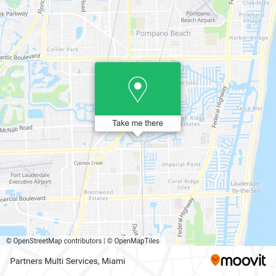
See Partners Multi Services, Pompano Beach, on the map
Public Transit to Partners Multi Services in Pompano Beach
Wondering how to get to Partners Multi Services in Pompano Beach? Moovit helps you find the best way to get to Partners Multi Services with step-by-step directions from the nearest public transit station.
Moovit provides free maps and live directions to help you navigate through your city. View schedules, routes, timetables, and find out how long does it take to get to Partners Multi Services in real time.
Looking for the nearest stop or station to Partners Multi Services? Check out this list of stops closest to your destination: Dixie Highway/#1857; Northeast 62nd Street/Dixie Highway; Cypress Creek Station.
Bus: 50, 62.Train: TRIRAIL.
Want to see if there’s another route that gets you there at an earlier time? Moovit helps you find alternative routes or times. Get directions from and directions to Partners Multi Services easily from the Moovit App or Website.
We make riding to Partners Multi Services easy, which is why over 1.5 million users, including users in Pompano Beach, trust Moovit as the best app for public transit. You don’t need to download an individual bus app or train app, Moovit is your all-in-one transit app that helps you find the best bus time or train time available.
For information on prices of bus and train, costs and ride fares to Partners Multi Services, please check the Moovit app.
Use the app to navigate to popular places including to the airport, hospital, stadium, grocery store, mall, coffee shop, school, college, and university.
Partners Multi Services Address: 1811 S Dixie Hwy Pompano Beach, FL 33060 street in Pompano Beach
- Le-Stylist Unisex Hair Designers,
- BFJ Media Group,
- Mikel Abbott Energy Calcs,
- Holiday Village,
- K D Construction of Florida,
- Metalshield,
- Town Car Transportation Service,
- Youth Impact Centers - Fort Lauderdale,
- Quality Assurance Comm,
- Silva Auto Body & Collision,
- Ivan Garage Door Repair Service,
- Cheers East - Kamikaze Karaoke,
- Pinecrest Square,
- Dulces Hermanitas,
- Los Guachi's Mexican Restaurants,
- Mardey's Appliances,
- Flip Side,
- Prorez Coatings, LLC,
- Tru Liquor,
- The Hula Dance Catering Services
Places Near Partners Multi Services (Pompano Beach)
- Sawgrass Mall, Miami,
- Miami VA Hospital, Miami,
- Aventura Mall, Miami,
- Keiser University Flagship Campus, West Palm Beach,
- Port of Miami Cruise Terminal, Miami,
- Hard Rock Stadium, Miami Gardens,
- Wynwood, Miami,
- Aventura Mall, Miami Beach,
- Zoo Miami, Miami,
- Sawgrass mall ( FL ), Miami Beach,
- Bayside Marketplace, Miami,
- Miami Freedom Park, Miami,
- Little Havana, Miami,
- Miami-Dade County Courthouse, Miami,
- Dolphin Mall, Miami,
- Dolphin Mall Bus, Miami,
- Miami Design District, Miami,
- Richard E. Gerstein Justice Building, Miami,
- Brickell City Centre, Miami,
- Marlins Park, Miami
How to get to popular places in Miami with public transit
Get around Pompano Beach by public transit!
Traveling around Pompano Beach has never been so easy. See step by step directions as you travel to any attraction, street or major public transit station. View bus and train schedules, arrival times, service alerts and detailed routes on a map, so you know exactly how to get to anywhere in Pompano Beach.
When traveling to any destination around Pompano Beach use Moovit's Live Directions with Get Off Notifications to know exactly where and how far to walk, how long to wait for your line, and how many stops are left. Moovit will alert you when it's time to get off — no need to constantly re-check whether yours is the next stop.
Wondering how to use public transit in Pompano Beach or how to pay for public transit in Pompano Beach? Moovit public transit app can help you navigate your way with public transit easily, and at minimum cost. It includes public transit fees, ticket prices, and costs. Looking for a map of Pompano Beach public transit lines? Moovit public transit app shows all public transit maps in Pompano Beach with all Bus, Train, Light Rail and Ferry routes and stops on an interactive map.
Miami has 4 transit type(s), including: Bus, Train, Light Rail and Ferry, operated by several transit agencies, including Broward County Transit, Miami-Dade Transit, Metrorail, Palm Tran, Tri-Rail, Brightline, MARTY, City of Homestead Trolley, Key West Transit, Treasure Coast Connector, GoLine IRT, Amtrak, Greyhound-us, FlixBus-us and Aventura Express Shuttle Bus