Directions to Paseo Bulnes (Santiago) with public transportation
The following transit lines have routes that pass near Paseo Bulnes
 Micro: 226, 301, 406, 214, 223.
- Metro: L3, L1, L2.
How to get to Paseo Bulnes by Micro?
Click on the Micro route to see step by step directions with maps, line arrival times and updated time schedules.
How to get to Paseo Bulnes by metro?
Click on the metro route to see step by step directions with maps, line arrival times and updated time schedules.
Micro stops near Paseo Bulnes in Santiago
- Pa197-Parada 1 / (M) Pque. Almagro, 3 min walk,
- Pa72-Parada 2 / (M) Pque. Almagro, 3 min walk,
- Pa467-Lord Cochrane / Esq. Eleuterio Ramírez, 4 min walk,
- San Diego, 310, 4 min walk,
- Pa54-Santa Isabel / Esq. Lord Cochrane, 5 min walk,
- Pa31-Parada / Palacio Cousiño, 6 min walk,
- San Diego, 648, 6 min walk,
Metro stations near Paseo Bulnes in Santiago
- Universidad De Chile, 7 min walk,
- Toesca, 12 min walk,
Micro lines to Paseo Bulnes in Santiago
- 214, Los Libertadores,
- 223, Lo Espejo,
- 226, Nonato Coo,
- 229, La Pintana,
- 264N, Santo Tomas,
- 301, Angelmo,
- 201, Mall Plaza Norte - San Bernardo,
- 271, Santiago - San Bernardo,
- 509, Maipu,
- ALTO JAHUEL, Alto Jahuel - Alameda (por Gran Avenida),
- BUIN MAIPO, Buin (Los Magnolios) - Santiago Centro (por Panamericana),
- BUIN MAIPO, Buin (Viluco) - Santiago Centro (por Gran Avenida),
- LARAPINTA, Lampa (Valle de la Luna) - Santiago Centro (por Lo Echevers),
- LARAPINTA, Valle Grande / Quilicura - Santiago Centro (por Independencia),
- LARAPINTA, Lampa (Isabel Riquelme) - Santiago Centro (por Lo Echevers),
- TRANSBER, Calera De Tango (Barrancon-Ochagavia)-San Francisco (Via Autop. Central),
- TRANSBER, Calera De Tango-San Francisco (Via Autop. Central),
- TRANSBER, Calera De Tango (Santa Ines)-San Francisco (Via Autop. Central),
- TRANSBER, Calera De Tango (Barrancon)-San Francisco (Via Autop. Central),
- D03, Las Parcelas,
What are the closest stations to Paseo Bulnes?
The closest stations to Paseo Bulnes are:
- Pa197-Parada 1 / (M) Pque. Almagro is 165 meters away, 3 min walk.
- Pa72-Parada 2 / (M) Pque. Almagro is 203 meters away, 3 min walk.
- Pa467-Lord Cochrane / Esq. Eleuterio Ramírez is 288 meters away, 4 min walk.
- San Diego, 310 is 292 meters away, 4 min walk.
- Pa54-Santa Isabel / Esq. Lord Cochrane is 374 meters away, 5 min walk.
- Pa31-Parada / Palacio Cousiño is 456 meters away, 6 min walk.
- San Diego, 648 is 457 meters away, 6 min walk.
- Universidad De Chile is 503 meters away, 7 min walk.
- Toesca is 847 meters away, 12 min walk.
Which Micro lines stop near Paseo Bulnes?
These Micro lines stop near Paseo Bulnes: 226, 301, 406.
Which metro line stops near Paseo Bulnes?
L3 (Dirección Plaza Quilicura)
What’s the nearest metro station to Paseo Bulnes in Santiago?
The nearest metro station to Paseo Bulnes in Santiago is Universidad De Chile. It’s a 7 min walk away.
What’s the nearest Micro station to Paseo Bulnes in Santiago?
The nearest Micro stations to Paseo Bulnes in Santiago are Pa197-Parada 1 / (M) Pque. Almagro and Pa72-Parada 2 / (M) Pque. Almagro. The closest one is a 3 min walk away.
What time is the first metro to Paseo Bulnes in Santiago?
The L1 is the first metro that goes to Paseo Bulnes in Santiago. It stops nearby at 6:12 AM.
What time is the last metro to Paseo Bulnes in Santiago?
The L3 is the last metro that goes to Paseo Bulnes in Santiago. It stops nearby at 11:20 PM.
What time is the first Micro to Paseo Bulnes in Santiago?
The 201 is the first Micro that goes to Paseo Bulnes in Santiago. It stops nearby at 3:01 AM.
What time is the last Micro to Paseo Bulnes in Santiago?
The 301 is the last Micro that goes to Paseo Bulnes in Santiago. It stops nearby at 3:35 AM.
See Paseo Bulnes, Santiago, on the map
Public Transit to Paseo Bulnes in Santiago
Wondering how to get to Paseo Bulnes in Santiago? Moovit helps you find the best way to get to Paseo Bulnes with step-by-step directions from the nearest public transit station.
Moovit provides free maps and live directions to help you navigate through your city. View schedules, routes, timetables, and find out how long does it take to get to Paseo Bulnes in real time.
Looking for the nearest stop or station to Paseo Bulnes? Check out this list of stops closest to your destination: Pa197-Parada 1 / (M) Pque. Almagro; Pa72-Parada 2 / (M) Pque. Almagro; Pa467-Lord Cochrane / Esq. Eleuterio Ramírez; San Diego; Pa54-Santa Isabel / Esq. Lord Cochrane; Pa31-Parada / Palacio Cousiño; San Diego; Universidad De Chile; Toesca.
Micro: 226, 301, 406, 214, 223, 229, 264N, 201, 271, 509, ALTO JAHUEL, BUIN MAIPO, BUIN MAIPO, LARAPINTA, LARAPINTA.Metro: L3, L1, L2.
Want to see if there’s another route that gets you there at an earlier time? Moovit helps you find alternative routes or times. Get directions from and directions to Paseo Bulnes easily from the Moovit App or Website.
We make riding to Paseo Bulnes easy, which is why over 1.5 million users, including users in Santiago, trust Moovit as the best app for public transit. You don’t need to download an individual bus app or train app, Moovit is your all-in-one transit app that helps you find the best bus time or train time available.
For information on prices of Micro and metro, costs and ride fares to Paseo Bulnes, please check the Moovit app.
Use the app to navigate to popular places including to the airport, hospital, stadium, grocery store, mall, coffee shop, school, college, and university.
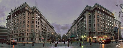
Paseo Bulnes Address: Paseo Bulnes - Avenida Presidente Bulnes, Santiago, Región Metropolitana, Chile street in Santiago
- Huerfanos Esquina Moneda,
- Instituto Nacional De Estadística (Ine),
- Casa Singer,
- Feria Cletera Parque Almagro,
- Luis Octavio Barriga Sanhueza,
- Paseo Bulnes & Eleuterio Ramírez,
- Gimnasio Edificio Palmas del Parque Almagro,
- Mensia de Los Nidos 1111,
- Capredena,
- Feria de las Pulgas Parque Almagro,
- Santa Isabel 1278,
- Armeria activ chile,
- Casino Ucen,
- Universidad Central-Campus Vicente Kovacevic I,
- 616,
- Paseo Bulnes 284,
- Parque Almagro,
- Salón de eventos VK II U.Central,
- Casino CONFAR,
- Eleuterio Ramírez 1331
Places Near Paseo Bulnes (Santiago)
- Mall Plaza Vespucio, La Florida,
- Estación Central, Estación Central,
- Estadio Bicentenario de La Florida, La Florida,
- Movistar Arena, Santiago,
- Clínica Indisa, Providencia,
- Estadio Nacional, Ñuñoa,
- Ciudad Empresarial, Huechuraba,
- Zoológico Nacional, Providencia,
- Metro Estadio Nacional, Ñuñoa,
- Hospital Clínico Félix Bulnes, Cerro Navia,
- Museo Interactivo Mirador Mim, La Florida,
- Mall Florida Center, La Florida,
- Mall Plaza Oeste, Cerrillos,
- Lampa, Lampa,
- 10 de Julio, Santiago,
- Terminal San Borja, Estación Central,
- Parque Bicentenario, Vitacura,
- Vitacura, Vitacura,
- Mall Parque Arauco, Las Condes,
- Costanera Center, Providencia
How to get to popular places in Santiago with public transit
Get around Santiago by public transit!
Traveling around Santiago has never been so easy. See step by step directions as you travel to any attraction, street or major public transit station. View bus and train schedules, arrival times, service alerts and detailed routes on a map, so you know exactly how to get to anywhere in Santiago.
When traveling to any destination around Santiago use Moovit's Live Directions with Get Off Notifications to know exactly where and how far to walk, how long to wait for your line, and how many stops are left. Moovit will alert you when it's time to get off — no need to constantly re-check whether yours is the next stop.
Wondering how to use public transit in Santiago or how to pay for public transit in Santiago? Moovit public transit app can help you navigate your way with public transit easily, and at minimum cost. It includes public transit fees, ticket prices, and costs. Looking for a map of Santiago public transit lines? Moovit public transit app shows all public transit maps in Santiago with all Micro, Metro, Light Rail and Funicular routes and stops on an interactive map.
Santiago has 4 transit type(s), including: Micro, Metro, Light Rail and Funicular, operated by several transit agencies, including Metro de Santiago, EFE Trenes de Chile, Red Metropolitana de Movilidad, Bus de Acercamiento Aeropuerto, Bus Rural, Centropuerto, Turbus, Bus Vecinal, Flota Talagante, Las Condes, Buses Colina, Bupesa, Buses Buin Maipo, Ascensor and FlixBus-cl