How to get to Pat Ogle Realtor -Long And Foster by bus?
Click on the bus route to see step by step directions with maps, line arrival times and updated time schedules.
From Bowie, MD, Prince George's County
107 minFrom Bowie Town Center, Prince George's County
114 minFrom Brazzers, Prince George's County
132 minFrom Glen Burnie, MD, Anne Arundel County
112 minFrom Anne Arundel Community College, Anne Arundel County
76 minFrom Pasadena, Maryland, Anne Arundel County
89 minFrom MVA Glen Burnie, Anne Arundel County
122 minFrom Archbishop Spalding High School, Severn
144 min
Bus stops near Pat Ogle Realtor -Long And Foster in Anne Arundel County
Bus lines to Pat Ogle Realtor -Long And Foster in Anne Arundel County
What are the closest stations to Pat Ogle Realtor -Long And Foster?
The closest stations to Pat Ogle Realtor -Long And Foster are:
- Medical Pkwy. at Sajak Building is 28 yards away, 2 min walk.
- Sajak Pavilion Annapolis is 32 yards away, 1 min walk.
- Anne Arundel Medical Center is 366 yards away, 5 min walk.
Which bus lines stop near Pat Ogle Realtor -Long And Foster?
These bus lines stop near Pat Ogle Realtor -Long And Foster: 921, RED.
What’s the nearest bus station to Pat Ogle Realtor -Long And Foster in Anne Arundel County?
The nearest bus station to Pat Ogle Realtor -Long And Foster in Anne Arundel County is Medical Pkwy. at Sajak Building. It’s a 2 min walk away.
What time is the first bus to Pat Ogle Realtor -Long And Foster in Anne Arundel County?
The RED is the first bus that goes to Pat Ogle Realtor -Long And Foster in Anne Arundel County. It stops nearby at 5:35 AM.
What time is the last bus to Pat Ogle Realtor -Long And Foster in Anne Arundel County?
The PURPLE is the last bus that goes to Pat Ogle Realtor -Long And Foster in Anne Arundel County. It stops nearby at 10:04 PM.
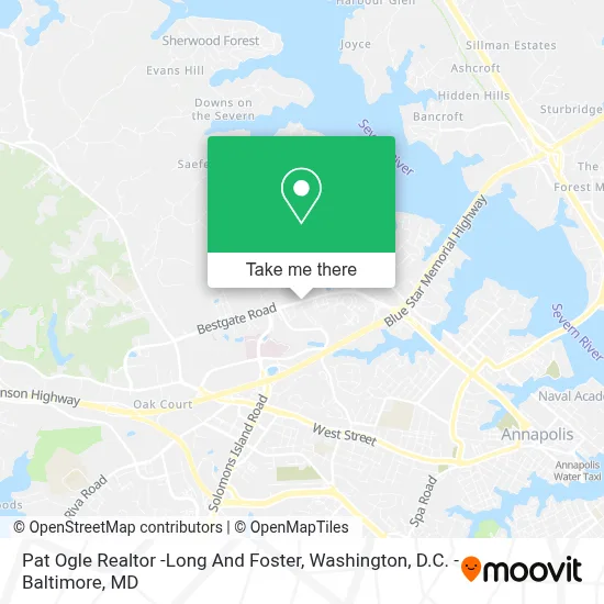
See Pat Ogle Realtor -Long And Foster, Anne Arundel County, on the map
Public Transit to Pat Ogle Realtor -Long And Foster in Anne Arundel County
Wondering how to get to Pat Ogle Realtor -Long And Foster in Anne Arundel County? Moovit helps you find the best way to get to Pat Ogle Realtor -Long And Foster with step-by-step directions from the nearest public transit station.
Moovit provides free maps and live directions to help you navigate through your city. View schedules, routes, timetables, and find out how long does it take to get to Pat Ogle Realtor -Long And Foster in real time.
Looking for the nearest stop or station to Pat Ogle Realtor -Long And Foster? Check out this list of stops closest to your destination: Medical Pkwy. at Sajak Building; Sajak Pavilion Annapolis; Anne Arundel Medical Center.
Bus: 921, RED, 3, PURPLE, PURPLE, 210, 215.
Want to see if there’s another route that gets you there at an earlier time? Moovit helps you find alternative routes or times. Get directions from and directions to Pat Ogle Realtor -Long And Foster easily from the Moovit App or Website.
We make riding to Pat Ogle Realtor -Long And Foster easy, which is why over 1.7 million users, including users in Anne Arundel County, trust Moovit as the best app for public transit. You don’t need to download an individual bus app or train app, Moovit is your all-in-one transit app that helps you find the best bus time or train time available.
For information on prices of bus and train, costs and ride fares to Pat Ogle Realtor -Long And Foster, please check the Moovit app.
Use the app to navigate to popular places including to the airport, hospital, stadium, grocery store, mall, coffee shop, school, college, and university.
Pat Ogle Realtor -Long And Foster Address: 711 Bestgate Rd street in Anne Arundel County
- Luminis Health Anne Arundel Medical Center,
- Anne Arundel County Department of Detention Facilities (Jennifer Road Detention Center),
- Jennifer Road Detention Center,
- Anne Arundel Medical Center Wayson Pavilion,
- Sajak Pavilion - AAMC,
- The Dolly Hazleton Surgical Suit,
- Blue Heron Handbags (Blue Heron Bags),
- 72785 - on-Street Oper,
- Westfield Annapolis Mall,
- Subway,
- Asian Massage by Tanya Wu,
- Union Jack's Annapolis (Union Jacks Annapolis),
- Westfield Annapolis Mall Parking Lot,
- Whole Foods Market,
- Ecco Retail,
- Annapolis Towne Centre at Parole (Annapolis Town Center At Annapolis),
- U.S. Rt. 50 (Exit 23) West St / MD 450,
- Annapolis Mall,
- Chuck E. Cheese's,
- Asian Massage by Tanya Wu
Places Near Pat Ogle Realtor -Long And Foster (Anne Arundel County)
- National Theatre, Washington,
- M&T Bank Stadium, Baltimore,
- Westfield Montgomery Mall, Montgomery County,
- Amazon Hq2, Arlington County,
- National Zoo, Washington,
- Pennsylvania Ave NW (3rd st and pennsylvania), Washington,
- Georgetown, Washington,
- Sibley Memorial Hospital, Washington,
- Washington National Cathedral, Washington,
- Washington DC VA Medical Center, Washington,
- Basilica of the National Shrine, Washington,
- Capital One Arena, Washington,
- PG Mall, Prince George's County,
- The Anthem, Washington,
- Warner Theatre, Washington,
- National Museum of African American History and Culture, Washington,
- Museum Of The Bible, Washington,
- Marriott Marquis Washington, DC, Washington,
- Rock Creek Tennis Center, Washington,
- Camden Yards, Baltimore
How to get to popular places in Washington, D.C. - Baltimore, MD with public transit
Get around Anne Arundel County by public transit!
Traveling around Anne Arundel County has never been so easy. See step by step directions as you travel to any attraction, street or major public transit station. View bus and train schedules, arrival times, service alerts and detailed routes on a map, so you know exactly how to get to anywhere in Anne Arundel County.
When traveling to any destination around Anne Arundel County use Moovit's Live Directions with Get Off Notifications to know exactly where and how far to walk, how long to wait for your line, and how many stops are left. Moovit will alert you when it's time to get off — no need to constantly re-check whether yours is the next stop.
Wondering how to use public transit in Anne Arundel County or how to pay for public transit in Anne Arundel County? Moovit public transit app can help you navigate your way with public transit easily, and at minimum cost. It includes public transit fees, ticket prices, and costs. Looking for a map of Anne Arundel County public transit lines? Moovit public transit app shows all public transit maps in Anne Arundel County with all Bus, Train, Metro, Light Rail and Ferry routes and stops on an interactive map.
Washington, D.C. - Baltimore, MD has 5 transit type(s), including: Bus, Train, Metro, Light Rail and Ferry, operated by several transit agencies, including WMATA, Montgomery County Ride On, Fairfax Connector, TheBus, PRTC, DASH - Alexandria, Arlington Transit (ART), RTA of Central Maryland, MDOT MTA, MDOT MTA Light RailLink, MDOT MTA Commuter Bus, MDOT MTA Local Bus, FXBGO!, Virginia Railway Express (VRE) and MARC