How to get to Path Shaala by bus?
Click on the bus route to see step by step directions with maps, line arrival times and updated time schedules.
From Cdac, Pune & Velhe
51 minFrom Hinjawadi Phase 1, Paud
46 minFrom Global Hospital & Research Institute, Pune & Velhe
61 minFrom Zudio, Pune & Velhe
33 minFrom Symbiosis Vocational Junior College, Pune & Velhe
35 minFrom Jogeshwari Mata Mandir, Pune & Velhe
52 minFrom Bakliwal tutorials, Pune & Velhe
73 minFrom Lal Bahadur Shastri Road, Pune & Velhe
51 minFrom COEP, Pune & Velhe
47 minFrom Navi Peth, Pune & Velhe
51 min
Bus stops near Path Shaala in Paud
Bus lines to Path Shaala in Paud
- 30, Marketyard,VIEW
- 142, Ghotawade Phata,VIEW
- 87A, Chande Gaon (ZP School),VIEW
- 142A, Ghotawade Gaon,VIEW
- 344A, Susgaon Sunny World Resort,VIEW
- 344B, Bhosari Gaon,VIEW
- 87D, Deccan Gymkhana,VIEW
- 258, Ma.Na.Pa Bhavan,VIEW
- 43, Nigdi Bhakti Shakti Terminal - Katraj,VIEW
- 44, Akurdi Railway Station - Katraj,VIEW
- 45, Radha Chowk (Mhalunge Phata) - Katraj,VIEW
- 77, Hinjawadi Maan Phase 3 - Ganpati Matha,VIEW
- 79, Hinjawadi Maan Phase 3 - Deccan Gymkhana,VIEW
- 228, Katraj - Vadgaon Mawal,VIEW
- 43A, Hinjawadi Maan Phase 3 - Katraj,VIEW
- 228B, Balewadi Depot - Katraj,VIEW
- 87E, Deccan Gymkhana To Radha Chowk (Mhalunge Phata),VIEW
- 50N, Nigdi Bhakti Shakti Terminal - Sinhgad Paytha,VIEW
What are the closest stations to Path Shaala?
The closest stations to Path Shaala are:
- Tapkir Wasti Susgaon is 141 meters away, 3 min walk.
- Bella Casa Society Baner is 793 meters away, 11 min walk.
- Renault Showroom is 1614 meters away, 21 min walk.
Which bus lines stop near Path Shaala?
These bus lines stop near Path Shaala: 43A, 87D.
What’s the nearest bus station to Path Shaala in Paud?
The nearest bus station to Path Shaala in Paud is Tapkir Wasti Susgaon. It’s a 3 min walk away.
What time is the first bus to Path Shaala in Paud?
The 30 is the first bus that goes to Path Shaala in Paud. It stops nearby at 5:37 AM.
What time is the last bus to Path Shaala in Paud?
The 44 is the last bus that goes to Path Shaala in Paud. It stops nearby at 12:45 AM.
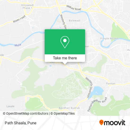
See Path Shaala, Paud, on the map
Public Transit to Path Shaala in Paud
Wondering how to get to Path Shaala in Paud? Moovit helps you find the best way to get to Path Shaala with step-by-step directions from the nearest public transit station.
Moovit provides free maps and live directions to help you navigate through your city. View schedules, routes, timetables, and find out how long does it take to get to Path Shaala in real time.
Looking for the nearest stop or station to Path Shaala? Check out this list of stops closest to your destination: Tapkir Wasti Susgaon; Bella Casa Society Baner; Renault Showroom.
Bus: 43A, 87D, 30, 142, 87A, 142A, 344A, 258, 43, 44, 45, 77, 79.
Want to see if there’s another route that gets you there at an earlier time? Moovit helps you find alternative routes or times. Get directions from and directions to Path Shaala easily from the Moovit App or Website.
We make riding to Path Shaala easy, which is why over 1.5 million users, including users in Paud, trust Moovit as the best app for public transit. You don’t need to download an individual bus app or train app, Moovit is your all-in-one transit app that helps you find the best bus time or train time available.
For information on prices of bus, costs and ride fares to Path Shaala, please check the Moovit app.
Use the app to navigate to popular places including to the airport, hospital, stadium, grocery store, mall, coffee shop, school, college, and university.
Path Shaala Address: Bhagwan Mahaveer Path पुणे 411021 MH street in Paud
- Chitale Badhu Mithaiwale,
- Asian Paint,
- LOTUS,
- Shree Datta Transport,
- Shell Recharge,
- Hotelganaraja,
- Shrike Raswanti House & Juice Center,
- S 360 Bikers Bike Servicevice Cen,
- Shivratna Lawns,
- New Right Angle Furniture,
- Mouha Bike Parts,
- Kalyana,
- Om Sai Snacks Center,
- Rupeshwara Supermarket,
- Raj Novelties,
- Victoria Ply & Hardware,
- Madhuri Tiffin,
- Saiba Amrutulya,
- Mauli Aangan,
- United India Insurance
Places Near Path Shaala (Paud)
- Pvr Icon - Pavilion Mall, Pune & Velhe,
- Dagadusheth Halwai Ganapati Temple, Pune & Velhe,
- Dagdusheth Halwai Ganpati Mandir, Pune & Velhe,
- Cognizant Deccan Campus (CDC), Paud,
- Sarasbaug, Pune & Velhe,
- Fc Road, Pune & Velhe,
- Tulshibaug, Pune & Velhe,
- Senapati Bapat Road, Pune & Velhe,
- Pune Okayama Friendship Garden, Pune & Velhe,
- ISKCON Nvcc Temple, Pune & Velhe,
- Laxmi Road, Pune & Velhe,
- ISKCON Pune, Pune & Velhe,
- BAPS Shri Swaminarayan Mandir, Pune & Velhe,
- Ion Digital Zone, Pune & Velhe,
- Chaturshringi Temple, Pune & Velhe,
- Symbiosis Lavale Bus Stop, Pune & Velhe,
- Swaminarayan Mandir, Pune & Velhe,
- Westend Mall, Pune & Velhe,
- M G Road, Pune & Velhe,
- Vishwakarma Institute Of Technology (Vit), Pune & Velhe
How to get to popular places in Pune with public transit
Get around Paud by public transit!
Traveling around Paud has never been so easy. See step by step directions as you travel to any attraction, street or major public transit station. View bus and train schedules, arrival times, service alerts and detailed routes on a map, so you know exactly how to get to anywhere in Paud.
When traveling to any destination around Paud use Moovit's Live Directions with Get Off Notifications to know exactly where and how far to walk, how long to wait for your line, and how many stops are left. Moovit will alert you when it's time to get off — no need to constantly re-check whether yours is the next stop.
Wondering how to use public transit in Paud or how to pay for public transit in Paud? Moovit public transit app can help you navigate your way with public transit easily, and at minimum cost. It includes public transit fees, ticket prices, and costs. Looking for a map of Paud public transit lines? Moovit public transit app shows all public transit maps in Paud with all Bus, Train and Metro routes and stops on an interactive map.
Pune has 3 transit type(s), including: Bus, Train and Metro, operated by several transit agencies, including Pune Metro (Maha Metro), PMPML, PMPML Night Bus Service (Ratrani) and Central Railways (Indian Railways)