Directions to Pathways To (Henrico County) with public transportation
The following transit lines have routes that pass near Pathways To
 Bus: 18, 19, BRT, 76, 79.
- Train: 18, CAROLINIAN, FLORIDIAN, NORTHEAST REGIONAL, PALMETTO.
How to get to Pathways To by bus?
Click on the bus route to see step by step directions with maps, line arrival times and updated time schedules.
From Lorton, VA, Fairfax County
246 minFrom Lorton, VA - Amtrak Auto Train Station (LOR), Fairfax County
251 minFrom Busch Gardens Williamsburg (Employee Parking Lot), James City County
177 minFrom Rose Gaming Resort, Prince William County
261 minFrom Potomac Mills Mall, Prince William County
236 minFrom Amazon Fulfillment Center-Ric3, Richmond
91 minFrom UVA Hospital Medical Center, Charlottesville
325 minFrom Woodbridge, VA, Prince William County
178 min
Bus stops near Pathways To in Henrico County
Train station near Pathways To in Henrico County
- Richmond Staples Mill Road Amtrak Station, 22 min walk,VIEW
Bus lines to Pathways To in Henrico County
What are the closest stations to Pathways To?
The closest stations to Pathways To are:
- Broad + Bremo is 469 yards away, 6 min walk.
- Libbie + Convalescent Center is 640 yards away, 8 min walk.
- St. Mary's Hospital at Monument is 1305 yards away, 16 min walk.
- Richmond Staples Mill Road Amtrak Station is 1846 yards away, 22 min walk.
Which bus lines stop near Pathways To?
These bus lines stop near Pathways To: 18, 19, BRT.
What’s the nearest train station to Pathways To in Henrico County?
The nearest train station to Pathways To in Henrico County is Richmond Staples Mill Road Amtrak Station. It’s a 22 min walk away.
What’s the nearest bus station to Pathways To in Henrico County?
The nearest bus station to Pathways To in Henrico County is Broad + Bremo. It’s a 6 min walk away.
What time is the first train to Pathways To in Henrico County?
The SILVER METEOR is the first train that goes to Pathways To in Henrico County. It stops nearby at 3:52 AM.
What time is the last train to Pathways To in Henrico County?
The SILVER METEOR is the last train that goes to Pathways To in Henrico County. It stops nearby at 3:52 AM.
What time is the first bus to Pathways To in Henrico County?
The 76 is the first bus that goes to Pathways To in Henrico County. It stops nearby at 5:27 AM.
What time is the last bus to Pathways To in Henrico County?
The 19 is the last bus that goes to Pathways To in Henrico County. It stops nearby at 12:00 AM.
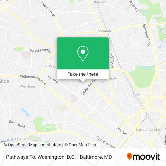
See Pathways To, Henrico County, on the map
Public Transit to Pathways To in Henrico County
Wondering how to get to Pathways To in Henrico County? Moovit helps you find the best way to get to Pathways To with step-by-step directions from the nearest public transit station.
Moovit provides free maps and live directions to help you navigate through your city. View schedules, routes, timetables, and find out how long does it take to get to Pathways To in real time.
Looking for the nearest stop or station to Pathways To? Check out this list of stops closest to your destination: Broad + Bremo; Libbie + Convalescent Center; St. Mary's Hospital at Monument; Richmond Staples Mill Road Amtrak Station.
Bus: 18, 19, BRT, 76, 79.Train: 18, CAROLINIAN, FLORIDIAN, NORTHEAST REGIONAL, PALMETTO.
Want to see if there’s another route that gets you there at an earlier time? Moovit helps you find alternative routes or times. Get directions from and directions to Pathways To easily from the Moovit App or Website.
We make riding to Pathways To easy, which is why over 1.5 million users, including users in Henrico County, trust Moovit as the best app for public transit. You don’t need to download an individual bus app or train app, Moovit is your all-in-one transit app that helps you find the best bus time or train time available.
For information on prices of bus and train, costs and ride fares to Pathways To, please check the Moovit app.
Use the app to navigate to popular places including to the airport, hospital, stadium, grocery store, mall, coffee shop, school, college, and university.
Pathways To Address: 2006 Bremo Rd Richmond, VA 23226 street in Henrico County
- Cosmetic & Plastic Surgery Center of Virginia,
- Greater Virginia Med,
- Insight Physicians PC,
- Safe Harbor,
- Fred N Kessler DDS,
- Vozza Nestor C MD,
- International Rescue Committee,
- Arcpoint Labs,
- Richmond Thoracic Surgeons,
- Nelson Gregory, DC,
- Dignitas Health,
- Dominion Day Services,
- Foster, Helen M,
- Knead To Move,
- Restorative Approach,
- Primary Health Group Bremo,
- Institute of Massage Therapies,
- Corning Clinical Laboratories,
- Mental Health America of Virginia,
- Virginia Foot & Ankle Center
Places Near Pathways To (Henrico County)
- Pennsylvania Ave NW (3rd st and pennsylvania), Washington,
- National Theatre, Washington,
- PG Mall, Prince George's County,
- Warner Theatre, Washington,
- Camden Yards, Baltimore,
- Rock Creek Tennis Center, Washington,
- Amazon Hq2, Arlington County,
- Capital One Arena, Washington,
- M&T Bank Stadium, Baltimore,
- Westfield Montgomery Mall, Montgomery County,
- Washington DC VA Medical Center, Washington,
- Basilica of the National Shrine, Washington,
- National Zoo, Washington,
- Georgetown, Washington,
- Museum Of The Bible, Washington,
- National Museum of African American History and Culture, Washington,
- The Anthem, Washington,
- Sibley Memorial Hospital, Washington,
- Marriott Marquis Washington, DC, Washington,
- Washington National Cathedral, Washington
How to get to popular places in Washington, D.C. - Baltimore, MD with public transit
Get around Henrico County by public transit!
Traveling around Henrico County has never been so easy. See step by step directions as you travel to any attraction, street or major public transit station. View bus and train schedules, arrival times, service alerts and detailed routes on a map, so you know exactly how to get to anywhere in Henrico County.
When traveling to any destination around Henrico County use Moovit's Live Directions with Get Off Notifications to know exactly where and how far to walk, how long to wait for your line, and how many stops are left. Moovit will alert you when it's time to get off — no need to constantly re-check whether yours is the next stop.
Wondering how to use public transit in Henrico County or how to pay for public transit in Henrico County? Moovit public transit app can help you navigate your way with public transit easily, and at minimum cost. It includes public transit fees, ticket prices, and costs. Looking for a map of Henrico County public transit lines? Moovit public transit app shows all public transit maps in Henrico County with all Bus, Train, Metro, Light Rail and Ferry routes and stops on an interactive map.
Washington, D.C. - Baltimore, MD has 5 transit type(s), including: Bus, Train, Metro, Light Rail and Ferry, operated by several transit agencies, including WMATA, Montgomery County Ride On, Fairfax Connector, TheBus, PRTC, DASH - Alexandria, Arlington Transit (ART), RTA of Central Maryland, MDOT MTA, MDOT MTA Light RailLink, MDOT MTA Commuter Bus, MDOT MTA Local Bus, FXBGO!, Virginia Railway Express (VRE) and MARC