How to get to Patitiba Fort by bus?
Click on the bus route to see step by step directions with maps, line arrival times and updated time schedules.
From Alambique Pedra Branca - Paraty, Parati
44 minFrom Cachaça Maria Izabel, Parati
36 minFrom Praia do Sono, Parati Mirim
61 minFrom Cachoeira do Tobogã e Poço do Tarzan, Parati
43 minFrom Patrimonio Paraty Rj, Parati Mirim
41 minFrom Barra Grande, Parati
39 minFrom Praia de Laranjeiras Paraty, Parati Mirim
64 minFrom Caminho do Ouro, Parati
41 minFrom Praia Do Furado, Parati Mirim
73 minFrom Novo Frade Angra dos Reis, Parati
36 min
Bus stops near Patitiba Fort in Parati
Bus lines to Patitiba Fort in Parati
- 10, Jabaquara (via Ilha / Mangueira),VIEW
- 11, Condado,VIEW
- 13, Pantanal,VIEW
- 14, Penha (via Pantanal),VIEW
- 16, Coriscão,VIEW
- 22, Paraty Mirim,VIEW
- 24, Vila Oratório,VIEW
- 25, Trindade,VIEW
- 26, Divisa Ubatuba,VIEW
- 32, Colônia (via Graúna / Serraria),VIEW
- 35, Sertão Taquari (via São Roque),VIEW
- 38, Vila Residencial,VIEW
- L101, Angra dos Reis - Paraty,VIEW
- L406, Paraty - Parque Mambucaba (via Campo da Gringa),VIEW
What are the closest stations to Patitiba Fort?
The closest stations to Patitiba Fort are:
- Avenida Octávio Gama, 277 is 161 meters away, 3 min walk.
- Terminal Rodoviário De Paraty - Colitur is 318 meters away, 5 min walk.
Which bus lines stop near Patitiba Fort?
These bus lines stop near Patitiba Fort: 10, 22, 24, 26, L406.
What’s the nearest bus station to Patitiba Fort in Parati?
The nearest bus station to Patitiba Fort in Parati is Avenida Octávio Gama, 277. It’s a 3 min walk away.
What time is the first bus to Patitiba Fort in Parati?
The 38 is the first bus that goes to Patitiba Fort in Parati. It stops nearby at 4:15 AM.
What time is the last bus to Patitiba Fort in Parati?
The L406 is the last bus that goes to Patitiba Fort in Parati. It stops nearby at 1:00 AM.
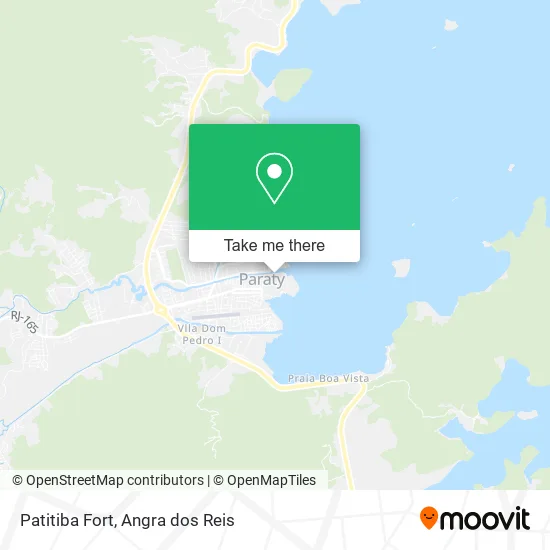
See Patitiba Fort, Parati, on the map
Public Transit to Patitiba Fort in Parati
Wondering how to get to Patitiba Fort in Parati? Moovit helps you find the best way to get to Patitiba Fort with step-by-step directions from the nearest public transit station.
Moovit provides free maps and live directions to help you navigate through your city. View schedules, routes, timetables, and find out how long does it take to get to Patitiba Fort in real time.
Looking for the nearest stop or station to Patitiba Fort? Check out this list of stops closest to your destination: Avenida Octávio Gama; Terminal Rodoviário De Paraty - Colitur.
Bus: 10, 22, 24, 26, L406, 11, 13, 14, 16.
Want to see if there’s another route that gets you there at an earlier time? Moovit helps you find alternative routes or times. Get directions from and directions to Patitiba Fort easily from the Moovit App or Website.
We make riding to Patitiba Fort easy, which is why over 1.5 million users, including users in Parati, trust Moovit as the best app for public transit. You don’t need to download an individual bus app or train app, Moovit is your all-in-one transit app that helps you find the best bus time or train time available.
For information on prices of bus, costs and ride fares to Patitiba Fort, please check the Moovit app.
Use the app to navigate to popular places including to the airport, hospital, stadium, grocery store, mall, coffee shop, school, college, and university.
Patitiba Fort Address: Rua Josephina Gibrail Costa, Centro Histórico Paraty-RJ 23970-000 street in Parati
- Tenda da Flipinha,
- Passeio de Carruagem de Paraty,
- Estacionamento do Itae,
- Sitio 3 Irmãos,
- Restaurante Caravelas,
- Prisma Paraty,
- Cachaça Tour Paraty,
- Paraty Walking Tours,
- Nala Turismo,
- Flor de Liz,
- Pupu's Panc Party,
- Pousada Divina Casa,
- Caip da Baixinha,
- Paraty Centro Histórico,
- Jardim Secreto Confeitaria E Café,
- Pousadacasada,
- Japamar,
- Good Memories Paraty,
- Grande da Deserta Beach, Paraty,
- Cheiro do Camarao
Places Near Patitiba Fort (Parati)
- Rodovia Procurador Haroldo Fernandes Duarte, Km 513,5 s / n, Cunhambebe,
- Alambique Engenho D'Ouro, Parati,
- Avenida Almirante Jair Carneiro Toscano de Brito 110, Angra Dos Reis,
- Vila Galé Eco Resort De Angra, Angra Dos Reis,
- Garatucaia, Angra Dos Reis,
- Rua Prefeito João Gregório Galindo, Cunhambebe,
- Rodovia BR 101, Km 533 s/n, Mambucaba,
- Praia do Laboratório, Angra Dos Reis,
- Avenida Antônio Bertholdo da Silva Jordão 7346, Jacuecanga,
- Cachoeira do Tobogã, Parati,
- Centro Histórico de Paraty, Parati,
- Vila Residencial De Mambucaba, Mambucaba,
- Verolme, Jacuecanga,
- BR 101, Km 508 s/n, Cunhambebe,
- Condominio Laranjeiras, Parati Mirim,
- Rua Prefeito João Gregório Galindo 2487, Angra Dos Reis,
- Mambucaba, Mambucaba,
- Rua Cônegos Bittencourt, Angra Dos Reis,
- praia jabaquara - parati, Parati,
- Praia de Paraty Mirim, Parati
How to get to popular places in Angra dos Reis with public transit
Get around Parati by public transit!
Traveling around Parati has never been so easy. See step by step directions as you travel to any attraction, street or major public transit station. View bus and train schedules, arrival times, service alerts and detailed routes on a map, so you know exactly how to get to anywhere in Parati.
When traveling to any destination around Parati use Moovit's Live Directions with Get Off Notifications to know exactly where and how far to walk, how long to wait for your line, and how many stops are left. Moovit will alert you when it's time to get off — no need to constantly re-check whether yours is the next stop.
Wondering how to use public transit in Parati or how to pay for public transit in Parati? Moovit public transit app can help you navigate your way with public transit easily, and at minimum cost. It includes public transit fees, ticket prices, and costs. Looking for a map of Parati public transit lines? Moovit public transit app shows all public transit maps in Parati with all Bus and Ferry routes and stops on an interactive map.
Angra dos Reis has 2 transit type(s), including: Bus and Ferry, operated by several transit agencies, including Viação Senhor do Bonfim, Colitur Transportes Rodoviários, Cooparatyense (Vans), Costa Verde Transportes, Barcas Rio, Objetiva Tour, Vilanova Tour, Rodoviário Oceano, BusUFF and Colitur (Tarifa Zero - Paraty)