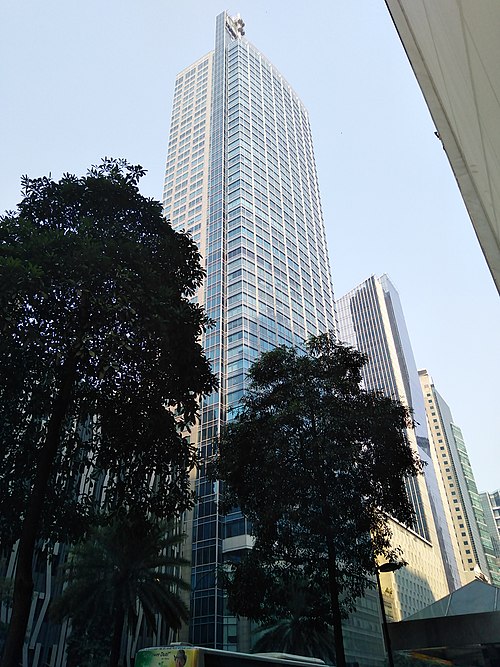
Directions to Pbcom (Makati City) with public transportation
The following transit lines have routes that pass near Pbcom
 Bus: JEEP, BUS, BUS, BUS.
- Train: MRT3, PNR MC.
How to get to Pbcom by bus?
Click on the bus route to see step by step directions with maps, line arrival times and updated time schedules.
How to get to Pbcom by train?
Click on the train route to see step by step directions with maps, line arrival times and updated time schedules.
Bus stops near Pbcom in Makati City
- Senator Gil Puyat Ave, Makati City, Manila, 4 min walk,
- Makati Ave / Paseo De Roxas Intersection, Makati City, Manila, 4 min walk,
- J.P. Rizal Ave / F.Zobel Intersection, Makati City, Manila, 5 min walk,
- Makati Cbd, 14 min walk,
Train stations near Pbcom in Makati City
- Buendia Mrt, 22 min walk,
- Pasay Road Pnr, 26 min walk,
Bus lines to Pbcom in Makati City
- JEEP, Guadalupe Cartimar via Roxas Blvd,
- JEEP, Bel-Air-Washington,
- JEEP, BUENDIA KALAYAAN - F BONIFACIO,
- JEEP, BUENDIA LRT TAFT - GUADALUPE,
- JEEP, Guadalupe - Cartimar,
- JEEP, AYALA LANDMARK - PUREGOLD,
- JEEP, Cartimar - EDSA/Buendia via Bel Air,
- JEEP, BEL AIR - WASHINGTON,
- JEEP, Landmark Puregold Loop,
- BUS, Ayala Quiapo via Kamagong Taft,
- JEEP, Guadalupe-Makati,
- JEEP, PATEROS - AYALA,
- JEEP, GUADALUPE IBABAW - AYALA,
- JEEP, AYALA - ZAPOTE RD,
- JEEP, Ayala Guadalupe Ibabaw via JP Rizal,
- JEEP, Ayala - Pateros via J.P. Rizal,
- BUS, Alabang Lawton via Sucat,
- JEEP, Guadalupe Delpan MRT,
- JEEP, Guadalupe Mkt. - L. Guinto via Pasig Line,
- JEEP, Del Pan Guadalupe (Ibabaw),
What are the closest stations to Pbcom?
The closest stations to Pbcom are:
- Senator Gil Puyat Ave, Makati City, Manila stop is 281 meters away, 4 min walk.
- Makati Ave / Paseo De Roxas Intersection, Makati City, Manila stop is 288 meters away, 4 min walk.
- J.P. Rizal Ave / F.Zobel Intersection, Makati City, Manila stop is 331 meters away, 5 min walk.
- Makati Cbd stop is 1017 meters away, 14 min walk.
- Buendia Mrt station is 1679 meters away, 22 min walk.
- Pasay Road Pnr station is 1968 meters away, 26 min walk.
Which bus line stops near Pbcom?
JEEP (Coronado, Makati City, Manila→Senator Gil Puyat Ave, Makati City)
Which train line stops near Pbcom?
MRT3 (Taft Avenue)
What’s the nearest train station to Pbcom in Makati City?
The nearest train station to Pbcom in Makati City is Buendia Mrt. It’s a 22 min walk away.
What’s the nearest bus station to Pbcom in Makati City?
The nearest bus stations to Pbcom in Makati City are Senator Gil Puyat Ave, Makati City, Manila and Makati Ave / Paseo De Roxas Intersection, Makati City, Manila. The closest one is a 4 min walk away.
What time is the first train to Pbcom in Makati City?
The MRT3 is the first train that goes to Pbcom in Makati City. It stops nearby at 5:15 AM.
What time is the last train to Pbcom in Makati City?
The PNR MC is the last train that goes to Pbcom in Makati City. It stops nearby at 1:10 AM.
What time is the first bus to Pbcom in Makati City?
The JEEP is the first bus that goes to Pbcom in Makati City. It stops nearby at 7:00 AM.
What time is the last bus to Pbcom in Makati City?
The BUS is the last bus that goes to Pbcom in Makati City. It stops nearby at 12:41 AM.
See Pbcom, Makati City, on the map
Public Transit to Pbcom in Makati City
Wondering how to get to Pbcom in Makati City? Moovit helps you find the best way to get to Pbcom with step-by-step directions from the nearest public transit station.
Moovit provides free maps and live directions to help you navigate through your city. View schedules, routes, timetables, and find out how long does it take to get to Pbcom in real time.
Looking for the nearest stop or station to Pbcom? Check out this list of stops closest to your destination: Senator Gil Puyat Ave; Makati Ave / Paseo De Roxas Intersection; J.P. Rizal Ave / F.Zobel Intersection; Makati Cbd; Buendia Mrt; Pasay Road Pnr.
Bus: JEEP, BUS, BUS, BUS.Train: MRT3, PNR MC.
Want to see if there’s another route that gets you there at an earlier time? Moovit helps you find alternative routes or times. Get directions from and directions to Pbcom easily from the Moovit App or Website.
We make riding to Pbcom easy, which is why over 1.7 billion users, including users in Makati City, trust Moovit as the best app for public transit. You don’t need to download an individual bus app or train app, Moovit is your all-in-one transit app that helps you find the best bus time or train time available.
For information on prices of bus and train, costs and ride fares to Pbcom, please check the Moovit app.
Use the app to navigate to popular places including to the airport, hospital, stadium, grocery store, mall, coffee shop, school, college, and university.
Pbcom Address: Senator Gil Puyat Avenue street in Makati City
- 349 Sen. Gil Puyat Ave,
- Oppen Building,
- The New DOT Building,
- Department Of Tourism, Dot,
- Platinum Plans Phil., Inc.,
- N8 Upper Cervical Chiropractic,
- Assad Mini Mart,
- LDS Chapel Buendia, Makati City,
- Morning Star Milling Corp,
- Filinvest,
- Centerstage Family KTV and Resto Bar,
- Morning Star Center,
- New Solid Building,
- New Solid Bldg.,
- Beauty Brick Hair Art Studio,
- Aub,
- Buendia Avenue,
- Wilhelmsen Shipping,
- Petron Megaplaza,
- Rajah Travel Corporation - Makati
Places Near Pbcom (Makati City)
- Ayala Malls Feliz, Pasig City,
- Civil Service Commission NCR Office, Quezon City,
- Jones Bridge, Manila,
- Eton Centris, Quezon City,
- Bridgetowne, Quezon City,
- Parqal Mall, Parañaque,
- WWW.Youjizz.Com, Antipolo City,
- CCF Center Main, Pasig City,
- Fisher Mall, Quezon City,
- SM City North EDSA, Quezon City,
- East Avenue Medical Center, Quezon City,
- U.S. Embassy, Manila Philippines, Manila,
- Double Dragon Plaza,
- Lemon Square Munoz QC, Quezon City,
- PSA - East Ave, Quezon City,
- Farmers Plaza Cubao, Quezon City,
- SB Park, Tandang Sora, Q.C., Quezon City,
- Jose R. Reyes Memorial Medical Center, Manila,
- Dfa Aseana, Parañaque,
- Ynares Sports Arena, Pasig City
How to get to popular places in Manila with public transit
Get around Makati City by public transit!
Traveling around Makati City has never been so easy. See step by step directions as you travel to any attraction, street or major public transit station. View bus and train schedules, arrival times, service alerts and detailed routes on a map, so you know exactly how to get to anywhere in Makati City.
When traveling to any destination around Makati City use Moovit's Live Directions with Get Off Notifications to know exactly where and how far to walk, how long to wait for your line, and how many stops are left. Moovit will alert you when it's time to get off — no need to constantly re-check whether yours is the next stop.
Wondering how to use public transit in Makati City or how to pay for public transit in Makati City? Moovit public transit app can help you navigate your way with public transit easily, and at minimum cost. It includes public transit fees, ticket prices, and costs. Looking for a map of Makati City public transit lines? Moovit public transit app shows all public transit maps in Makati City with all Bus and Train routes and stops on an interactive map.
Manila has 2 transit type(s), including: Bus and Train, operated by several transit agencies, including MRTC, LRTA, PNR, LTFRB, BGC Bus, P2P and UV Express