How to get to Pci Graphics by bus?
Click on the bus route to see step by step directions with maps, line arrival times and updated time schedules.
From Politics and Prose, Washington
103 minFrom Wheaton Mall, Montgomery County
62 minFrom Adventist HealthCare Shady Grove Medical Center, Montgomery County
67 minFrom St John's College High School, Washington
100 minFrom Silver Spring, Maryland, Montgomery County
54 minFrom Regal Majestic Stadium 20 and IMAX, Montgomery County
57 minFrom Montgomery College-Rockville, Montgomery County
37 minFrom Brookside Gardens, Montgomery County
35 minFrom Comet Ping Pong, Washington
102 min
How to get to Pci Graphics by train?
Click on the train route to see step by step directions with maps, line arrival times and updated time schedules.
How to get to Pci Graphics by metro?
Click on the metro route to see step by step directions with maps, line arrival times and updated time schedules.
From Politics and Prose, Washington
56 minFrom Wheaton Mall, Montgomery County
84 minFrom Silver Spring, Maryland, Montgomery County
72 minFrom Regal Majestic Stadium 20 and IMAX, Montgomery County
74 minFrom Montgomery College-Rockville, Montgomery County
55 minFrom Brookside Gardens, Montgomery County
99 minFrom Comet Ping Pong, Washington
54 min
Bus stops near Pci Graphics in Montgomery County
Train station near Pci Graphics in Montgomery County
- Kensington Marc Wb, 9 min walk,VIEW
Bus lines to Pci Graphics in Montgomery County
What are the closest stations to Pci Graphics?
The closest stations to Pci Graphics are:
- Boiling Brook Pkwy & Rockinghorse Rd is 57 yards away, 1 min walk.
- Parklawn Dr+Boiling Brook Pkwy is 437 yards away, 6 min walk.
- Kensington Marc Wb is 688 yards away, 9 min walk.
- Randolph Rd & Hunters La is 1133 yards away, 14 min walk.
Which bus lines stop near Pci Graphics?
These bus lines stop near Pci Graphics: 38, M42, M44.
Which train line stops near Pci Graphics?
MARC (Inbound - Brunswick)
Which metro line stops near Pci Graphics?
RED (Shady Grove)
What’s the nearest train station to Pci Graphics in Montgomery County?
The nearest train station to Pci Graphics in Montgomery County is Kensington Marc Wb. It’s a 9 min walk away.
What’s the nearest bus station to Pci Graphics in Montgomery County?
The nearest bus station to Pci Graphics in Montgomery County is Boiling Brook Pkwy & Rockinghorse Rd. It’s a 1 min walk away.
What time is the first metro to Pci Graphics in Montgomery County?
The RED is the first metro that goes to Pci Graphics in Montgomery County. It stops nearby at 5:07 AM.
What time is the last metro to Pci Graphics in Montgomery County?
The RED is the last metro that goes to Pci Graphics in Montgomery County. It stops nearby at 12:35 AM.
What time is the first train to Pci Graphics in Montgomery County?
The MARC is the first train that goes to Pci Graphics in Montgomery County. It stops nearby at 5:45 AM.
What time is the last train to Pci Graphics in Montgomery County?
The MARC is the last train that goes to Pci Graphics in Montgomery County. It stops nearby at 7:45 PM.
What time is the first bus to Pci Graphics in Montgomery County?
The M12 is the first bus that goes to Pci Graphics in Montgomery County. It stops nearby at 4:19 AM.
What time is the last bus to Pci Graphics in Montgomery County?
The M12 is the last bus that goes to Pci Graphics in Montgomery County. It stops nearby at 2:05 AM.
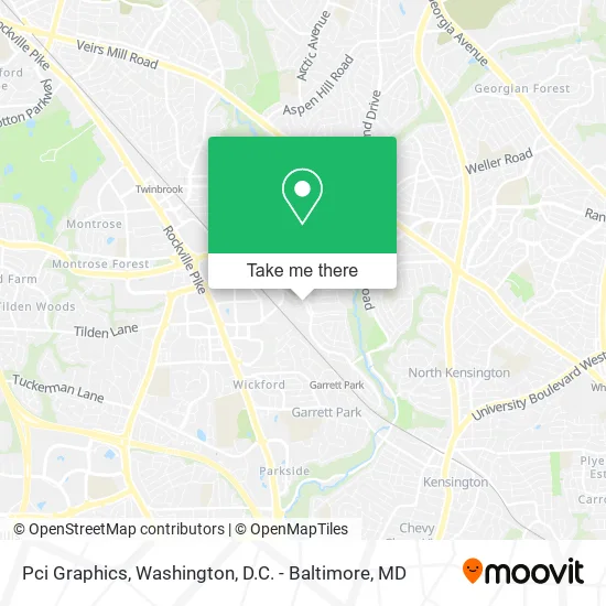
See Pci Graphics, Montgomery County, on the map
Public Transit to Pci Graphics in Montgomery County
Wondering how to get to Pci Graphics in Montgomery County? Moovit helps you find the best way to get to Pci Graphics with step-by-step directions from the nearest public transit station.
Moovit provides free maps and live directions to help you navigate through your city. View schedules, routes, timetables, and find out how long does it take to get to Pci Graphics in real time.
Looking for the nearest stop or station to Pci Graphics? Check out this list of stops closest to your destination: Boiling Brook Pkwy & Rockinghorse Rd; Parklawn Dr+Boiling Brook Pkwy; Kensington Marc Wb; Randolph Rd & Hunters La.
Bus: 38, M42, M44, M12.Train: MARC.Metro: RED.
Want to see if there’s another route that gets you there at an earlier time? Moovit helps you find alternative routes or times. Get directions from and directions to Pci Graphics easily from the Moovit App or Website.
We make riding to Pci Graphics easy, which is why over 1.5 million users, including users in Montgomery County, trust Moovit as the best app for public transit. You don’t need to download an individual bus app or train app, Moovit is your all-in-one transit app that helps you find the best bus time or train time available.
For information on prices of bus, metro and train, costs and ride fares to Pci Graphics, please check the Moovit app.
Use the app to navigate to popular places including to the airport, hospital, stadium, grocery store, mall, coffee shop, school, college, and university.
Pci Graphics Address: 5004 Boiling Brook Pkwy Rockville, MD 20852 street in Montgomery County
- Pro-Fit Basketball Training,
- Dill Dinkers,
- Game Gym,
- Filo Cafe,
- Cafe 2020,
- Godaddy S It E S,
- Tattoolandia,
- Tatuajes por Boris Kuryakin,
- Goodwill,
- Moti's Market (Moti's Grill Restaurant),
- Woodrow Wilson High School,
- Charles E Smith Jewish Day School,
- Midatlantic Installations,
- American Choice Exteriors,
- Jewish Social Services Agency,
- Renewal by Anderson of DC and MD,
- Bethesda PLBG Beautiful Baths,
- Kid To Kid - Rockville,
- 495 Strength and Performance,
- Citydance Conservatory
Places Near Pci Graphics (Montgomery County)
- The Anthem, Washington,
- Washington DC VA Medical Center, Washington,
- National Theatre, Washington,
- Basilica of the National Shrine, Washington,
- Pennsylvania Ave NW (3rd st and pennsylvania), Washington,
- Museum Of The Bible, Washington,
- Georgetown, Washington,
- National Zoo, Washington,
- M&T Bank Stadium, Baltimore,
- Westfield Montgomery Mall, Montgomery County,
- PG Mall, Prince George's County,
- Camden Yards, Baltimore,
- National Museum of African American History and Culture, Washington,
- Capital One Arena, Washington,
- Sibley Memorial Hospital, Washington,
- Warner Theatre, Washington,
- Amazon Hq2, Arlington County,
- Washington National Cathedral, Washington,
- Rock Creek Tennis Center, Washington,
- Marriott Marquis Washington, DC, Washington
How to get to popular places in Washington, D.C. - Baltimore, MD with public transit
Get around Montgomery County by public transit!
Traveling around Montgomery County has never been so easy. See step by step directions as you travel to any attraction, street or major public transit station. View bus and train schedules, arrival times, service alerts and detailed routes on a map, so you know exactly how to get to anywhere in Montgomery County.
When traveling to any destination around Montgomery County use Moovit's Live Directions with Get Off Notifications to know exactly where and how far to walk, how long to wait for your line, and how many stops are left. Moovit will alert you when it's time to get off — no need to constantly re-check whether yours is the next stop.
Wondering how to use public transit in Montgomery County or how to pay for public transit in Montgomery County? Moovit public transit app can help you navigate your way with public transit easily, and at minimum cost. It includes public transit fees, ticket prices, and costs. Looking for a map of Montgomery County public transit lines? Moovit public transit app shows all public transit maps in Montgomery County with all Bus, Train, Metro, Light Rail and Ferry routes and stops on an interactive map.
Washington, D.C. - Baltimore, MD has 5 transit type(s), including: Bus, Train, Metro, Light Rail and Ferry, operated by several transit agencies, including WMATA, Montgomery County Ride On, Fairfax Connector, TheBus, PRTC, DASH - Alexandria, Arlington Transit (ART), RTA of Central Maryland, MDOT MTA, MDOT MTA Light RailLink, MDOT MTA Commuter Bus, MDOT MTA Local Bus, FXBGO!, Virginia Railway Express (VRE) and MARC