How to get to Pcmax by bus?
Click on the bus route to see step by step directions with maps, line arrival times and updated time schedules.
From Gare SNCF de Manduel - Redessan, Manduel
38 minFrom 30620, Uchaud
60 minFrom Tables & Auberges de France, Garons
42 minFrom Cabinet Dentair, Garons
56 minFrom FedEx, Caissargues
56 minFrom Domaine De Praden, Marguerittes
50 minFrom Allée Louis Blériot 76, Marguerittes
45 minFrom Aéroport de Nîmes Alès Camargue Cévennes, Saint-Gilles
68 minFrom Amazon Locker-Hubrecht, Saint-Dionizy
64 minFrom St-Gervasy, Saint-Gervasy
47 min
Bus stops near Pcmax in Nimes
Bus lines to Pcmax in Nimes
- 9, Route D'Arles,VIEW
- 14, Vacquerolles - Golf,VIEW
- 16, Ville Active,VIEW
- 7, Ville Active,VIEW
- 10, Gare Feucheres,VIEW
- 70, HAUTS DE NIMES - JAURES,VIEW
- 77, MONTAURY - JAURES,VIEW
- 78, CAMPLANIER - JAURES,VIEW
- 61, Nîmes Gare Feucheres,VIEW
- T1, Gambetta - Coupole,VIEW
- 51, Nîmes Gare Routiere,VIEW
- 52, Saint Come Et Maruejols,VIEW
- T2, Paloma,VIEW
- T3, Gare Feucheres,VIEW
- 105, Mas Roman,VIEW
- 804B, Nîmes Gare Routiere,VIEW
What are the closest stations to Pcmax?
The closest stations to Pcmax are:
- Place D'Assas is 169 meters away, 3 min walk.
- Arènes is 327 meters away, 5 min walk.
- Jaurès is 362 meters away, 5 min walk.
- Emilien Dumas is 429 meters away, 6 min walk.
Which bus lines stop near Pcmax?
These bus lines stop near Pcmax: 14, 16, 51, 9, T1, T2, T4.
What’s the nearest bus station to Pcmax in Nimes?
The nearest bus station to Pcmax in Nimes is Place D'Assas. It’s a 3 min walk away.
What time is the first bus to Pcmax in Nimes?
The T1 is the first bus that goes to Pcmax in Nimes. It stops nearby at 5:32 AM.
What time is the last bus to Pcmax in Nimes?
The T2 is the last bus that goes to Pcmax in Nimes. It stops nearby at 1:04 AM.
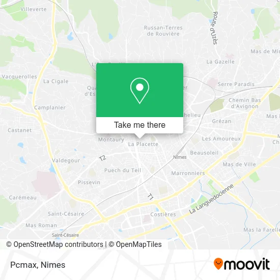
See Pcmax, Nimes, on the map
Public Transit to Pcmax in Nimes
Wondering how to get to Pcmax in Nimes? Moovit helps you find the best way to get to Pcmax with step-by-step directions from the nearest public transit station.
Moovit provides free maps and live directions to help you navigate through your city. View schedules, routes, timetables, and find out how long does it take to get to Pcmax in real time.
Looking for the nearest stop or station to Pcmax? Check out this list of stops closest to your destination: Place D'Assas; Arènes; Jaurès; Emilien Dumas.
Bus: 14, 16, 51, 9, T1, T2, T4, 7, 10, 70, 77, 78, 61, 52, T3.
Want to see if there’s another route that gets you there at an earlier time? Moovit helps you find alternative routes or times. Get directions from and directions to Pcmax easily from the Moovit App or Website.
We make riding to Pcmax easy, which is why over 1.5 million users, including users in Nimes, trust Moovit as the best app for public transit. You don’t need to download an individual bus app or train app, Moovit is your all-in-one transit app that helps you find the best bus time or train time available.
For information on prices of bus, costs and ride fares to Pcmax, please check the Moovit app.
Use the app to navigate to popular places including to the airport, hospital, stadium, grocery store, mall, coffee shop, school, college, and university.
Pcmax Address: 33 Rue Émile Jamais 30900 Nîmes street in Nimes
- Cordonnerie l'Émile Pompe,
- Surface Immobilier,
- Crazy'Lash,
- La Compagnie des Familles,
- Société d'Édition Provence,
- Patrimoine et Habitat,
- Institut Citron Vert,
- Black Flamingo Coffee Roasters,
- Votre Intérieur sur Mesure,
- L'Atelier Caline,
- Collège Sacré-Coeur,
- Lhamo,
- L'Arbre Bleu,
- Abecassis Bouenel Nadine,
- Les Reflets Verts,
- Studio Mezzanine Centre,
- Le Comptoir National de l'or,
- City Shopping,
- La Chouette Bleue,
- LES ATELIERS DE NADINE
Places Near Pcmax (Nimes)
- École Nationale De Police,
- Kinepolis,
- La Galerie - Cap Costières,
- Geant Casino,
- E.Leclerc,
- VILLE ACTIVE, Nîmes,
- Saint-Césaire,
- Parc Kennedy,
- Rond-Point Kilomètre Delta, Nîmes,
- CHU de Nîmes - Hôpital universitaire Carémeau,
- Centre hospitalier Caremeau,
- Les 7 Collines,
- Hôpital Privé Les Franciscaines,
- Aire De Covoiturage Nîmes Ouest,
- Clinique Franciscaine,
- Rue Gilles Roberval 285,
- Le Parnasse, Nîmes,
- Polyclinique Du Grand Sud,
- Carrefour Nîmes Sud,
- Jardins de la Fontaine
How to get to popular places in Nimes with public transit
Get around Nimes by public transit!
Traveling around Nimes has never been so easy. See step by step directions as you travel to any attraction, street or major public transit station. View bus and train schedules, arrival times, service alerts and detailed routes on a map, so you know exactly how to get to anywhere in Nimes.
When traveling to any destination around Nimes use Moovit's Live Directions with Get Off Notifications to know exactly where and how far to walk, how long to wait for your line, and how many stops are left. Moovit will alert you when it's time to get off — no need to constantly re-check whether yours is the next stop.
Wondering how to use public transit in Nimes or how to pay for public transit in Nimes? Moovit public transit app can help you navigate your way with public transit easily, and at minimum cost. It includes public transit fees, ticket prices, and costs. Looking for a map of Nimes public transit lines? Moovit public transit app shows all public transit maps in Nimes with all bus routes and stops on an interactive map.
Nimes has 1 transit type(s), including: bus, operated by several transit agencies, including TANGO