How to get to Pdq Key & Security Systems by bus?
Click on the bus route to see step by step directions with maps, line arrival times and updated time schedules.
From Lincoln Center, Manhattan
52 minFrom Consulado Ecuatoriano en Queens, Queens
67 minFrom Broadway Theatre, Manhattan
50 minFrom Jackson Ave, Queens
52 minFrom W 45th St / 6th Ave, Manhattan
32 minFrom Astoria, Queens
86 minFrom 31st St (astoria blvd & 31st street), Queens
87 minFrom IKEA, Manhattan
45 minFrom Walmart Supercenter, Bayonne
67 minFrom Bayonne, NJ, Bayonne
50 min
How to get to Pdq Key & Security Systems by train?
Click on the train route to see step by step directions with maps, line arrival times and updated time schedules.
How to get to Pdq Key & Security Systems by subway?
Click on the subway route to see step by step directions with maps, line arrival times and updated time schedules.
From Lincoln Center, Manhattan
25 minFrom Consulado Ecuatoriano en Queens, Queens
44 minFrom Broadway Theatre, Manhattan
25 minFrom Jackson Ave, Queens
30 minFrom W 45th St / 6th Ave, Manhattan
24 minFrom Astoria, Queens
39 minFrom 31st St (astoria blvd & 31st street), Queens
40 minFrom IKEA, Manhattan
21 min
Subway stations near Pdq Key & Security Systems in Manhattan
Bus stops near Pdq Key & Security Systems in Manhattan
Bus lines to Pdq Key & Security Systems in Manhattan
- M15, East Harlem 125 St Via 1 Av,VIEW
- M15-SBS, Select Bus Service South Ferry Via 2 Av,VIEW
- SIM5, Eltvlle Trans Ctr Via F Cap Bl Via Gfrds,VIEW
- SIM15, Eltingville Transit Center Via Richmond,VIEW
- SIM35, Port Richmond Via Clove Rd,VIEW
- DOWNTOWN CONNECTION, Chambers Street,VIEW
- QM65, Laurelton,VIEW
- M103, East Harlem 125 St Via 3 Av,VIEW
- QM11, Forest Hills,VIEW
- QM25, Downtown Via Church St Via Water St,VIEW
- BM1, Mill Basin - Downtown/Midtown,VIEW
- BM2, Canarsie/Spring Creek - Downtown/Midtown,VIEW
- BM3, Sheepshead Bay - Downtown/Midtown,VIEW
- BM4, Gerritsen Beach - Downtown/Midtown,VIEW
- M22, Lower E. Side Fdr Dr,VIEW
- QM7, Fresh Meadows - Downtown Express,VIEW
- QM8, Glen Oaks - Downtown Express,VIEW
What are the closest stations to Pdq Key & Security Systems?
The closest stations to Pdq Key & Security Systems are:
- Fulton St is 21 yards away, 1 min walk.
- City Hall is 211 yards away, 3 min walk.
- Pearl St/Fulton St is 283 yards away, 4 min walk.
- Water St & Fulton St is 313 yards away, 4 min walk.
- Brooklyn Bridge-City Hall is 344 yards away, 5 min walk.
- Park Row/Beekman St is 385 yards away, 5 min walk.
- Water St/John St is 392 yards away, 5 min walk.
- Pearl St / Peck Slip is 407 yards away, 5 min walk.
- Frankfort St/William St is 416 yards away, 5 min walk.
- Pearl St/Peck Slip is 421 yards away, 6 min walk.
Which bus lines stop near Pdq Key & Security Systems?
These bus lines stop near Pdq Key & Security Systems: 120, BXM18, M15-SBS, M20, QM11.
Which train lines stop near Pdq Key & Security Systems?
These train lines stop near Pdq Key & Security Systems: BLU, GRE, RED.
Which subway lines stop near Pdq Key & Security Systems?
These subway lines stop near Pdq Key & Security Systems: 2, 4, 5, A.
What’s the nearest subway station to Pdq Key & Security Systems in Manhattan?
The nearest subway station to Pdq Key & Security Systems in Manhattan is Fulton St. It’s a 1 min walk away.
What’s the nearest bus station to Pdq Key & Security Systems in Manhattan?
The nearest bus stations to Pdq Key & Security Systems in Manhattan are Pearl St/Fulton St and Water St & Fulton St. The closest one is a 4 min walk away.
What time is the first subway to Pdq Key & Security Systems in Manhattan?
The J is the first subway that goes to Pdq Key & Security Systems in Manhattan. It stops nearby at 3:00 AM.
What time is the last subway to Pdq Key & Security Systems in Manhattan?
The 2 is the last subway that goes to Pdq Key & Security Systems in Manhattan. It stops nearby at 4:12 AM.
What time is the first bus to Pdq Key & Security Systems in Manhattan?
The M15 is the first bus that goes to Pdq Key & Security Systems in Manhattan. It stops nearby at 3:04 AM.
What time is the last bus to Pdq Key & Security Systems in Manhattan?
The M15 is the last bus that goes to Pdq Key & Security Systems in Manhattan. It stops nearby at 3:12 AM.
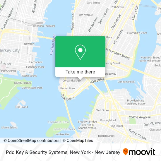
See Pdq Key & Security Systems, Manhattan, on the map
Public Transit to Pdq Key & Security Systems in Manhattan
Wondering how to get to Pdq Key & Security Systems in Manhattan? Moovit helps you find the best way to get to Pdq Key & Security Systems with step-by-step directions from the nearest public transit station.
Moovit provides free maps and live directions to help you navigate through your city. View schedules, routes, timetables, and find out how long does it take to get to Pdq Key & Security Systems in real time.
Looking for the nearest stop or station to Pdq Key & Security Systems? Check out this list of stops closest to your destination: Fulton St; City Hall; Pearl St/Fulton St; Water St & Fulton St; Brooklyn Bridge-City Hall; Park Row/Beekman St; Water St/John St; Pearl St / Peck Slip; Frankfort St/William St; Pearl St/Peck Slip.
Bus: 120, BXM18, M15-SBS, M20, QM11, M15, SIM5, SIM15, SIM35, DOWNTOWN CONNECTION.Train: BLU, GRE, RED.Subway: 2, 4, 5, A, C, J, Z, N, Q, R, W, 6, 6X.
Want to see if there’s another route that gets you there at an earlier time? Moovit helps you find alternative routes or times. Get directions from and directions to Pdq Key & Security Systems easily from the Moovit App or Website.
We make riding to Pdq Key & Security Systems easy, which is why over 1.5 million users, including users in Manhattan, trust Moovit as the best app for public transit. You don’t need to download an individual bus app or train app, Moovit is your all-in-one transit app that helps you find the best bus time or train time available.
For information on prices of subway, bus, train and light rail, costs and ride fares to Pdq Key & Security Systems, please check the Moovit app.
Use the app to navigate to popular places including to the airport, hospital, stadium, grocery store, mall, coffee shop, school, college, and university.
Pdq Key & Security Systems Address: 90 Fulton St street in Manhattan
- Wall Street Bath & Spa 88,
- Nycity Gold and Rolex Buyers,
- Lot-Less,
- Bounce Luggage Storage - Fulton St,
- Fulton St,
- Lash Love Nyc,
- Rafael's Cleaners & Tailor,
- Koba Korean Bbq,
- Fulton St (fulton street and gold street),
- Octopus New York,
- Concacaf,
- Lot Less on Fulton St,
- Sreynith 9creator,
- Mi Apartamento En Nueva York,
- Delfin Dental,
- Ear Properties,
- Fulton St (William St and fulton street),
- Lifestyle Podiatry,
- 140 Nassau,
- Caffeine Cart
Places Near Pdq Key & Security Systems (Manhattan)
- Mountainside Hospital, Glen Ridge,
- qqqq, Manhattan,
- Bellevue Hospital, Manhattan,
- Hudson Yards, Manhattan,
- San Gennaro Feast, Manhattan,
- 1 Police Plaza, Manhattan,
- 111 Centre New York City Supreme Court, Manhattan,
- Wall Street, Manhattan,
- 911 Memorial, Manhattan,
- SoHo, Manhattan,
- Katz's Deli, Manhattan,
- 66 John Street, Manhattan,
- Pier 83, Manhattan,
- 376 Hudson Street, Manhattan,
- 26 Federal Plaza, Manhattan,
- Queens Center Mall, Queens,
- Times Square, Manhattan,
- Rockefeller Center, Manhattan,
- Chinatown, Manhattan,
- 3 Stone St, Manhattan
How to get to popular places in New York - New Jersey with public transit
Get around Manhattan by public transit!
Traveling around Manhattan has never been so easy. See step by step directions as you travel to any attraction, street or major public transit station. View bus and train schedules, arrival times, service alerts and detailed routes on a map, so you know exactly how to get to anywhere in Manhattan.
When traveling to any destination around Manhattan use Moovit's Live Directions with Get Off Notifications to know exactly where and how far to walk, how long to wait for your line, and how many stops are left. Moovit will alert you when it's time to get off — no need to constantly re-check whether yours is the next stop.
Wondering how to use public transit in Manhattan or how to pay for public transit in Manhattan? Moovit public transit app can help you navigate your way with public transit easily, and at minimum cost. It includes public transit fees, ticket prices, and costs. Looking for a map of Manhattan public transit lines? Moovit public transit app shows all public transit maps in Manhattan with all Bus, Train, Subway, Light Rail, Ferry and Cable Car routes and stops on an interactive map.
New York - New Jersey has 6 transit type(s), including: Bus, Train, Subway, Light Rail, Ferry and Cable Car, operated by several transit agencies, including MTA Subway, Metro-North Railroad, LIRR, PATH, MTA New York City Transit - Express routes, MTA Bus, NJ Transit, NYC Ferry, NICE bus, Bee-Line Bus, NJ Transit Rail, Norwalk Transit District, Hartford Line, River Valley Transit and HART