How to get to Peba by bus?
Click on the bus route to see step by step directions with maps, line arrival times and updated time schedules.
From Norcenni Girasole Club, Figline Valdarno
65 minFrom Rondine, Arezzo
106 minFrom Dr. Tani Alfiero, Figline Valdarno
67 minFrom Hu Norcenni Girasole Village, Figline Valdarno
63 minFrom Serristori Hospital, Figline and Incisa Valdarno
71 minFrom Gaiole In Chianti, Gaiole In Chianti
478 minFrom Figline Valdarno, Figline Valdarno
68 min
How to get to Peba by train?
Click on the train route to see step by step directions with maps, line arrival times and updated time schedules.
Bus stops near Peba in Arezzo
Train station near Peba in Arezzo
- San Giovanni Valdarno, 50 min walk,VIEW
Bus lines to Peba in Arezzo
- A, Terranuova-Penna-Montemarciano-Nuova Squarcia,VIEW
- D, Ville-Badiola-Treggiaia,VIEW
- MIV04, Levane-Ponte Leonardo-Terranuova-Ponte Leonardo-Montevarchi,VIEW
- MIV10, Loro-Terranuova-Via Poggilupi/Via Ville-San Giovanni Valdarno,VIEW
- 360 A, Montevarchi-Incisa Valdarno-Pontassieve-Florence,VIEW
- 361 A, Levanella-Terranuova-Incisa-Florence,VIEW
- VERDE, Terranuova-Hospital-Diaz-Montevarchi,VIEW
- MIV02, Terranuova-Hospital-Via della Farnia-Montevarchi,VIEW
- MIV03, Montevarchi-Terranuova-San Giovanni Valdarno,VIEW
- MIV01, Levane Coop,VIEW
- MIV06, Bakery,VIEW
- MIV06, Cavriglia Nardi,VIEW
- SI330, San Giovanni Valdarno Coop,VIEW
- 351 A, Figline Valdarno Railway Station,VIEW
- 351 A, Old Montevarchi Bus Station,VIEW
- 360 A, Old Montevarchi Bus Station,VIEW
- MIV08, Piandiscò-Castelfranco-Faella-Figline-San Giovanni-Montevarchi,VIEW
- MIV09, Piandiscò-Castelfranco-Via Botriolo-San Giovanni-Montevarchi,VIEW
- 351 A, Montevarchi-Figline Valdarno-Incisa Valdarno-Florence,VIEW
- Urban, Piazza Silone,VIEW
What are the closest stations to Peba?
The closest stations to Peba are:
- Terranuova Poggilupi Prada Factory is 145 meters away, 3 min walk.
- Giacomo Leopardi (Towards Hospital) is 2625 meters away, 34 min walk.
- Valdarno Hospital is 3134 meters away, 40 min walk.
- San Giovanni Valdarno is 3913 meters away, 50 min walk.
Which bus lines stop near Peba?
These bus lines stop near Peba: 360 B, MIV10, SI330, VERDE.
Which train line stops near Peba?
R (Arezzo/Chiusi)
What’s the nearest bus station to Peba in Arezzo?
The nearest bus station to Peba in Arezzo is Terranuova Poggilupi Prada Factory. It’s a 3 min walk away.
What time is the first train to Peba in Arezzo?
The R is the first train that goes to Peba in Arezzo. It stops nearby at 6:05 AM.
What time is the last train to Peba in Arezzo?
The R is the last train that goes to Peba in Arezzo. It stops nearby at 12:17 AM.
What time is the first bus to Peba in Arezzo?
The 351 A is the first bus that goes to Peba in Arezzo. It stops nearby at 8:35 AM.
What time is the last bus to Peba in Arezzo?
The VERDE is the last bus that goes to Peba in Arezzo. It stops nearby at 5:08 PM.
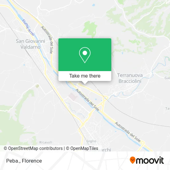
See Peba, Arezzo, on the map
Public Transit to Peba in Arezzo
Wondering how to get to Peba in Arezzo? Moovit helps you find the best way to get to Peba with step-by-step directions from the nearest public transit station.
Moovit provides free maps and live directions to help you navigate through your city. View schedules, routes, timetables, and find out how long does it take to get to Peba in real time.
Looking for the nearest stop or station to Peba? Check out this list of stops closest to your destination: Terranuova Poggilupi Prada Factory; Giacomo Leopardi (Towards Hospital); Valdarno Hospital; San Giovanni Valdarno.
Bus: 360 B, MIV10, SI330, VERDE, A, D, MIV04, 360 A, MIV02, MIV03, MIV01, MIV06, MIV06, 351 A, MIV08, MIV09, 351 A, Urban.Train: R.
Want to see if there’s another route that gets you there at an earlier time? Moovit helps you find alternative routes or times. Get directions from and directions to Peba easily from the Moovit App or Website.
We make riding to Peba easy, which is why over 1.5 million users, including users in Arezzo, trust Moovit as the best app for public transit. You don’t need to download an individual bus app or train app, Moovit is your all-in-one transit app that helps you find the best bus time or train time available.
For information on prices of bus and train, costs and ride fares to Peba, please check the Moovit app.
Use the app to navigate to popular places including to the airport, hospital, stadium, grocery store, mall, coffee shop, school, college, and university.
Peba Address: Via Quinta Strada Poggilupi, 52028 Terranuova Bracciolini street in Arezzo
- Lucacci Alvaro,
- Idea Clothing,
- Thermolana by Giannetti Simone,
- Polvani Pianigiani Architects Associated Studio,
- Db Motors - New and Used Car Sales - Used Car Buying,
- BURGER KING,
- Bonura Brothers,
- Grotti Marbles Fireplaces,
- Illy Coffee & Restaurant,
- Via Poggilupi 890 Prada Establishment,
- Terranuova B.Ni Poggilupi Street,
- Legno Living,
- Province of Arezzo,
- Viaroma Men's Outlet S,
- Carglass,
- San Lorenzo Farm by Piloto Andrea,
- Mario Bizzarri,
- Marionnaud Parfumeries Italia,
- Marionnaud,
- B & G by Bruni and Gavagni
Places Near Peba (Arezzo)
- Santa Maria Nuova Hospital, Florence,
- Verdi Theater, Florence,
- Field of Mars, Florence,
- Piero Palagi Hospital Facility-Florence, Florence,
- IKEA Florence, Sesto Fiorentino,
- Wanny Palace, Florence,
- Torregalli Hospital Scandicci *, Scandicci,
- Tobacco Manufacture, Florence,
- Artemio Franchi Municipal Stadium, Florence,
- I Gigli, Campi Bisenzio,
- Michelangelo Square, Florence,
- Nelson Mandela Forum, Florence,
- Santa Maria Novella Station, Florence,
- Asmana, Campi Bisenzio,
- Viola Park, Bagno a Ripoli,
- OOO, Florence,
- Mandela Forum (Nelson Mandela Forum), Florence,
- Michelangelo Square, Florence,
- Cascine Park, Florence,
- Campi Bisenzio, Campi Bisenzio
How to get to popular places in Florence with public transit
Get around Arezzo by public transit!
Traveling around Arezzo has never been so easy. See step by step directions as you travel to any attraction, street or major public transit station. View bus and train schedules, arrival times, service alerts and detailed routes on a map, so you know exactly how to get to anywhere in Arezzo.
When traveling to any destination around Arezzo use Moovit's Live Directions with Get Off Notifications to know exactly where and how far to walk, how long to wait for your line, and how many stops are left. Moovit will alert you when it's time to get off — no need to constantly re-check whether yours is the next stop.
Wondering how to use public transit in Arezzo or how to pay for public transit in Arezzo? Moovit public transit app can help you navigate your way with public transit easily, and at minimum cost. It includes public transit fees, ticket prices, and costs. Looking for a map of Arezzo public transit lines? Moovit public transit app shows all public transit maps in Arezzo with all Bus, Train, Light Rail, Ferry and Funicular routes and stops on an interactive map.
Florence has 5 transit type(s), including: Bus, Train, Light Rail, Ferry and Funicular, operated by several transit agencies, including Florence Urban - Tuscan Bus Lines, GEST, Florence and Province - Tuscan Bus Lines, Livorno and Province - Tuscan Bus Lines, Arezzo, Florence and Provinces - Tuscan Bus Lines, Prato and Province - Tuscan Bus Lines, Massa, Carrara and Province - Tuscan Bus Lines, Pisa and Province - Tuscan Bus Lines, Grosseto, Siena and Provinces - Tuscan Bus Lines, Arezzo, Siena and Provinces - Tuscan Bus Lines, Pistoia and Province - Tuscan Bus Lines, Siena and Province - Tuscan Bus Lines, Arezzo and Province - Tuscan Bus Lines, Lucca and Province - Tuscan Bus Lines and Trenitalia