Directions to Peffer Farm (Boston) with public transportation
The following transit lines have routes that pass near Peffer Farm
 Bus: 31, 32, GREYHOUND US0255S, GREYHOUND US0256S.
- Train: VERMONTER, VALLEY FLYER.
How to get to Peffer Farm by bus?
Click on the bus route to see step by step directions with maps, line arrival times and updated time schedules.
How to get to Peffer Farm by train?
Click on the train route to see step by step directions with maps, line arrival times and updated time schedules.
Train station near Peffer Farm in Boston
- Greenfield Amtrak Station, 38 min walk,VIEW
What are the closest stations to Peffer Farm?
The closest stations to Peffer Farm are:
- Greenfield Amtrak Station is 3205 yards away, 38 min walk.
Which bus lines stop near Peffer Farm?
These bus lines stop near Peffer Farm: 31, 32, GREYHOUND US0255S, GREYHOUND US0256S.
Which train line stops near Peffer Farm?
VERMONTER (St Albans)
What time is the first train to Peffer Farm in Boston?
The VALLEY FLYER is the first train that goes to Peffer Farm in Boston. It stops nearby at 6:05 AM.
What time is the last train to Peffer Farm in Boston?
The VALLEY FLYER is the last train that goes to Peffer Farm in Boston. It stops nearby at 10:33 PM.
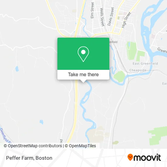
See Peffer Farm, Boston, on the map
Public Transit to Peffer Farm in Boston
Wondering how to get to Peffer Farm in Boston? Moovit helps you find the best way to get to Peffer Farm with step-by-step directions from the nearest public transit station.
Moovit provides free maps and live directions to help you navigate through your city. View schedules, routes, timetables, and find out how long does it take to get to Peffer Farm in real time.
Looking for the nearest stop or station to Peffer Farm? Check out this list of stops closest to your destination: Greenfield Amtrak Station.
Bus: 31, 32, GREYHOUND US0255S, GREYHOUND US0256S.Train: VERMONTER, VALLEY FLYER.
Want to see if there’s another route that gets you there at an earlier time? Moovit helps you find alternative routes or times. Get directions from and directions to Peffer Farm easily from the Moovit App or Website.
We make riding to Peffer Farm easy, which is why over 1.7 million users, including users in Boston, trust Moovit as the best app for public transit. You don’t need to download an individual bus app or train app, Moovit is your all-in-one transit app that helps you find the best bus time or train time available.
For information on prices of bus and train, costs and ride fares to Peffer Farm, please check the Moovit app.
Use the app to navigate to popular places including to the airport, hospital, stadium, grocery store, mall, coffee shop, school, college, and university.
Location: Boston
- Williams,
- Cumberland Substation,
- Williams,
- Green River Cemetery Co.,
- Williams,
- North Cemetery,
- Williams,
- Enviro Tech Systems,
- Williams,
- Calvary Cemetery,
- Williams,
- Va Greenfield Clinic,
- Pine Hill,
- Williams,
- Franklin Law Library,
- Allergy & Immunology Associates of New England,
- Melanson Heath & Company PC,
- Twombly Wealth Management Group,
- Interim Health Care,
- Anderson Cleaning
Places Near Peffer Farm (Boston)
- Td Garden, Boston,
- Wang Theater, Boston,
- Museum Of Science, Boston,
- North End, Boston,
- Isabella Stewart Gardner Museum, Boston,
- Faneuil Hall, Boston,
- Boston Medical Center, Boston,
- Wilbur Theatre, Boston,
- Prudential Center, Boston,
- Cheers, Boston,
- Boston Common, Boston,
- Mgm Music Hall, Boston,
- House Of Blues, Boston,
- Massachusetts General Hospital, Boston,
- Quincy Market, Boston,
- Boston Children's Hospital, Boston,
- Boston Convention & Exhibition Center, Boston,
- Seaport District, Boston,
- Leader Bank Pavilion (Leader Bank Pavillion), Boston,
- Castle Island, Boston
How to get to popular places in Boston with public transit
Get around Boston by public transit!
Traveling around Boston has never been so easy. See step by step directions as you travel to any attraction, street or major public transit station. View bus and train schedules, arrival times, service alerts and detailed routes on a map, so you know exactly how to get to anywhere in Boston.
When traveling to any destination around Boston use Moovit's Live Directions with Get Off Notifications to know exactly where and how far to walk, how long to wait for your line, and how many stops are left. Moovit will alert you when it's time to get off — no need to constantly re-check whether yours is the next stop.
Wondering how to use public transit in Boston or how to pay for public transit in Boston? Moovit public transit app can help you navigate your way with public transit easily, and at minimum cost. It includes public transit fees, ticket prices, and costs. Looking for a map of Boston public transit lines? Moovit public transit app shows all public transit maps in Boston with all Bus, Train, Subway and Ferry routes and stops on an interactive map.
Boston has 4 transit type(s), including: Bus, Train, Subway and Ferry, operated by several transit agencies, including MBTA, Southeastern Regional Transit Authority, MetroWest Regional Transit Authority, Rhode Island Public Transit Authority, WRTA, Lowell Regional Transit Authority, Merrimack Valley Transit, Montachusett Regional Transit Authority, Cape Cod Regional Transit Authority, Brockton Area Transit Authority, Martha's Vineyard Transit Authority, the WAVE - Nantucket Regional Transit Authority, GATRA, Cape Ann Transportation Authority and Massport