Pelizzi/Torre Spaccata stop - Tuesday schedule
| Line | Direction | Time |
|---|---|---|
| N500 | Policlinico/Tor Vergata Hospital | 3:37 AM |
| N500 | Policlinico/Tor Vergata Hospital | 3:37 AM |
| N500 | Policlinico/Tor Vergata Hospital | 4:37 AM |
| N500 | Policlinico/Tor Vergata Hospital | 4:37 AM |
| 559 | Anagnina Metro | 5:18 AM |
| 559 | Anagnina Metro | 5:36 AM |
| 559 | Anagnina Metro | 5:53 AM |
| 213 | Cinecitta (Ma) | 6:04 AM |
| 559 | Anagnina Metro | 6:10 AM |
| 213 | Cinecitta (Ma) | 6:28 AM |
| 559 | Anagnina Metro | 6:28 AM |
| 559 | Anagnina Metro | 6:47 AM |
| 213 | Cinecitta (Ma) | 6:49 AM |
| 559 | Anagnina Metro | 7:07 AM |
| 213 | Cinecitta (Ma) | 7:08 AM |
| 213 | Cinecitta (Ma) | 7:26 AM |
| 559 | Anagnina Metro | 7:27 AM |
| 213 | Cinecitta (Ma) | 7:43 AM |
| 559 | Anagnina Metro | 7:46 AM |
| 559 | Anagnina Metro | 7:56 AM |
| 213 | Cinecitta (Ma) | 8:00 AM |
| 559 | Anagnina Metro | 8:06 AM |
| 213 | Cinecitta (Ma) | 8:17 AM |
| 559 | Anagnina Metro | 8:17 AM |
| 559 | Anagnina Metro | 8:27 AM |
Directions to Pelizzi/Torre Spaccata stop (Roma) with public transit
The following transit lines have routes that pass near Pelizzi/Torre Spaccata
 Bus: 213, 520, 559, N500, 500.
- Train: FL4.
- Metro: A, C.
How to get to Pelizzi/Torre Spaccata stop by bus?
Click on the bus route to see step by step directions with maps, line arrival times and updated time schedules.
How to get to Pelizzi/Torre Spaccata stop by train?
Click on the train route to see step by step directions with maps, line arrival times and updated time schedules.
How to get to Pelizzi/Torre Spaccata stop by metro?
Click on the metro route to see step by step directions with maps, line arrival times and updated time schedules.
Bus stops near Pelizzi/Torre Spaccata stop in Roma
- Pelizzi/Torre Spaccata, 1 min walk,
- Rizzieri/Torre Spaccata, 5 min walk,
- Vignali/Pelizzi, 9 min walk,
Metro stations near Pelizzi/Torre Spaccata station in Roma
- Giulio Agricola, 5 min walk,
- Torre Spaccata, 27 min walk,
Bus lines to Pelizzi/Torre Spaccata stop in Roma
- N500, Cinecitta (Ma),
- 559, Anagnina Metro,
- 213, Largo Preneste,
- 500, Anagnina Metro,
- 657, Vignali/Scintu,
What are the closest stations to Pelizzi/Torre Spaccata?
The closest stations to Pelizzi/Torre Spaccata are:
- Pelizzi/Torre Spaccata stop is 46 meters away, 1 min walk.
- Rizzieri/Torre Spaccata stop is 314 meters away, 5 min walk.
- Giulio Agricola station is 349 meters away, 5 min walk.
- Vignali/Pelizzi stop is 651 meters away, 9 min walk.
- Torre Spaccata station is 2140 meters away, 27 min walk.
Which bus lines stop near Pelizzi/Torre Spaccata?
These bus lines stop near Pelizzi/Torre Spaccata: 213, 520, 559.
Which train line stops near Pelizzi/Torre Spaccata?
FL4 (Frascati/Albano/Velletri)
Which metro line stops near Pelizzi/Torre Spaccata?
A (Anagnina)
What’s the nearest metro station to Pelizzi/Torre Spaccata in Roma?
The nearest metro station to Pelizzi/Torre Spaccata in Roma is Giulio Agricola. It’s a 5 min walk away.
What’s the nearest bus station to Pelizzi/Torre Spaccata in Roma?
The nearest bus station to Pelizzi/Torre Spaccata in Roma is Pelizzi/Torre Spaccata. It’s a 1 min walk away.
What time is the first metro to Pelizzi/Torre Spaccata in Roma?
The A is the first metro that goes to Pelizzi/Torre Spaccata in Roma. It stops nearby at 5:30 AM.
What time is the last metro to Pelizzi/Torre Spaccata in Roma?
The A is the last metro that goes to Pelizzi/Torre Spaccata in Roma. It stops nearby at 12:12 AM.
What time is the first bus to Pelizzi/Torre Spaccata in Roma?
The N500 is the first bus that goes to Pelizzi/Torre Spaccata in Roma. It stops nearby at 3:18 AM.
What time is the last bus to Pelizzi/Torre Spaccata in Roma?
The N500 is the last bus that goes to Pelizzi/Torre Spaccata in Roma. It stops nearby at 2:39 AM.
Pelizzi/Torre Spaccata station
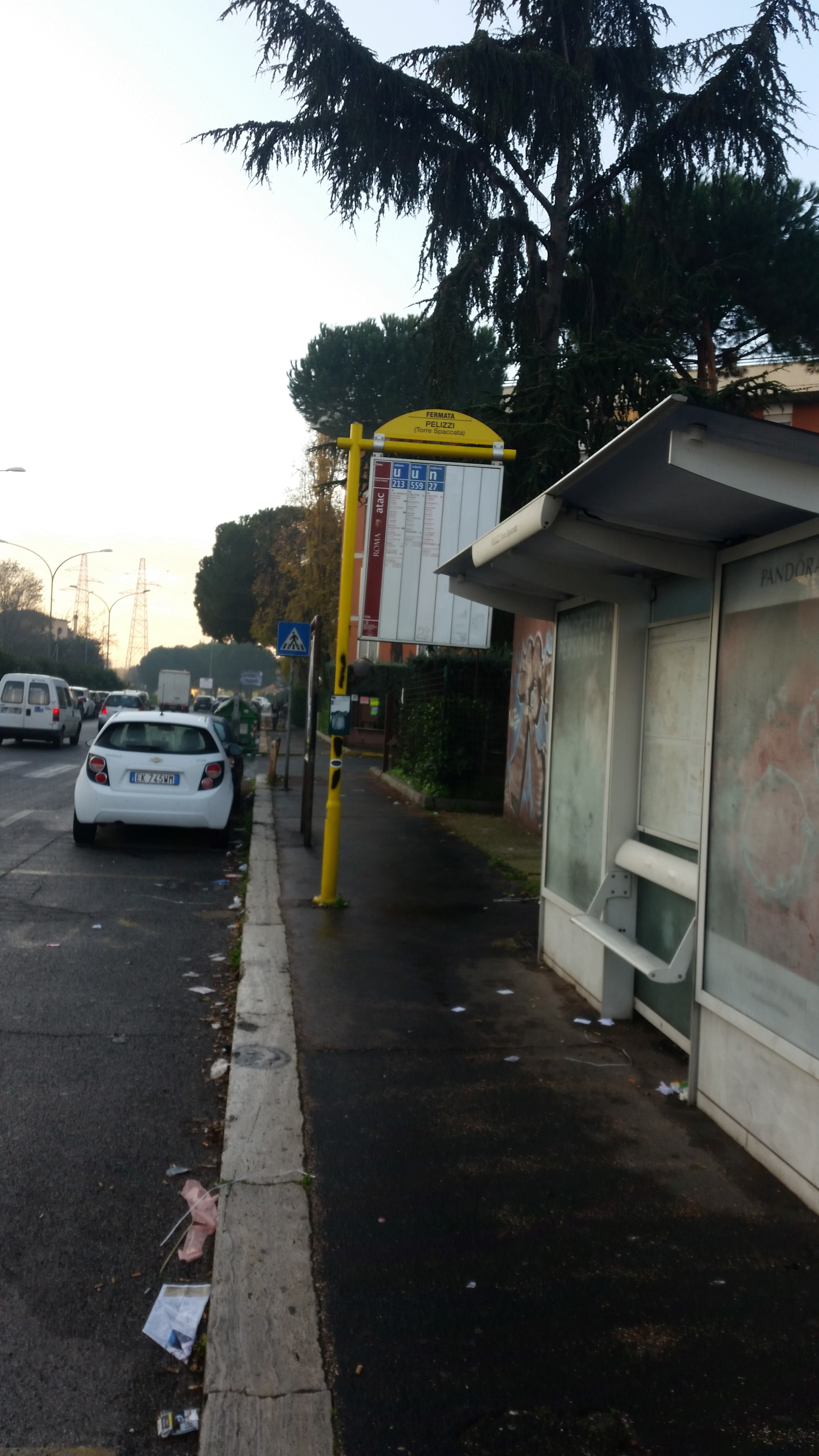 Taken by Anonymous
See Pelizzi/Torre Spaccata stop, Roma, on the map
Public transit to Pelizzi/Torre Spaccata stop (ID: 75326) in Roma
Looking for directions to Pelizzi/Torre Spaccata in Roma, Italy?
Download the Moovit App to find the current schedule and step-by-step directions for Bus, Metro or Train routes that pass through Pelizzi/Torre Spaccata.
Looking for the nearest stops closest to Pelizzi/Torre Spaccata ? Check out this list of closest stops to your destination: Pelizzi/Torre Spaccata; Rizzieri/Torre Spaccata; Giulio Agricola; Vignali/Pelizzi; Torre Spaccata.
Bus: 213, 520, 559, N500, 500, 657.Train: FL4.Metro: A, C.
We make riding on public transit to Pelizzi/Torre Spaccata easy, which is why over 1.7 billion users, including users in Roma trust Moovit as the best app for public transit.
Use the app to navigate to popular places including to the airport, hospital, stadium, grocery store, mall, coffee shop, school, college, and university.
Pelizzi/Torre Spaccata stop’s code is 75326
The first line to this stop is N500, at 3:37 AM, and the last line is N500 at 2:37 AM.
21 Viale Bruno Pelizzi, Roma, Italy
This stop serves ATAC and Troiani Transportation Services’s lines
- Pelizzi/Torre Spaccata,
- Rizzieri/Torre Spaccata,
- Vignali/Pelizzi
Bus stops near Pelizzi/Torre Spaccata stop
- Giulio Agricola,
- Torre Spaccata
Metro stations near Pelizzi/Torre Spaccata station
- Sezze | Anfiteatro,
- Lungotevere Thaon Di Revel/Ponte Milvio,
- Malatesta (MC),
- Fortifiocca/Denina,
- Sperlonga | Lepanto Street,
- Casal Selce/Aurelia,
- Fiumicino City,
- Nepi | Colle Farnese,
- Nettuno,
- Monte Cervialto/Bonomi,
- Laurentina/Trigoria,
- Lungotevere Aventino,
- Flaminia/Morlupo,
- Torre Argentina Street,
- Gregory VII/St. Damaso,
- Gardenie,
- Guido Carli,
- XXII Street,
- Italian Forum/Sports Fields,
- Poggio Nativo | Casali
Popular public transit stations in Roma
Get around Roma by public transit!
Traveling around Roma has never been so easy. See step by step directions as you travel to any attraction, street or major public transit station. View bus and train schedules, arrival times, service alerts and detailed routes on a map, so you know exactly how to get to anywhere in Roma.
When traveling to any destination around Roma use Moovit's Live Directions with Get Off Notifications to know exactly where and how far to walk, how long to wait for your line, and how many stops are left. Moovit will alert you when it's time to get off — no need to constantly re-check whether yours is the next stop.
Wondering how to use public transit in Roma or how to pay for public transit in Roma? Moovit public transit app can help you navigate your way with public transit easily, and at minimum cost. It includes public transit fees, ticket prices, and costs. Looking for a map of Roma public transit lines? Moovit public transit app shows all public transit maps in Roma with all Bus, Train, Metro, Light Rail, Ferry, Funicular and Gondola routes and stops on an interactive map.
Rome and Lazio has 7 transit type(s), including: Bus, Train, Metro, Light Rail, Ferry, Funicular and Gondola, operated by several transit agencies, including ATAC, Cotral, Trenitalia, Troiani Transportation Services, BIS, ATR Mobility, Tuscia, Shuttle, Seatour, Troiani Bus Lines, CSC Mobility, Terravision, ATRAL, Tambus and Sitbus