Directions to Pensao das Torres (Duque De Caxias) with public transportation
The following transit lines have routes that pass near Pensao das Torres
 Bus: 024, 411.
- Train: RAMAL SARACURUNA.
How to get to Pensao das Torres by bus?
Click on the bus route to see step by step directions with maps, line arrival times and updated time schedules.
From Centro de Caxias, Duque De Caxias
59 minFrom Parque Duque, Duque De Caxias
52 minFrom Bairro Amapá, Duque de Caxias, Duque De Caxias
86 minFrom Shopping Center de Caxias (Shopping Center-Centro De Duque De Caxias), Duque De Caxias
56 minFrom ponto da van: campo grande X caxias, Duque De Caxias
74 minFrom Rua Mariano Sendra dos Santos, Duque De Caxias
56 minFrom Parque Lafaiete, Duque De Caxias
78 minFrom Rio Minho (Niterói x Duque De Caxias), Duque De Caxias
57 minFrom Morro do Garibaldi, Duque De Caxias
65 minFrom Jardim 25 De Agosto, Duque De Caxias
55 min
How to get to Pensao das Torres by train?
Click on the train route to see step by step directions with maps, line arrival times and updated time schedules.
From Centro de Caxias, Duque De Caxias
70 minFrom Shopping Center de Caxias (Shopping Center-Centro De Duque De Caxias), Duque De Caxias
72 minFrom ponto da van: campo grande X caxias, Duque De Caxias
84 minFrom Rua Mariano Sendra dos Santos, Duque De Caxias
75 minFrom Parque Lafaiete, Duque De Caxias
90 minFrom Rio Minho (Niterói x Duque De Caxias), Duque De Caxias
74 minFrom Jardim 25 De Agosto, Duque De Caxias
81 min
Bus stop near Pensao das Torres in Duque De Caxias
- Alameda Dos Cajueiros, 635-679, 12 min walk,VIEW
Train station near Pensao das Torres in Duque De Caxias
- Campos Elíseos, 16 min walk,VIEW
Bus lines to Pensao das Torres in Duque De Caxias
- 024, Campos Elíseos ↔ Jardim Primavera (Circular),VIEW
What are the closest stations to Pensao das Torres?
The closest stations to Pensao das Torres are:
- Alameda Dos Cajueiros, 635-679 is 875 meters away, 12 min walk.
- Campos Elíseos is 1192 meters away, 16 min walk.
Which bus lines stop near Pensao das Torres?
These bus lines stop near Pensao das Torres: 024, 411.
Which train line stops near Pensao das Torres?
RAMAL SARACURUNA (Saracuruna)
What’s the nearest train station to Pensao das Torres in Duque De Caxias?
The nearest train station to Pensao das Torres in Duque De Caxias is Campos Elíseos. It’s a 16 min walk away.
What’s the nearest bus station to Pensao das Torres in Duque De Caxias?
The nearest bus station to Pensao das Torres in Duque De Caxias is Alameda Dos Cajueiros, 635-679. It’s a 12 min walk away.
What time is the first train to Pensao das Torres in Duque De Caxias?
The RAMAL SARACURUNA is the first train that goes to Pensao das Torres in Duque De Caxias. It stops nearby at 4:09 AM.
What time is the last train to Pensao das Torres in Duque De Caxias?
The RAMAL SARACURUNA is the last train that goes to Pensao das Torres in Duque De Caxias. It stops nearby at 11:37 PM.
What time is the first bus to Pensao das Torres in Duque De Caxias?
The 411 is the first bus that goes to Pensao das Torres in Duque De Caxias. It stops nearby at 4:30 AM.
What time is the last bus to Pensao das Torres in Duque De Caxias?
The 411 is the last bus that goes to Pensao das Torres in Duque De Caxias. It stops nearby at 12:17 AM.
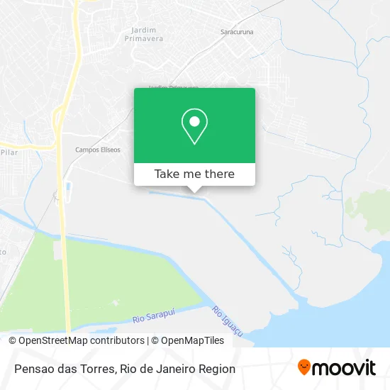
See Pensao das Torres, Duque De Caxias, on the map
Public Transit to Pensao das Torres in Duque De Caxias
Wondering how to get to Pensao das Torres in Duque De Caxias? Moovit helps you find the best way to get to Pensao das Torres with step-by-step directions from the nearest public transit station.
Moovit provides free maps and live directions to help you navigate through your city. View schedules, routes, timetables, and find out how long does it take to get to Pensao das Torres in real time.
Looking for the nearest stop or station to Pensao das Torres? Check out this list of stops closest to your destination: Alameda Dos Cajueiros; Campos Elíseos.
Bus: 024, 411.Train: RAMAL SARACURUNA.
Want to see if there’s another route that gets you there at an earlier time? Moovit helps you find alternative routes or times. Get directions from and directions to Pensao das Torres easily from the Moovit App or Website.
We make riding to Pensao das Torres easy, which is why over 1.5 million users, including users in Duque De Caxias, trust Moovit as the best app for public transit. You don’t need to download an individual bus app or train app, Moovit is your all-in-one transit app that helps you find the best bus time or train time available.
For information on prices of bus and train, costs and ride fares to Pensao das Torres, please check the Moovit app.
Use the app to navigate to popular places including to the airport, hospital, stadium, grocery store, mall, coffee shop, school, college, and university.
Pensao das Torres Address: Estrada da Petrobrás, 226 Campos Elíseos Duque de Caxias-RJ 25225-030 street in Duque De Caxias
- Chevron Brasil Lubrificantes,
- Chevron - Fabrica de Lubrificantes,
- Braskem,
- Chevron Duque De Caxiad Rio De Janeiro,
- Avenida Fabor 3501,
- Termorio,
- Transpetro - Terminal de Campos Elíseos,
- Usina Termelétrica Gov. Leonel Brizola (UTE-GLB),
- Termorio (BR),
- Terminal de Campos Elíseos (Tecam),
- Transpetro,
- Arlanxeo,
- Lanxess / Petroflex,
- Cosan,
- Estação De Distribuição Reduc - Ute Termório,
- Comunicação REDUC,
- Rua Inhambupe,
- Reduc - Duque de Caxias,
- Rua Guianas 80,
- Santiago
Places Near Pensao das Torres (Duque De Caxias)
- Hospital Pedro Ernesto, Vila Isabel,
- Rio De Janeiro,
- Museu Do Amanhã, Centro,
- Rua Licínio Cardoso, São Francisco Xavier,
- Hospital Federal Do Andaraí, Andaraí,
- Feira Livre da Gloria, Glória,
- Avenida Rio Branco, Centro,
- Rua Ulysses Guimarães 16, Cidade Nova,
- Avenida Venezuela 134, Saúde,
- Rodoviária Novo Rio (Rodoviária do Rio de Janeiro), Santo Cristo,
- Shopping RioSul, Botafogo,
- Shopping Rio Sul, Botafogo,
- Norte Shopping, Cachambi,
- Shopping Nova América, Del Castilho,
- Feirão De Malhas, Duque De Caxias,
- Niterói, Niterói,
- Shopping Downtown, Barra Da Tijuca,
- Praia do Arpoador, Ipanema,
- Hospital Federal Cardoso Fontes, Jacarepaguá,
- Hospital Municipal Ronaldo Gazolla, Acari
How to get to popular places in Rio de Janeiro Region with public transit
Get around Duque De Caxias by public transit!
Traveling around Duque De Caxias has never been so easy. See step by step directions as you travel to any attraction, street or major public transit station. View bus and train schedules, arrival times, service alerts and detailed routes on a map, so you know exactly how to get to anywhere in Duque De Caxias.
When traveling to any destination around Duque De Caxias use Moovit's Live Directions with Get Off Notifications to know exactly where and how far to walk, how long to wait for your line, and how many stops are left. Moovit will alert you when it's time to get off — no need to constantly re-check whether yours is the next stop.
Wondering how to use public transit in Duque De Caxias or how to pay for public transit in Duque De Caxias? Moovit public transit app can help you navigate your way with public transit easily, and at minimum cost. It includes public transit fees, ticket prices, and costs. Looking for a map of Duque De Caxias public transit lines? Moovit public transit app shows all public transit maps in Duque De Caxias with all Bus, Train, Metro, Light Rail, Ferry, Cable Car, Gondola and Funicular routes and stops on an interactive map.
Rio de Janeiro Region has 8 transit type(s), including: Bus, Train, Metro, Light Rail, Ferry, Cable Car, Gondola and Funicular, operated by several transit agencies, including TrensRJ, Metrô Rio, VLT Carioca, Barcas Rio, BRT MOBI-Rio, Auto Viação Alpha, Auto Viação Tijuca, Gire Transportes, Transurb, Viação Nossa Senhora das Graças, Consórcio INTERSUL, Braso Lisboa (Municipal), Caprichosa Auto Ônibus, Auto Viação Três Amigos and Rodoviária Âncora Matias