How to get to Perfluence by bus?
Click on the bus route to see step by step directions with maps, line arrival times and updated time schedules.
From Boulevard de Magenta, Paris
72 minFrom Sorbonne Nouvelle Paris 3, Paris
68 minFrom Pont de l'Alma, Paris
43 minFrom Bateaux Mouches, Paris
49 minFrom 6 Villa du Mont Tonnerre, Paris
56 minFrom Clinique Geoffroy Saint-Hilaire, Paris
75 minFrom Mairie du 10e arrondissement, Paris
76 minFrom Palais de l'Élysée, Paris
52 minFrom Rue De Santeuil, Paris
92 minFrom La Comedie Saint Martin, Paris
71 min
How to get to Perfluence by train?
Click on the train route to see step by step directions with maps, line arrival times and updated time schedules.
Bus stops near Perfluence in Suresnes
Light Rail stations near Perfluence in Suresnes
- Les Coteaux, 12 min walk,VIEW
Bus lines to Perfluence in Suresnes
- 263, De Gaulle,VIEW
- 40, Saint-Cucufa - Commandant Rivière,VIEW
- 144, Rueil-Malmaison Rer - La Défense (voie Perronet Nord),VIEW
- 244, Rueil-Malmaison Rer - Porte Maillot - Métro - Rer,VIEW
- N53, Gare Saint-Lazare - Nanterre - Anatole France,VIEW
- 70, Félix Faure,VIEW
- 175, Les Bruyères,VIEW
- 160, Nanterre - Ville RER,VIEW
- 241, Porte D'Auteuil - Métro,VIEW
- 360, La Défense (Voie Perronet Sud),VIEW
What are the closest stations to Perfluence?
The closest stations to Perfluence are:
- Suresnes - Longchamp is 338 meters away, 5 min walk.
- Garibaldi is 355 meters away, 5 min walk.
- De Gaulle is 563 meters away, 8 min walk.
- Clavel is 648 meters away, 9 min walk.
- Les Coteaux is 877 meters away, 12 min walk.
- Les Bons Raisins is 990 meters away, 13 min walk.
Which bus line stops near Perfluence?
70 (De Gaulle)
Which train line stops near Perfluence?
L (Cergy-le-Haut/ Versailles-Rive-Droite/ Saint-Nom-la-Bretèche - Forêt de Marly)
Which light rail line stops near Perfluence?
T2 (Porte de Versailles)
What’s the nearest light rail station to Perfluence in Suresnes?
The nearest light rail station to Perfluence in Suresnes is Les Coteaux. It’s a 12 min walk away.
What’s the nearest bus station to Perfluence in Suresnes?
The nearest bus stations to Perfluence in Suresnes are Suresnes - Longchamp and Garibaldi. The closest one is a 5 min walk away.
What time is the first light rail to Perfluence in Suresnes?
The T2 is the first light rail that goes to Perfluence in Suresnes. It stops nearby at 5:17 AM.
What time is the last light rail to Perfluence in Suresnes?
The T2 is the last light rail that goes to Perfluence in Suresnes. It stops nearby at 12:55 AM.
What time is the first train to Perfluence in Suresnes?
The L is the first train that goes to Perfluence in Suresnes. It stops nearby at 5:03 AM.
What time is the last train to Perfluence in Suresnes?
The L is the last train that goes to Perfluence in Suresnes. It stops nearby at 10:30 PM.
What time is the first bus to Perfluence in Suresnes?
The N53 is the first bus that goes to Perfluence in Suresnes. It stops nearby at 3:02 AM.
What time is the last bus to Perfluence in Suresnes?
The N53 is the last bus that goes to Perfluence in Suresnes. It stops nearby at 3:04 AM.
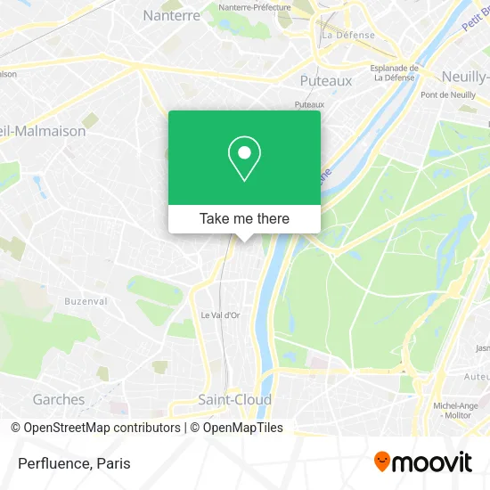
See Perfluence, Suresnes, on the map
Public Transit to Perfluence in Suresnes
Wondering how to get to Perfluence in Suresnes? Moovit helps you find the best way to get to Perfluence with step-by-step directions from the nearest public transit station.
Moovit provides free maps and live directions to help you navigate through your city. View schedules, routes, timetables, and find out how long does it take to get to Perfluence in real time.
Looking for the nearest stop or station to Perfluence? Check out this list of stops closest to your destination: Suresnes - Longchamp; Garibaldi; De Gaulle; Clavel; Les Coteaux; Les Bons Raisins.
Bus: 70, 263, 40, 144, 244, N53, 175, 160, 241, 360.Train: L.Light Rail: T2.
Want to see if there’s another route that gets you there at an earlier time? Moovit helps you find alternative routes or times. Get directions from and directions to Perfluence easily from the Moovit App or Website.
We make riding to Perfluence easy, which is why over 1.5 million users, including users in Suresnes, trust Moovit as the best app for public transit. You don’t need to download an individual bus app or train app, Moovit is your all-in-one transit app that helps you find the best bus time or train time available.
For information on prices of metro, light rail, bus and train, costs and ride fares to Perfluence, please check the Moovit app.
Use the app to navigate to popular places including to the airport, hospital, stadium, grocery store, mall, coffee shop, school, college, and university.
Perfluence Address: 43 Rue des Moulineaux 92150 Suresnes street in Suresnes
- Jean-Jacques Rousseau,
- Academie Clairefontaine,
- France Rec,
- Canler Alain,
- Good Poke,
- 623 Incom,
- Annabel Baronnet,
- Sarah,
- 40 Rue Jean Jacques Rousseau,
- Wash,
- Campanile Paris Ouest Pont de Suresnes,
- Neimad,
- Punchlyne,
- Bs Maritime Services,
- La Maison Bleue,
- Cost&Co,
- Boulevard Henri Sellier,
- Sensnatur,
- A Propos,
- Amc Avocats
Places Near Perfluence (Suresnes)
- Centre Hospitalier des 15/20, Paris,
- Galeries Lafayette, Paris,
- Hôpital Saint-Joseph, Paris,
- Hôpital Henri Mondor, Creteil,
- Hôpital de la Pitié-Salpêtrière, Paris,
- Atelier Des Lumieres, Paris,
- 29 Rue Manin, Paris,
- Marché Saint-Pierre, Paris,
- Hôpital Pitié Salpêtrière, Paris,
- Galeries Lafayette Haussmann, Paris,
- Institut Curie, Paris,
- Hôpital Beaujon, Clichy,
- Hôpital Necker, Paris,
- Hopital Lariboisière, Paris,
- Fondation Louis Vuitton, Paris,
- Théâtre Mogador, Paris,
- Hôpital Cochin, Paris,
- Créteil Soleil, Creteil,
- Hopital Foch, Suresnes,
- Gare Routière Flixbus, Paris
How to get to popular places in Paris with public transit
Get around Suresnes by public transit!
Traveling around Suresnes has never been so easy. See step by step directions as you travel to any attraction, street or major public transit station. View bus and train schedules, arrival times, service alerts and detailed routes on a map, so you know exactly how to get to anywhere in Suresnes.
When traveling to any destination around Suresnes use Moovit's Live Directions with Get Off Notifications to know exactly where and how far to walk, how long to wait for your line, and how many stops are left. Moovit will alert you when it's time to get off — no need to constantly re-check whether yours is the next stop.
Wondering how to use public transit in Suresnes or how to pay for public transit in Suresnes? Moovit public transit app can help you navigate your way with public transit easily, and at minimum cost. It includes public transit fees, ticket prices, and costs. Looking for a map of Suresnes public transit lines? Moovit public transit app shows all public transit maps in Suresnes with all Bus, Train, Metro, Light Rail, RER, Funicular and Gondola routes and stops on an interactive map.
Paris has 7 transit type(s), including: Bus, Train, Metro, Light Rail, RER, Funicular and Gondola, operated by several transit agencies, including RATP, RER, RER Bus de remplacement, Train, Train Bus de remplacement, Tramway Bus de remplacement, TER, ADP, Magical Shuttle, Argenteuil - Boucles de Seine, Autocars Dominique, Bièvre, Brie et 2 Morin, Le Bus - C.C. du Clermontois and Cœur d’Essonne