Directions to Performance Credit Card Processing (Grafton) with public transportation
The following transit lines have routes that pass near Performance Credit Card Processing
 Bus: BLUE ROUTE, RIVER ROUTE, 71, 72, 89ER SOUTH.
How to get to Performance Credit Card Processing by bus?
Click on the bus route to see step by step directions with maps, line arrival times and updated time schedules.
Bus stops near Performance Credit Card Processing in Grafton
Bus lines to Performance Credit Card Processing in Grafton
What are the closest stations to Performance Credit Card Processing?
The closest stations to Performance Credit Card Processing are:
- Heater Rd. Bus Shelter is 453 yards away, 6 min walk.
- Dmhc Heater Road Westward at Road is 455 yards away, 6 min walk.
- Heater Rd, Dhmc is 456 yards away, 6 min walk.
- Lebanon is 554 yards away, 7 min walk.
Which bus lines stop near Performance Credit Card Processing?
These bus lines stop near Performance Credit Card Processing: BLUE ROUTE, RIVER ROUTE.
What’s the nearest bus station to Performance Credit Card Processing in Grafton?
The nearest bus stations to Performance Credit Card Processing in Grafton are Heater Rd. Bus Shelter, Dmhc Heater Road Westward at Road and Heater Rd, Dhmc. The closest one is a 6 min walk away.
What time is the first bus to Performance Credit Card Processing in Grafton?
The ENFIELD-CANAAN is the first bus that goes to Performance Credit Card Processing in Grafton. It stops nearby at 5:15 AM.
What time is the last bus to Performance Credit Card Processing in Grafton?
The BLUE ROUTE is the last bus that goes to Performance Credit Card Processing in Grafton. It stops nearby at 8:44 PM.
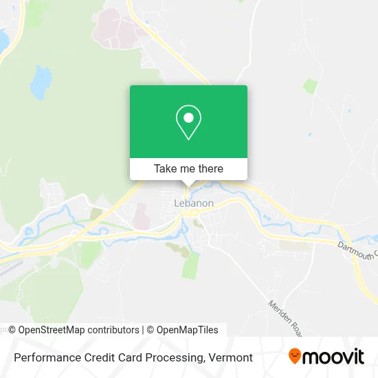
See Performance Credit Card Processing, Grafton, on the map
Public Transit to Performance Credit Card Processing in Grafton
Wondering how to get to Performance Credit Card Processing in Grafton? Moovit helps you find the best way to get to Performance Credit Card Processing with step-by-step directions from the nearest public transit station.
Moovit provides free maps and live directions to help you navigate through your city. View schedules, routes, timetables, and find out how long does it take to get to Performance Credit Card Processing in real time.
Looking for the nearest stop or station to Performance Credit Card Processing? Check out this list of stops closest to your destination: Heater Rd. Bus Shelter; Dmhc Heater Road Westward at Road; Heater Rd; Lebanon.
Bus: BLUE ROUTE, RIVER ROUTE, 71, 72, 89ER SOUTH, BLUE-RED ROUTE, ENFIELD-CANAAN, RED ROUTE.
Want to see if there’s another route that gets you there at an earlier time? Moovit helps you find alternative routes or times. Get directions from and directions to Performance Credit Card Processing easily from the Moovit App or Website.
We make riding to Performance Credit Card Processing easy, which is why over 1.5 million users, including users in Grafton, trust Moovit as the best app for public transit. You don’t need to download an individual bus app or train app, Moovit is your all-in-one transit app that helps you find the best bus time or train time available.
For information on prices of bus and train, costs and ride fares to Performance Credit Card Processing, please check the Moovit app.
Use the app to navigate to popular places including to the airport, hospital, stadium, grocery store, mall, coffee shop, school, college, and university.
Performance Credit Card Processing Address: 103 Hanover St street in Grafton
- Governanti Bartolo,
- Exxon,
- DUNKIN',
- Hughes John R Jr Law Office,
- Sacred Heart Public School,
- Bryce M Wing Attorney,
- Krista Canty,
- TPI Staffing Lebanon NH,
- Keller Williams Realty,
- Sandy Burns,
- Ccba,
- New England Sports Park,
- Carter Community Building,
- Ccba's Witherell Recreation Center,
- Upper Valley Humane Society,
- Spark Community Center,
- Salvation Army,
- Grafton County Senior Citizens Council,
- RSVP of the Upper Valley & White Mountains,
- Servicelink
Places Near Performance Credit Card Processing (Grafton)
- Derby Line Stanstead Border Crossing,
- Missisquoi River Basin Association,
- Richford Auto,
- Castleton University, Rutland,
- Barre, VT,
- Hannaford, Rutland,
- Ecco,
- MVU,
- Waterbury, VT,
- Castleton, VT, Rutland,
- Xxxxxxxxxxxxx, Chittenden,
- WXXX, Chittenden,
- Champlain Valley Exposition, Chittenden,
- GLOBALFOUNDRIES, Chittenden,
- Spring Step,
- Dartmouth-Hitchcock Medical Center, Clinical Systems, Grafton,
- Rutland, VT, Rutland,
- Sugarbush Resort,
- Springfield, VT, Windsor,
- University of Vermont Medical Center - Fanny Allen Campus, Chittenden
How to get to popular places in Vermont with public transit
Get around Grafton by public transit!
Traveling around Grafton has never been so easy. See step by step directions as you travel to any attraction, street or major public transit station. View bus and train schedules, arrival times, service alerts and detailed routes on a map, so you know exactly how to get to anywhere in Grafton.
When traveling to any destination around Grafton use Moovit's Live Directions with Get Off Notifications to know exactly where and how far to walk, how long to wait for your line, and how many stops are left. Moovit will alert you when it's time to get off — no need to constantly re-check whether yours is the next stop.
Wondering how to use public transit in Grafton or how to pay for public transit in Grafton? Moovit public transit app can help you navigate your way with public transit easily, and at minimum cost. It includes public transit fees, ticket prices, and costs. Looking for a map of Grafton public transit lines? Moovit public transit app shows all public transit maps in Grafton with all Bus, Train and Ferry routes and stops on an interactive map.
Vermont has 3 transit type(s), including: Bus, Train and Ferry, operated by several transit agencies, including Green Mountain Transit, Wilmington MOOver, Advance Transit, Vermont Translines, Rockingham MOOver, The Bus (Marble Valley Regional Transit District), Green Mountain Express, Rural Community Transportation, Addison County Transit Resources, Stagecoach Transportation Services, Amtrak, Greyhound-us, Dartmouth Campus Connector and Lake Champlain Ferries