Directions to Performance Software Group (Baltimore County) with public transportation
The following transit lines have routes that pass near Performance Software Group
 Bus: CITYLINK PURPLE, 34, 77.
How to get to Performance Software Group by bus?
Click on the bus route to see step by step directions with maps, line arrival times and updated time schedules.
From Medstar Harbor Hospital, Baltimore
56 minFrom Medstar Union Memorial Hospital, Baltimore
59 minFrom Port of Baltimore - Cruise Maryland Terminal, Baltimore
62 minFrom CFG Bank Arena, Baltimore
35 minFrom Fells Point, Baltimore
48 minFrom Giant Food Stores, Baltimore
54 minFrom Johns Hopkins Mountcastle Auditorium, Baltimore
51 minFrom The Johns Hopkins Hospital, Baltimore
53 minFrom Lyric Theater, Baltimore
47 minFrom Coppin State University, Baltimore
45 min
Bus stops near Performance Software Group in Baltimore County
Bus lines to Performance Software Group in Baltimore County
What are the closest stations to Performance Software Group?
The closest stations to Performance Software Group are:
- Frederick Rd & Belle Grove Rd Wb is 173 yards away, 3 min walk.
- Edmondson Ave & Academy Rd Opp Eb is 976 yards away, 12 min walk.
Which bus line stops near Performance Software Group?
CITYLINK PURPLE (Catonsville)
What’s the nearest bus station to Performance Software Group in Baltimore County?
The nearest bus station to Performance Software Group in Baltimore County is Frederick Rd & Belle Grove Rd Wb. It’s a 3 min walk away.
What time is the first bus to Performance Software Group in Baltimore County?
The 77 is the first bus that goes to Performance Software Group in Baltimore County. It stops nearby at 3:53 AM.
What time is the last bus to Performance Software Group in Baltimore County?
The CITYLINK PURPLE is the last bus that goes to Performance Software Group in Baltimore County. It stops nearby at 2:44 AM.
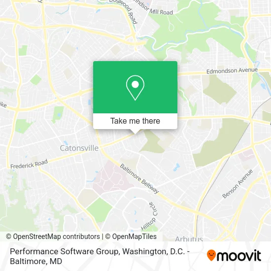
See Performance Software Group, Baltimore County, on the map
Public Transit to Performance Software Group in Baltimore County
Wondering how to get to Performance Software Group in Baltimore County? Moovit helps you find the best way to get to Performance Software Group with step-by-step directions from the nearest public transit station.
Moovit provides free maps and live directions to help you navigate through your city. View schedules, routes, timetables, and find out how long does it take to get to Performance Software Group in real time.
Looking for the nearest stop or station to Performance Software Group? Check out this list of stops closest to your destination: Frederick Rd & Belle Grove Rd Wb; Edmondson Ave & Academy Rd Opp Eb.
Bus: CITYLINK PURPLE, 34, 77.
Want to see if there’s another route that gets you there at an earlier time? Moovit helps you find alternative routes or times. Get directions from and directions to Performance Software Group easily from the Moovit App or Website.
We make riding to Performance Software Group easy, which is why over 1.5 million users, including users in Baltimore County, trust Moovit as the best app for public transit. You don’t need to download an individual bus app or train app, Moovit is your all-in-one transit app that helps you find the best bus time or train time available.
For information on prices of bus and metro, costs and ride fares to Performance Software Group, please check the Moovit app.
Use the app to navigate to popular places including to the airport, hospital, stadium, grocery store, mall, coffee shop, school, college, and university.
Location: Baltimore County, Washington, D.C. - Baltimore, MD
- Capitol Sweeping & Repair Corporation,
- Surichamorn Paiboon MD,
- Belle Rd MD-144,
- Quility Concrete,
- Family Enterprises 2,
- 9 Poplar Ave,
- Abstract Catering,
- Paradise Bed & Breakfast,
- Next Generation,
- Quality First Home Inspection,
- Lind Construction Contracting,
- Frederick Rd & Symington Ave WB,
- Lee Brothers Contracting,
- Golden Arc Center,
- Jedi Resource Center,
- Professional Business Builders,
- Catonsville Appliance Repair Men,
- USPS Collection Box - Blue Box,
- Tara Hope Photography,
- Hearts & Homes for Youth
Places Near Performance Software Group (Baltimore County)
- The Anthem, Washington,
- Washington DC VA Medical Center, Washington,
- Museum Of The Bible, Washington,
- National Mall, Washington,
- Pennsylvania Ave NW (3rd st and pennsylvania), Washington,
- Georgetown, Washington,
- Amazon Hq2, Arlington County,
- M&T Bank Stadium, Baltimore,
- Warner Theatre, Washington,
- Marriott Marquis Washington, DC, Washington,
- Camden Yards, Baltimore,
- Basilica of the National Shrine, Washington,
- Sibley Memorial Hospital, Washington,
- National Museum of African American History and Culture, Washington,
- Capital One Arena, Washington,
- Westfield Montgomery Mall, Montgomery County,
- Washington National Cathedral, Washington,
- Rock Creek Tennis Center, Washington,
- National Zoo, Washington,
- PG Mall, Prince George's County
How to get to popular places in Washington, D.C. - Baltimore, MD with public transit
Get around Baltimore County by public transit!
Traveling around Baltimore County has never been so easy. See step by step directions as you travel to any attraction, street or major public transit station. View bus and train schedules, arrival times, service alerts and detailed routes on a map, so you know exactly how to get to anywhere in Baltimore County.
When traveling to any destination around Baltimore County use Moovit's Live Directions with Get Off Notifications to know exactly where and how far to walk, how long to wait for your line, and how many stops are left. Moovit will alert you when it's time to get off — no need to constantly re-check whether yours is the next stop.
Wondering how to use public transit in Baltimore County or how to pay for public transit in Baltimore County? Moovit public transit app can help you navigate your way with public transit easily, and at minimum cost. It includes public transit fees, ticket prices, and costs. Looking for a map of Baltimore County public transit lines? Moovit public transit app shows all public transit maps in Baltimore County with all Bus, Train, Metro, Light Rail and Ferry routes and stops on an interactive map.
Washington, D.C. - Baltimore, MD has 5 transit type(s), including: Bus, Train, Metro, Light Rail and Ferry, operated by several transit agencies, including WMATA, Montgomery County Ride On, Fairfax Connector, TheBus, PRTC, DASH - Alexandria, Arlington Transit (ART), RTA of Central Maryland, MDOT MTA, MDOT MTA Light RailLink, MDOT MTA Commuter Bus, MDOT MTA Local Bus, FXBGO!, Virginia Railway Express (VRE) and MARC